So, here we were in El Dos. It had taken a lot of hard driving to get here, all day in fact. We started out on a freeway, then had put in 70 or 80 miles on paved state highways – that got us to the Mexican border. When we crossed into Sasabe, Sonora, all semblance of good roads quickly evaporated. The main street through the town was just plain nasty – let’s just say I wouldn’t want to drive my car on it. Any car that lives there would soon be reduced to a rattling piece of junk (and there were many). Sasabe, Arizona is a tiny place with maybe a hundred residents, whereas it’s contiguous namesake in Sonora has several thousand unfortunate souls.
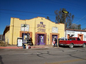
The most impressive thing on the U.S. side is the big new port of entry building. Other than that, there’s a convenience store with a gas pump.
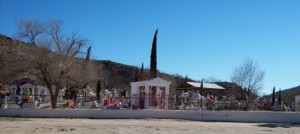
The Mexican town of Sasabe is one of many border towns that God forgot. It is the definition of abject poverty in the western hemisphere. Perhaps the most impressive thing to be found there is the graveyard on the south edge of town, where the most lavish memorials are those of wealthy druglords who had the misfortune to have perished there.
It is a well-known fact in these parts that Sasabe’s sole raison-d’être nowadays is as a jumping-off point for those planning to cross illegally into the U.S. to find work or to transport drugs to the waiting throngs of American users. Without those activities, which have produced an unusual number of flophouses and mom-and-pop grocery stores, the town would surely dry up and blow away. If it sounds like I’m being overly unkind to Sasabe, I’m not – in fact, this description has been rather flattering.
Once you leave town heading south, the dirt road soon widens into what might be called a dirt freeway – smooth, flat and fifty feet wide for long stretches. We continued on for an hour and a half on this road, looking for a turnoff that would take us on the start of the real back-country driving. We spotted what looked like some kind of parked police vehicle and pulled over to talk to a young officer who was there. He was a nice kid, and told us what little he knew about the roads we would have to travel to get to our destination. We could see the Sierra El Humo from where we were standing (it was hard to miss, as it dominated the entire western skyline) and he took a particular interest in our plans to climb its high point. He asked us if we had a hay pay essay – we couldn’t figure out what he was talking about, and after several attempts to clarify the situation, finally it dawned on us that he was asking if we had a GPS. Derrr! It sure seemed like he wanted to come with us, but of course he couldn’t, so we said goodbye. Hey, maybe he’ll become a climber someday.
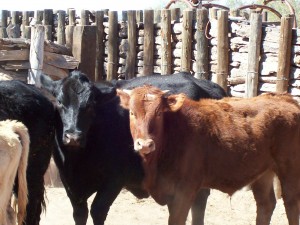
We left this main road near Los Molinos and headed west for another hour and a half, all the while taking GPS readings and noting distances between sometimes-faint road junctions, before arriving at the next sign of human habitation. In fact, we drove right into the front yard of a house and couldn’t figure out how to continue. A man came out to talk to us, and assured us we were still on the right road to El Dos. He opened a couple of gates for us and we carefully drove through his cattle to get to the other side of his property.
We drove several miles farther along this pretty decent dirt road, following the helpful directions he had given us, when what to our wondering eyes should appear but a large area of cleared land with a terrific dirt airstrip and a small hangar. This was waaay out there, with nobody living within many miles, although there was a house there. I can’t remember if we saw anybody, but there were a couple of pickups and a few dogs. A lot of marijuana travels through this part of Sonora en route to the U.S. They move their loads in the fall and winter, but fortunately it was February and all seemed quiet. Still, it was obvious why this airstrip even existed, so we nervously drove past the place, hoping we wouldn’t run into anybody, and continued along the ever-less-traveled road.
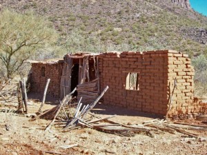
Well, to make a long story even longer, we finally navigated our way to El Dos. I can’t say if it was what we were expecting, because we didn’t really know what to expect. It was a name on the Mexican topo map, but little more than that. We weren’t even sure what the name meant – The Two? Two people, two houses? Hard to say if we were the first gringos to ever set foot there, but it didn’t look like anybody had been there for a long time.
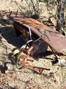
It wasn’t much more than a crumbling adobe ruin. The site was beautiful, with the nearby sierra towering over it, but it was tinged with sadness – a rusted child’s tricycle lay nearby, an indication that once a family had tried to make a go of it here. There were no such luxuries as electricity, running water or a flush toilet, things we take for granted. The Sonoran desert is a cruel mistress, and it had won the battle these poor campesinos had waged against it. This was definitely the end of the road, at 31 12 55 north by 111 58 31 west.
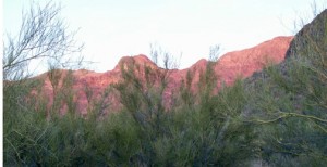
We didn’t hang around for long, as we still needed to find a good campsite. Another kilometer farther north is where we ended up, in a bit of a clearing in the brush. We set up camp and broke out the black-and-tans. The weather was perfect – clear blue sky (naturally, it’s the desert!) and pleasant temps. It had taken us seven hours to end up in this remote spot, amazingly, less than a hundred air miles from home in Tucson, Arizona. We settled in to enjoy the campfire and good tunes, looking forward to the climb in the morning as we watched the setting sun turn the western flank of the range a rosy pink.
There’s plenty of excitement still to come, so stay tuned to see what happens on summit day.
TO BE CONTINUED………
Check out our Facebook page at https://www.facebook.com/pages/Desert-Mountaineer/192730747542690

