Chapter One
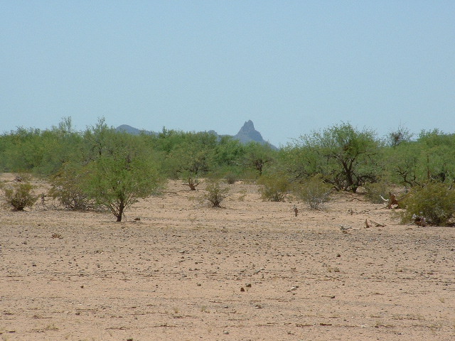
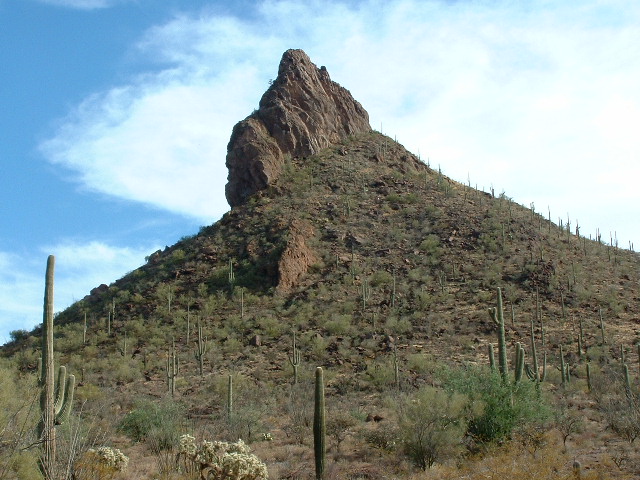
Way back in May of 1989, I visited a remote area along the Mexican border. I was there for only one reason, to climb the highest point of the La Lesna Mountains. The 100-plus-degree heat of the May afternoon had addled my brain enough that I didn’t pay a lot of attention to the rest of the scenery around me – I just climbed Peak 2694 and got the heck out of there. In the intervening years, I had some tantalizing views down to that area, but only from a distance. This next photo shows a view I had one day from about nine miles away while I was in the Tecolote Valley. You are looking southwest in the photo. I wondered what the heck this striking mountain was – it looked mean and steep, but I couldn’t place it at the time. It sure looked like it would be a challenge to climb. And I have to admit that, if it turned out to be really difficult, I hoped that I wouldn’t have to climb it.
Fast-forward to the year 2004. In all of the intervening 15 years, I had never been back to the La Lesnas, but now it was time to go in there and climb a few more peaks. On April 19th, I headed out. I had decided to go in there and attempt 3 peaks and do it all as a day climb from Tucson. I realized that this would make for a long day, but hey – Andy Martin is famous for his outrageously long day climbs (he’d drive non-stop from Tucson to Mt. Shasta, climb it, then drive back home all without sleeping if that was the only way he could fit it into his schedule), so why couldn’t I do it too? Because it was getting light out so much earlier now, I drove away from my house by 3:30 AM and by 5:15 I had reached the village of Pisinimo (pretty much all the way across the reservation), the headquarters of the Pisinimo district. This name means “buffalo head” in the O’odham language – I can’t figure that one out – I don’t think buffalo ever lived there – maybe some nearby peak looked like a buffalo head to someone. Dawn was breaking in the eastern sky. For about 10 miles, between AZ Highway 86 and the village, a marked Tohono O’odham police car followed me. He never stopped me, but he certainly had plenty of time to do so. That made me think that they weren’t so worried any more about outsiders being on the reservation, unless you looked like one of the Bad Guys.
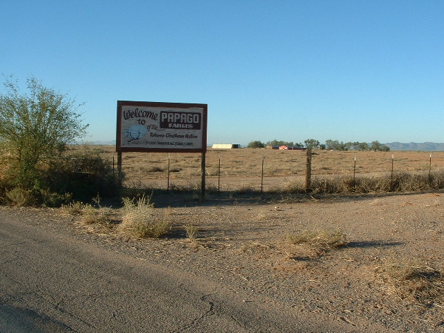
I went through Pisinimo and continued south on the paved highway, through Tatk Kam Vo (“Root Pond”) and Kom Vo (“Hackberry Pond”, perhaps better known as Santa Cruz). Just past Stan Shuatuk (which means “Hot Water”) the pavement ends. There is a farm there which has a big sign saying “Welcome to Papago Farms”.
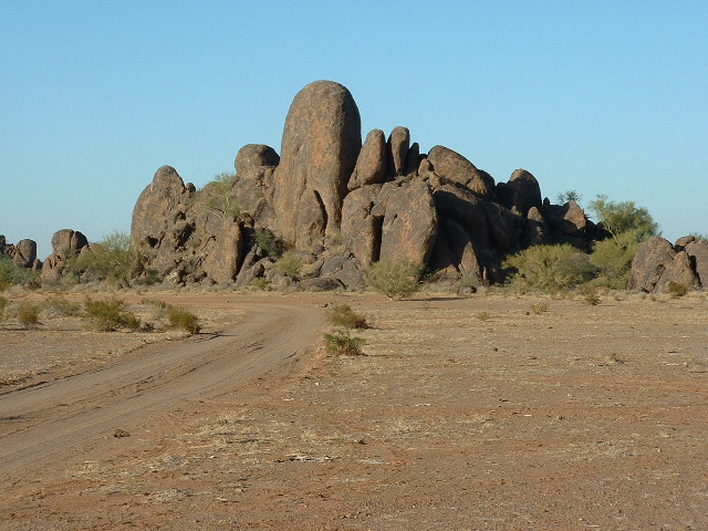
From here the off-road adventure began. I headed east on a good dirt road for about 4 1/2 miles, then veered north and in a while crossed the many branches of Chukut Kuk wash. This is a large wash which drains a big portion of the south central reservation. It forms a huge loop heading north, then west, and finally south through Papago Farms and disappears into Sonora, Mexico. It is one of those steep-sided washes that you stand on the edge of and ask yourself “If I drive down into this, and I have to come back this way, will I be able to get back through it or not?” I decided to give it a try and made it okay, but knew that I really didn’t want to come back that way – it was too steep-sided and it gave me an uneasy feeling. I headed farther east and then south along a road which skirts the east side of the La Lesna Mountains. The northern end of the range is a fairyland of grotesque rock shapes which must be seen to be believed.
Finally I found and drove through a low pass and parked east of La Lesna Peak. It had taken 1 1/2 hours to drive from Papago Farms to here, a distance of less than 12 miles, proof that this was pretty tough country.
I headed out on foot, crossed some flat country and reached and climbed La Lesna Peak (2413 feet) and found Lesna Benchmark. I built a cairn and left a register, then descended to the south and went over to Peak 2645, which was easily ascended (although brushy in spots). I left another cairn and register and returned to the truck, the two-peak loop taking about 3 hours. Next, I continued south along the east side of the La Lesnas and drove past Ak Komelik (which means “Arroyo Flat”). Many of these named places only have one house and are often abandoned. I hadn’t been here since the 1980s when I climbed the nearby range highpoint. A few more miles brought me to the border road. A short drive west along the Mexican border brought me to a good parking spot for Peak 2650. Boy, was I in for a shock!
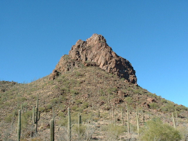
The nasty-looking peak which I had been eyeballing for the past few hours turned out to be Peak 2650. It was really dramatic. Of the 500-or-so feet of relief this peak has, the uppermost 150 or 200 feet is VERY STEEP. But even more amazing is that Border Monument 153 sits right on its shoulder, perhaps 100 feet south of the summit. In the above photo, the monument shows as a white speck on the left side of the notch to the left of the summit. Very impressive, I thought. Well, if the surveyors got up there, so can I. I crawled under the flimsy barbed-wire fence and, lo and behold, there I was in Mexico. I headed farther south to follow easier ground and gain the upper part of the peak. The closer I got, the steeper it looked. I walked all around the mountain but couldn’t get anywhere near the summit. Near-vertical walls defended it on all sides. No way, José.
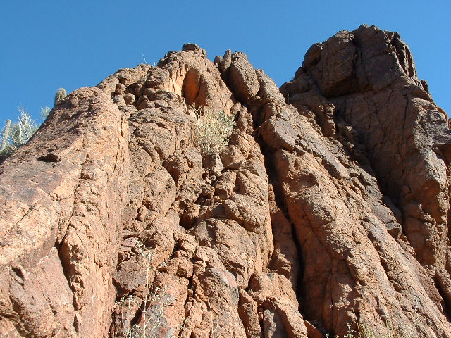
I wondered if they used a helicopter to haul in all the concrete and steel needed to erect it. At about six feet in height, those monuments are large and heavy, and this one was no exception (unless it was made of styrofoam and painted to look like a regular monument!). I was impressed. I returned to my truck and looked back up at the monument, which is plainly visible from the border road – so near, yet so far.
I had been skunked by Peak 2650, the bearer and guardian of Border Monument 153. There was no way I could climb it alone – this thing was going to be technical, period! The long, lonely drive back across the desert gave me plenty of time to ponder what I would do next to try to get to the top of the thing.
Please stay tuned for Chapter 2 – a full-frontal assault on the peak.
To be continued………….
Visit our Facebook page at https://www.facebook.com/pages/Desert-Mountaineer/192730747542690

