The next morning we were up by 5:30 a.m. and quickly broke camp. Down we drove out of the Sierra la Juriquipa and all the way back out to the paved highway. We were able to bypass our friend’s locked gate by his house by driving down a steep side road we spotted, thus not having to bother him so early in the morning. It was a beautiful day with a cloudless sky. A.J. had done all of the planning for this trip and knew where we were going, so I just drove the truck and enjoyed the scenery. We headed south on a good paved highway, through a valley surrounded by high peaks, passing through the villages of Los Hoyos and Agua Caliente and finally arrived at Cumpas. We were now about 40 miles south of Nacozari, or about 100 miles into Mexico.
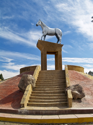
Cumpas is a pretty town of 2,800 inhabitants, sitting along a river at about 3,000 feet elevation. It is the municipal seat of the Cumpas district, and was founded way back in the year 1643. Raising cattle is the most important economic activity in this area. The main claim to fame for Cumpas is the story of El Moro, a dapple-grey horse lauded in song and even a movie.
We didn’t spend much time here, figuring it was important to move on to our next mountain. A.J. was navigating, and a few short miles south of Cumpas, we came to a dirt road which left the highway and headed east into the Sierra la Madera. A sign indicated that it led to a microwave tower, which in fact we could see high on the ridge many miles to the east. Each of the three ranges in which we were climbing this weekend were in fact smaller ranges within the very much larger Sierra Madre Occidental.
Driving across the lowlands for several miles, we saw plants which were very different than those around home in the Sonoran desert, but which looked a lot like those found in the thorn forests of southern Sonora. It’s always a crap-shoot driving these back roads in rural Mexico, using the leaving-much-to-be-desired 1:50,000-scale topographic maps which are usually many years out-of-date. A spot on the map with the name of Las Bateas was our next objective, and we found it okay – it was a simple ranch house, which appeared to be abandoned..
Once through an unlocked gate, the dirt road changed dramatically beyond the house – it became paved with a sort of rough cobblestone. Not like the nice cobblestones you see carefully laid in the streets of old cities, or in driveways of some newer homes, but, rather, stones of irregular shape and size. The road surface had been carefully prepared and the stones all laid by hand. It caught us by surprise, as we didn’t expect to find anything like that out there. This wonderful road dropped down through a major drainage and climbed up the other side for a mile or so, then climbed steeply up in a series of switchbacks. It went for miles, sometimes gently and at other times so steeply that it required a slow crawl in 4wd. It was both exciting and puzzling at the same time to be on this road. Why was it paved with these stones? I mean, this was way out in the middle of nowhere, it was beyond beyond.Someone had gone to enormous expense to pave it, and the only thing that made sense was that the entity that owned the microwave towers on the ridge was behind it. There were a few spots where the road was eroded on its side and some of the pavers had fallen away, but for the most part it was in really good shape. Along the road, we passed a couple of ranch houses which seemed unoccupied. As we approached the ridge crest, the cobblestones ended and a decent dirt road continued. A few more miles brought us to a saddle at 6,025′ elevation. It was about 10:30 a.m.
From here, the road continued steeply on up to the microwave tower to the north, but that was not our objective. We wanted to head south along the spine of the Sierra la Madera to its highest point, Cerro San Jose, several miles distant. A.J. had located a road on the map which headed in the direction we wished to go, and it looked pretty decent on Google Earth as well. It was easy to find, as it started right at the saddle where we were now parked. We opened a wire gate in a fence and drove on through, continuing along a narrow ridge on a pretty good road. There was a very steep hill which we drove down right at the beginning, and then the road stayed level for a while. Farther on, there were some very steep hills we had to drive up. It had not been traveled by anyone for some time, as it was covered with grass two to three feet tall, making it hard to see the actual road surface.
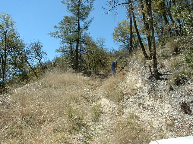
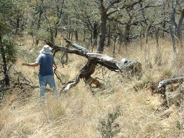
Normally that wouldn’t be a concern, but here the road was narrow and the dropoff on the side was often extreme, so we didn’t want to get too close to the edge. However, the best indicator that this road had not been driven for some years was the fact that many trees had toppled down into the roadway and were blocking our path. One by one, A.J. would wrestle them out of our way so we could continue. Several times, I would just shut the engine off, get out and help him move the bigger ones off the road. We had to wear leather gloves to do this work, as some of the trees were very heavy. In this next picture, there is a road, but you’d be hard-pressed to know it.
I’d guess that, in total, there were probably fifty trees that we needed to move out of the way. Several large rocks needed to be rolled out of the way too. Not long before noon, we reached a point where the road crossed the northeast ridge of Cerro Zizicota. We parked here at 6,665′. It had taken about an hour and a half to clear the road enough to drive it. One could argue that we could have walked the road more quickly than it had taken us to clear it to be driven, but clearing it had allowed us to drive about 3 1/2 extra miles. And from what you’ll see later, it was a good thing that we didn’t have to walk those extra miles on the way out.
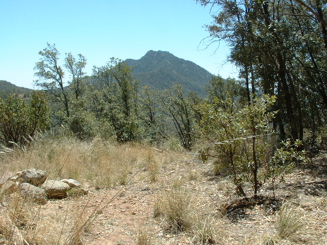
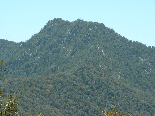
There was no point trying to continue driving, as a fence blocked the way and the road didn’t go much farther anyway. We ate lunch and got our packs ready. We could look south along the ridge to our objective, a few miles away. There were a lot of sizeable bumps on this ridge which we would have to climb over – two times, once on the way in and again on the way back out. This next picture shows Cerro San Jose, our objective, as seen from where we parked.
It seemed a long way off. I took another photo from our parking place, with the longest telephoto possible. I’m glad I did, because it shows some important things. Before I describe them to you, I must apologize for the poor resolution of the shot – it gets pretty pixelated when you blow it up a lot. But blow it up you must, in order to see some details. So, in the next photo, there are a few things I’d like to point out. The highest land in the photo is the summit ridge. The bit on the left which looks highest of all is in fact the actual summit. It is made up of some huge blocks of granite. If you move along the ridge to the right, about halfway along it is a prominent bump – that is where the radio towers sit. In the lower half of the picture, a heavily-wooded ridge runs from left to right. Where it meets the main part of the mountain, near the center of the photo, you can see a small white object which looks a bit like a hat, and is flat on the bottom. That is the forestry lookout.
The first thing we did was to walk what was left of the old road down a steep hill, losing over 200 vertical feet in the process. The road ended soon after that, and we continued through oak forest along the ridge. The bushwhacking wasn’t too bad and we made good time. After a couple of miles, a long uphill stretch brought us to a forestry lookout at 7,075′. A.J. climbed the ladder up to the platform where a small room sat with a commanding view of the surrounding lands. The wind had picked up and was blowing pretty hard by then. We found a good trail which ended at the lookout, appearing to climb up out of the lower country to the west. However, this trail was of no help to us as its path only followed ours for a hundred feet or so.
From the lookout tower, our route dropped almost 125′ and then started up steeply to the summit. There were large rock outcroppings on the ridge which forced us to choose our route carefully, and in some spots there was only one way through them. Finally we climbed out onto a brushy knoll where two small radio towers stood. But we still weren’t on the summit! A.J. had conjectured from much lower down on the mountain that when we arrived at the radio towers we could find that a large granitic outcropping nearby to the southeast might in fact be the true summit. He was right, but I didn’t like the look of it.
We descended into a gentle saddle and climbed up to the base of the summit rock. It looked like a miniature of Sugarloaf Mountain in Rio. We did some brief exploration around its base but decided the northwest side of it offered the only possibility of ascent. Had I been there alone, I don’t know that I would have tried it by myself. But A.J. was very determined. Here follows an account in his own words of the route he discovered to the top.
The summit block is clearly seen from the fire tower 1 km to the north. The block is perhaps 60 feet tall, and mostly steep bare rock on the north side. There is a large crack from bottom to top that lies just west of the highest point of the summit block. About half way down the block is a large ledge that extends to the west. After climbing up 200 meters vertically from the fire tower a couple of small radio towers are reached. From here you traverse SW a couple hundred meters to the summit block, and head to the base of the large crack. It is perhaps 10 feet wide. The first obstacle is a 10-foot climb up some large chockstones. At this point a good climber could probably continue climbing up the crack, but I exited to my right, and got on to the bouldery ledge. You must downclimb about 10 feet at the end of the ledge, using a narrow vertical rock edge in front of you for footholds/handholds.
From here you pass through a small hole, and then head left, crossing some large boulders to a sloping rock. A pine-needle-filled gutter can be used by your right foot to aid progress. At the top of this ~15 foot slope you pass through a large hole by a dead pine tree. We initially went right here, and climbed a tree.This scouting showed that the highest outcrop is reached by turning left at the large hole. Perhaps 30 feet to the left a slot is seen that can be used to gain about 10 feet elevation. You can wriggle up the slot, then climb out of it. You are nearly at the top now. You cross some large boulders to get 20 feet south, to the easiest way up the summit rock. A 2′ detached flake here may (?) provide a foothold as you clamber up a 2′ steep bit and on to the bald top. It is exposed but safe to stand on the apex, and enough flat space exists for a few people on top, though the rock drops off steeply on all sides. A couple notable outcrops are seen to the SE, but they are ruled lower by visual inspection. Descent is on the same route as ascent. We did not circle the summit block to rule out other routes up. In particular, from the top it looked possible to descend 20 feet to the north, which could be the start of another route off the summit.
I would like to add my comments to A.J.’s route description. First of all, in his typically understated way, he gives an accurate description of the route but fails to give himself credit for his accomplishment. His route-finding was brilliant! The starting moves up the chockstones would have deterred many from even attempting the climb. Yes, those starting moves were only ten feet or so, but it was vertical to slightly overhanging and he finessed it beautifully. I watched, mouth agape, as he clambered up that part, then disappeared from sight inside the rocky tower. I called out after him and he said it looked like he could continue. I followed after him but he was moving so quickly that he was always several moves ahead of me. The path was so circuitous and confusing inside these towering rocks that several times I had to ask him for directions, as he was not visible. Once, he waved his hand at me through a hole through which he had crawled to show me the path he had taken. Higher up, he wiggled his body through a slot that was just wide enough for him to pass through. It was so tight that I asked him to please consider carefully whether he might get stuck in it and not be able to get back out. Once in it, he did a 180-degree pirouette in place to get turned around so he could continue. The summit was a bare, smooth, sloping piece of granite which was very exposed. Not a place to linger, given the very strong winds which were blowing at the time. We saw no sign of any previous human visit there. To reach the summit, A.J. had to use a wide variety of rock-climbing moves, pretty much everything in the book. There were some moves that were low 5th-class, albeit done in a Class 3 and Class 4 setting. Well-done, Sir! We are claiming the first ascent on this one, until proven otherwise.
Once we had downclimbed to our packs, I took some GPS readings which showed the summit to be 7,780′ in elevation. Then I looked at my watch and was shocked to see that it was already 4:00 p.m.! I called to A.J. as he was leaving a register at the base of the climb (I was 40 feet below him), telling him that we needed to get a bloody move-on if we wanted to get back to the truck before dark. We started down, passing the radio towers and then following our flagged route down through the tricky part of the mountain top.The slopes were steep and very slippery in spots, being a thick layer of pine needles sitting on top of bare rock. We had to go slowly to avoid taking a dangerous slip, but A.J. was going especially slowly. I kept stopping and waiting for him to catch up. It’s not that I was fast, but he seemed somehow slower than usual. Normally he and I go at the same speed, but he kept falling behind. We made it down to the forest lookout tower, but still had a long way to go. As we walked through the forest, going up and down over the numerous bumps, A.J. was going slower and slower. Something was wrong and I was becoming worried. More than once, I asked him if he was okay and he always said yes. Finally, after once waiting an especially long time for him to catch up, I just came out and told him that he didn’t seem himself. I told him that he seemed really out of it, kind of spaced-out. Upon further questioning, he told me that he was pretty much out of water by that point, and that water was all he had been drinking all day. Mystery solved – he was dehydrated and showing a lot of the classic symptoms! I knew we had plenty to drink back at the truck, so I gave him a quart of gatorade from my pack and insisted he drink it. This seemed to perk him up, enough that he got a second wind, and we plodded on. Up the last nasty hill, and we were back at the truck – it was just after 6:15 p.m. What a relief!
Daylight was fading quickly. Our main priority now was to get back out to the main dirt road, because the road we had cleared on the way in was narrow, steep and had, in places, large drop-offs which we didn’t want to mess with in the dark. Away we went, driving probably too quickly for safety, but we made really good time and got back out to the saddle where we re-gained the main dirt road. Down the mountain we went in the dark, seeming to take forever to reach the valley bottom, finally reaching the paved highway by 8:30 p.m. or so. We gassed up in Cumpas, none-too-pleased about the fact that our final climb had taken a lot longer than we had planned. Now we were forced to do something we didn’t want to do at all, and that was driving at night in Mexico, but obviously it had to be done. It took us well over three hours to drive the winding paved highway through the mountains to finally cross the border into Arizona around midnight. After stopping for a bite at the Mickey-D’s in Douglas, we continued, regaling each other with our life stories in order to stay awake. We didn’t reach my house until 2:15 a.m., and I doubt A.J. made it home before 3:00 a.m. That was one looooong day. Fortunately, A.J.’s dehydration didn’t turn out to be a bigger problem, so it all ended well. We had bagged our three peaks in three different ranges, and that’s what we went there to do.
Neither of us has gone back to Mexico to climb since then. It just seems that with all of the kidnappings, murders and beheadings that have gone on in the midst of the drug cartel wars down there, it isn’t worth the risk. What a shame! Mexico is a country filled with good people who are victims of the horror that continues on a daily basis. In the five-year period ending in January 2012, their own government has reported a total of 47,515 people murdered as a result of drug-related violence. Although it seems like a long shot, hopefully that will change in the future and Mexico will become a safer place in which to climb again.
Please visit our Facebook page at https://www.facebook.com/pages/Desert-Mountaineer/192730747542690

