Andy, the climb leader, continues: (his words are in italics)
The Desert Mountaineer (DM) and I retraced our route down to the flats, and hiked to the broad 2650′ saddle north of Peak 3050 (3057). We then worked our way around a hidden cliff face to drop into the valley directly north below the true summit. The sun had risen high enough by this time to remind me how grateful I was for my hat.
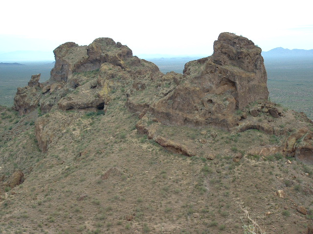
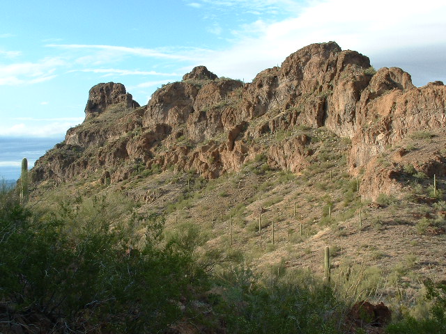
DM writes: The first photo above shows Peak 3057′. This is the northwest side, seen in a telephoto, from 2,680 feet away on the other peak. As you can see, the mountain is literally falling apart. There are a lot of caves, and many overhanging cliffs, and the rock is generally poor. The highest point is just to the left of center.
Hiking uphill to the base of the “distinct” cliff band was tedious and included some brief scrambling. A large overhang here provided year-round shade, and we enjoyed a water break before the actual climbing began. Much of our extra stuff was stashed here, and we roped up for the first pitch.
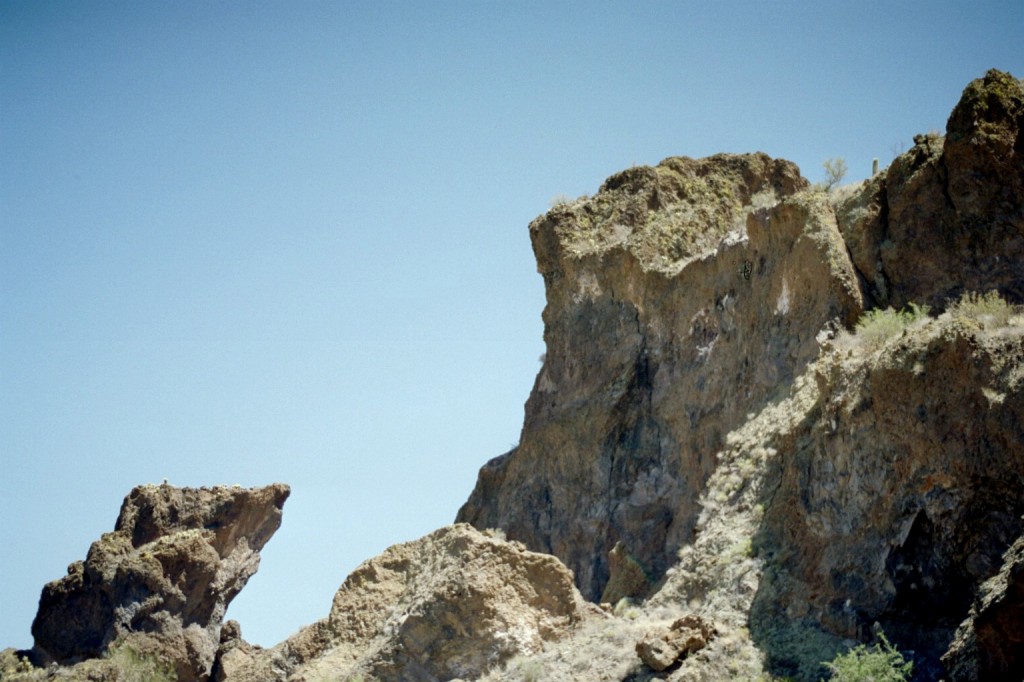
DM writes: In the above photo, at the top, the summit is the flat area just left of center. Just to the right of center, lower down, you can see a yellow ramp going uphill from right to left. Part of our route followed this ramp. Most of the rest of the route is not seen, and is located in the mess below the ramp. The photo is deceptive – anything that looks like an easy way up this thing is an illusion.
This pitch was directly below the aforementioned corner of perpendicular rock faces, and gained access to the “big shelf”. The climbing was mostly 4th class up small, easy, vegetated ledges, but did smooth out right below the top to maybe 5.4. I only managed to place one “marginal” piece of protection for the 80-90′ climb. Not much else available. On top of the shelf, I struggled awhile to find anything decent to anchor onto. Finally a sling wrapped around a thorny bush in conjunction with a small nut and cam sufficed. The cam was housed in the only crack around – also the home of a local lizard. The reptile crawled out, expressed its disapproval with a glare, and scurried on. DM quickly followed the climb, carrying the bag with our water bottles, my camera, his GPS and sight level, and other odds and ends. Before attempting the “V-crack” directly above us, we decided to check for other routes. I figured if we could circle around to the summit’s southwest side, we might be able to take advantage of the ramps and even walk up to the top. We untied and walked over to a notch that offered views to the SW. The ground dramatically dropped 150′ or more in that direction and overhanging cliff faces sealed any further possible way around. It was the “V- crack” or nothing. We roped up and I started off with a few awkward moves to get into an inside corner. Vegetation impeded any upward progress until I ripped out the plants by their roots. They fought back by dropping insidious leaf particles into my eyes. The rock itself was solid outside of this corner, but heavily fractured in some places within, cemented in with a sort of “rock glue”. In those places the rock could be broken apart if pulled on in the wrong direction. Despite this I was able to get a couple of solid placements using large hexes. The climbing was no more difficult than 5.6-5.8 for the first 15′ and opened up to easier rock above that for the remainder of the 40′ pitch. Above the pitch a conveniently located palo verde tree served as an anchor and rappel point. Once both of us reached this point, we left our rock gear and walked towards the top. The peak would not be beat and put up one more line of defense. A 3rd class weak spot allowed us to scramble to the summit.
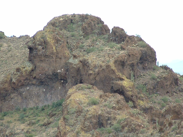
DM writes: This picture above shows the middle to upper section of the roped part of the climb of Peak 3057 from up close. Here is a guide to what you are seeing. From the dark rock at the far right side at the top of the photo, go down to the left along the skyline. You can see the top of a saguaro. To the left of it is a palo verde tree in a little sunlit gap on the skyline. That palo verde is the top of the 5.6-5.8 pitch. Directly below it can be seen the open book of the crack, the 5.6-5.8 pitch itself. The bottom of the pitch is in the dark shadow right behind the bright green bush seen in the sunlight. The start of this pitch was slightly overhanging, and I was really impressed how nicely Andy led it. The lower pitch, which was 5.4, more or less followed the brightly sunlit ramp running from lower left to upper right over in the right side of the photo, and ends just behind the aforementioned bright green bush. Andy belayed me from behind the bright green bush and again from the palo verde tree.
Like the other, this peak also showed no sign of any human presence. From the top we could easily tell that we were higher than the western point. DM’s GPS read 3057′. Upon leaving a register and snapping a couple of photos, we finished off our remaining water and headed down. The rappel down the V-crack was routine. Rather than rappel down over the first pitch’s route, we walked along the big shelf a short distance to the north, and found a large tree to anchor onto. The rap off of the overhanging wall below was exciting and much safer.
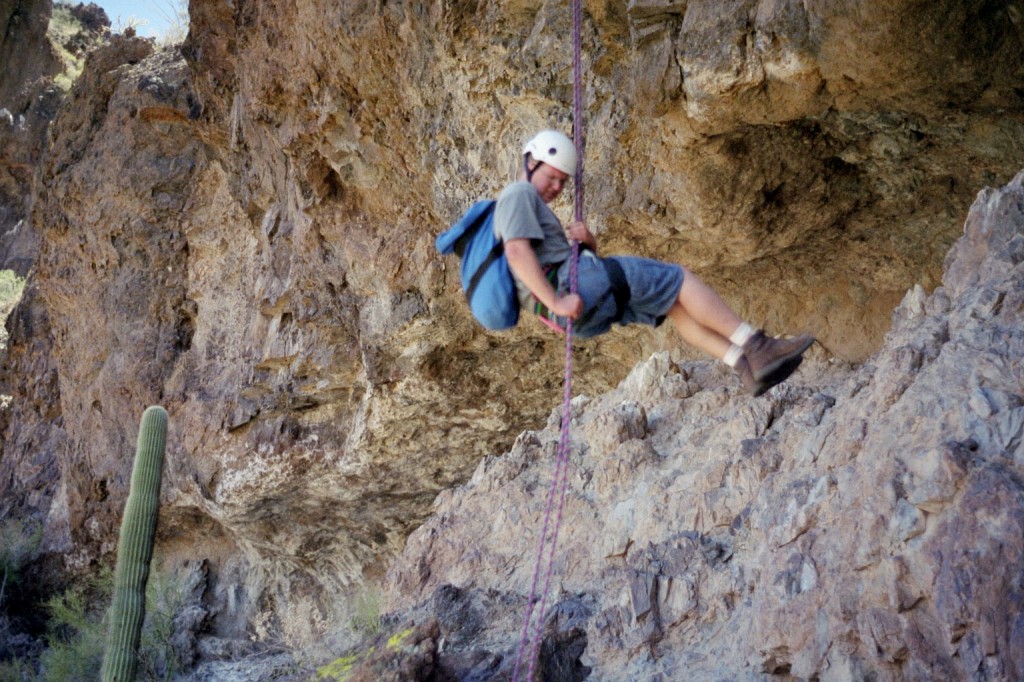
DM writes: The above picture is one I took of Andy rappelling down the overhanging wall on Peak 3057. This wall was VERY overhanging. Where we reached the ground at the bottom of the rappel, the cliff face was a good 30 feet away from us! And it was only about a 60 foot rappel to start with. Very badly eroded and undercut. One of those rappels where you can easily start spinning in mid-air. Andy is touching down near the bottom here. This entire mountain is a crumbling ruin – if there were ever an earthquake here, most of it would fall down.
Once both of us were down on the ground and the rope retrieved, we dropped our gear and immediately walked back to the stashed packs with the extra water. Both of us were quite “parched” from the heat, having had no water since the summit. The shade and water felt particularly refreshing – our day’s goals completed. Gathering our gear, we soon hiked back to the truck without any difficulty. An alternate route up to the big shelf was found on the way out. A small gully a few hundred feet west of our 1st pitch will prove to make that pitch obsolete to future parties. The small gully appears to have two 10’+ rock steps that lead directly to the big shelf. The difficulty might be harder, but the climbing much safer and shorter. Our return time to the truck was 2:15 PM, a total of 8.5 hours for the overall climb.
We returned to Tucson by 4 PM, allowing me enough time to even make it home for a dinner appointment with the family and guests. The day of desert climbing couldn’t have worked out more perfectly!
DM concludes: a number of climbers have driven through the Castle Mountains and gazed with awe at the otherworldly-looking peaks. I know pretty much all of these climbers, and none of them had tried to climb the bizarre castellated summit just to the north of the highway. You can’t miss this peak – in fact, you can’t take your eyes off of it if you are in the vicinity! It is of course Peak 3057, and its summit lies a mere half-mile away from the highway. Many times I have been rubber-necking it while driving by and nearly driven off the road. It looks so near, but there is no obvious way up it. The view from the highway shows it to be defended by huge, overhanging, rotting cliffs, only adding to its mystique.
It felt great when we built cairns and left a summit register on each peak, savoring the fact that nobody had stood there before us. I am very grateful to Andy for his effort and ingenuity in leading these climbs. He forged a way where none had before. Andy, you’re a class act, and it’s always a pleasure to climb with you.
Please visit our Facebook page at https://www.facebook.com/pages/Desert-Mountaineer/192730747542690

