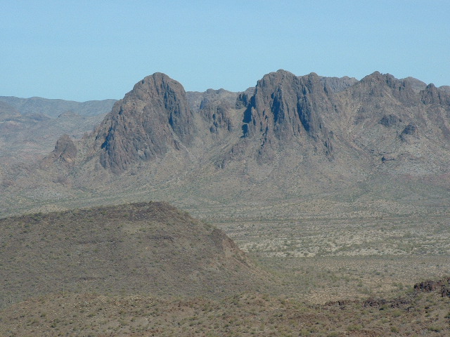
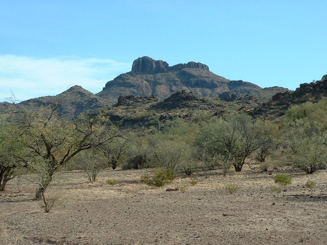
Mike had accompanied me on a lot of trips out to the Tohono O’odham Indian Reservation (TOIR), and I asked him if he wanted to write up our latest climb. He said that he’d like to, so what follows is his original write-up in his own words. Thanks to Mike for his time spent doing this. I have added some pictures with descriptions in my words.
We agreed to leave at 4:30A. Would he be ready 20 minutes early? What was I thinking? This was the Desert Mountaineer, TOIR peakbagger extraordinaire we’re waking up here. Of course he was ready. When I arrived, his day’s equipment, standing by the door, nearly leaped into my van and the last map was spitting out of the printer. Let’s roll! Among the maps was a roll showing all the remaining non- technical peaks to complete his project on the TOIR, all in the Hickiwan district in the NW corner of the reservation.
Sunday morning, 29 January, out Ajo Road and thru Sells. First faint light saw us to the end of the pavement at Kaka, “eastern gateway to the pipeline road”. Having been through the area several times now, DM picked his way through the village and on to the pipeline. Several more miles brought us to our turnoff to the northwest, a disappointing faded trail into the featureless desert. This was going to be a long bash through the creosote and cacti. Fortunately, the faded track joined an adjacent road (shown on the topo), a veritable superhighway of the desert. “Now we’re f.. Oh, I mean, cooking with gas.”
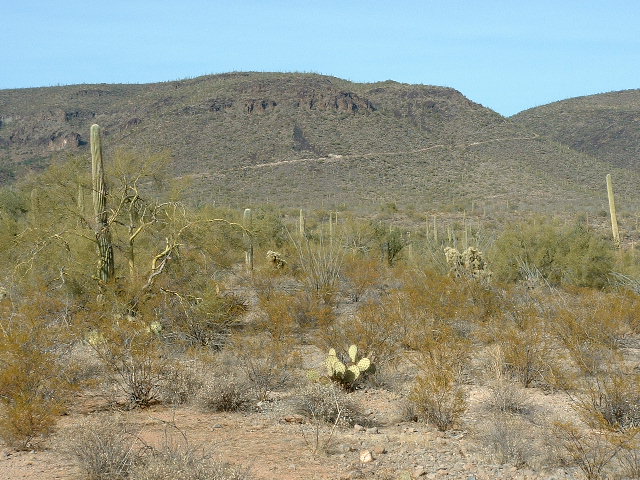
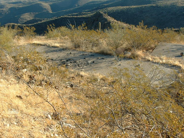
Here is a view looking north to the road which climbs up Peak 3667.
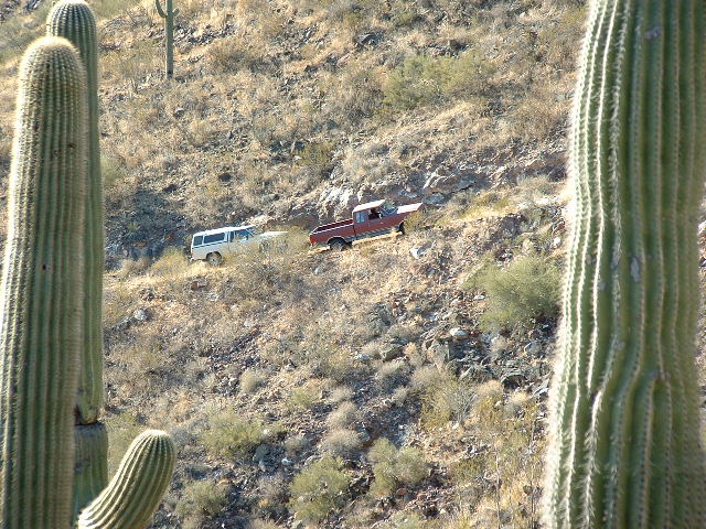
We plugged up the road for quite a distance only to find an abandoned truck in the road ahead. Merely a 2WD, we were impressed it had come this far. There was space to get around it, but after several dust-storm-creating attempts, we abandoned the idea. The ground was too loose, rocky, rutted, and steep. But we were close enough to the top to summit it in ten minutes. We had noticed that this road cut into the hillside was not your average tank-access desert road. It clearly had been relatively wide with deep hillside cuts and fills; we even crossed two culverts, very rare sights on the TOIR.
The above photo shows the abandoned red truck blocking the road. It was too risky to try to drive past it.
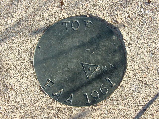
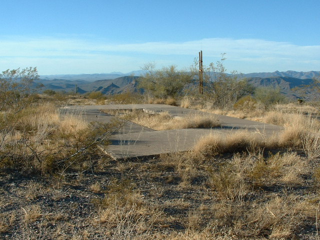
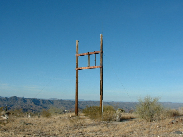
Upon reaching the top we understood why. There was once a rather extensive facility located atop a fairly flat mountain top with commanding views all around. Several concrete slabs had been poured and a benchmark set in one. ” PAA 1961″.
We reckoned it was a former military (or, at least, government) post, long abandoned. Twin telephone poles pierced the sky; atop one, a lightning rod drawing fire from the thunder gods.
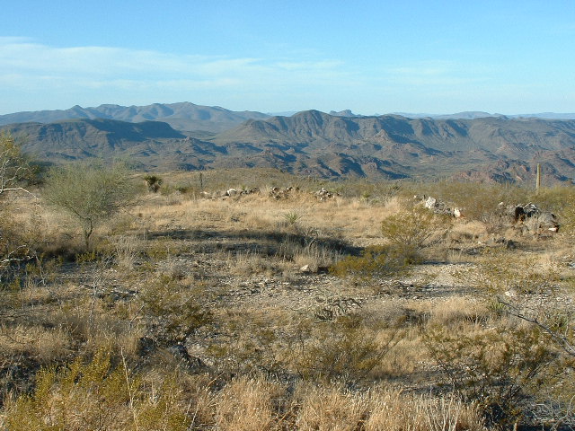
Peak 3667 is higher than anything else for miles around, so the views from the summit were great. Cimarron Peak, Table Top and many others could easily be seen. Here is a view you won’t see anywhere else. You are looking southwest over the Sauceda Mountains to Sauceda Benchmark and Coffeepot Mountain.
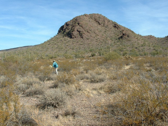
So back down to the sturdy Toyota and what became an agonizing back-up down the road to a wide-ish spot where we could turn around. It only took a couple of jiggers to get facing downhill and we were off to peak #2. Just a few more miles out, our superhighway brought us near the base of Peak 2679 with Peak 2913 back behind it, a mile distant. An uneventful 25 minutes (except for spotting a fox) brought us to the top, register placed, and off to the last of today’s goals. This was a traverse down a ridge moving straight toward Peak 2913. In about a mile we had climbed to the bottom of extensive capstone protecting the summit.
Here, an innocent-looking slip ended my climbing for the day and made for an unpleasant stagger back to the car. In minutes, DM found a way up to the top and placed a register, took pictures and descended back to my position via another route.
The next photo is the view northeast from Peak 2913 to Dragon’s Tooth (already familiar to my readers from other stories on this website). The east end of Peak 2614 can be seen on the lower left. The summit of Peak 2913 is only 175 feet away from the edge of the Air Force bombing range.
On the way out we explored the remains of Moivayi, labeled on the topo; some cleared paddocks and a water tank is all that remained of someone’s ranching dream.
We left there at 3:00P and arrived back onto pavement in less than an hour. The usual two more hours got us back to Tucson in fading light.
There ends Mike’s account of our trip to the mysterious mountain-top. But, the story doesn’t quite end there. Six years later, I had a powerful urge to go back and climb another mountain in the vicinity. Andy said he wanted to accompany me. His idea was that while I went and bagged my peak, he would climb Peak 3667. So, at an insanely-early hour, we left Tucson and drove through the night, arriving three hours later at the start of the road heading up to 3667. I dropped Andy off and away he headed at a brisk pace. It didn’t take him long to walk the road to the summit. En route, he passed the Ford, which was still blocking the road. Once on the flat mountain-top, Andy found everything the same as Mike and I had left it six years earlier.
Meanwhile, I had continued northwest down the valley and had reached the Moivayi site. The road condition had worsened in those six years. A couple of miles later, I parked in a conspicuous spot so both Andy and I could easily see the truck from a distance. Away I went, heading across some tortured country to reach a low saddle at 2,400 feet. I then dropped down into a wash and headed north. It was like riding a bike, nothing to it, all I had to do was just keep heading downstream in the valley bottom. A few miles later, I rounded a corner and entered a very flat stretch of desert. My goal was Peak 2614, and there it was right in front of me. A short climb took me to the top, marked by a cairn (no doubt left by the military). I left a register and beat a hasty retreat, retracing my steps all the way back to the truck. When I got there, Andy was already waiting for me. He had tagged the summit of 3667, then dropped down the steep 1,300 vertical feet of its west side. While continuing west to the truck, he scooped up Peak 2679.
We drove back to the village of Kaka, to pavement, then over to the tiny hamlet of Ventana. Andy had another peak in mind and wanted to climb it on our way home, so we did. Peak 2670 was a quick romp up and down. Now we could say our day was done, and we were back in Tucson two hours later.
To this day, we’re still not sure what kind of installation sat on top of Peak 3667. There are no power lines to the mountain-top. It appears that several buildings had stood there at one time, but what were they for? As the crow flies, the summit is just under a mile from the boundary of the military air-to-ground bombing range. Could it have been some facility that the Air Force had up there? Probably not, as I don’t know of any other instance where the Tohono O’odham have given the military such permission. We think it most likely that it may have been some sort of Federal Aviation Administration facility. Perhaps it was there to track commercial aircraft, or satellites, or maybe it was part of an ICBM monitoring site. Whatever it was, the government seems to have wiped it from the record. We have never been able to find any trace of it on the Internet. The more we dig, the less we know. Curiouser and curiouser.
Check out Desert Mountaineer’s Facebook page at https://www.facebook.com/pages/Desert-Mountaineer/192730747542690

