Way back on May 14, 2002 I tried to get into an area in the northwest part of the Santa Rosa Mountains but, try as I might, I couldn’t find the road I needed – it was as if the desert had reclaimed it completely. Almost two years had passed since I had made that attempt. I remember it well, though, as it was the day that the ice broke on the Rillito River in Tucson. That’s a local joke we use here to indicate that it hit 100 degrees for the first time that year. The media have all kinds of contests and offer big prizes (such as a trip for two to Europe) to anyone who can predict to the nearest minute when we cross that threshold. Anyway, I had driven around for quite a while that afternoon in the heat looking in vain for that road and had come up empty-handed. It had tormented me ever since, and I was determined to go back and try again.
On Monday, March the 8th, I drove to the village of North Komelik, the headquarters of the Sif Oidak district. In the O’odham language, “Komelik” means “low flat place” and “Sif Oidak” means “bitter field”. The only claim to fame of North Komelik is the now-closed copper mine less than two miles away which is polluting all of the local water supply. From the village, a dirt road heads south past Komelik Mountain and then straight as an arrow for probably ten miles. I followed it for just over six, then stopped. The 7 1/2 minute quad shows a road heading east towards the northern end of the range. In 2002 I did not have my GPS unit with me. This time I did, and I had entered the exact location of the start of the elusive road. A GPS unit should be able to tell you, to within 50 feet, easily, where you are. I stopped when it told me I was 0.00 miles from where the road should start. I got out and walked the area and couldn’t see a road anywhere. I had entered a whole bunch of waypoints marking the position of the road, so I just started to drive from one to the next. The desert was fairly open here, but still I had to drive for over 1/3 of a mile before I found what looked like a faint track. Sure enough, it was the road. After that I was able to follow it without too much difficulty. The farther east I headed, the more well-defined it got. After a few miles, I reached what was labelled as a 4wd road. This was very faint and hard to follow. It headed southeast and soon got so bad it wasn’t even worth continuing. Sometimes you just feel guilty bashing up your truck and know it’s time to stop for the day.
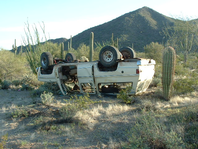
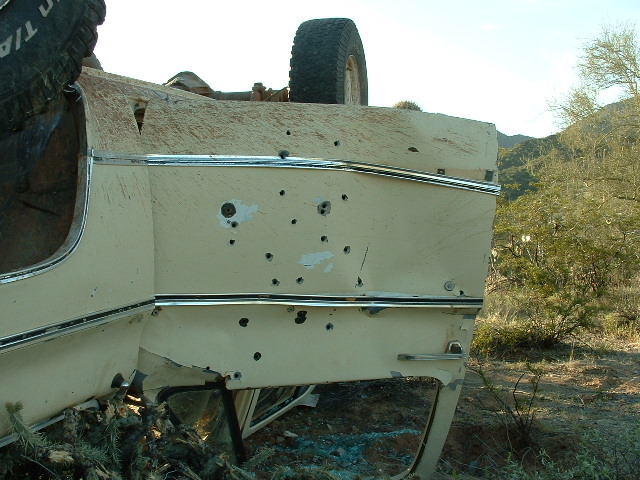
Something suspicious caught my eye – an overturned vehicle. I wanted to investigate, but I felt concerned for my safety, so I parked my truck down in a deep wash in a thick cluster of trees. Just as I was locking up the truck, I heard the sound of a vehicle approaching at high speed. I hid, well out of sight, as it passed by. It was heading north, on a road not shown on any map, and someone let out a loud yell when it passed by the vehicle. It didn’t stop, but sped off into the distance. Somewhat rattled by this, I slowly emerged from my hiding-place and went over for a look. Here is what I found, a vehicle upside-down and full of bullet holes.
This was all-too-typical for the area. It had probably been in a high-speed chase, and the driver had lost control. Most likely Mexican smugglers, even though this was a 75-mile drive from the border into U.S. territory. Still, I must admit that by now I was more nervous than a ceiling-fan storeowner with a comb-over. I poked around the vehicle for a bit, then decided it was time to leave.
I drove a little farther into the western edge of the mountains and found a flat place to park at 2,025 feet elevation. The temperature was 90 degrees, so sitting in my lawn chair in the shade felt good. I managed to climb a few hundred feet up to a nearby ridge and got a cell phone call out to my wife to tell her I had made it as far in as I had hoped. By then, it was getting dark so I headed back to the truck for the night. It was so quiet and peaceful out there. And dark! The moon wasn’t going to rise for a few more hours, but Venus was high and bright. For only the third time in my life I noticed that Venus was so brilliant that it cast a shadow. The first time I observed this was in November of 1989 while camping in the Chocolate Mountains on the Yuma Proving Grounds. The second time was while I was camping with Andy Martin in the Sierra Pinacate in Mexico earlier this year.
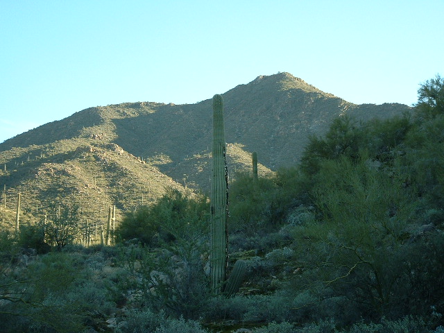
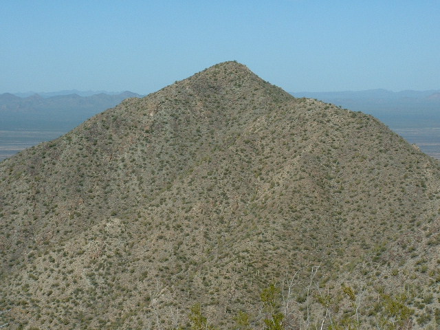
I awoke at 5:00 am the next morning and was moving by first light at 6:30. I headed south and up the slopes of Peak 3407 which is the second-highest summit in the Santa Rosa Mountains. It was a perfect blue-sky day and I had everything going for me. There was a bit of fun rock scrambling near the top. When I reached the summit, there was no sign of a previous visit, so I built a cairn and left a register. It had taken an hour and fifteen minutes to climb the 1,400 vertical feet to the top – not bad for an old guy. The day was getting off to a good start. Even though this was the second-highest peak in the Santa Rosa Mountains, it was dwarfed by Gu Achi Peak, the range high point at 4,556 feet. Here is a picture of Peak 3407 as seen the previous evening from my campsite.
What I needed to do next was head due east off the summit towards my next objective. I felt a slight twinge in my calf, a feeling I have had in the past just before getting a leg cramp. I was drinking gatorade and eating energy bars to try to stave off getting cramps, but throughout the day I felt many times like I was about to get one. Descending this east ridge was pretty straightforward, with only one intervening bump to negotiate.
I reached the saddle at 2,950′ and then ascended the west slope of Peak 3327. On its summit, I found a cairn, probably left by a miner associated with the old digging near where I was camped. Pulling another jar out of my pack, I left a register. It was about 8:30 a.m. but I still had a long way to go. Things got a little more complicated during the next leg of my journey. The southeast ridge of Peak 3327 had two large bumps I had to climb over, as well as a great deal of smaller bits of up and down over some messy terrain. All this to reach a saddle at 3,000 feet.
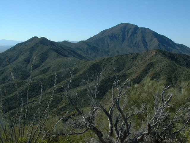
My third peak of the day involved a detour away from my main path of travel, and I had a decision to make. I could skip this peak and simply continue on to number four. It would save a lot of time and energy to do so, but I’d still have to come back another day to climb it. I’d never be closer to it than I was right now. It really didn’t take me long to decide to go for it. A quick climb of 300 vertical feet put me on the summit. Peak 3290 showed no sign of a previous visit, so once again I built a cairn and left the customary register. It was 2 1/2 miles due south as the crow flies to the summit of Gu Achi, which towered over everything for many miles in every direction. All of the other mountain terrain you see in this next photo is just part of the long, winding ridge that drops northeast from Gu Achi and makes its way northwards.
It was about 9:45 a.m. and time to go. Retracing my steps, I returned to the saddle at 3,000 feet, then headed northeast in a descending traverse to reach another saddle at 2,600 feet. The next peak I was eyeing was labelled Peak 2972 on the map. It was a pretty straightforward climb from there and I soon reached the summit, which was a bunch of boulders perched on a ridge. There was no sign of a previous visit, so once again I built a cairn and left a register.
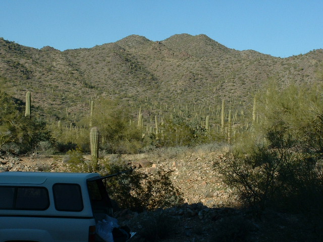
At 10:45, I left, heading down the north ridge. One long push to peak number five awaited. I reached a saddle, then had to climb over a good-sized bump, then down to yet another saddle. The final stretch had me climbing up another 400 feet of pretty decent slope, to arrive at the top of Peak 2779. There I found a cairn, probably left by miners. I added a register. It occurred to me that I had just reached something of a milestone. This was my 250th summit on the Tohono O’odham Indian Reservation – just over 150 more to do before I would have climbed every one of its peaks. Here is a picture of Peak 2779 as seen from my camping spot the previous evening. The summit is the double bump just to the right of center on the skyline.
Now, it was a straight shot back to my truck. I dropped down the west ridge, then headed cross-country. Simple enough, except for negotiating two major washes and many smaller gullies, which added an extra 150 feet of climbing to what would, ideally, have been an all-downhill march. It was one o’clock when I got to my camp, about 6 1/2 hours after I had left. It was hot, nearly 90 – way too hot for this time of year, even here in the desert. Just two more peaks to climb to finish off the Santa Rosa Mountains. I drove back out the way I had come in without incident and returned home to Tucson.
Please check out our Facebook page at https://www.facebook.com/pages/Desert-Mountaineer/192730747542690

