In May of 1985, I moved to Arizona – Phoenix, more specifically – from Iowa. It felt like I had died and gone to heaven. For those of you who don’t know Iowa, there’s something I need to tell you: the good people of Iowa are the salt of the earth, kind to a fault, but they don’t realize that they haven’t any mountains. Well, not exactly none – in fact, they have three that have 300′ of prominence or more, but that doesn’t count for much. By contrast, Arizona has a whopping 7,496. So after only a few years of living in the Hawkeye state, I was ready for a change.
One July day, I hopped in my car and drove north to Flagstaff. At 7,000 feet elevation, it was a welcome change from sweltering Phoenix, which sits at a mere thousand feet above sea level. I discovered that I could drive to a trailhead at 9,300′ hard by Arizona Snowbowl, a big ski hill. It was a great day, walking up the trail to the summit of Humphreys Peak, at 12,633 feet the highest point in the state. Little did I know it, but I had just climbed the highest point in Coconino county. On the way back down, I tossed my cookies by the side of the trail. The altitude had gotten to me – that’s what comes from being a flatlander for so long.
Later that year, I was becoming sick and tired of pushing paper in what had become a sedentary lifestyle. Just after Christmas, I noticed an article in the local paper (complete with compelling photos and even directions) extolling the virtues of Browns Peak. It claimed that it was a world apart from the hustle and bustle of the Phoenix megalopolis which had started to rot me, body and soul. I couldn’t resist. On January 4th, I headed out and drove the 45 miles of good highway, then another 18 miles on an ever-worsening dirt road, to park at 6,840 feet elevation. I readied my pack and climbed up to a spot 300 feet higher, camping there for the night.
The next morning dawned clear and cold. There was some ice and snow en route to the summit of Browns Peak, the highest of a set of bumps called Four Peaks. I topped out at 7,657 feet, which was also the high point of Maricopa County. What a great feeling, to be actually climbing something again – I was inspired to keep going, to stay active. How many counties did Arizona have, I wondered. It didn’t take long to figure out that there were only 15 – very few for such a large state, and I had already done two of them.
The local university had a huge map library, so I started spending time there studying maps to make a list of each county’s highest point. That was easier said than done. I didn’t have much to go on, and I made a few mistakes. One I got right was Mt. Graham. At 10,720′ it was the highest point of Graham County. I went there on March 8th, just two months after regaining my inspiration. At that time, there were no restrictions in place for travel to the top of the mountain. I walked the old road, deep in snow, to the summit, where I found an assortment of scientific equipment in place. In fact, it had been put there to study atmospheric conditions, to see if it were advisable to build what would, in later years, become the Large Binocular Telescope.
A month later, I camped out overnight and made my way to the summit of Mazatzal Peak. In so doing, I was pretty pleased that I had climbed the highest point of two different counties, both Yavapai and Gila. Back in 1986, that was the current thinking. At 7,903 feet, it was a nice high summit. I didn’t learn until later that the highest point of Yavapai County was Mount Union. At 7,979 feet, this wooded summit just outside of Prescott, Arizona wasn’t climbed by me until May 22nd of the following year. Once done, that gave me four, or so I thought. More on Gila county later.
Another one that wasn’t in question was Signal Peak, in far western Arizona. A true desert peak, it stood a full 4,877 feet, towering over the surrounding area in Yuma County. I climbed it in mid-April, and a fine climb it was. The Kofa Mountains have a lot of interesting rock, and a large population of desert bighorn sheep, so the climbing there is always entertaining. Completing this one bumped my list up to five.
Now I set my sights on La Paz County. My research turned up Smith Peak as the county high point, so I climbed it the day after Signal, on April 13th. The weather was getting pretty toasty, so I was glad to be done with both of them. The problem was, in climbing Smith Peak I had made another error, but didn’t know it yet.
Pinal County was a puzzler. My early research told me that its highest point was something called White Mountain, at 6,100′, out in the Superstition Wilderness. I climbed this with a friend, both of us idiots, running out of water and trying to suck the juice out of a cactus (not recommended). This we tried on April 21st. Turns out we were wrong – this wasn’t the county high point, but I didn’t discover that until much later.
Next, I turned my attention to Mojave County. Near Kingman is a high range called the Hualapai Mountains, with Hualapai Peak as its high point. At 8,417 feet, it was a cool respite in high forested country. Even though it was already April 25th, it didn’t matter up in the pine forest. This county high point was for real, so I actually had a true total of four by this time, April 25, 1986.
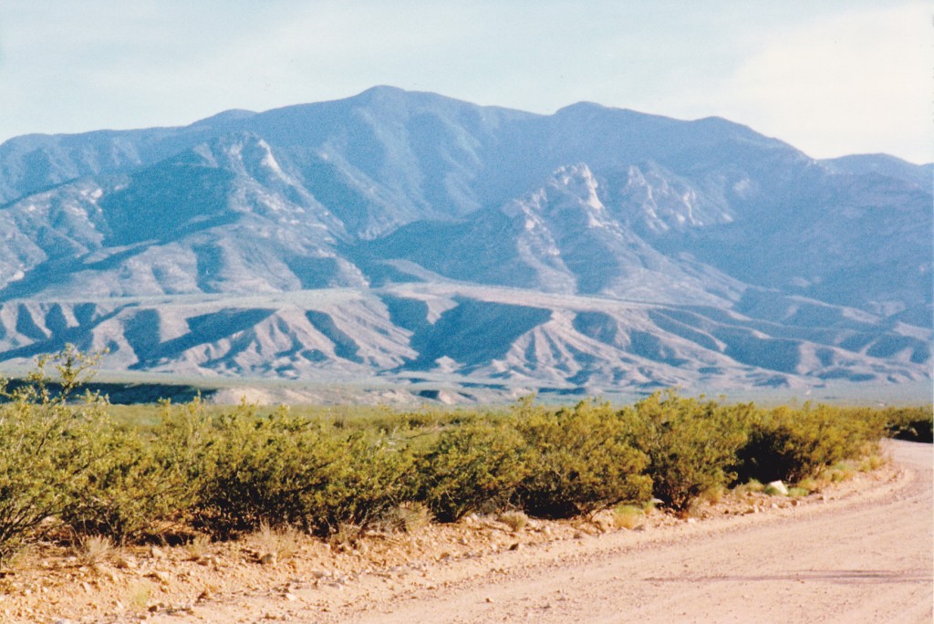
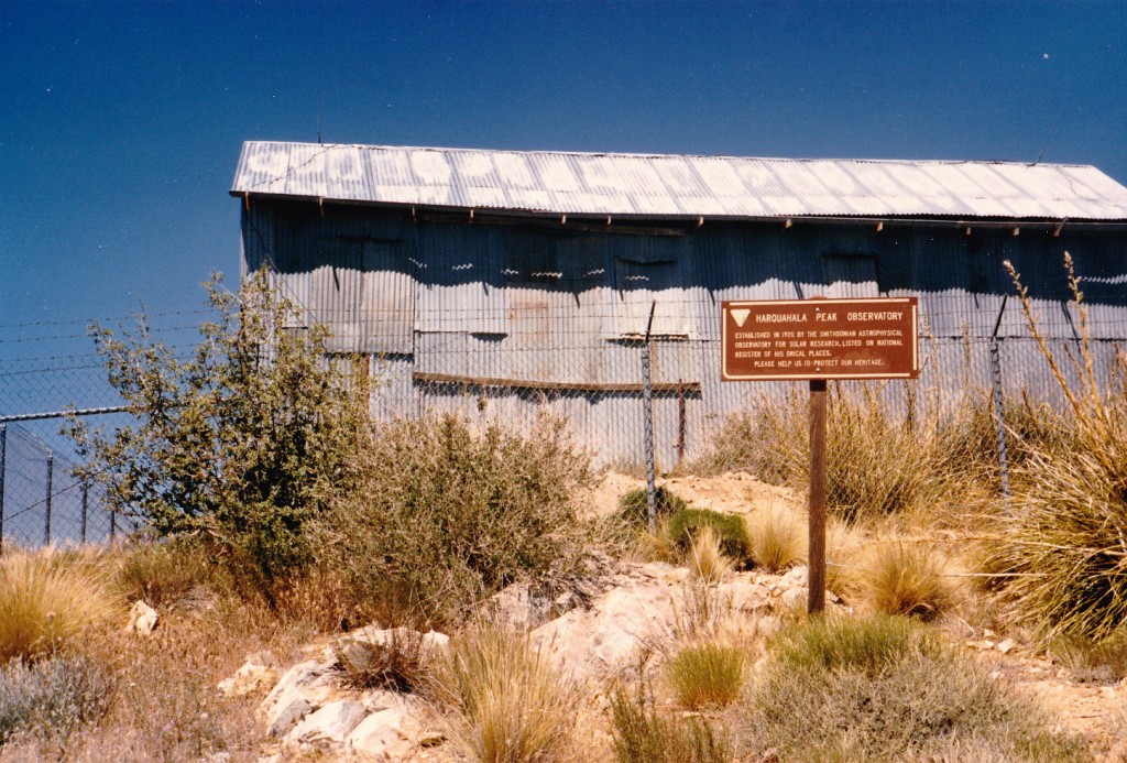
By now, I had figured out that the actual high point of La Paz County was something called Harquahalla Mountain. At 5,681 feet, it was the highest peak in all of southwestern Arizona. Like a real dope, I set out to climb it in the heat of the day on May 18th. At that time, I didn’t own a four-wheel-drive vehicle, only a piece-of-crap little car, ill-suited to driving any rough roads. I parked miles away on the northwest side of the peak, well over 3,000 vertical feet below the summit. After hours of struggling in the heat, I arrived on the summit. Imagine my shock to discover a road ending right on the top. Maybe I could have driven it, or at least walked it, all the way to the top. Another surprise was this building, which turned out to be an old solar observatory put in by the Smithsonian Institute.
Finding the road that day didn’t help me any, as I had no choice but to retrace my steps back down to my car. The heat almost did me in that day – I was learning about the desert the hard way.
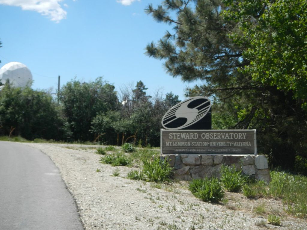
Now it was June, and summer had arrived with a vengeance. Continuing with my quest, I needed some high ones up in cool country. Heading south from Phoenix to Tucson, I drove up the beautiful paved road to Mt. Lemmon in the Santa Catalina Mountains. Towering 6,500 vertical feet above the city, this peak is Pima County’s highest point. The road ends close to the summit, but not quite. An observatory complex sits atop the mountain. In order to reach the very highest point, at 9,157′, you need to sneak inside the chain-link fence which encircles the telescopes. Easy peasy.
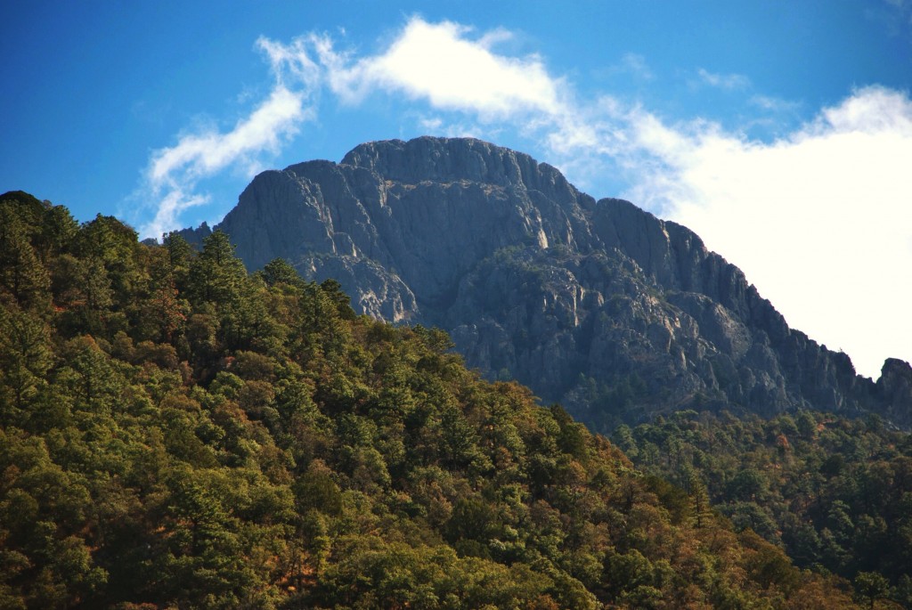
A few short miles away sat another high peak. Mt. Wrightson was the high point of the Santa Rita Mountains and also the highest point of Santa Cruz County. A paved road takes you to 5,400 feet, and then you follow an excellent trail to the summit at 9,453 feet. I did this one on June 8th, one day after Mt. Lemmon. Now I had seven of them done for sure.
As the summer progressed, I learned of a peak in Pinal County that was higher than White Mountain. It was way out in the Galiuro Mountains, and Little Table Mountain was its name. I tried to drive there on September 9th, but was stymied by the confusing back roads and ran out of time. Four days later, I was back. I was able to make it as far in as the top of a horrific hill known as “Carpet Hill” along the “Rug Road”. There was no way I was going to drive down that hill – I’d be stuck at its base for all eternity. Check out this link to learn more about the road. I parked at the top and made ready to walk the rest of the way. It was my lucky day, because at that moment two guys on quads came along and offered me a ride. They took me all the way to a saddle northwest of the summit and dropped me off. Once done with the climb, as I was walking the road, the quads returned and took me back to my car. That was a lucky break, as I now had one more county high point completed. Or did I?
A couple of months passed. It was now mid-November, and I wanted to complete more of the county list. From Phoenix, I drove to the southeastern corner of the state, to the Chiricahua Mountains. I parked up high and backpacked into the heart of the range. On the 13th, I stood in the snow on the summit of Chiricahua Peak, at 9,759′ the highest point of Cochise County.
One week later, I drove up to the Navajo Indian Reservation in far northeastern Arizona. My goal was to climb the highest point in Navajo County. I arrived after dark, then drove a rough dirt road to a point northwest of Black Mesa. I had a feeling I wasn’t really supposed to be there, that maybe I was trespassing, so I decided to climb this one under cover of darkness. It was cold, and the steep forested slope was frozen hard. I made it up to a large plateau, almost 2,000 vertical feet higher, navigating by map, compass and altimeter, but it took a while. Once on the plateau, the going was almost flat. It was snowing lightly as I walked, orienteering along until I finally reached the highest point at 8,168 feet. From it, I could look out to the north and see the lights of the town of Kayenta down below.
Once I left, a strange thing occurred as I walked west along the plateau in the dark. It was snowing harder and visibility was near zero. It was pitch black and I couldn’t see much at all. I heard a strange sound approaching, muffled by the falling snow. It scared me as it approached, then all of a sudden it was upon me. A group of horses, maybe six of them (it was hard to be certain in the dark) ran up to me at high speed, then parted to pass around me on both sides. It was all over in a few seconds, but it scared the crap out of me. Obviously, they could see better in the dark than I. By the time I got back to my car, it was well after midnight.
Two days later found me snowshoeing my way up through the forest to the top of Mt. Baldy. This peak, at 11,420 feet, is one of the few in Arizona that actually top out above treeline. It is the highest point of the White Mountains, as well as that of Apache County. I made good time back down the snow-covered trail to my car, then worked my way back to U.S. Highway 666. Later the same day saw me walking through easy terrain over to the summit of Peak 9,441, the high point of Greenlee County. “So, that’s it then, I’m done” I thought as I walked back to my vehicle. I had climbed the highest point of all 15 of Arizona’s counties. Or had I?
A couple of years passed, and I was busy climbing other things. One day, somebody (I’m not sure who) informed me that Little Table Mountain was not the highest point of Pinal County. The true high point was, in fact, no peak at all. The boundary between Pinal and Pima counties runs up and over a high ridge on the north side of the Santa Catalina Mountains, and where it crosses that ridge is actually the highest point of land in all of Pinal County, at 7,300′. No sooner had I heard this bit of news than I drove up to the Catalinas, parked and set out on foot. I climbed Rice Peak, then headed down its north ridge. Using altimeter and compass, I spent quite a while determining the location of the county line. That done, I built a cairn and left a register to mark the spot – it was February 22, 1989, and it appeared that nobody had beaten me to it. Now, I really was finished the list of county high points.
Finished, that is, until several years later when another climber informed me that Gila County’s true high point was not Mazatzal Peak after all, but was an obscure spot named Promontory Butte up along the edge of the Mogollon Rim. Upon learning the news, away I dashed. After a night of camping out in a snowstorm, the next morning dawned beautifully clear. A short walk took me to 7,940 feet at the top of the butte, and there I was. It was 8:00 AM on May 11, 1994, and now I was truly done.
A lesson I learned from this little project is that as maps are revised and climbers do more research, things can change. However, since nothing else has changed in the past twenty years, it seems likely that Arizona’s county highpoints list is set in stone.
Please visit our Facebook page at https://www.facebook.com/pages/Desert-Mountaineer/192730747542690


