
It’s kind of a cool name, isn’t it? – The Icefields Parkway. If you’ve never been there, or have never before heard of it, can you guess where it is? I’ll give you a few hints. It’s part of a UNESCO World Heritage Site, and is found in the Canadian Rocky Mountains. Lying entirely within the province of Alberta, it sits within Banff National Park and Jasper National Park, and is served by Alberta Highway 93, which is the actual parkway or driving route through it. It’s an excellent 2-lane paved road with wide shoulders. At 144 miles (252 KM) from one end to the other, it’s not a terribly long road, but what it lacks in distance, it makes up for in its scenery. Condé Nast Traveler ranks it as one of the top 10 most beautiful drives on the planet.
The city of Banff, Alberta (population 7,850) lies within Banff National Park, but isn’t actually a part of the Icefields Parkway – instead, it sits 37 miles (60 KM) to the east of the actual southern end of the Parkway, which is over by the village of Lake Louise (population 700). From there, the Parkway winds its way north along Highway 93 for those 144 gorgeous miles to end at the town of Jasper, Alberta (population 4,600). Truth be told, Highway 93 starts at its junction with the Trans-Canada Highway No.1 almost 5 KM west of Lake Louise. If you want to drive the Parkway, or even ride a bike along it, you need to buy a Parks Canada pass. The cost is $10.50 for a day pass, or $72.25 for an entire year, and you can buy the pass at either end of Highway 93.
My first experience with the Parkway was in 1966. I was working at a sawmill in Golden, British Columbia and, for the first time in my life, I had a vehicle of my own. It wasn’t a car, but rather a motorcycle – nevertheless, it gave me the freedom to actually go where I wanted and on my own schedule, unlike hitch-hiking which had been my only way of getting around up until then. Since it was a quick 50 miles from Golden to the start of the Parkway at its southern end, by mid-June I’d decided I’d waited long enough to head out for a weekend and drive the route. At that time, I had a cheap 35MM camera – nothing fancy, no interchangeable lenses or anything like that. I couldn’t afford anything better, but I did take a lot of pictures with it. I thought that first of all, I’d share with you the photos I took on that June, 1966 weekend. However, I’m going to mix in with them a lot of photos taken on later trips that show some things better.
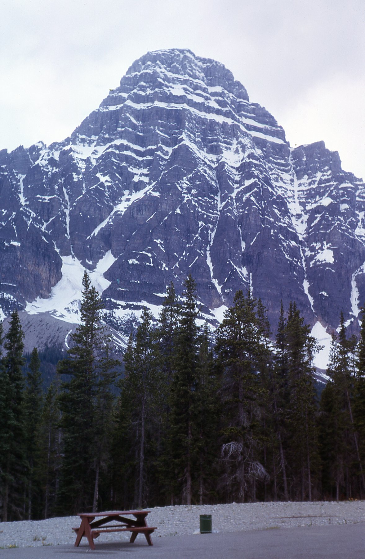
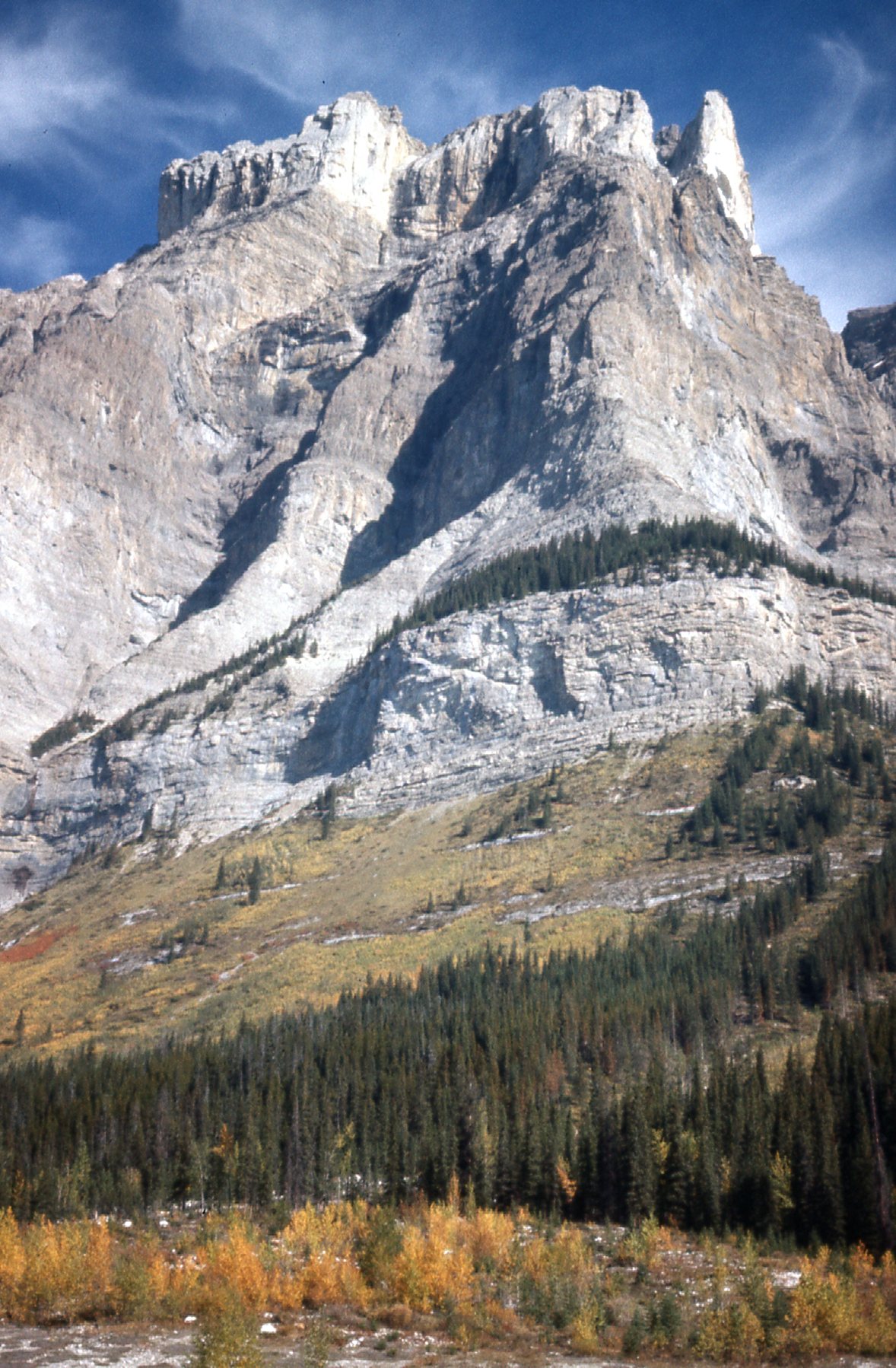
Although these next 2 pictures aren’t exactly along the Parkway, they kind of anchor the southern end of it near Lake Louise. They show famous mountains which are seen by millions of people each year as they drive through on the Trans-Canada Highway. This first one is of Castle Mountain, which sits on the north side of the highway about half-way between Banff and Lake Louise. From 1946 to 1979, it was called Mount Eisenhower, but public pressure caused its original name of Castle Mountain to be restored.
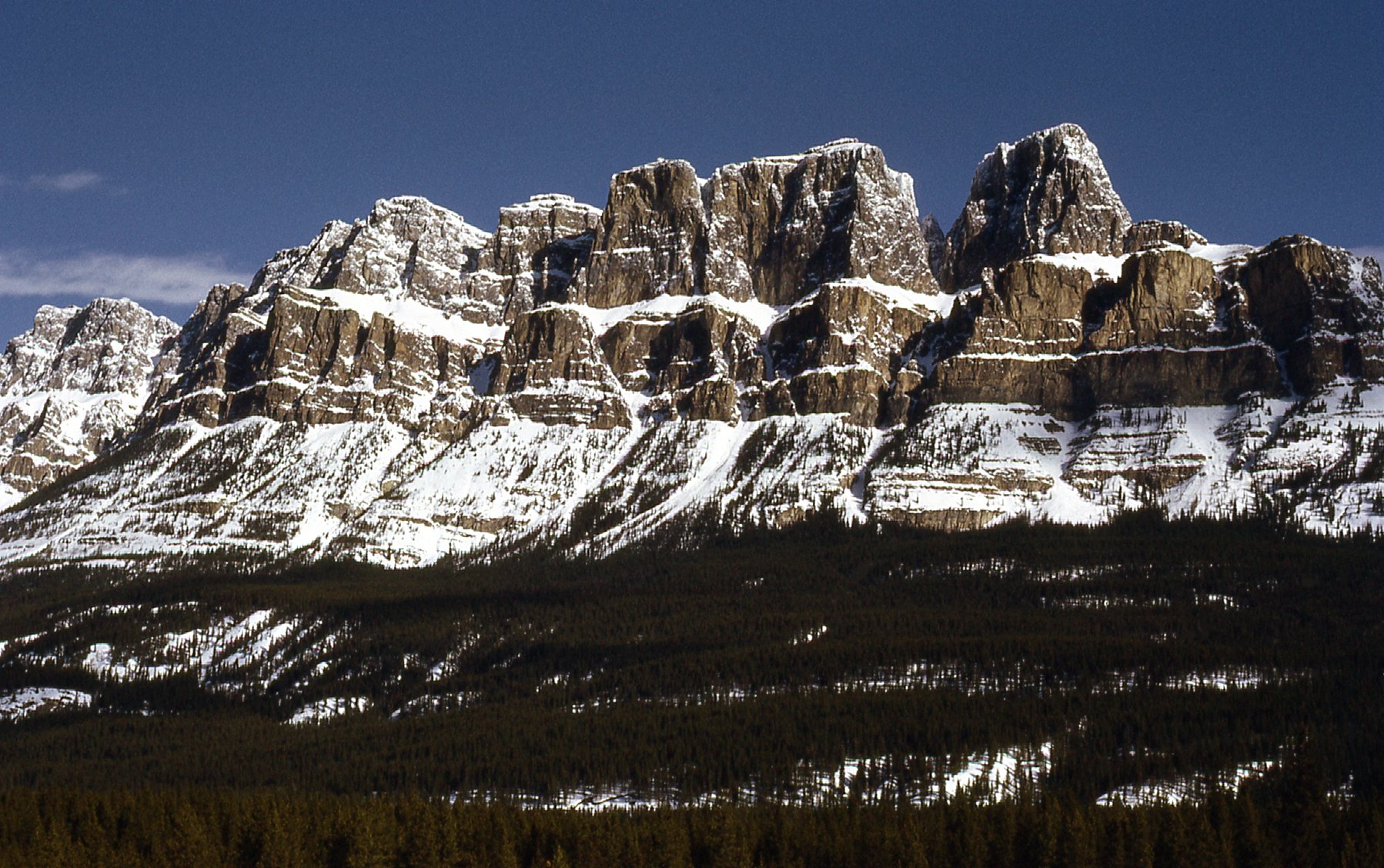
The south side of Castle Mountain, elevation 9,075 feet.
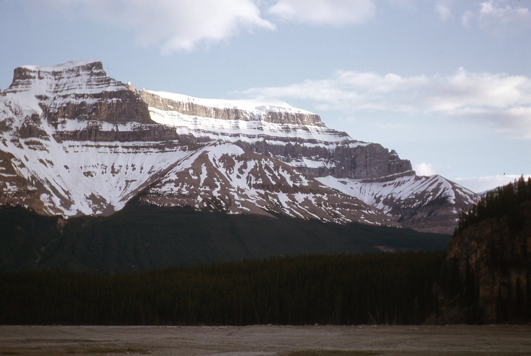
And then there’s this, probably the famousest view in the area – the mighty Mount Temple, elevation 11,627 feet, as seen from Lake Louise. This was the first of the 11,000-ers in the Canadian Rockies to be climbed, way back in the year 1894.
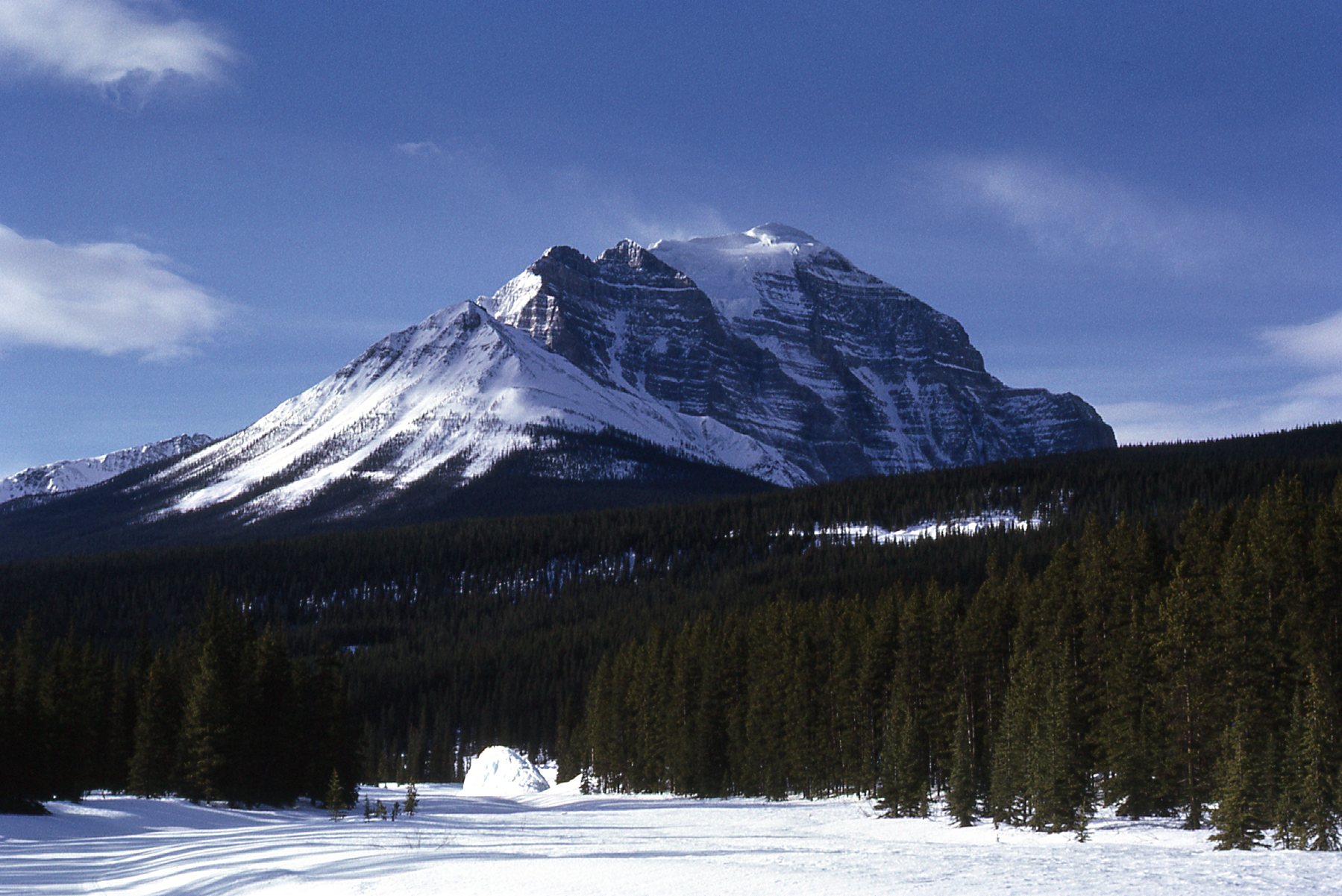
Looking south to Mount Temple.
Those 2 pictures were taken in March of 1972 on a winter trip to the area – I include them here because they turned out so well. So now, back to my 1966 outing. As I started north on the Parkway, I soon came to Hector Lake.

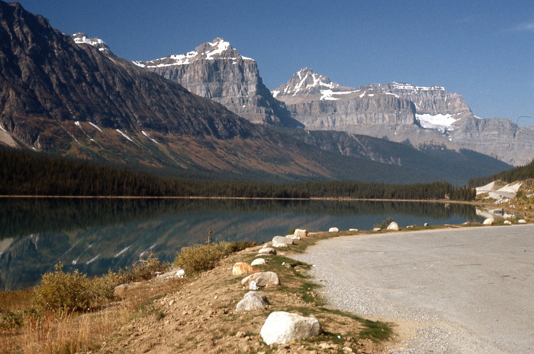
Looking northwest to Hector Lake.
Nearby sat Dolomite Peak, elevation 9,836 feet.
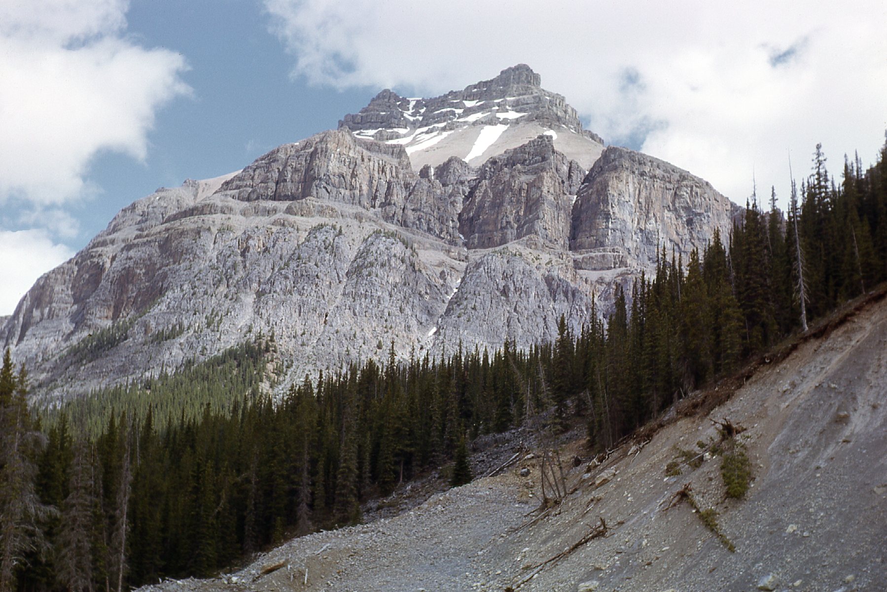
Dolomite Peak – we are looking north.
The Crowfoot Glacier sits a bit farther north. Here, we are looking southwest at it, and it lies on the northeast side of Crowfoot Mountain, elevation 9,593 feet.
The Crowfoot Glacier
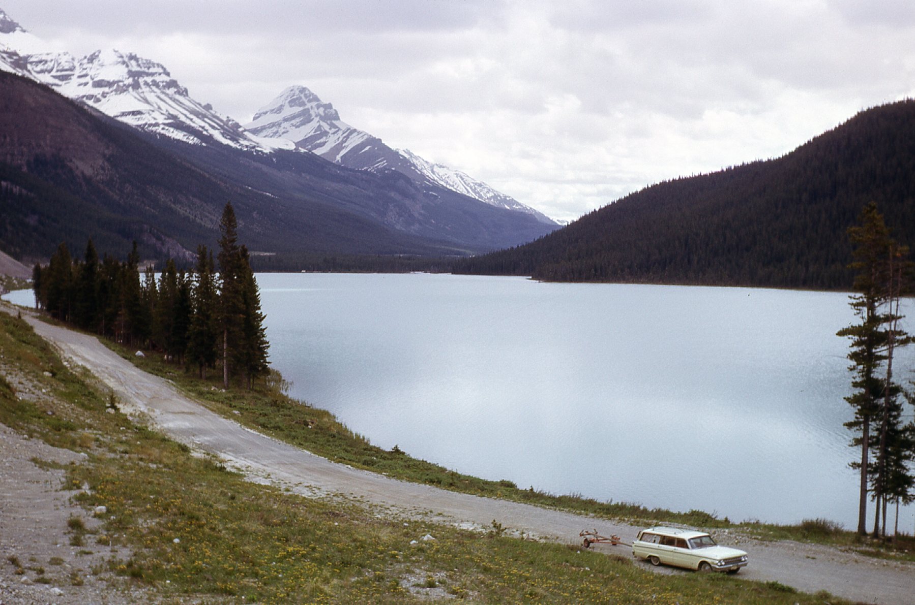
Waters from the Crowfoot Glacier flow into Bow Lake.
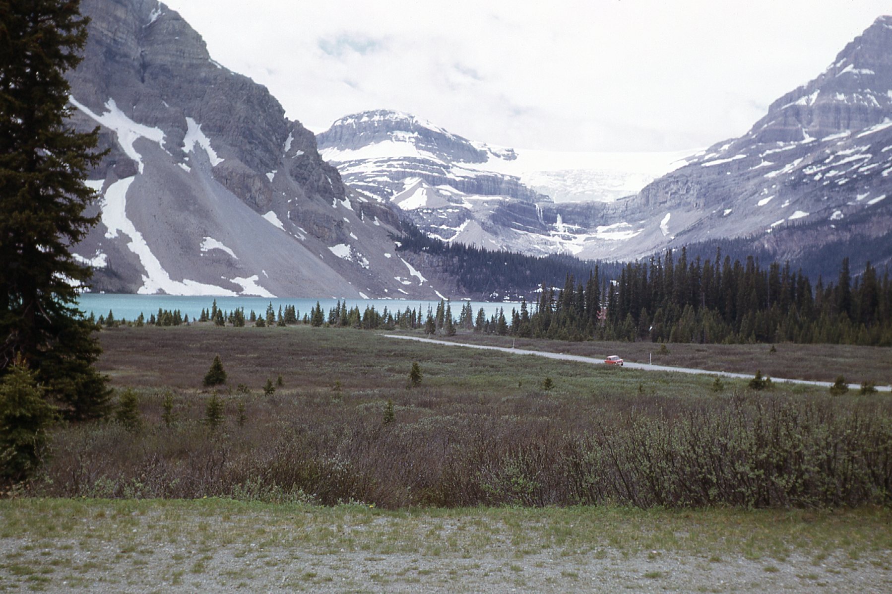
Bow Lake.
Here is a better photo of Bow Lake, with Mount Thompson on the right side.
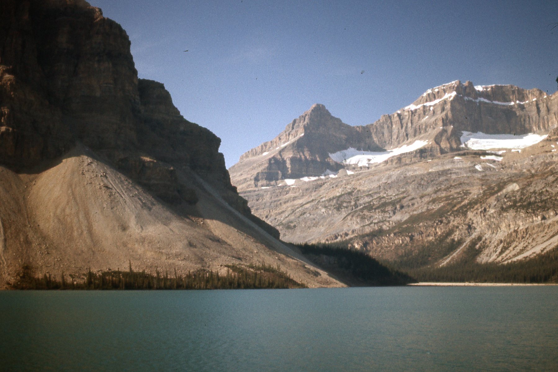
Looking across Bow Lake to Mt. Thompson, elevation 10,135 feet.
The Bow River starts at Bow Lake, and flows south to Lake Louise, then east to Banff, Canmore and Calgary. It continues out on to the prairies to join with the Oldman River to form the South Saskatchewan River. The Bow runs a total distance of 365 miles as such and drains an area of 10,100 square miles.
Some of these pictures were taken on a day when the weather was rather unsettled. I drove down to the shore and came to this – it was called Num-Ti-Jah Lodge back then, but has since been re-named The Lodge At Bow Lake.
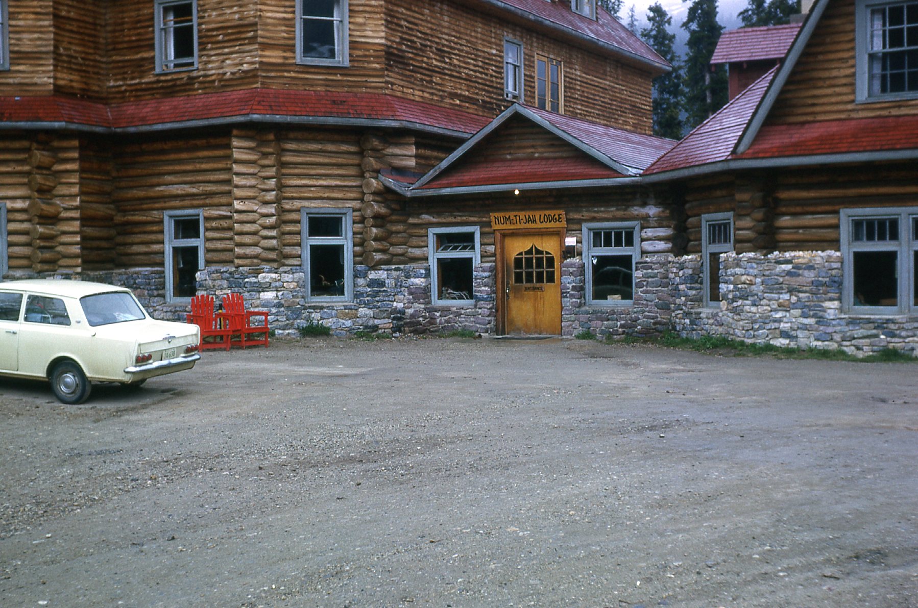
Num-Ti-Jah Lodge
It was trying to snow, entirely possible in June in the Rockies here at 6,400 feet above sea level.
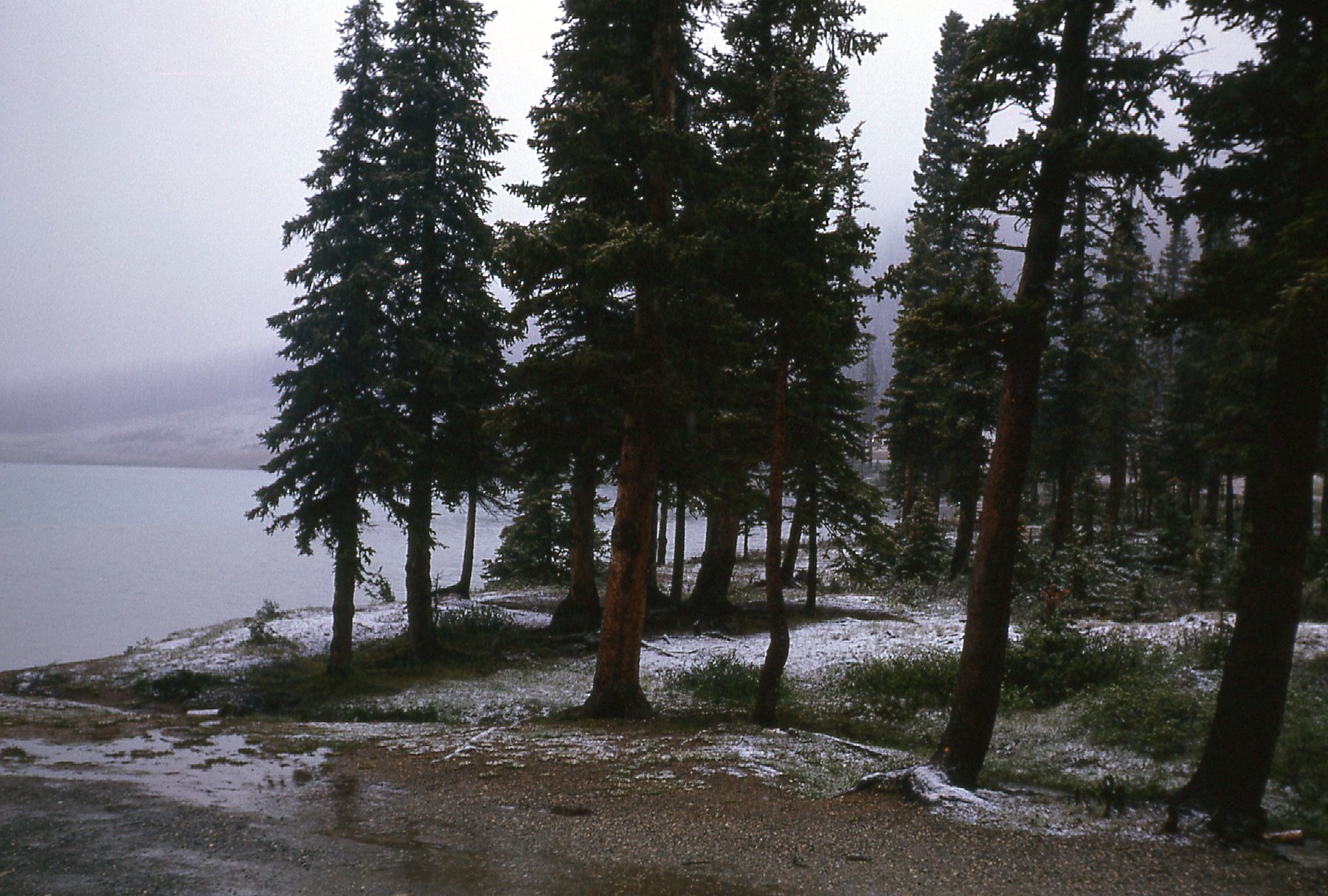
Snow in June.
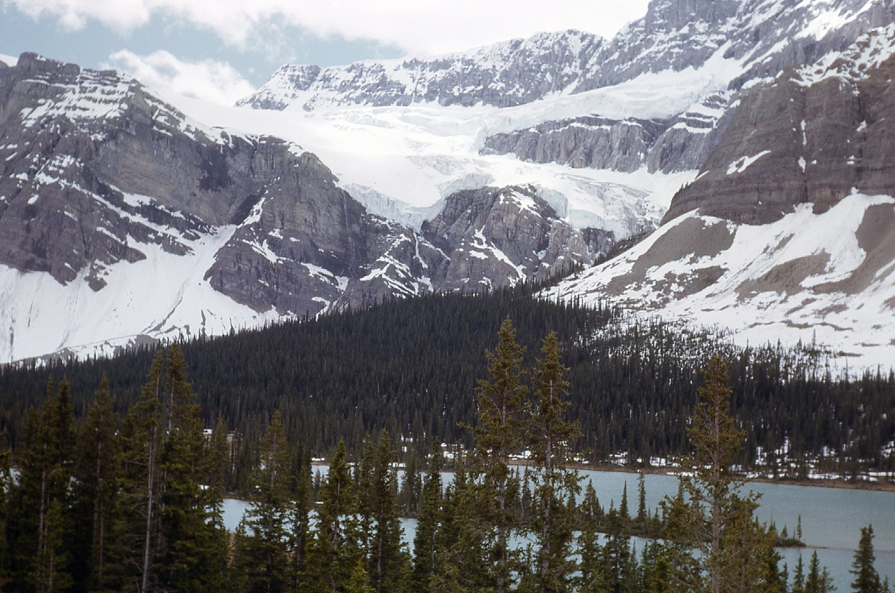
As you continue north from Bow Lake along the Parkway, you soon come to a turnoff which takes you west from the highway a short distance to a viewpoint. From there, at 6,890 feet elevation, you get a terrific view down to Peyto Lake, 750 feet below.
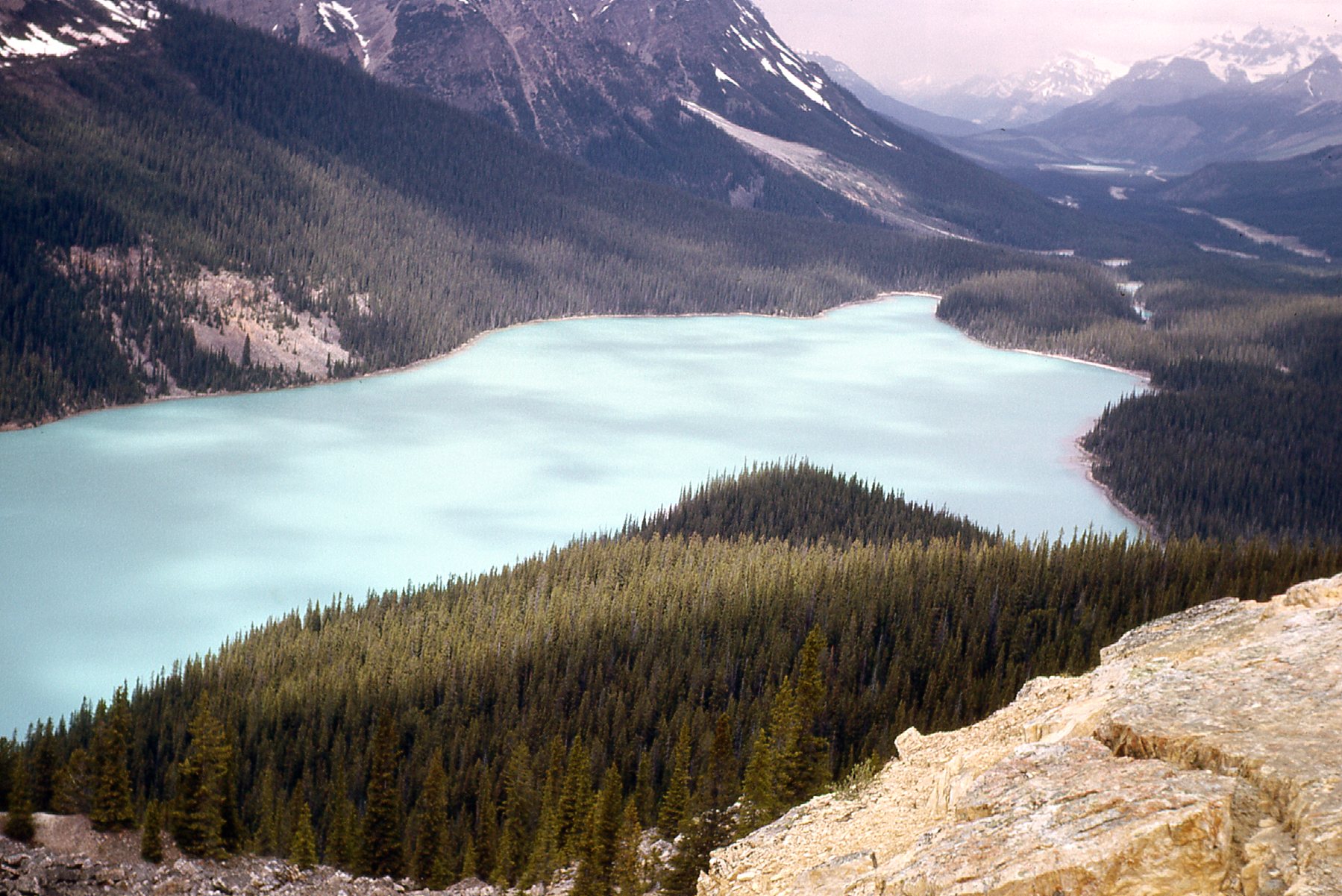
Looking northwest over Peyto Lake
You also get a good view southwest to Peyto Peak (9,780′) and Peyto Glacier.
The view to the southwest.
Once back on the highway, just a few more miles north brings you to yet another viewpoint, where you can see Mt. Patterson (10,489′ elevation) and the Snowbird Glacier.
The Snowbird Glacier on Mt. Patterson – we are looking southwest.
The views are non-stop. A short distance beyond Mt. Patterson, Howse Peak comes into view – it’s the one on the left.
Howse Peak, elevation 10,810 feet.
Just north of Mt. Patterson sit the Waterfowl Lakes. Here, we are looking south over the lower lake.
Lower Waterfowl Lake
The real view, though, the elephant in the room, from the lake is Mount Chephren, elevation 10,715 feet. It sits nearby to the west and towers over its surroundings.
Mount Chephren
Looking across Lower Waterfall Lake, we see the Kaufmann Peaks, a double summit reaching 10,203 feet.
The Kaufmann Peaks
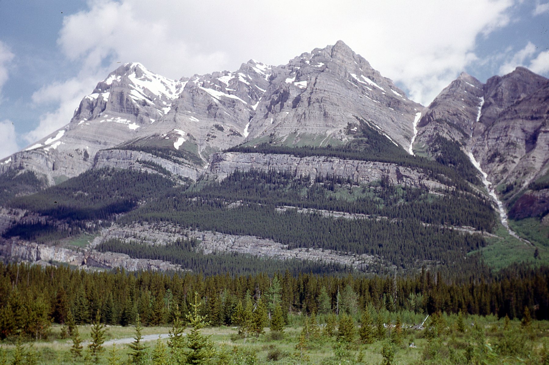
Here’s a view north to more beautiful peaks.
Beauty everywhere you look.
A few miles more along the Parkway brings us to a place called Saskatchewan River Crossing, so-named because in the 19th century, travelers and fur traders used to cross the North Saskatchewan River at this spot on their way to British Columbia. Today, it is the only place between Lake Louise and Jasper that offers basic services such as gasoline, food and lodging. It lies 47 miles along the Parkway from where we started our journey near Lake Louise. During the winter, however, those services are closed.
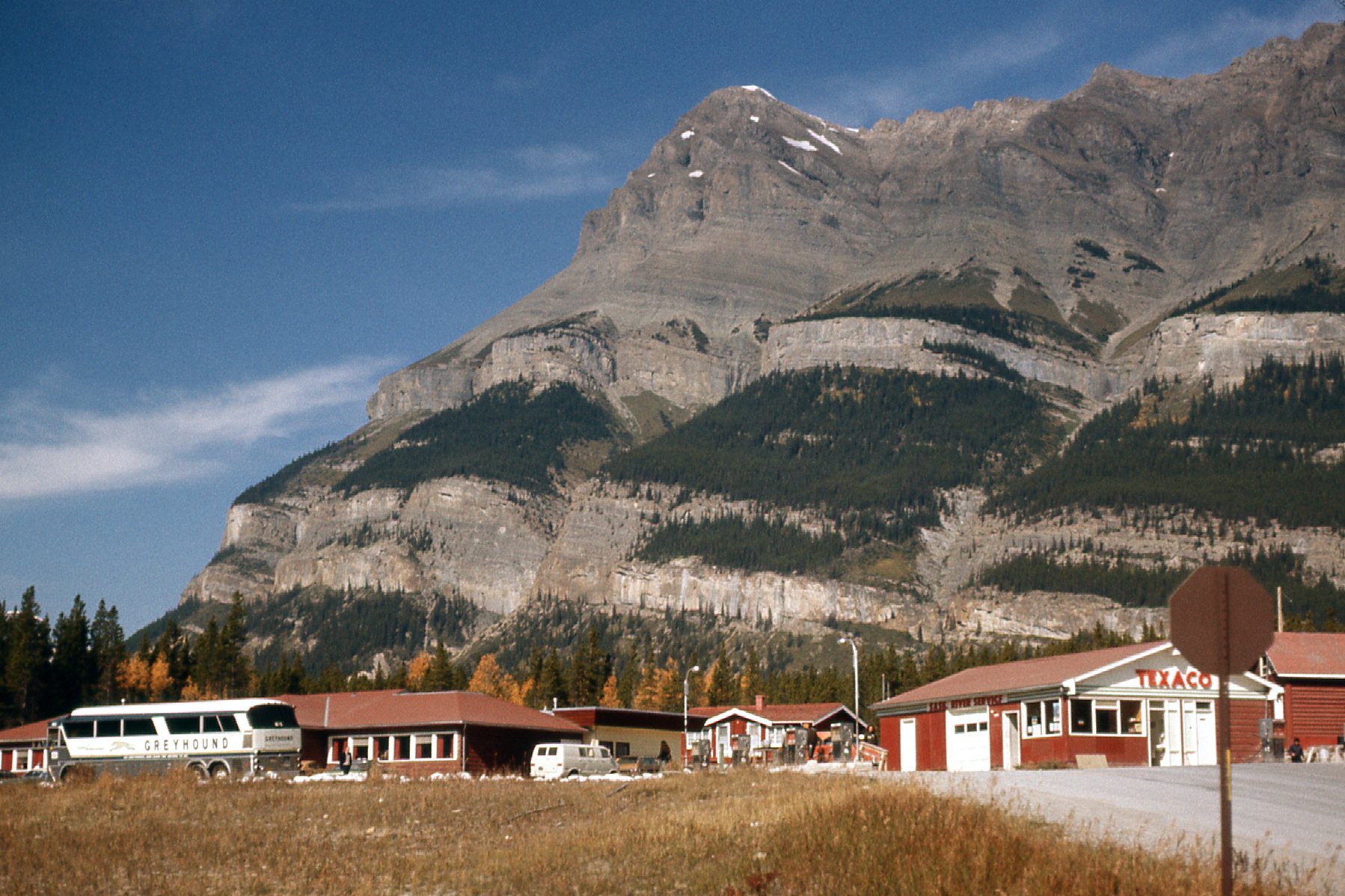
Saskatchewan River Crossing
The crossing marks the confluence of the Howse River and the Mistaya River with the North Saskatchewan. One more thing of note – it is the only place along the Parkway where you can actually leave it and drive somewhere else – namely, Alberta Highway 11 which goes 110 miles east to the town of Rocky Mountain House and the prairies. If we look back to the south from the crossing, this is our view.
Looking back the way we came.
If we look east, here’s what we see.
Looking east.
And just north of the crossing, towering above the highway, sits Mt. Wilson, elevation 10,184 feet.
North to Mt. Wilson
Here’s a different view of Mt. Wilson, this time from its west side.
The west side of Mount Wilson
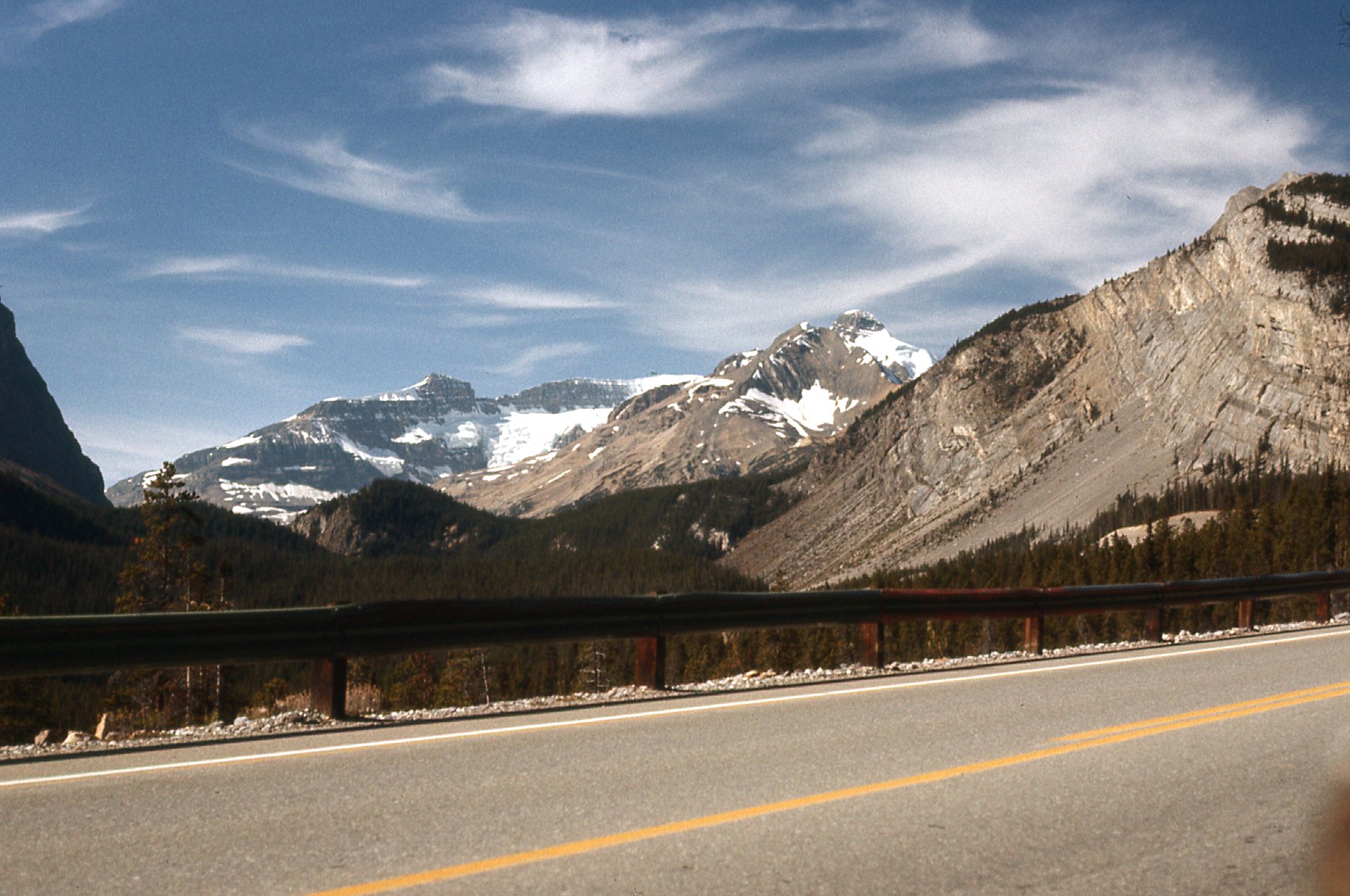
Not far beyond Mt. Wilson, we get these great views of the northeast side of Mount Amery. It sits off to the west of the Parkway.
The east side of Mount Amery, elevation 10,922 feet.
Even as we continue north along the Parkway, the peak is still quite visible.
Looking south-southeast to Mount Amery
Here’s another view, taken from even farther north.
Another view of Mount Amery, from farther north, along the edge of the North Saskatchewan River.
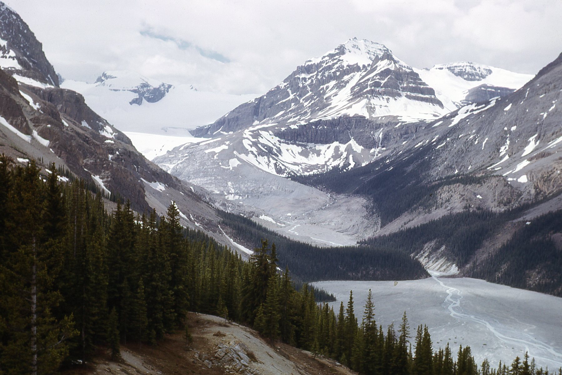
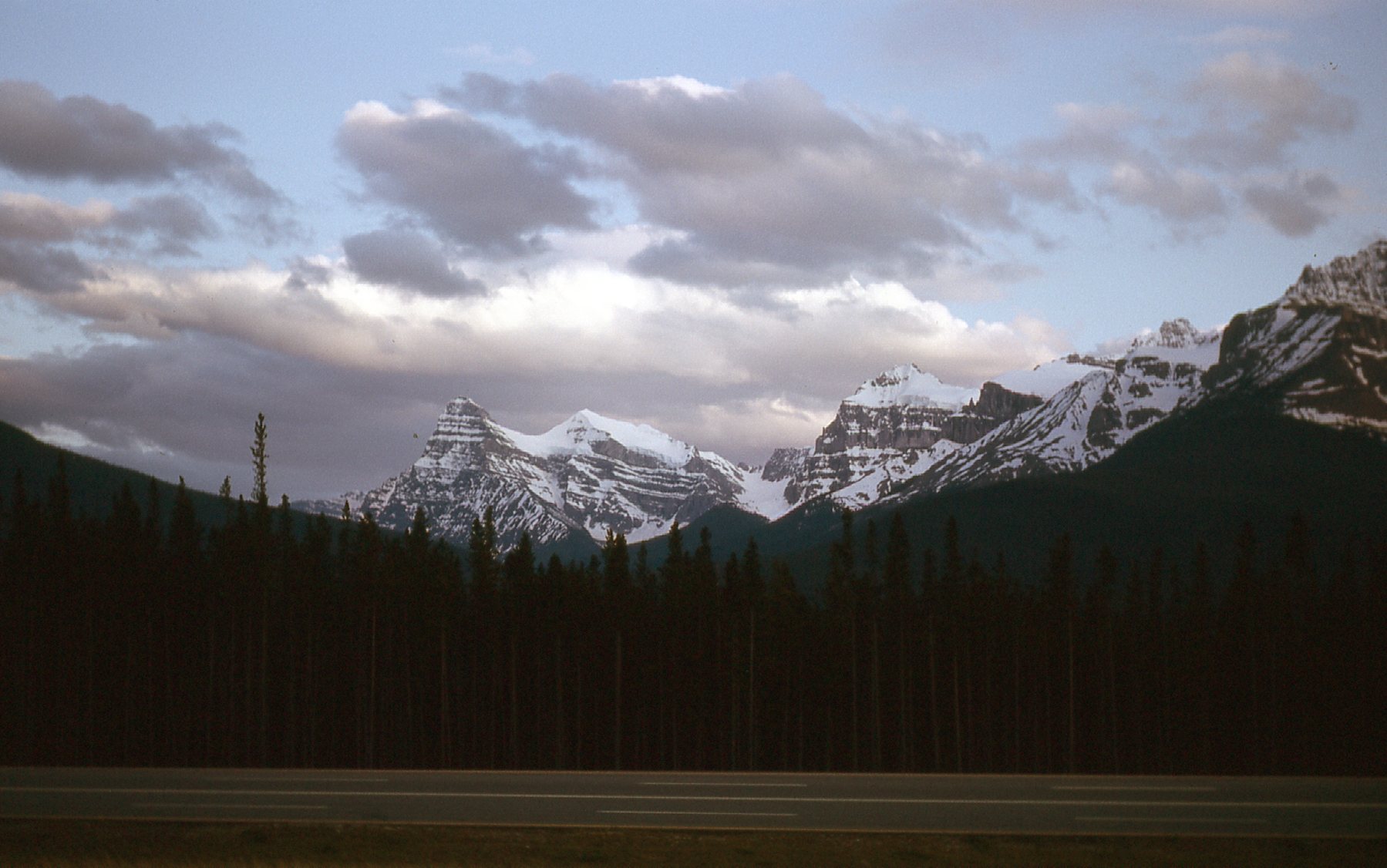
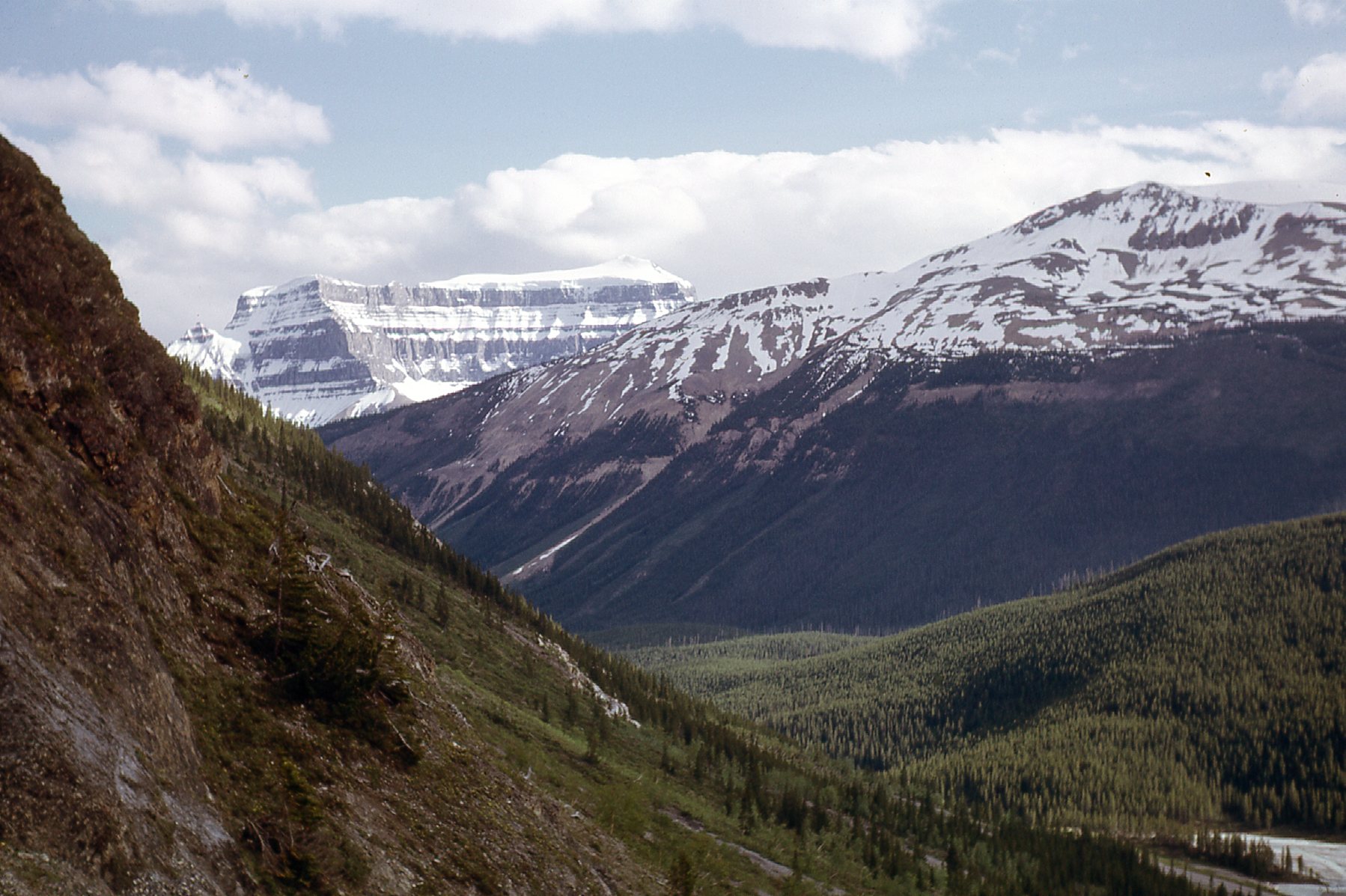
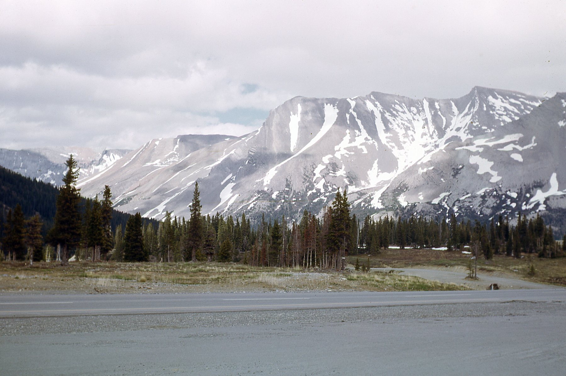
As we climb up towards Sunwapta Pass, we can see some of the peaks to the south of the Columbia Icefields.
South of the Icefields
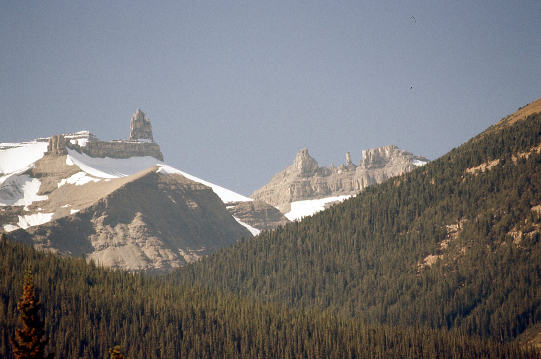
Here’s a view of Mt. Saskatchewan, elevation 10,965 feet. It’s not a simple climb. Off to its right sits Cleopatra’s Needle, elevation 9,710 feet.
Mt. Saskatchewan on the left and Cleopatra’s Needle on the right.
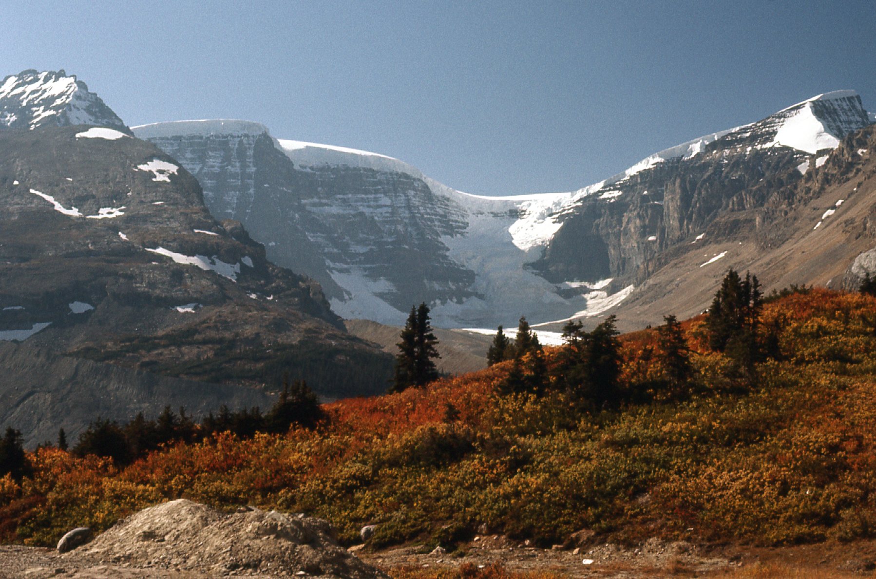
Here’s the same view, but taken in the fall instead of June.
The same view but 3 months later in the season.
Here’s a very different view of Mt. Saskatchewan.
Mt. Saskatchewan
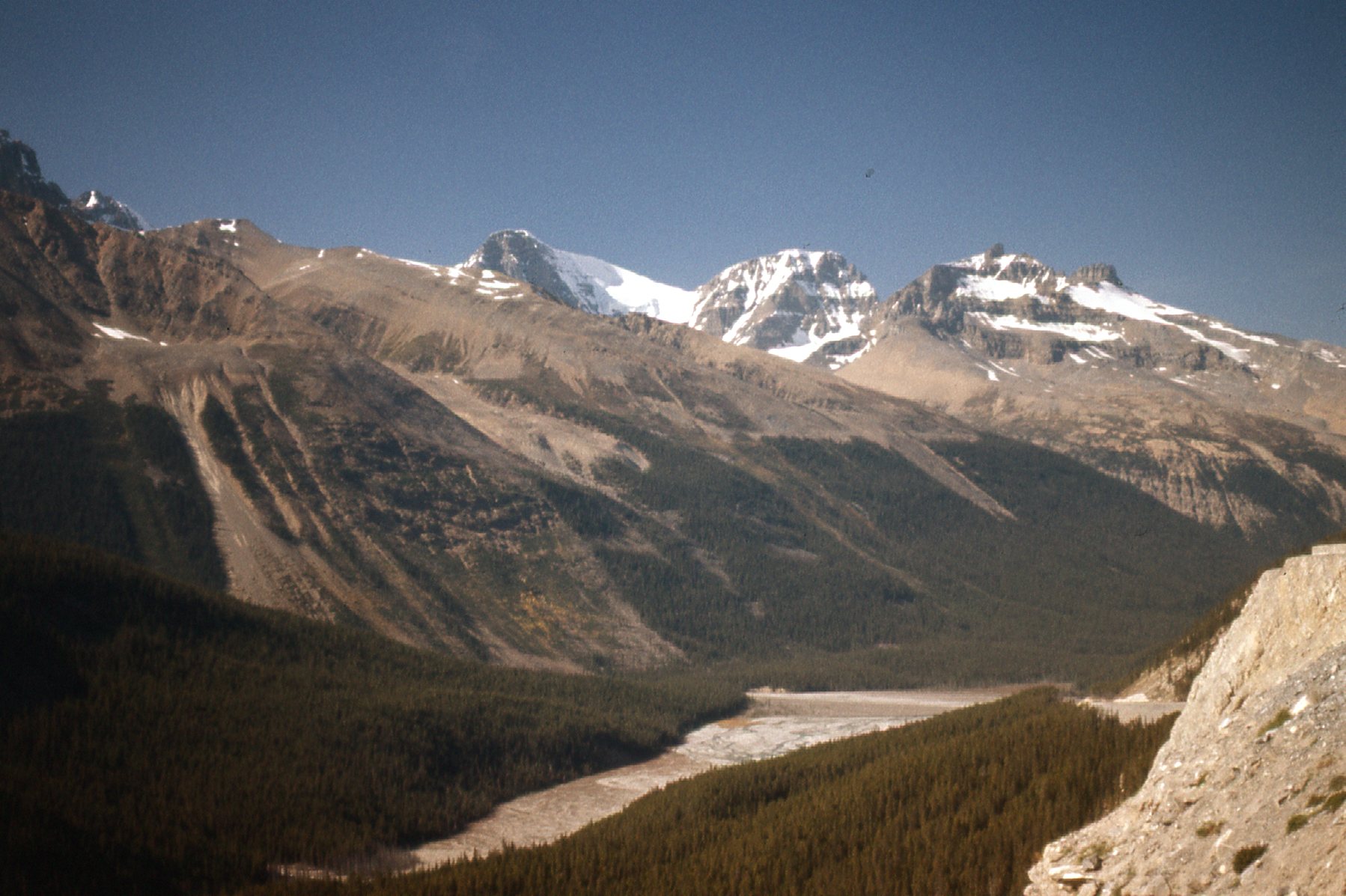
And here’s more scenery near Mt. Saskatchewan.
Near Mount Saskatchewan
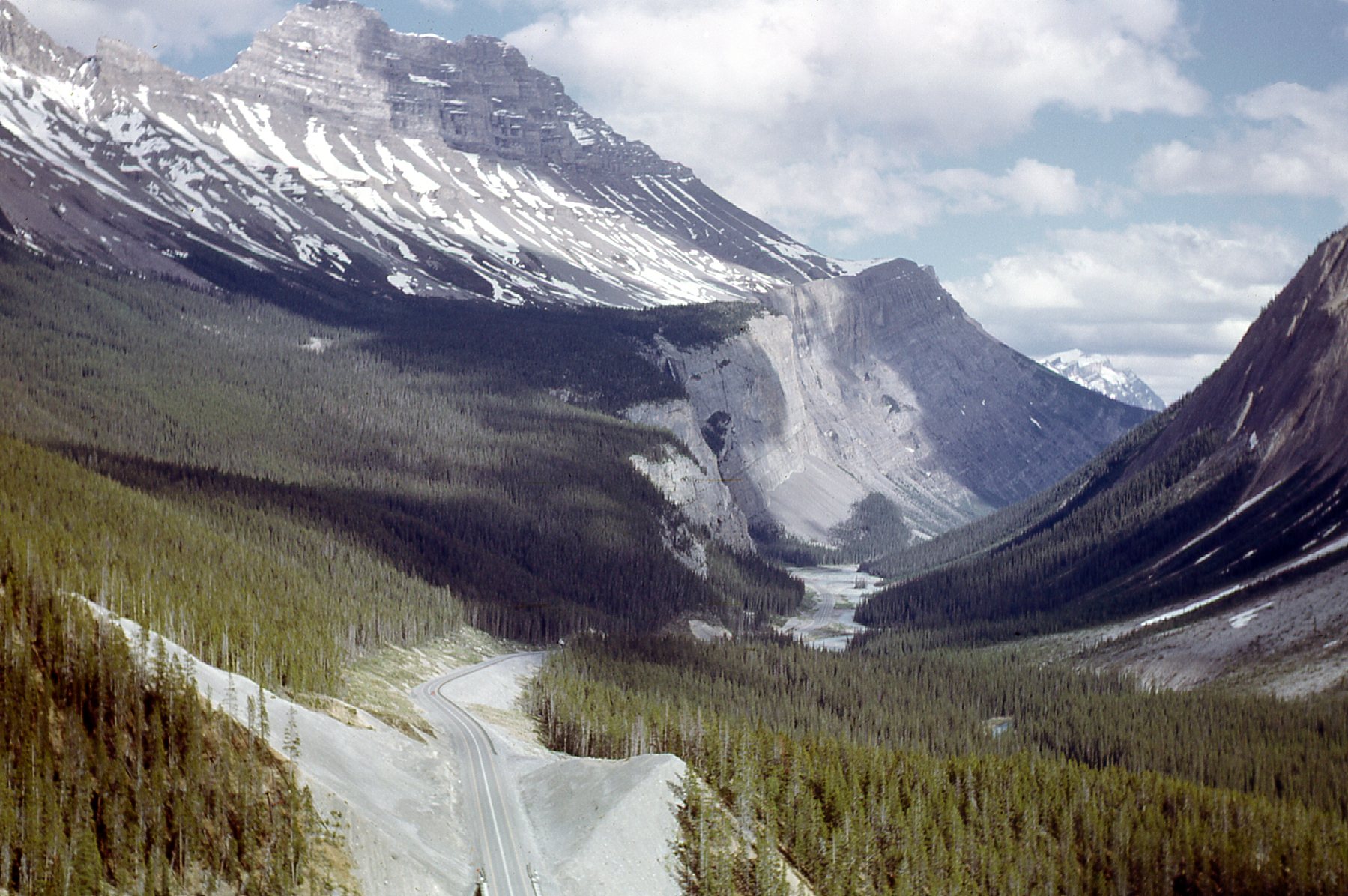
Continuing north, we soon come to a very prominent peak on the east side of the road. It is Cirrus Mountain, elevation 10,730 feet. It is known for its west face which looks down over the Parkway, and is called the Weeping Wall. The wall is 1,200 feet high and has a number of waterfalls which tumble down it. One of them is Panther Falls, 130 feet high.
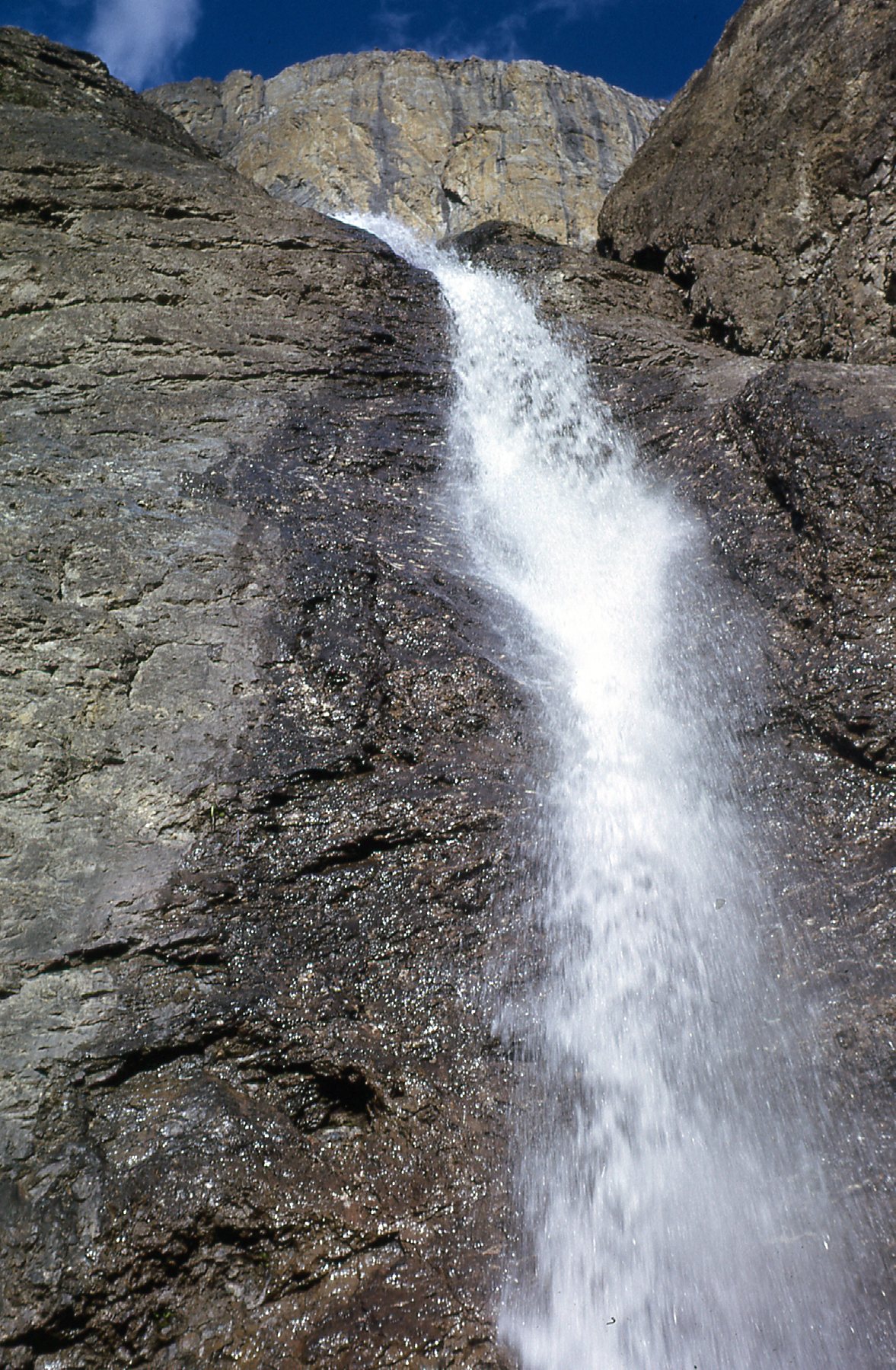
Panther Falls
A much taller falls, though, is Bridal Veil Falls. It has a total drop of 1,200 feet, and the largest single drop is 400 feet. The falls flows into Nigel Creek, which in turn flows into the North Saskatchewan River.
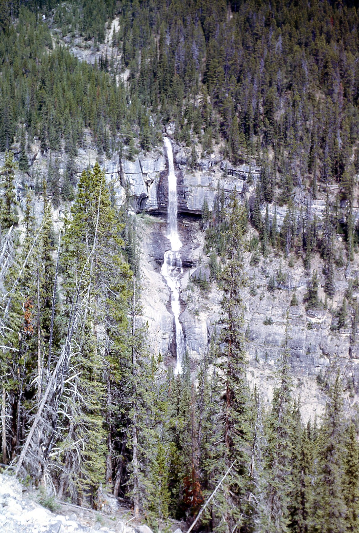
Bridal Veil Falls
Here’s a broader view of the Weeping Wall.
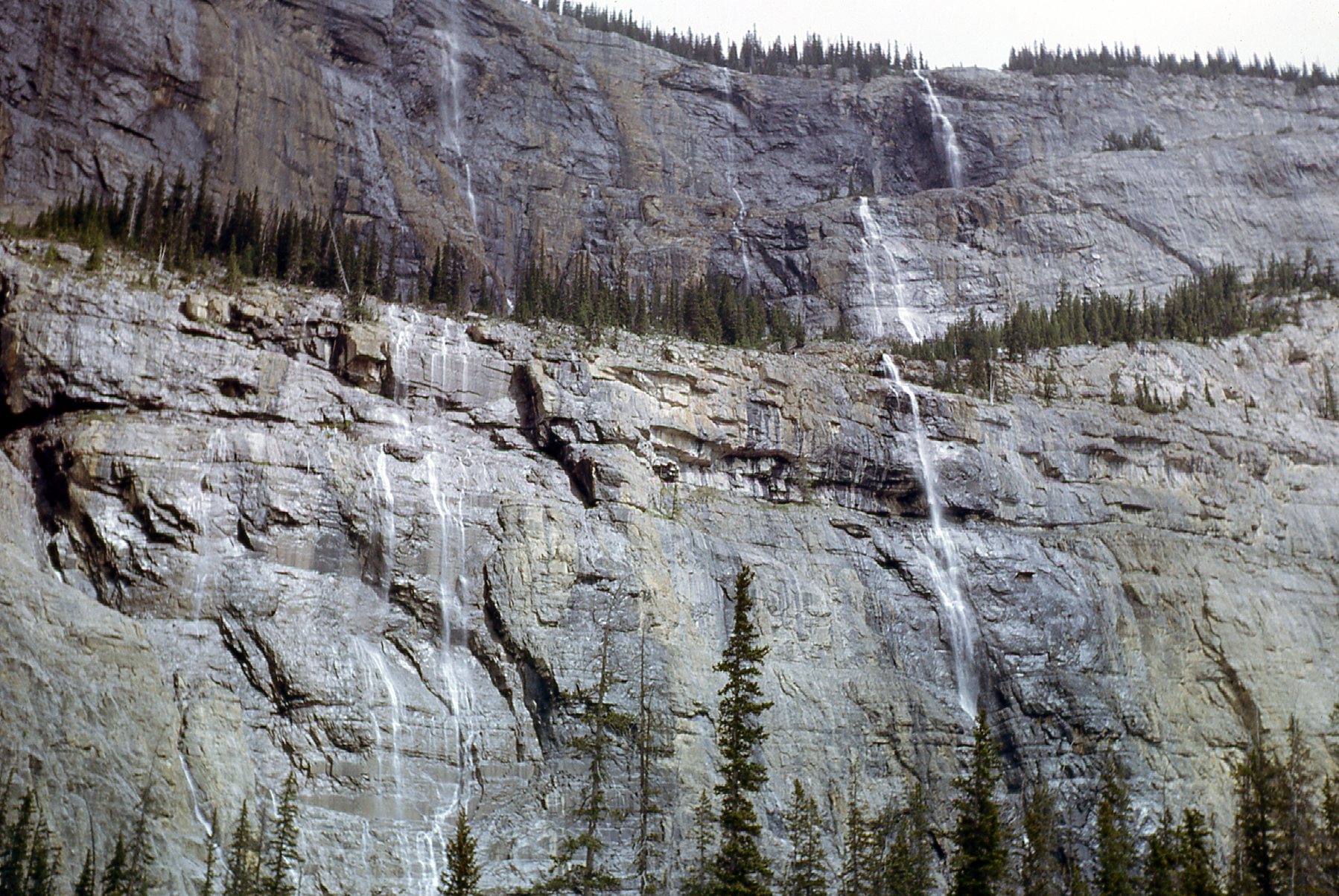
The Weeping Wall
If we drive a couple of miles farther north, we can look back and see a better view. That’s Cirrus Mountain, and the steep gray area lower down to the right is the Weeping Wall. In winter, the falls on the wall can freeze up and create some world-class ice climbing.
Cirrus Mountain, with the Weeping Wall below.
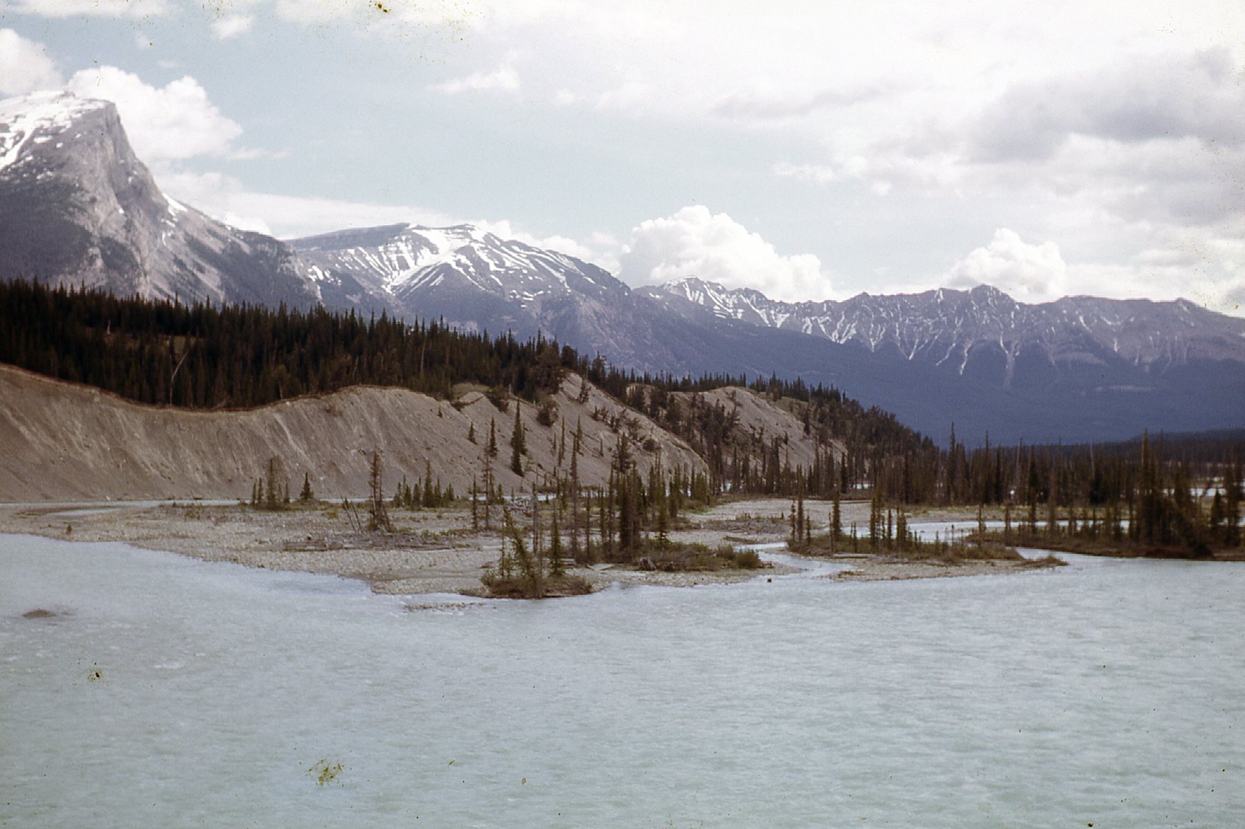
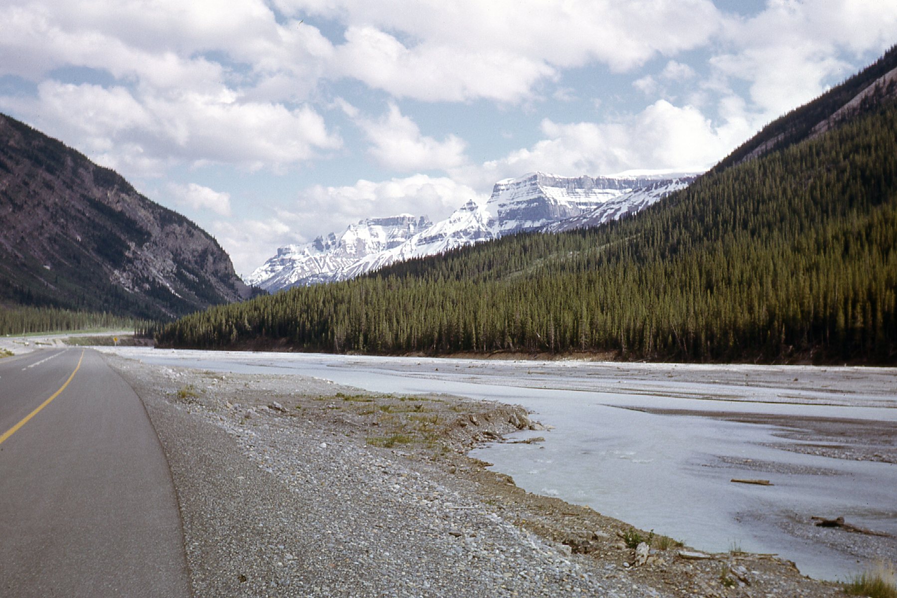
Here’s a view looking north along the river.
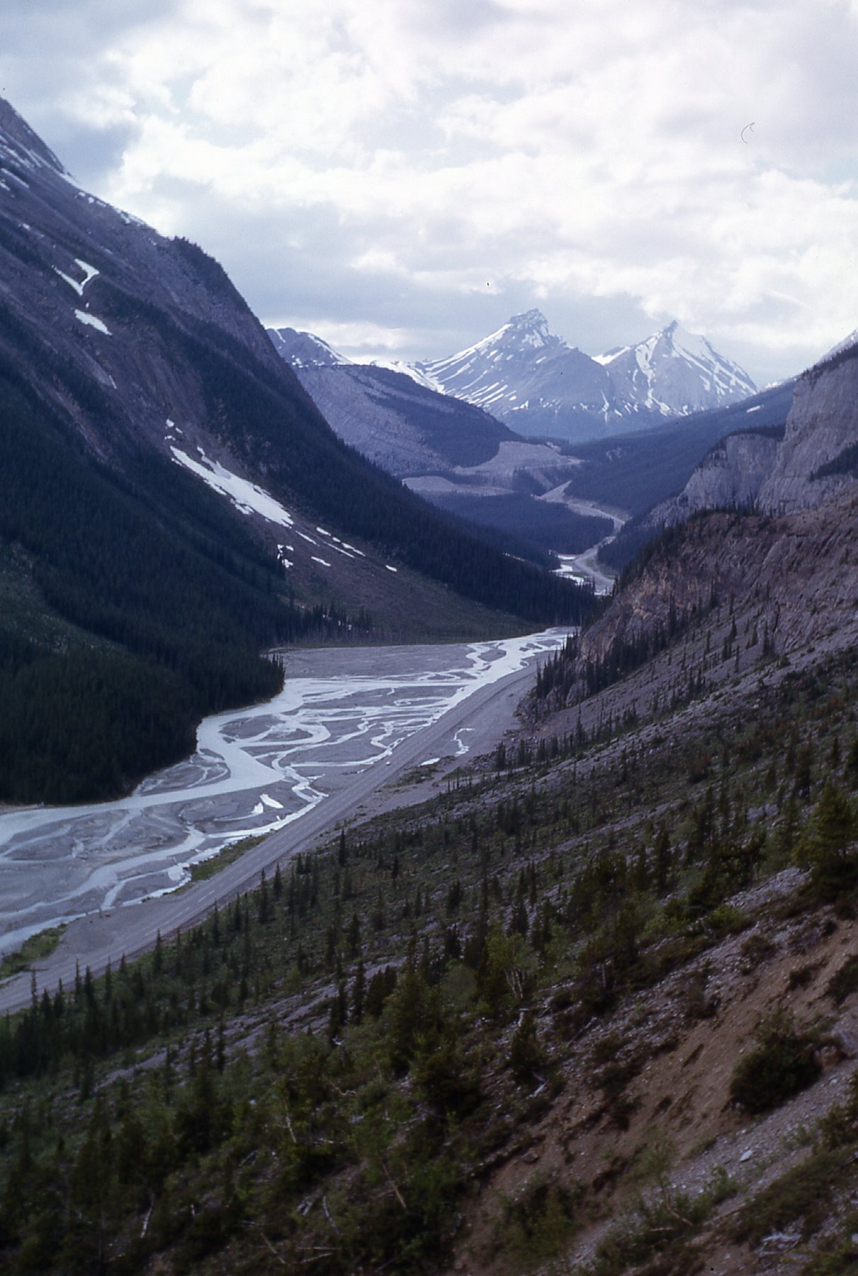
Looking up the North Saskatchewan River.
The North Saskatchewan River is 800 miles long. Its source is the toe of the Saskatchewan Glacier, which is part of the larger Columbia Icefield. At Saskatchewan River Crossing, it turns east and passes by Rocky Mountain House, then makes its way up and through Edmonton. From there, it flows east to pass near North Battleford and then through Prince Albert. Shortly after that, it joins the South Saskatchewan River and continues east into Manitoba and Lake Winnipeg. It drains a total area of 47,400 square miles as the North Saskatchewan.
The Parkway then climbs north, and a few miles later reaches Sunwapta Pass at an elevation of 6,677 feet. Here, we leave behind Banff National Park and enter Jasper National Park. This is the view at the pass.
The photo was taken in the pass, east of Parker Ridge.
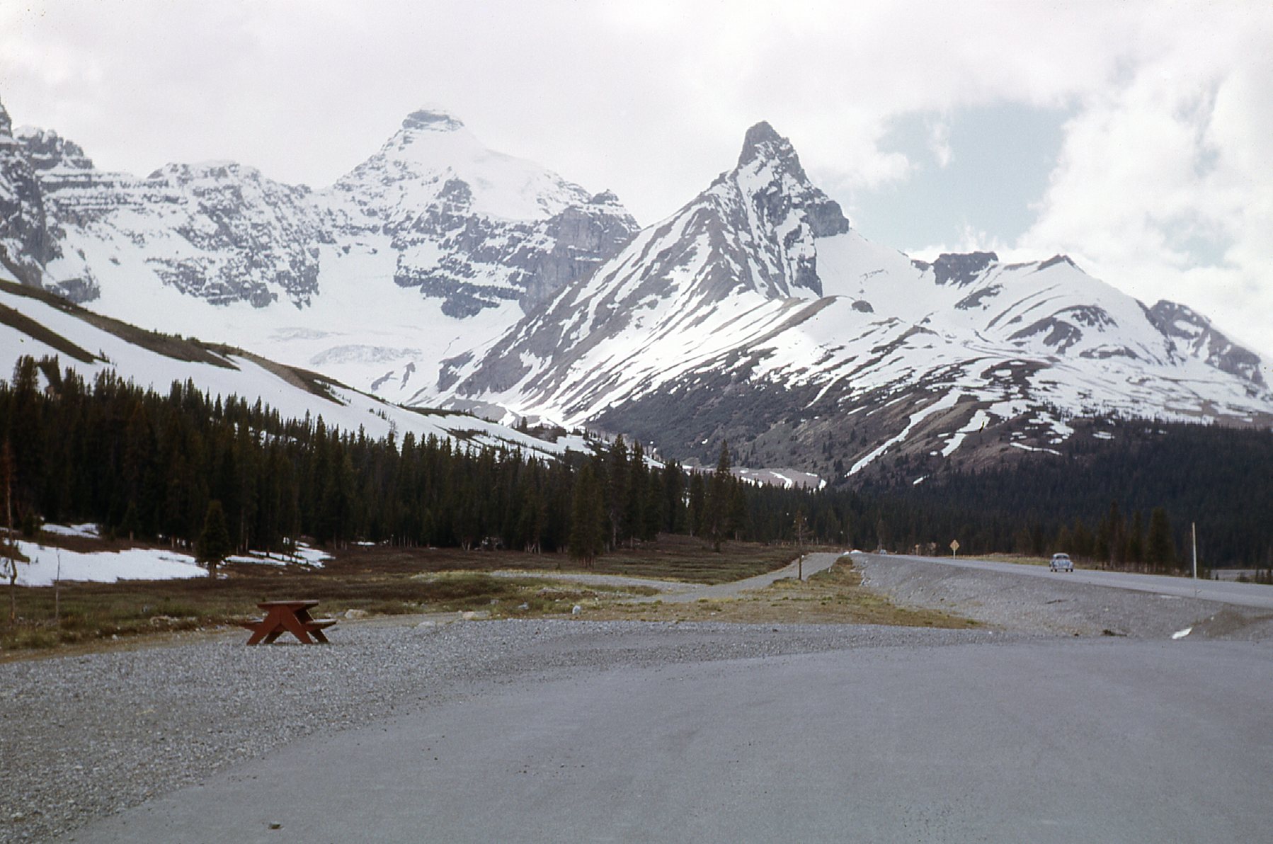
Slightly farther along the Parkway, we can look north to Nigel Peak, 10,535 feet elevation.
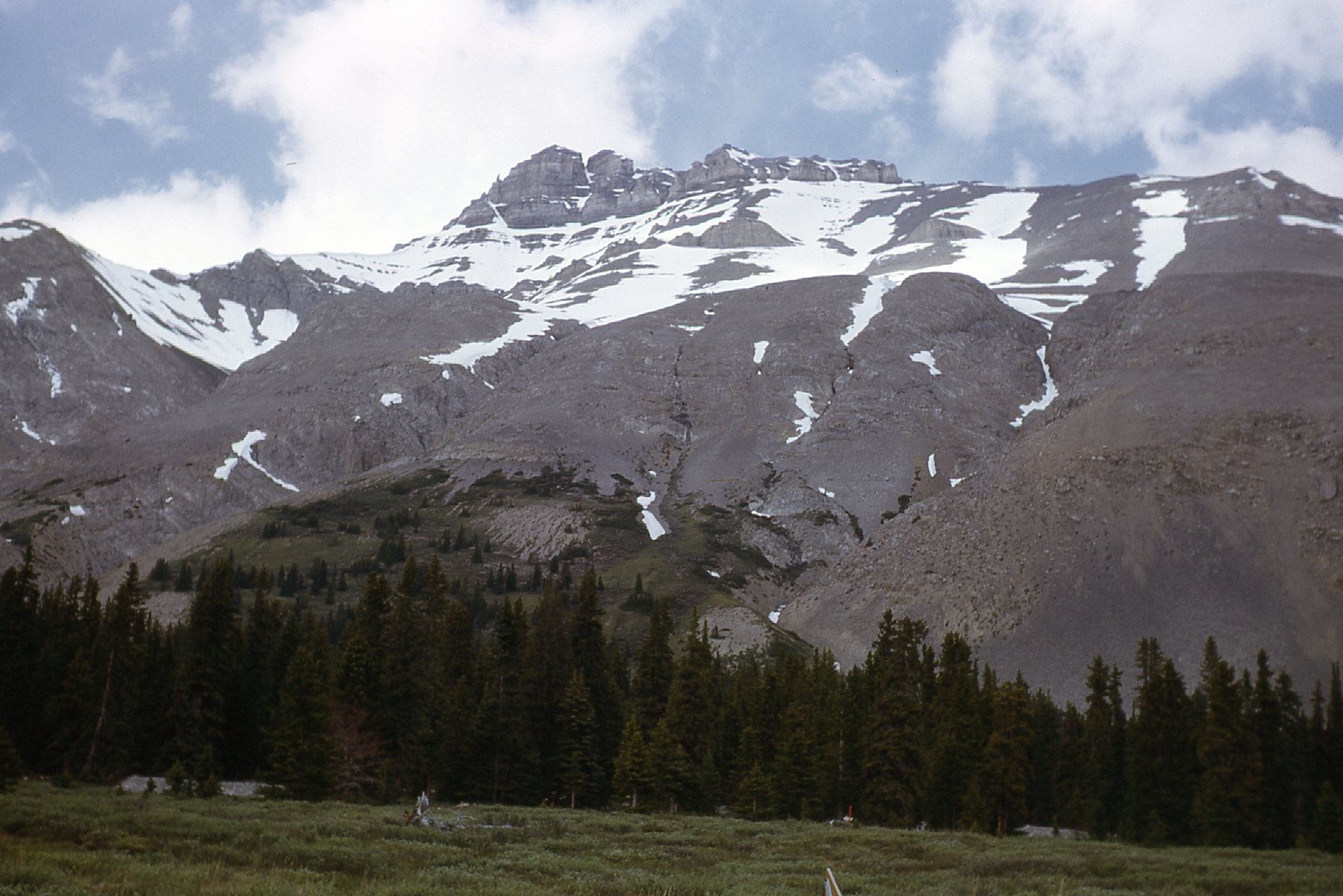
A few of us spent some time in the area in 1988. We climbed to within 30 feet of the top of Nigel Peak 2, where we were stopped by a gap.
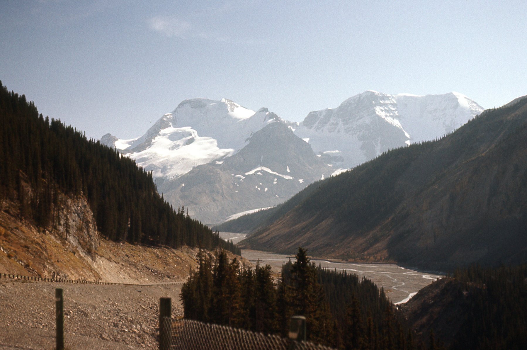
Just beyond the pass, we arrive at the Athabasca Glacier. There are over 100 glaciers that can be seen from the Icefields Parkway, but this is by far the most famous one. In fact, it is the most visited glacier in North America. And why not, it’s so easy to get to. You can park and walk a path that takes you to the toe of the glacier.
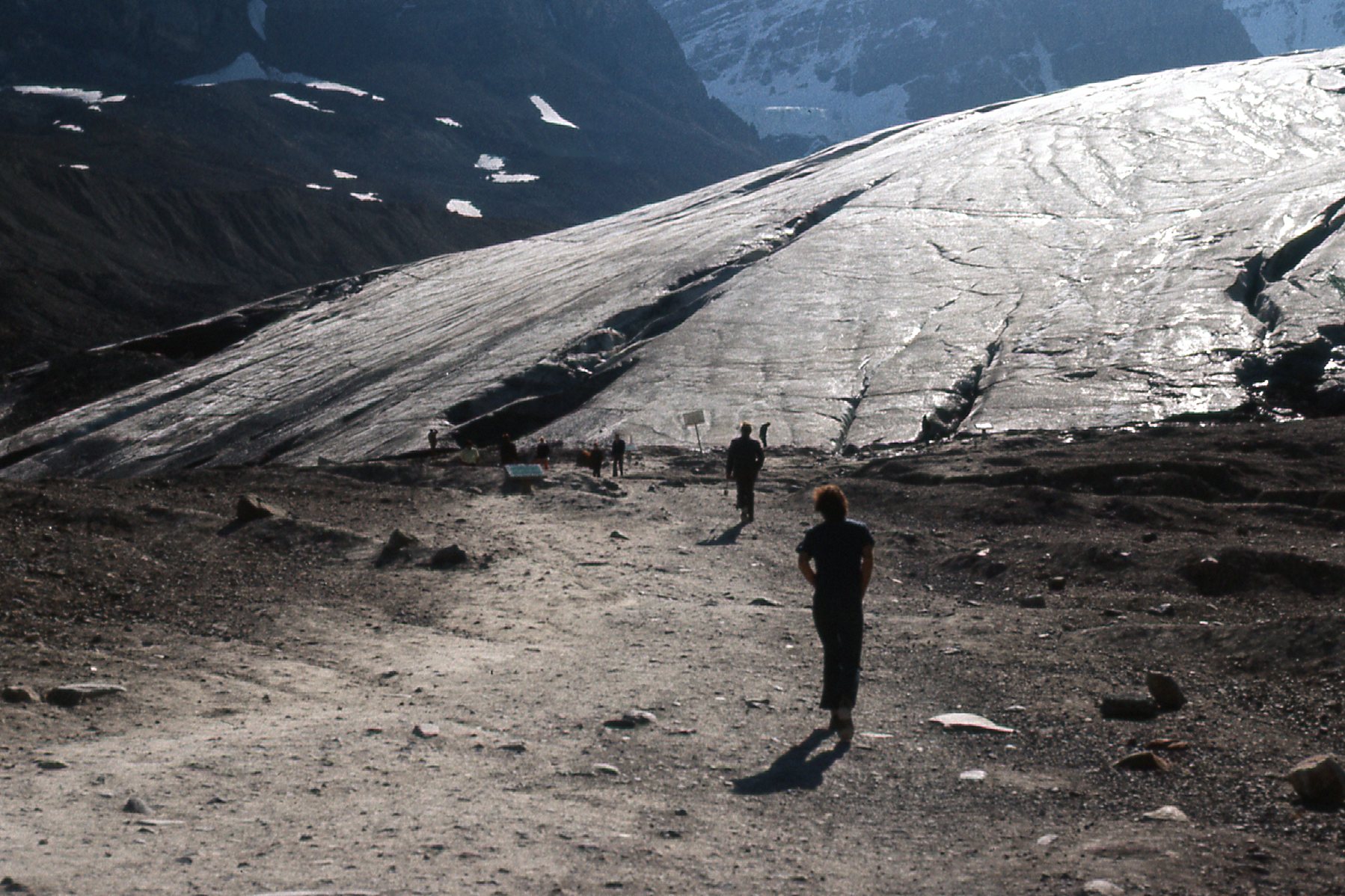
Folks strolling up to the toe of the glacier.
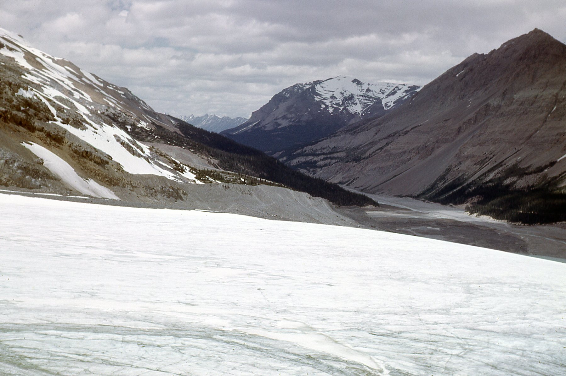
Signs show the location of the toe each year, and the distance it has receded is quite remarkable. Since the mid-1800s, it has receded 5,750 feet. And even since my first visit there in 1966, the toe has receded 1970 feet. Here is what it looked like when I was first there.
The Athabasca Glacier
You can drive a road up and along the south side of the glacier and park. From there, you can walk down to and on to the glacier itself. Here was the parking area in 1966.
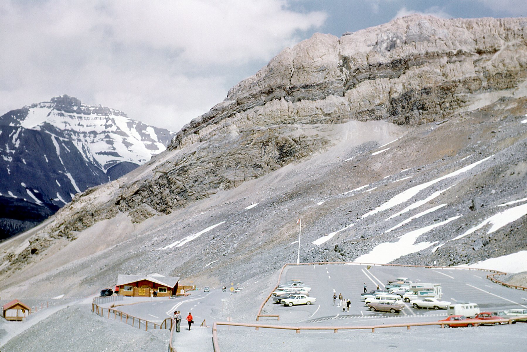
Park here to walk down to the glacier.
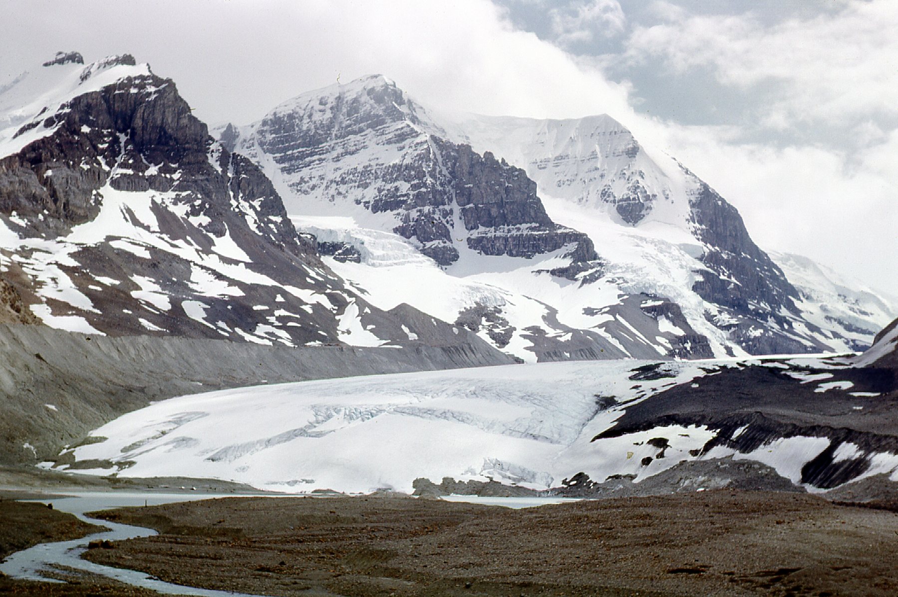
From the parking area, you had these excellent views.
Looking up the glacier.
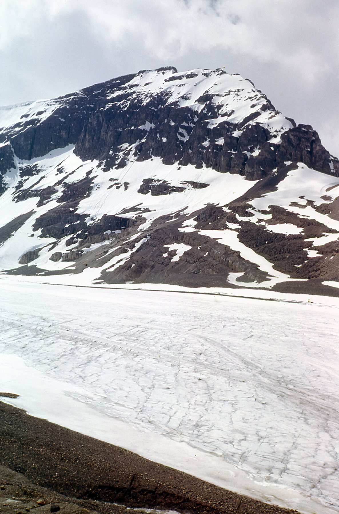
Here’s one looking across it to the north.
Looking north across the glacier to the Sunwapta Valley.
And here’s a look to the northwest to the Dome Glacier which comes down from a peak called Snow Dome.
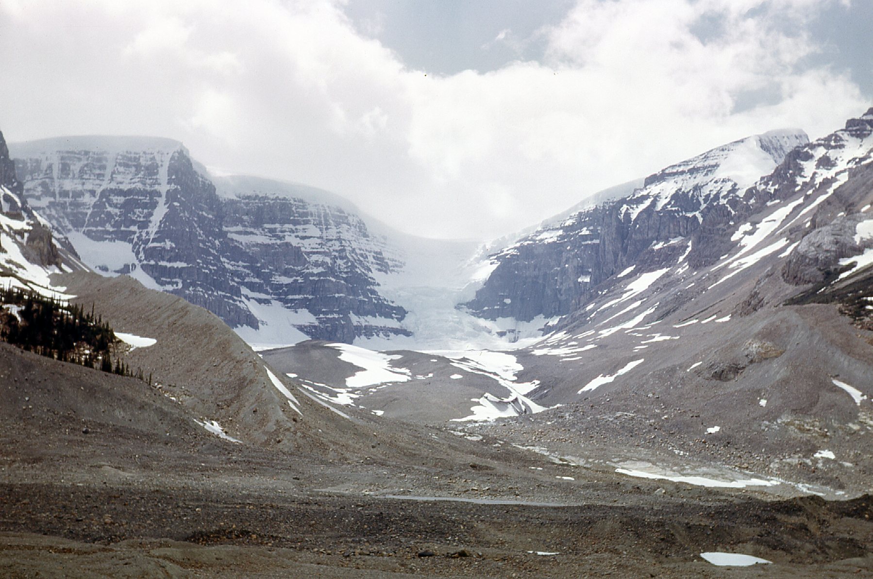
The Dome Glacier
The same view taken in better weather.
Snow Dome
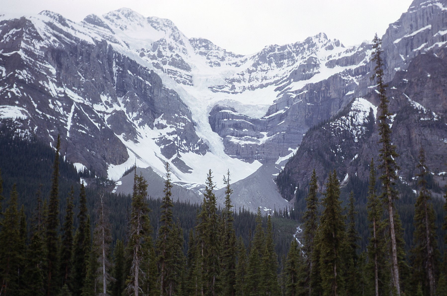
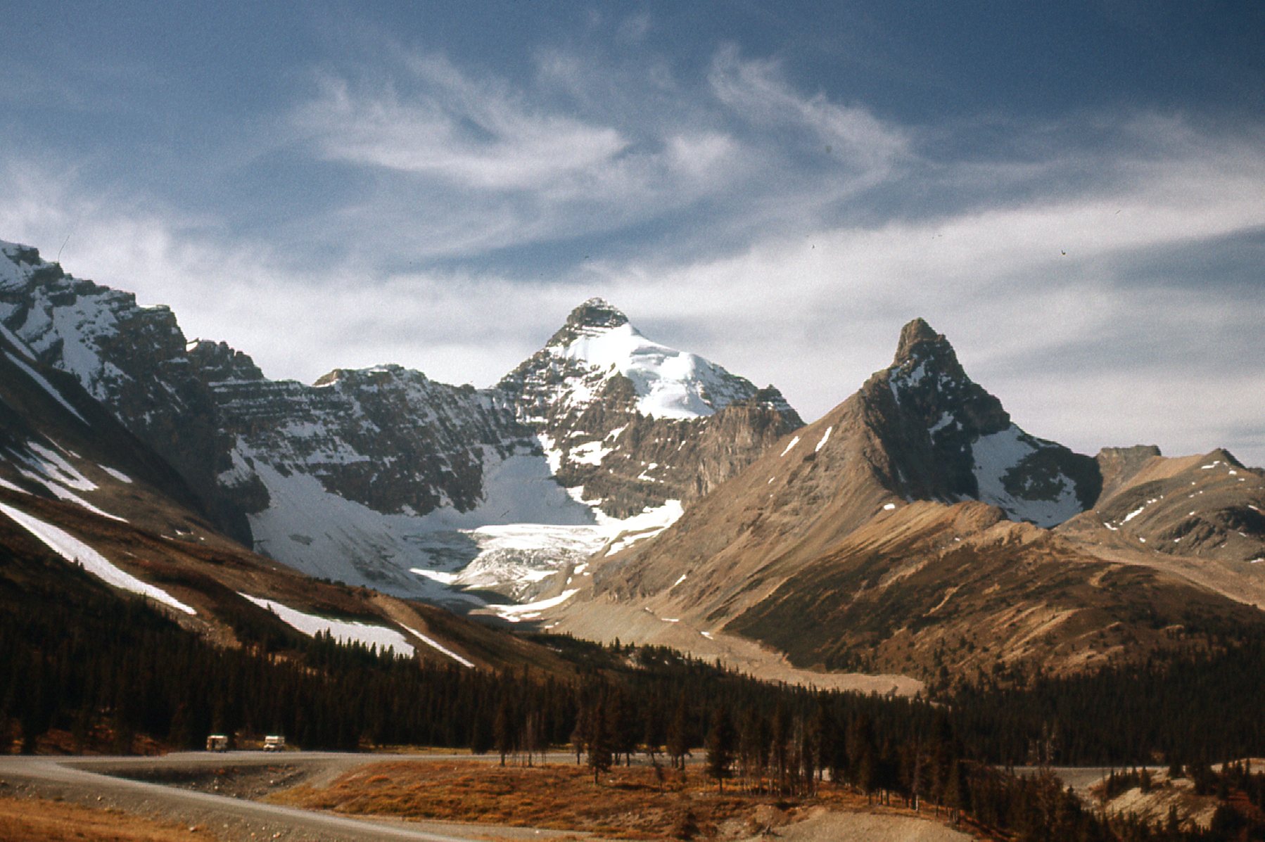
A bit farther north from Athabasca Glacier, we get this view of Diadem Peak. It has an elevation of 11,060 feet, but is a lesser bump of Mt. Woolley (11,171 feet), sitting on its north shoulder. Woolley is the higher bump just to the left of center on the skyline. Diadem was the first 11,000-er north of the Columbia Icefield to be climbed, and was one of the few peaks in the Canadian Rockies to be climbed before 1900.
Diadem Peak is just to the right of center on the skyline.
Here’s a view looking back south. We can see two of the giants just to the south of the Athabasca Glacier.
That’s Mount Andromeda (11,319′) on the left and Mount Athabasca (11,453′) on the right.
I am writing this piece at the end of 2023, so it has been 57 years since these Athabasca Glacier pictures were taken. I have returned many times over the years -sometimes just passing through as a tourist; other times to climb some of the terrific peaks nearby. In the dead of winter in late 1968, I came up with the hare-brained idea to come back to this area to climb a peak. I camped there for a few days over Christmas, but there was too much snow, and it was insanely cold. The morning of December 26th, it was -11 degrees F, or -24 degrees C. I had to leave, as the cold had become deadly.
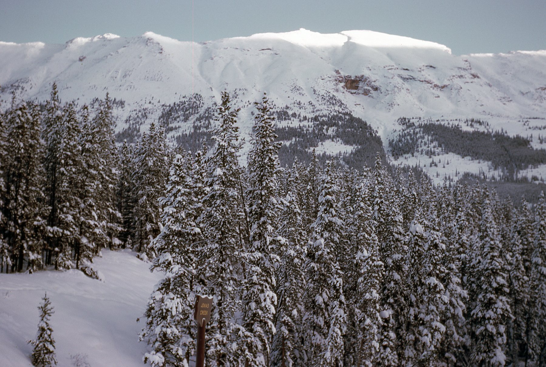
Camping in the snow at Jonas Creek, about 15 miles north of the Athabasca Glacier.
About 14 miles north of Jonas Creek, we come to Sunwapta Falls.
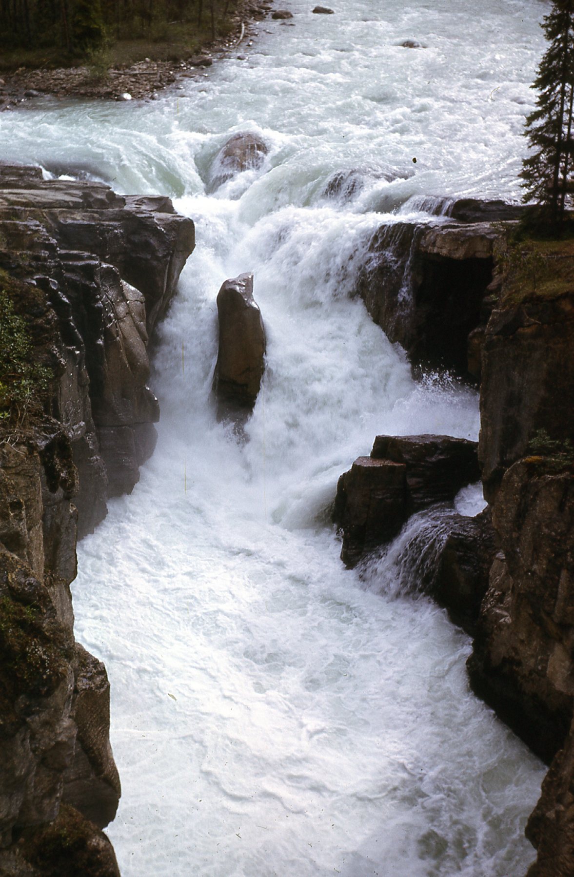
Sunwapta Falls
These falls are found along the Sunwapta River, which has its start back at the Athabasca Glacier. There are 2 falls, with a total drop of 61 feet. You can drive right up close to them and park.
If you continue north along the Parkway, in another 15 miles you come to Athabasca Falls. There are 2 falls there, with a total drop of 79 feet. These are a powerful Class 5 waterfall, and are found on the Athabasca River. The river originates at the toe of the Columbia Glacier and flows 765 miles until it enters Lake Athabasca. From there, its waters eventually flow into the Mackenzie River system and to the Arctic Ocean.
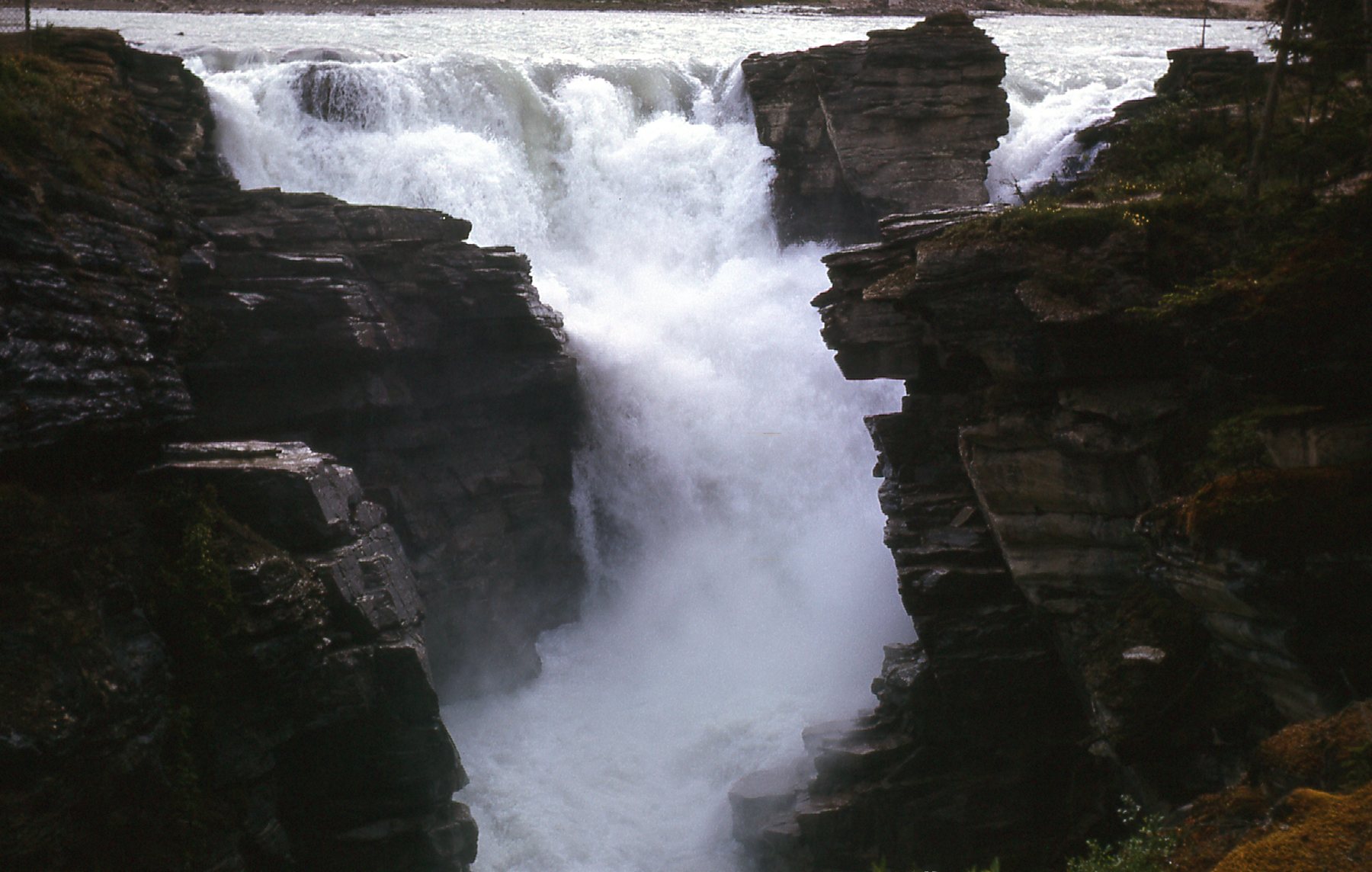
Athabasca Falls
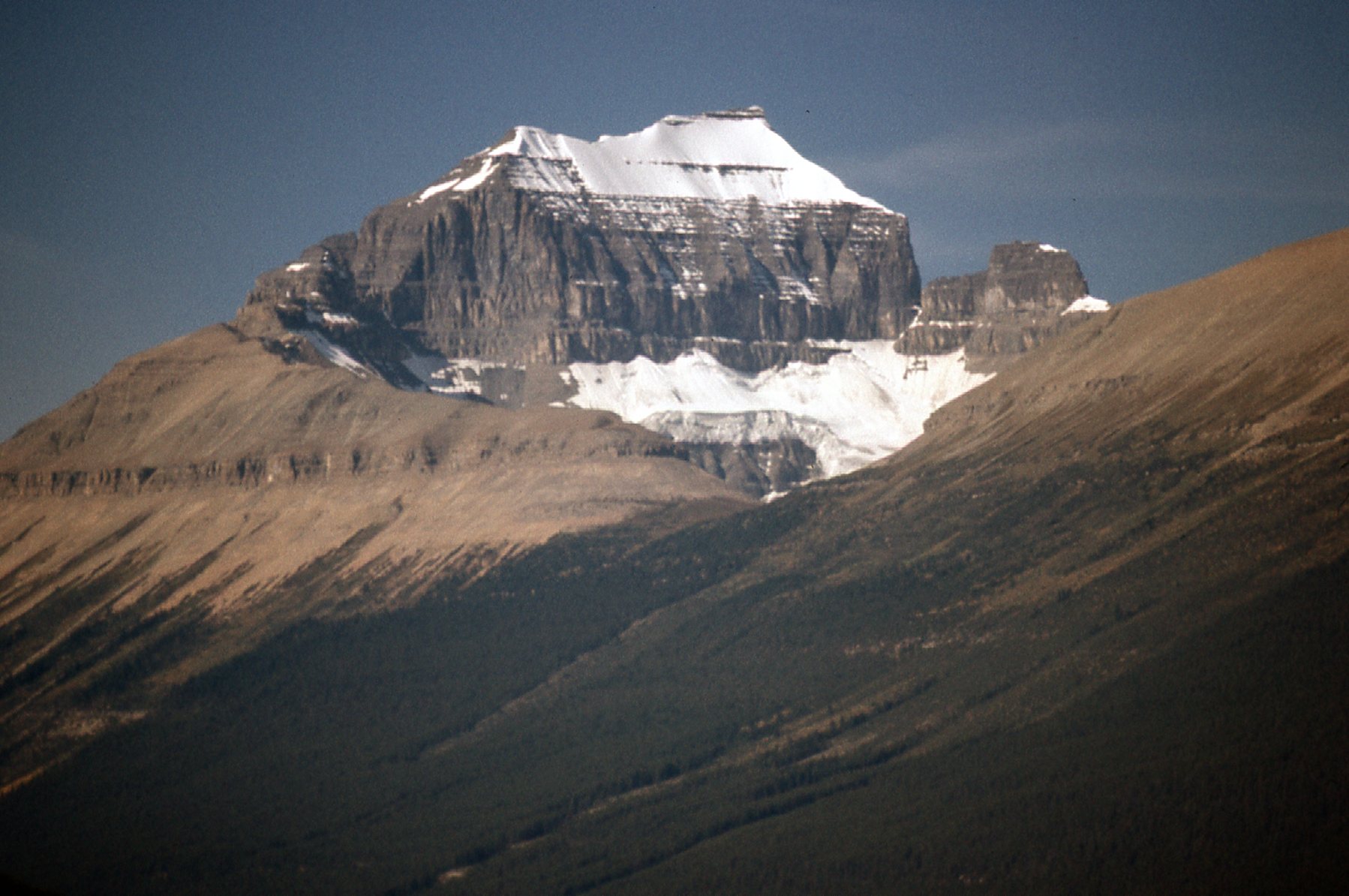
Our journey along the Icefields Parkway is almost over. From the falls, it’s only 20 more miles to the north to arrive at the pretty town of Jasper. That’s where the Parkway ends – we’ve come a total of 144 miles, and what a trip it’s been. Here’s one final look – the building is the CN train station in the middle of town. In the distance sits snowy Mt. Edith Cavell, elevation 11,033 feet – it is only 12 air miles from the town.
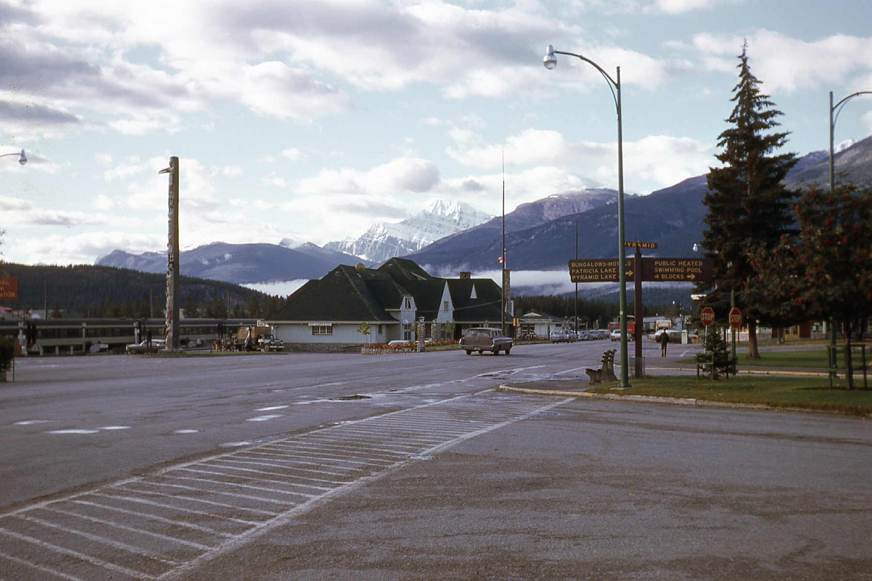
Looking south to Mt. Edith Cavell
From Jasper, you can continue east on the Yellowhead Highway to Edmonton. If you head west on the same highway, you enter British Columbia after a quick 16 miles, and only 38 miles beyond that, you reach the turnoff to mighty Mount Robson, the highest peak in the Canadian Rockies.
Well, Folks, that’s it, my offering of the Icefields Parkway. Thanks for coming along for the ride.