
Please be sure to read the previous 3 chapters of ‘The Bucket List” before jumping into this one.
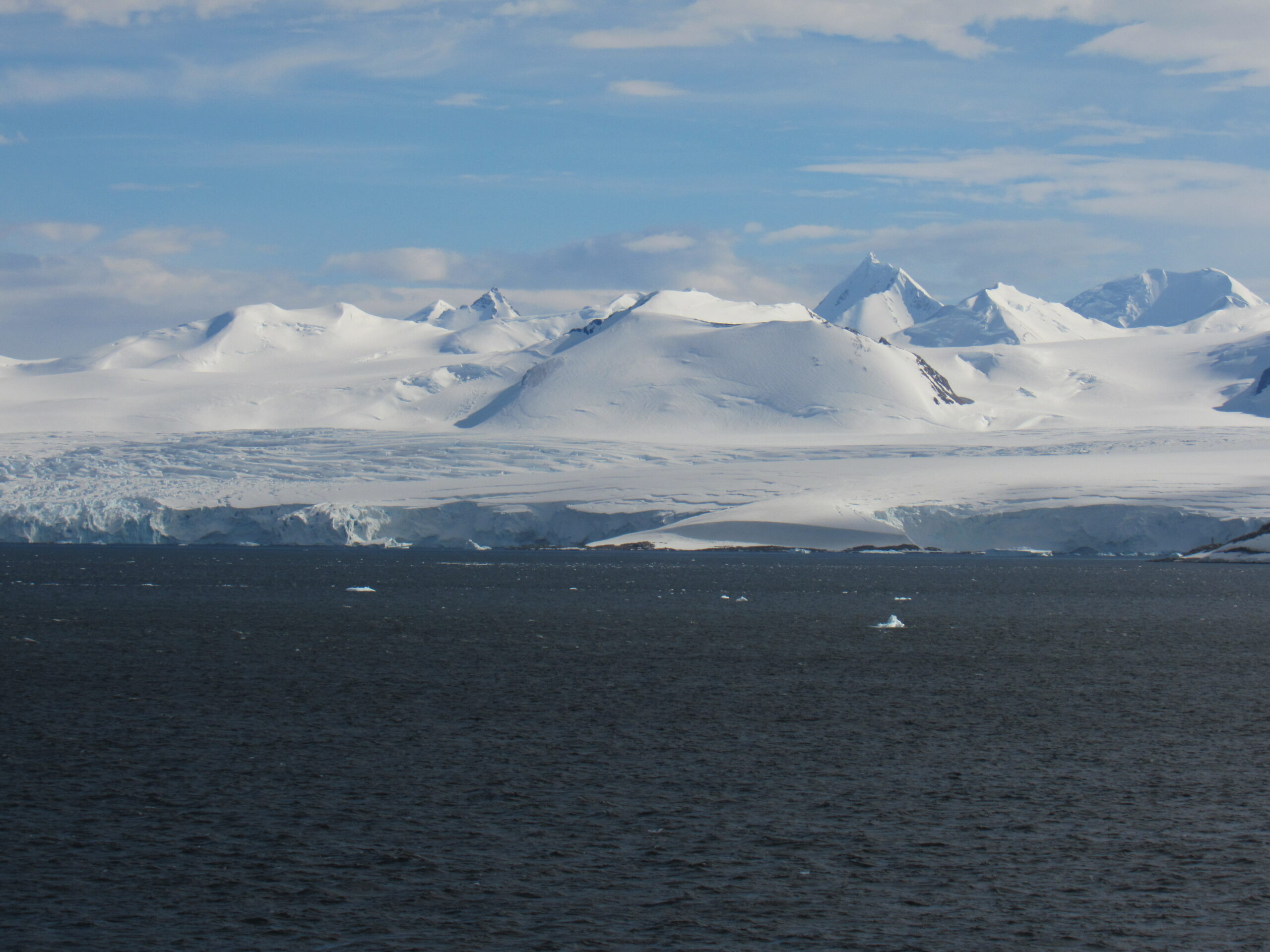
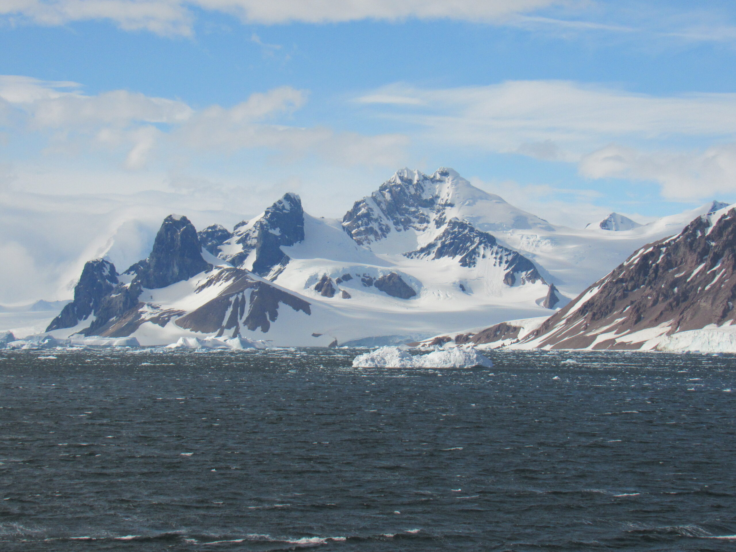
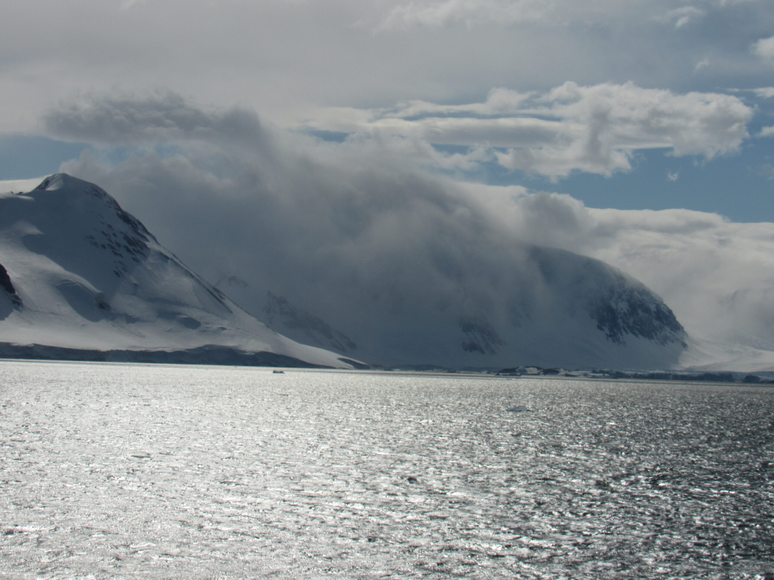
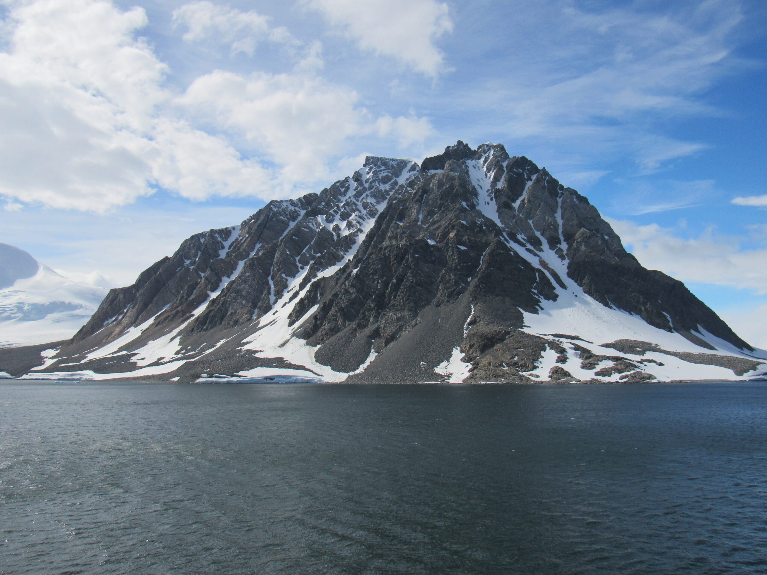
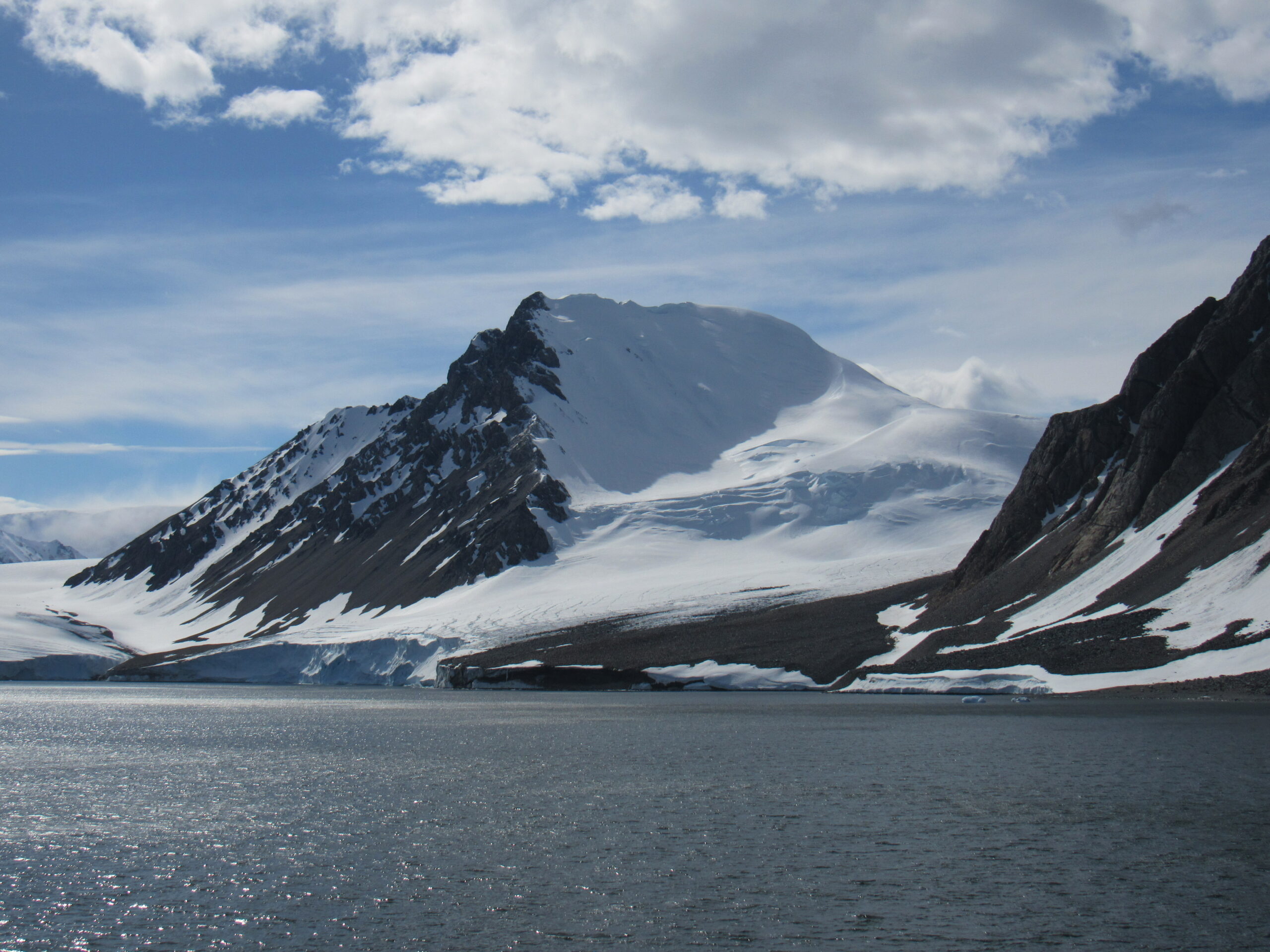
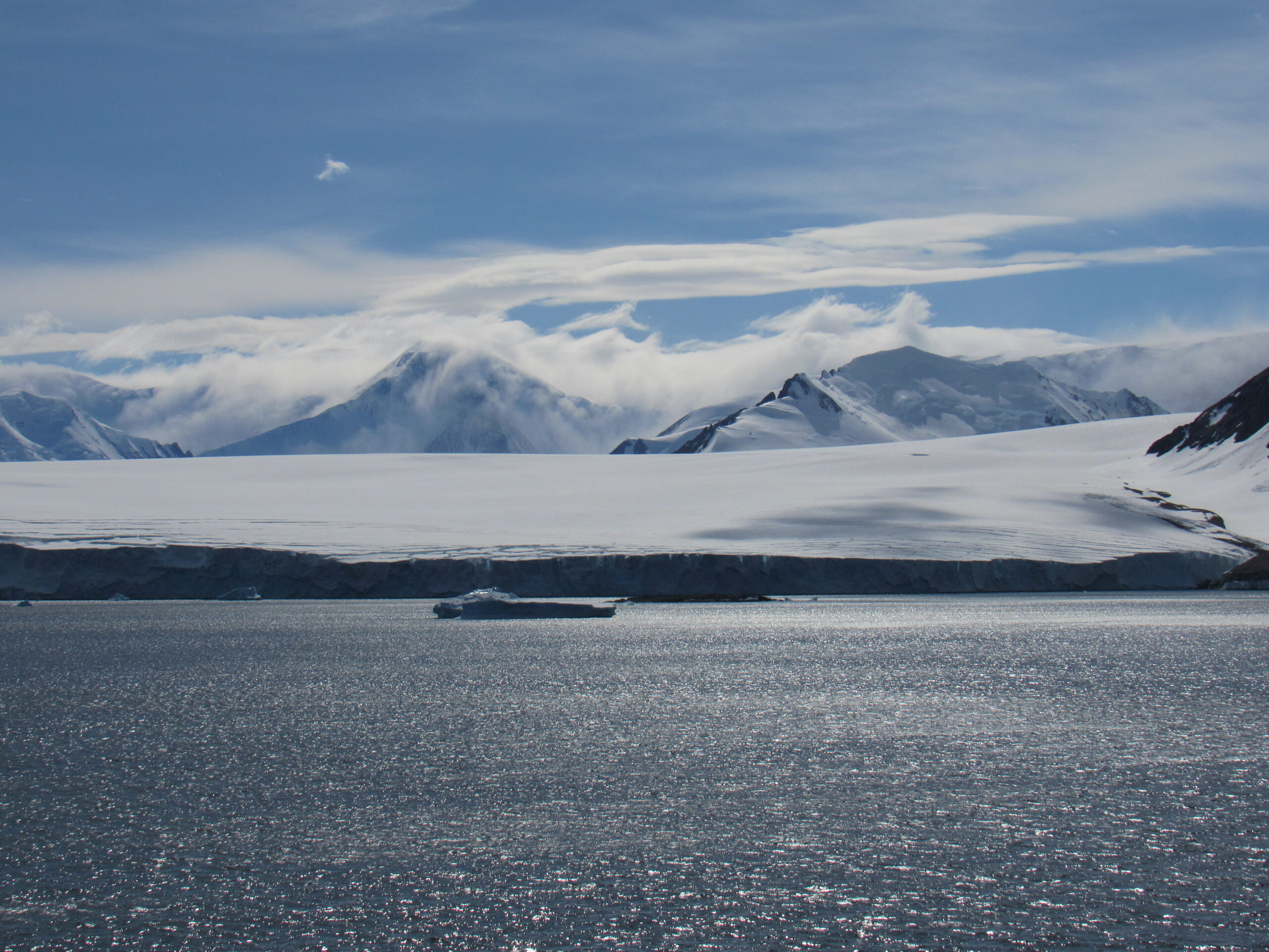
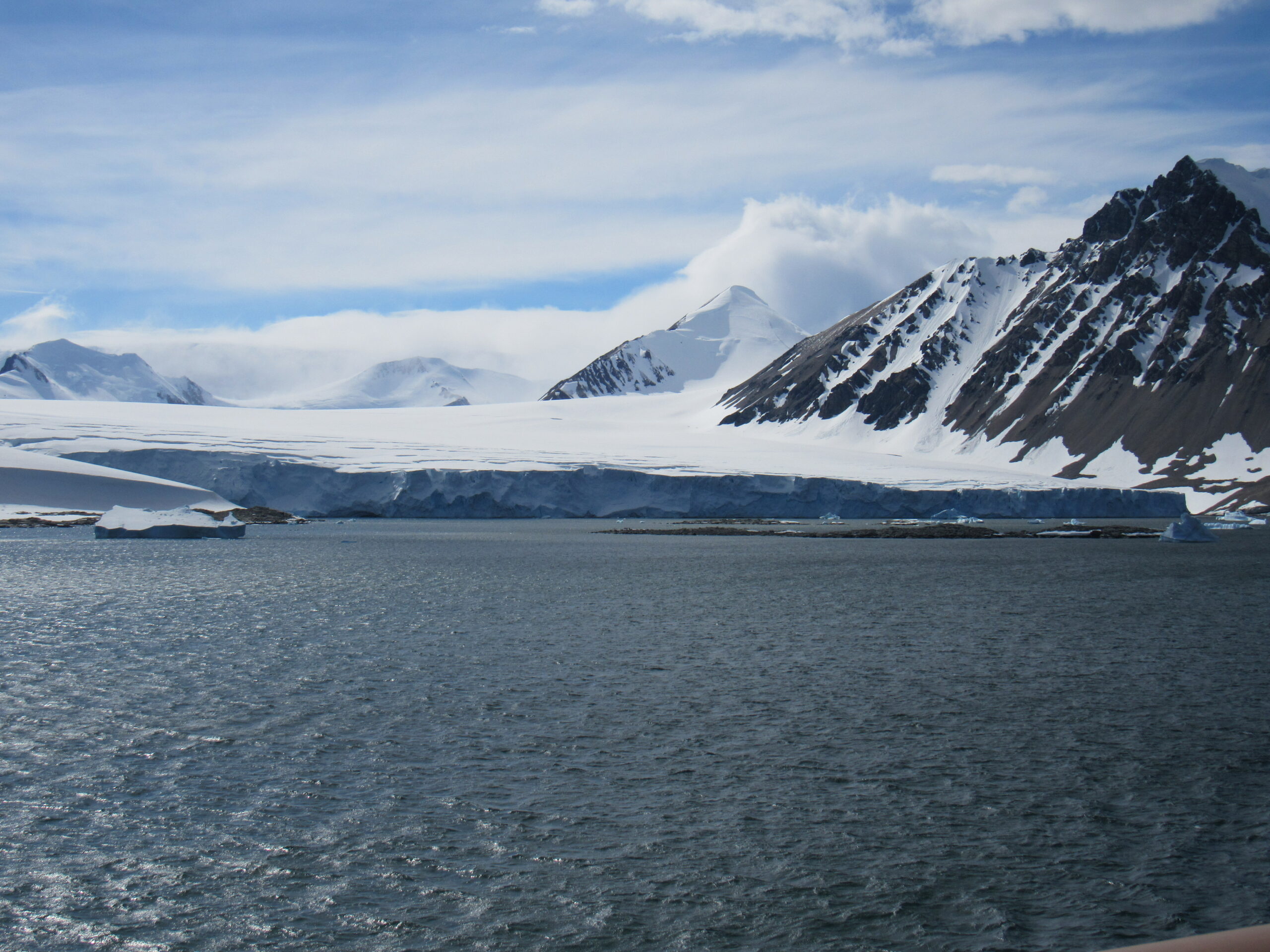
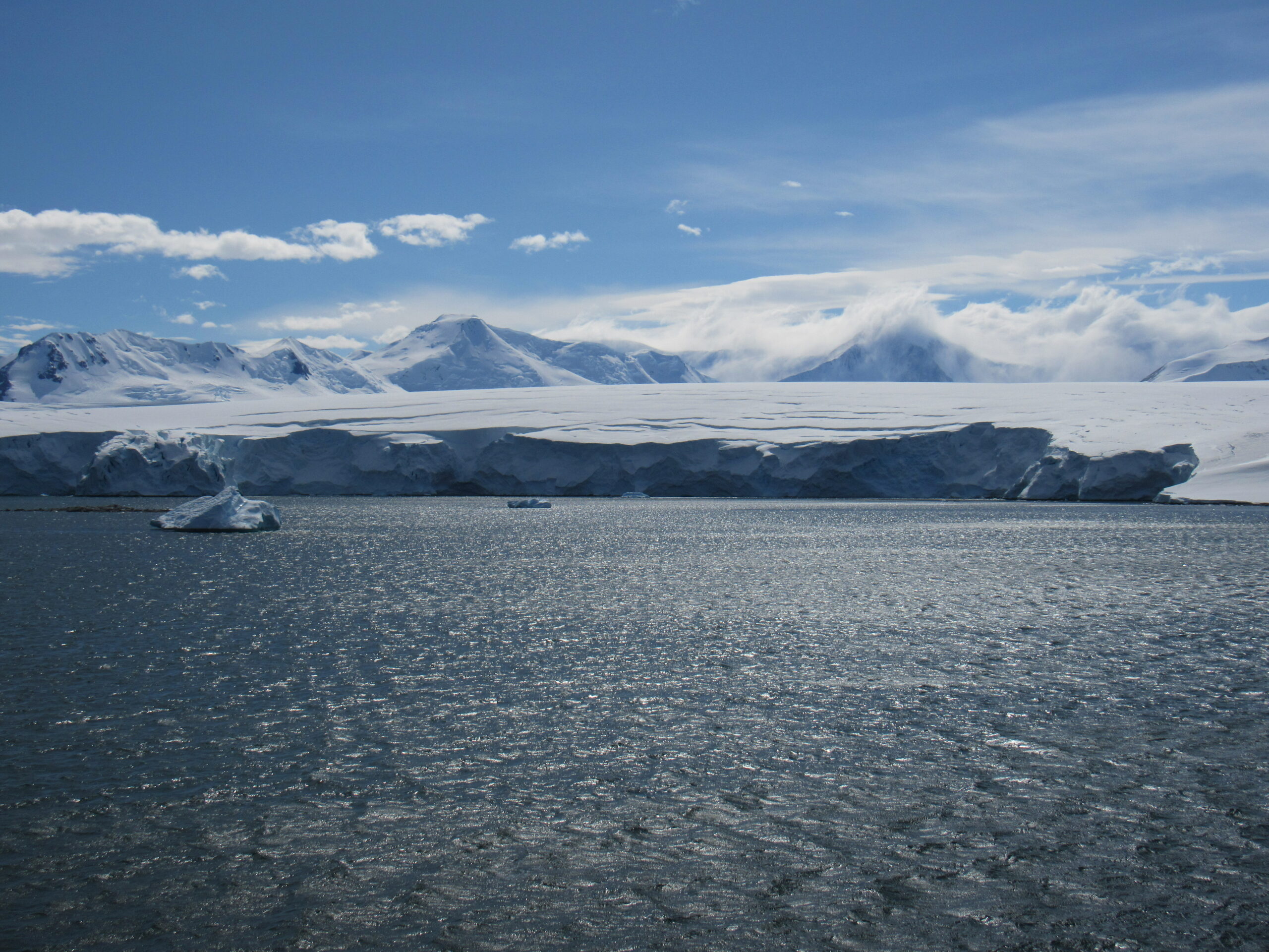
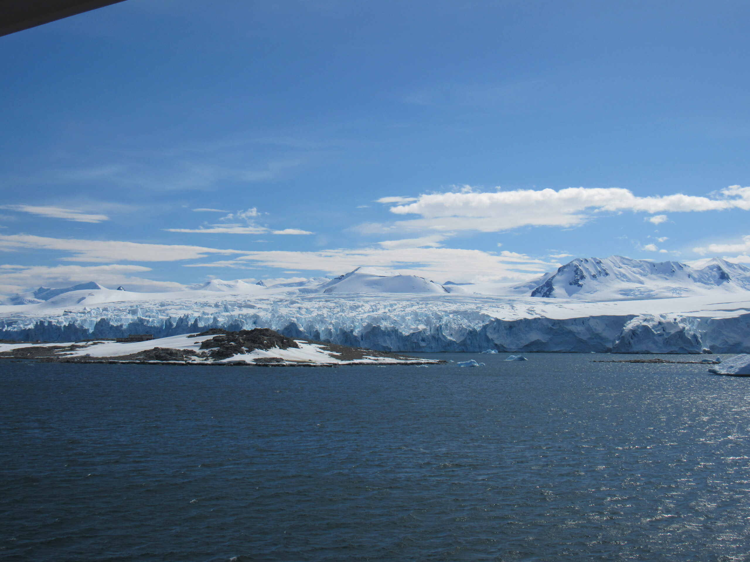
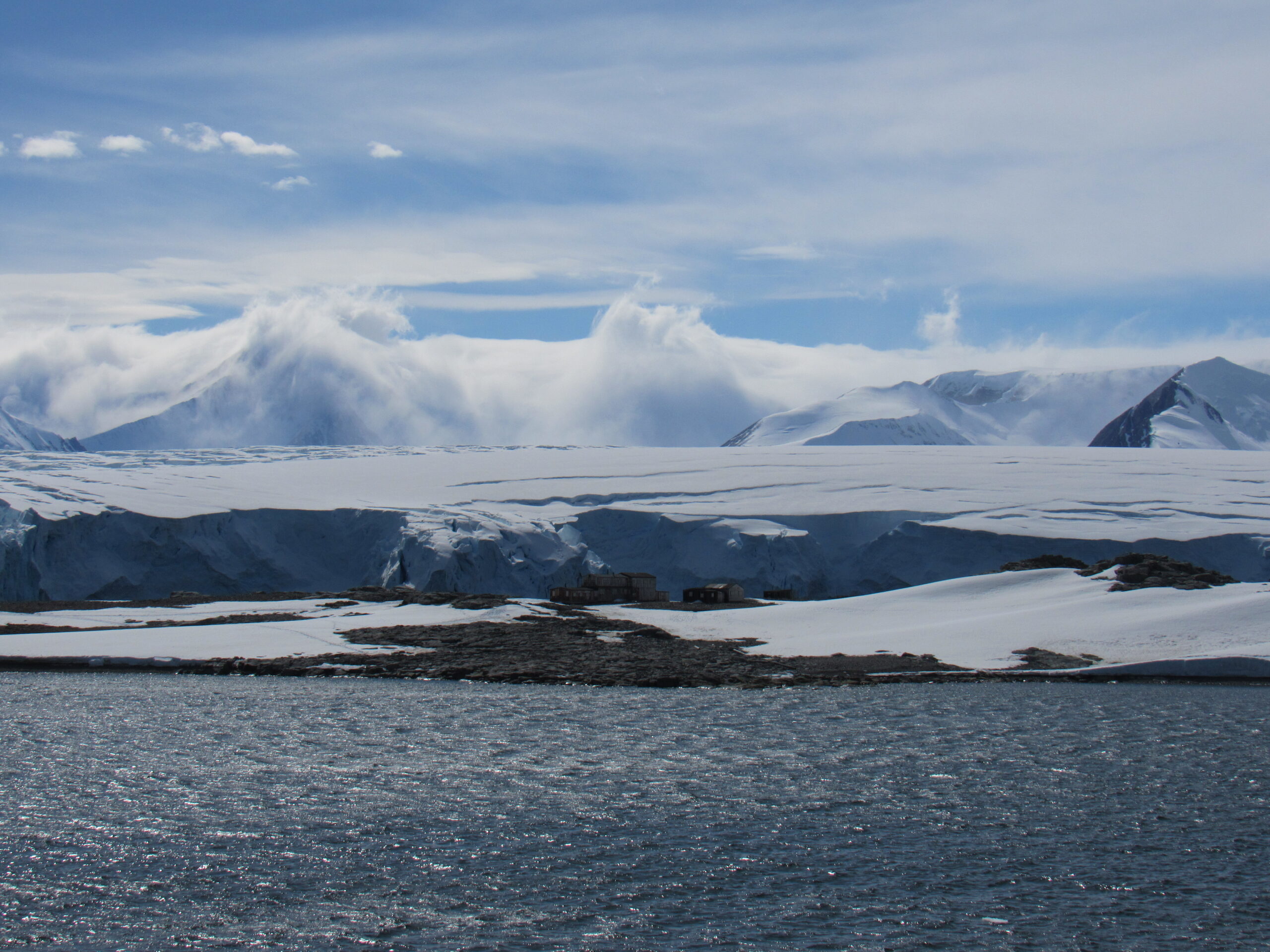
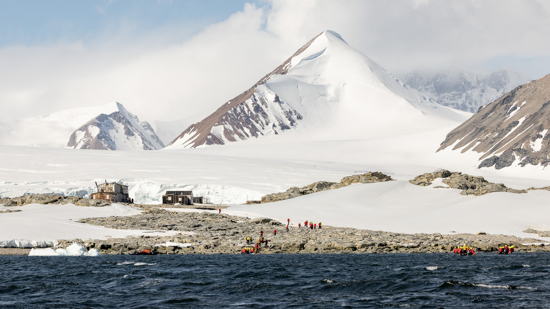
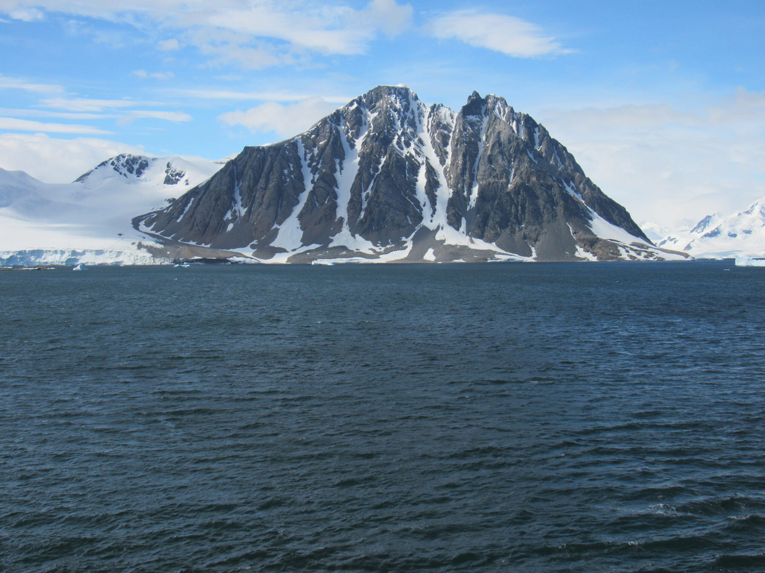
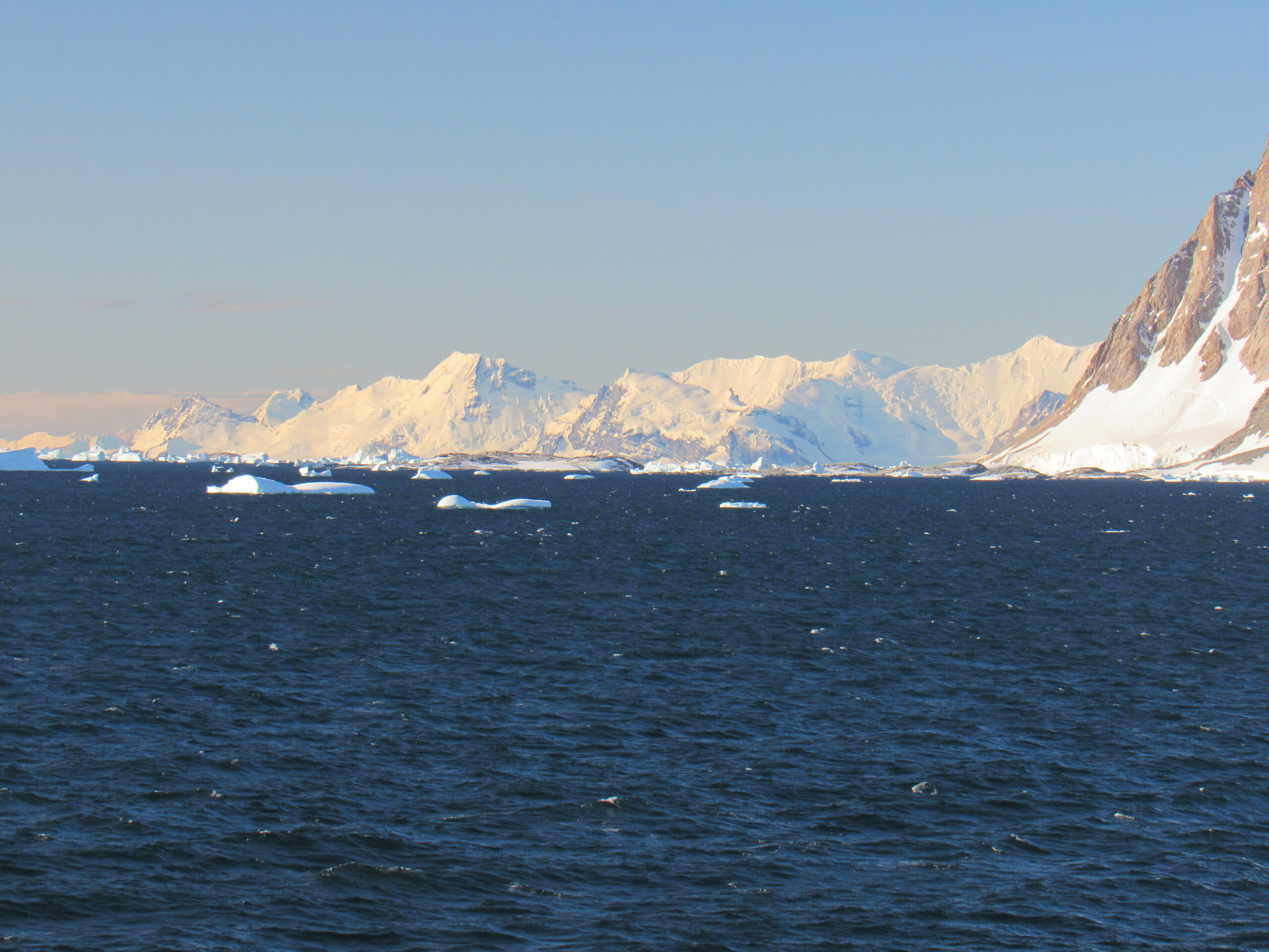
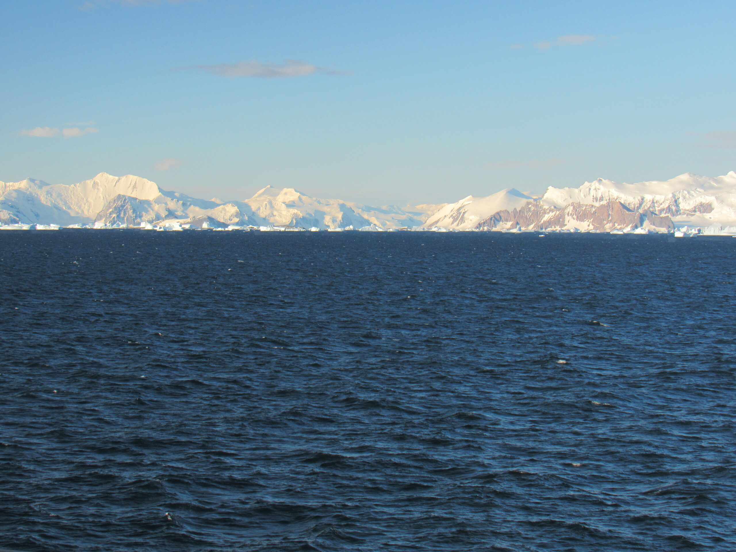
Fresh off of the experience of seeing the sun not set last night, I awoke to clear skies and in a very happy mood. We were still in Marguerite Bay, about a third of the way down its eastern shore, entering a deep inlet to the south of Neny Island and Millerand Island. I knew this because there was a channel on the television in my room which constantly showed our exact position on a map – latitude, longitude, time of day, water depth, wind speed and the speed of our ship – there was never any doubt as to our location. Most of the ships that go to Antarctica don’t go all the way south to Marguerite Bay – it’s a long way to go, and many ships only go as far as the South Shetland Islands and call it good. It was Saturday, January 13th, the 6th day aboard the ship, and the first really sunny day of the trip. We were slowly cruising into a deep inlet known as Neny Fjord which lies south of Neny Island and Millerand Island.
Neny Island was discovered by the British Graham Land Expedition (BGLE) (1934–1937) under John Riddich Rymill and named after nearby Neny Fjord. It is only 1.7 miles across but rises to an impressive 2,215 feet elevation. Several features on Neny Island have been charted and named by various Antarctic expeditions. Store Point is the island’s northernmost point. It was surveyed in 1947 by the Falkland Islands Dependencies Survey (FIDS), who so named it because FIDS maintained an emergency food store on this point. Norseman Point is the easternmost point, first surveyed in 1936 by the British expedition under Rymill and later named by FIDS after the Norseman airplane which landed near the point to relieve the FIDS party on Stonington Island in February 1950.
Millerand Island is a high rugged island 4 miles in diameter, lying 4.3 miles south of Cape Calmette, off the west coast of Graham Land. It was discovered by the French Antarctic Expedition (1908-1910) under Jean-Baptiste Charcot, who thought that it was a cape of the mainland and named it as such after Alexandre Millerand, a French statesman.
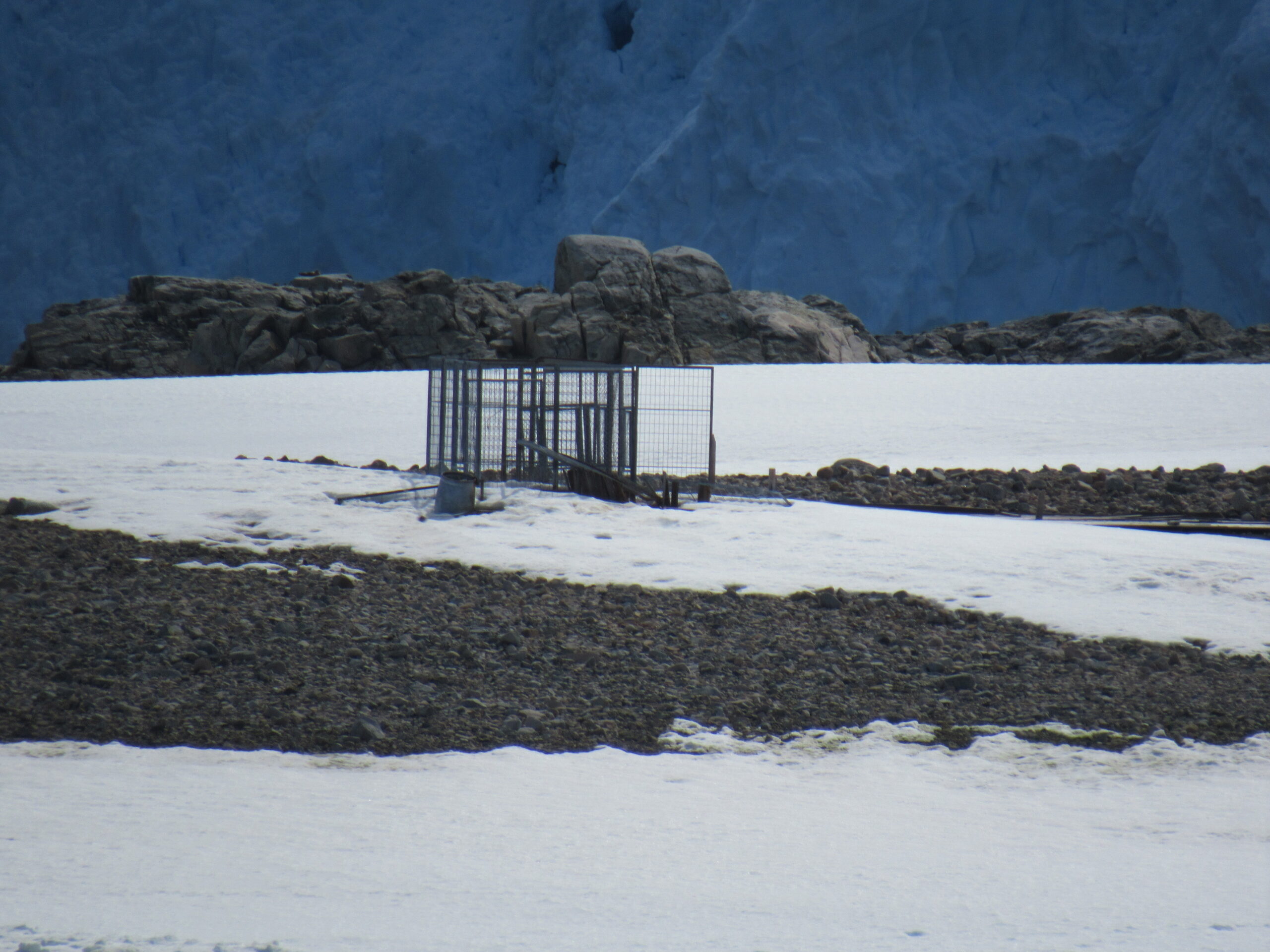
Refugio 17 de Agosto is located in the northeast part of the island. It is operated by the Argentine army and was inaugurated on 17 August 1957. Its existence is dependent on the San Martín base, which is five kilometers away on Barry Island. The refuge consists of a red hut, used by personnel employed in missions carried out in the area, and can accommodate four people and has enough food for two weeks, fuel, gas and first aid kit.
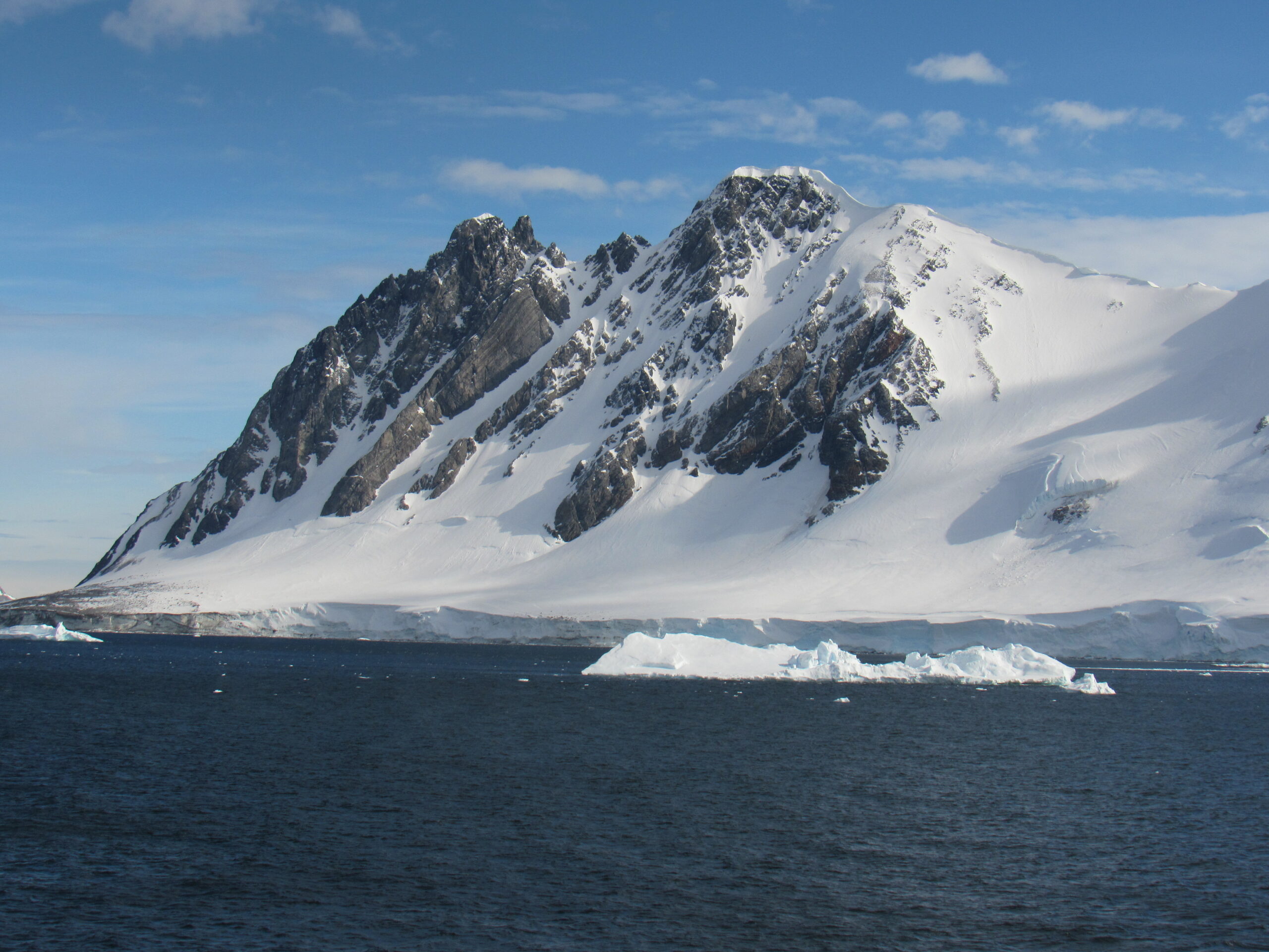
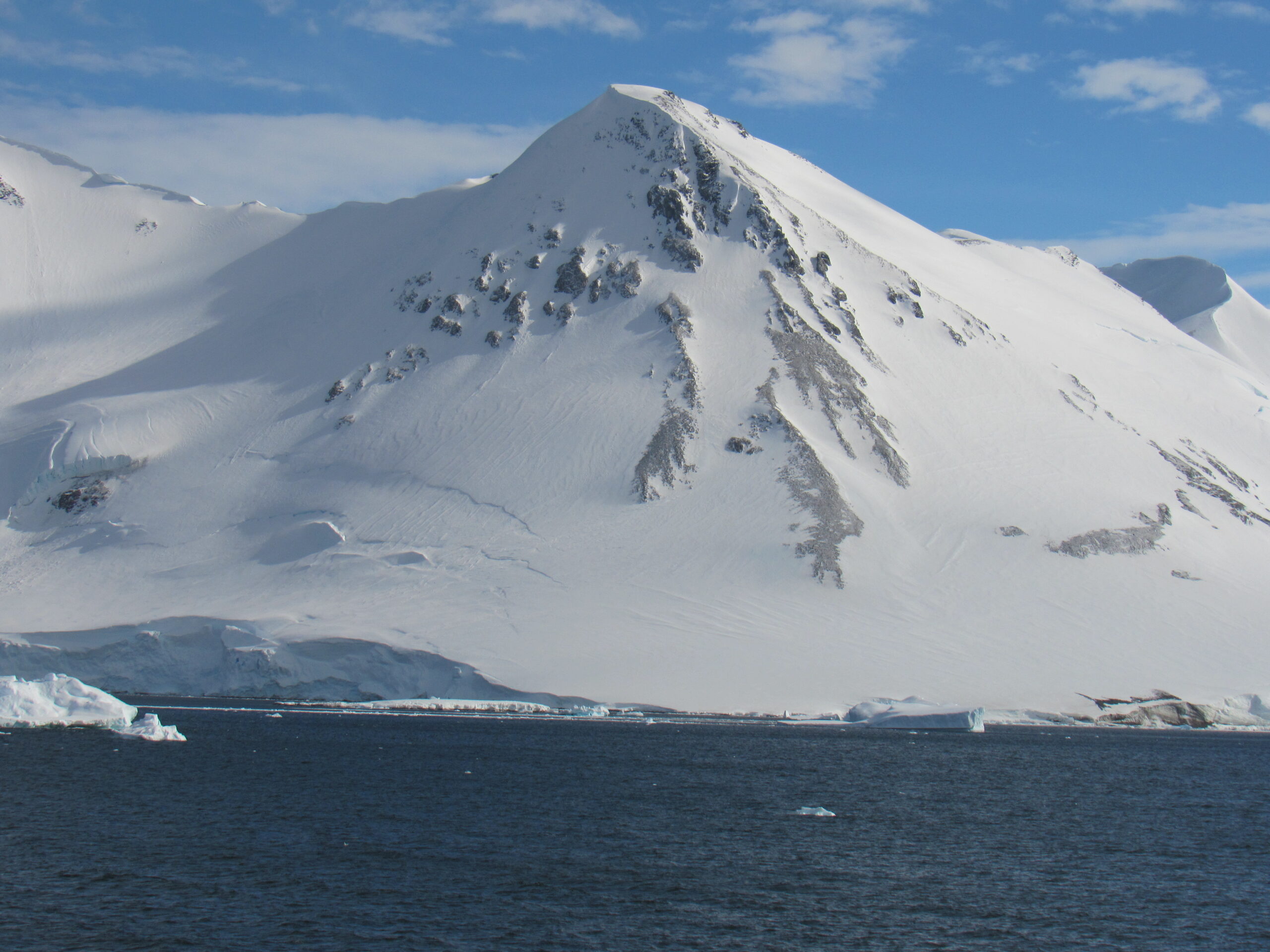
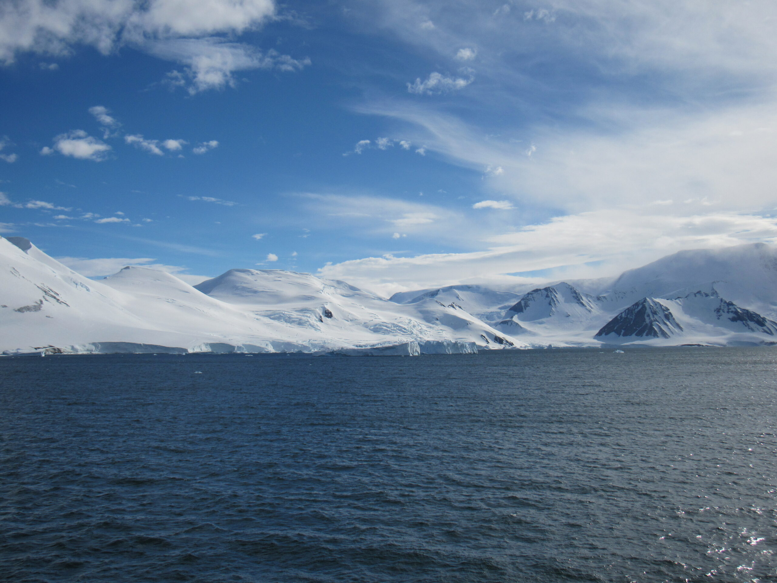
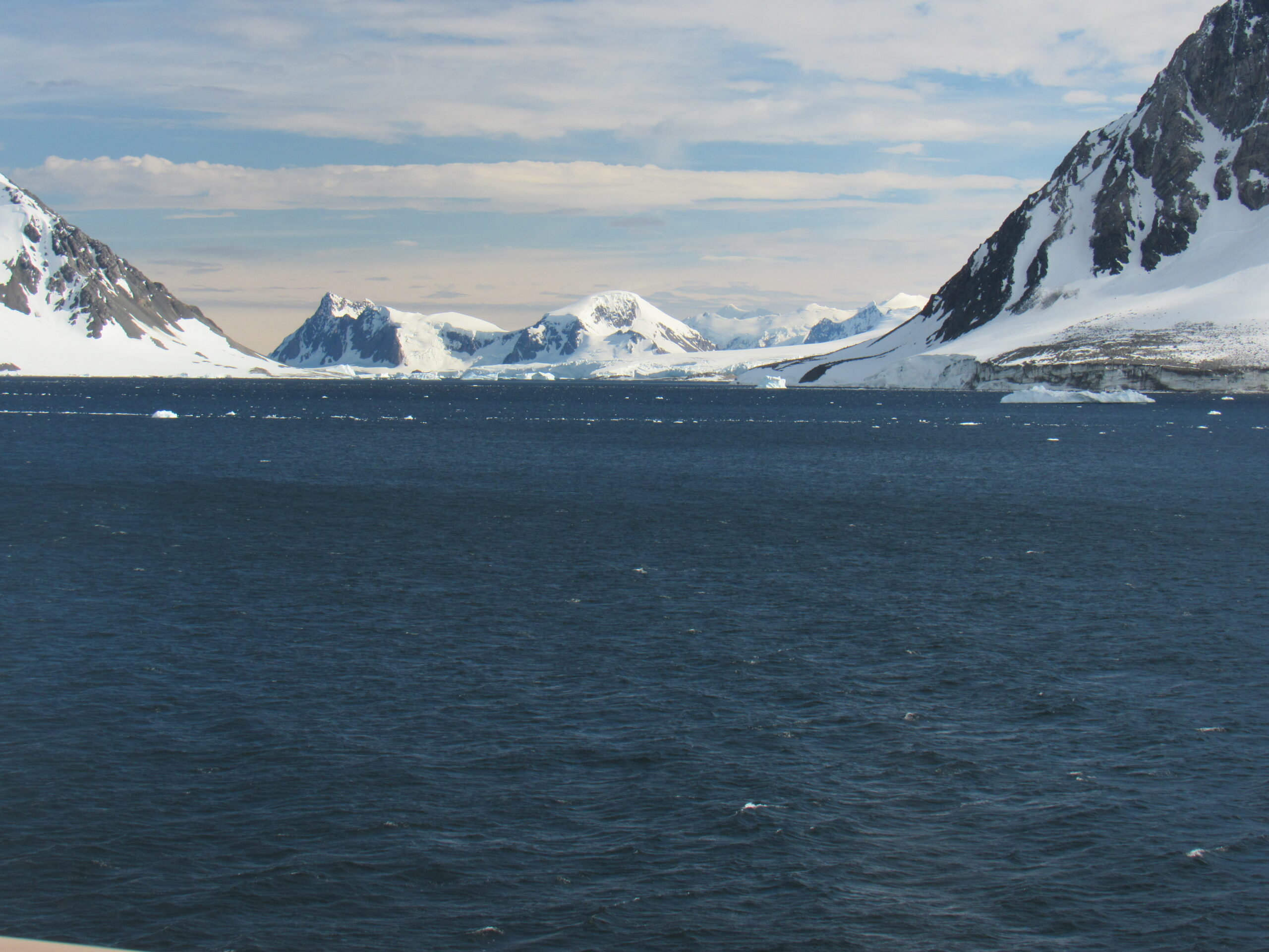
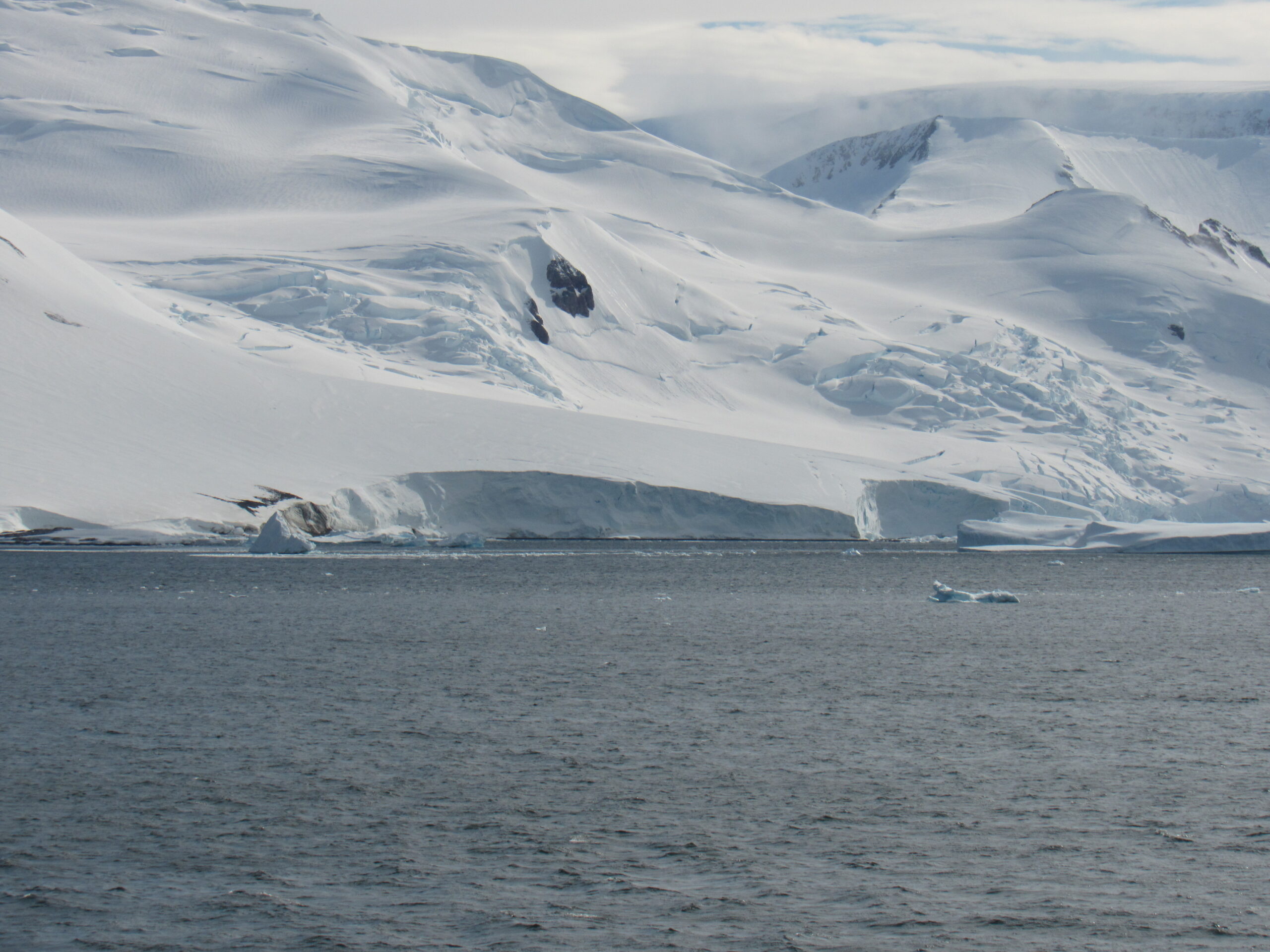
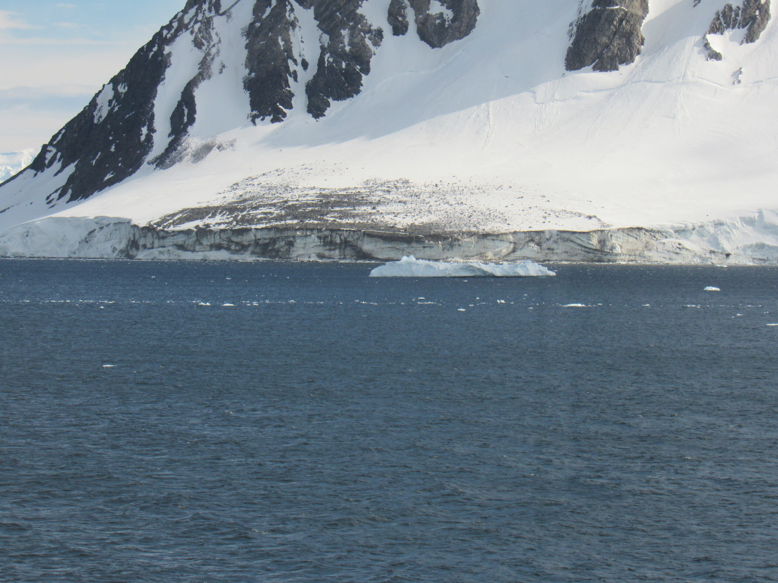
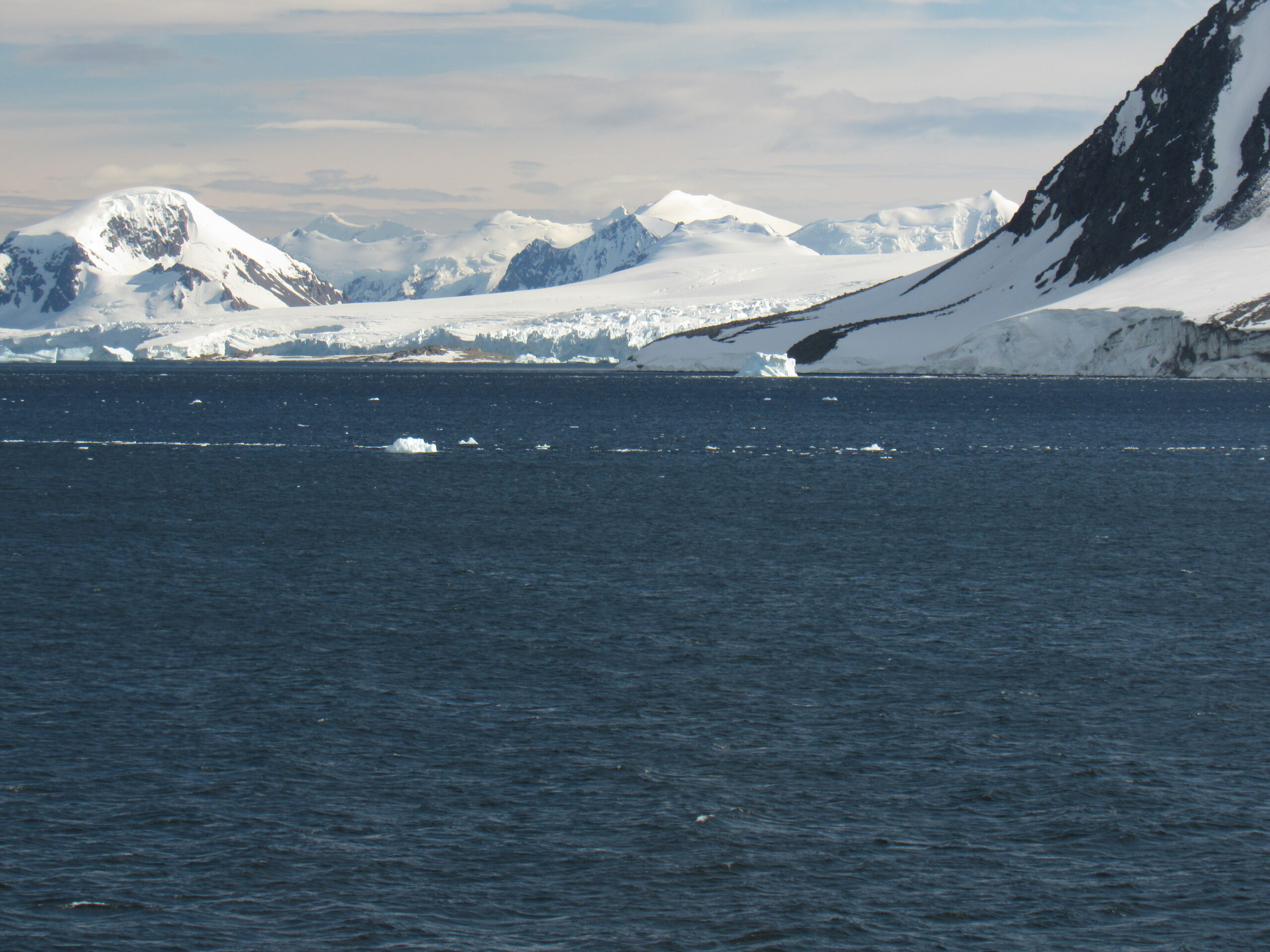
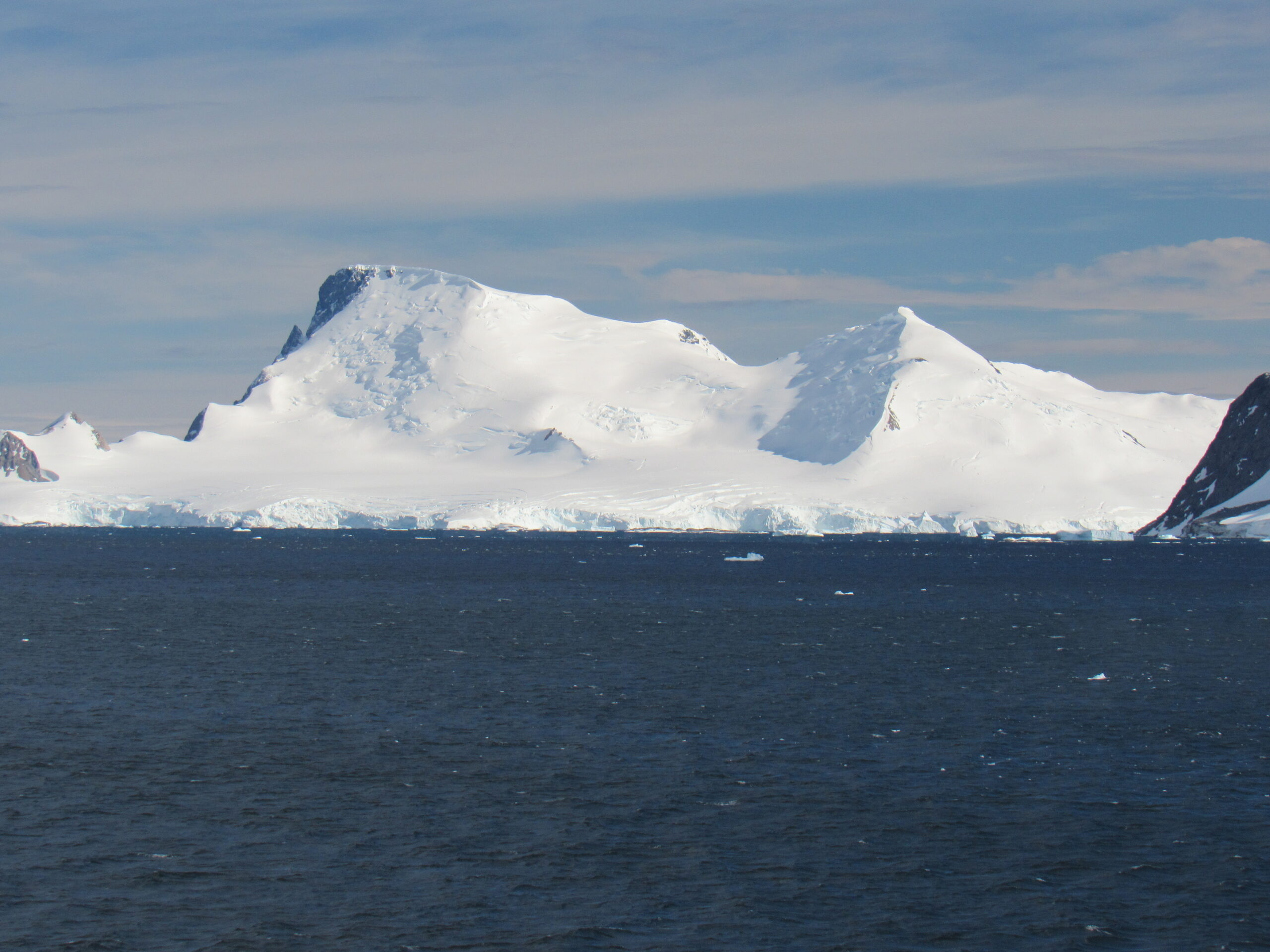
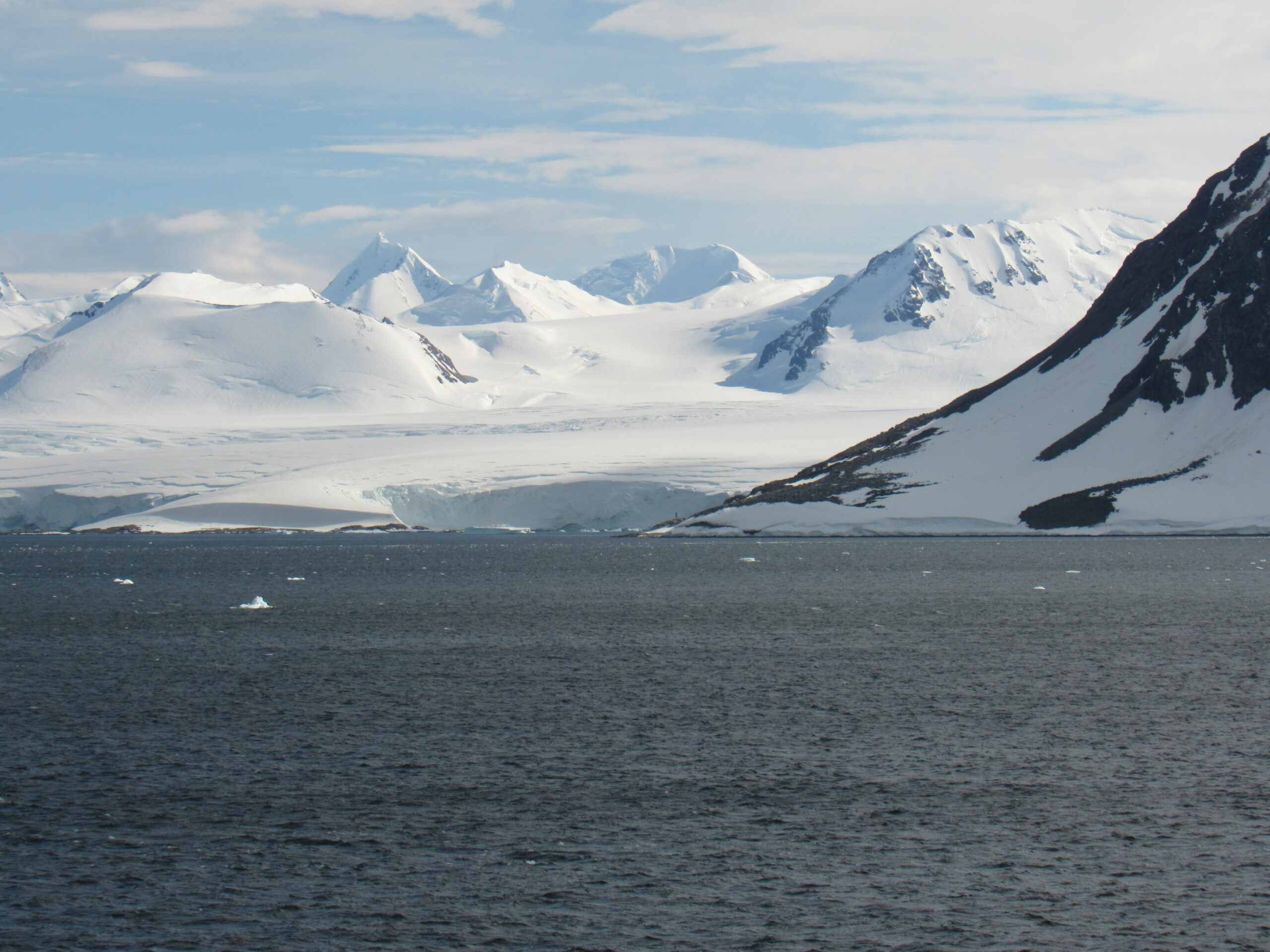
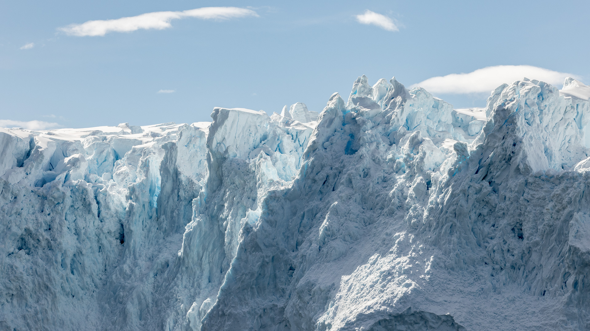
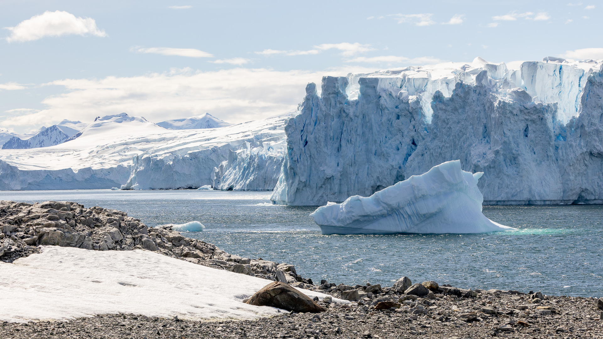
We spent all morning cruising slowly back and forth in the fjord. My guess is that another ship was ahead of us near Stonington Island and taking its passengers ashore, so we had to wait our turn. That certainly wasn’t a hardship, though, as the scenery was amazing and I took hundreds of pictures. I’ll share some of them here with you. Few words, just great views.
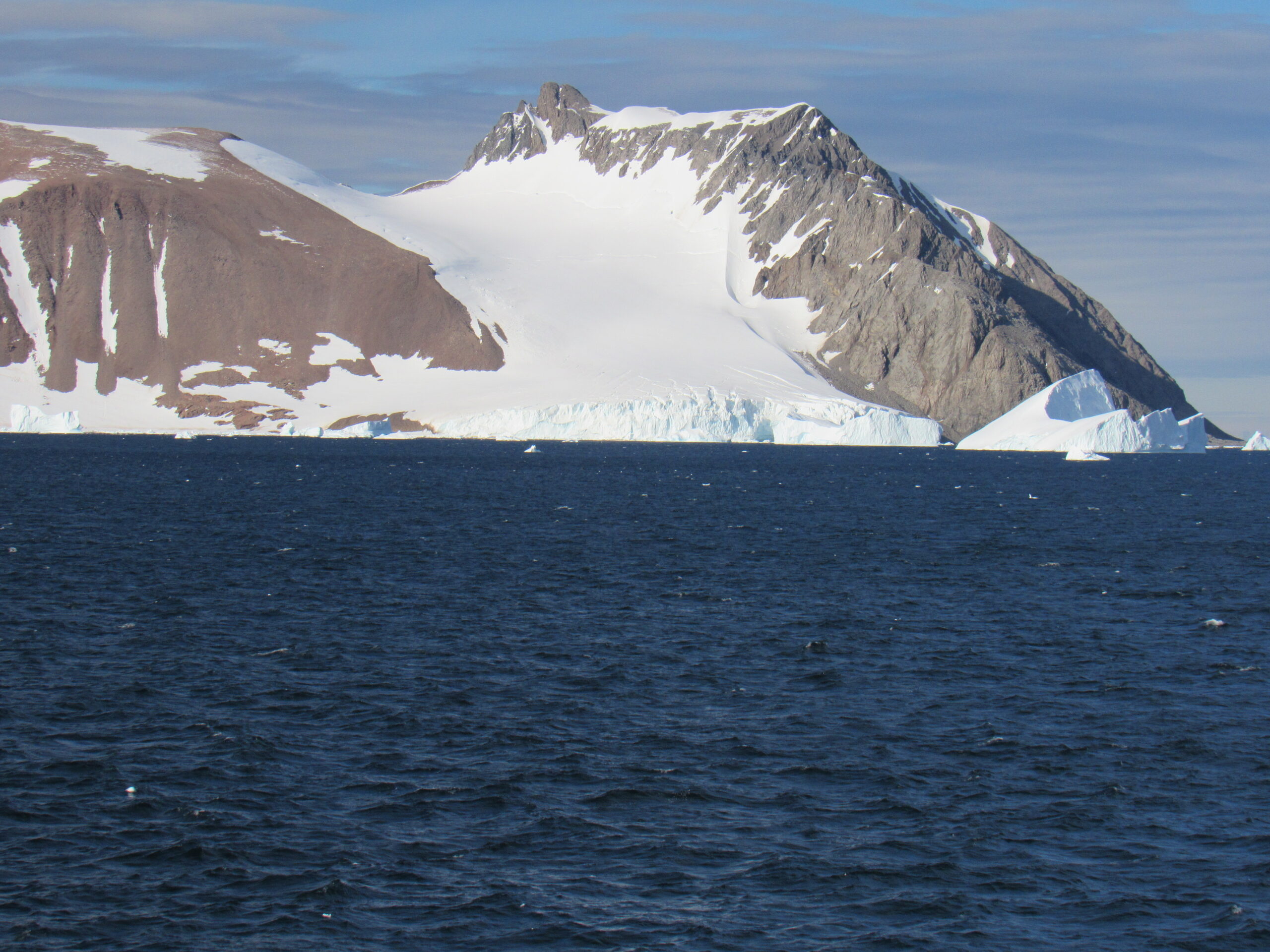
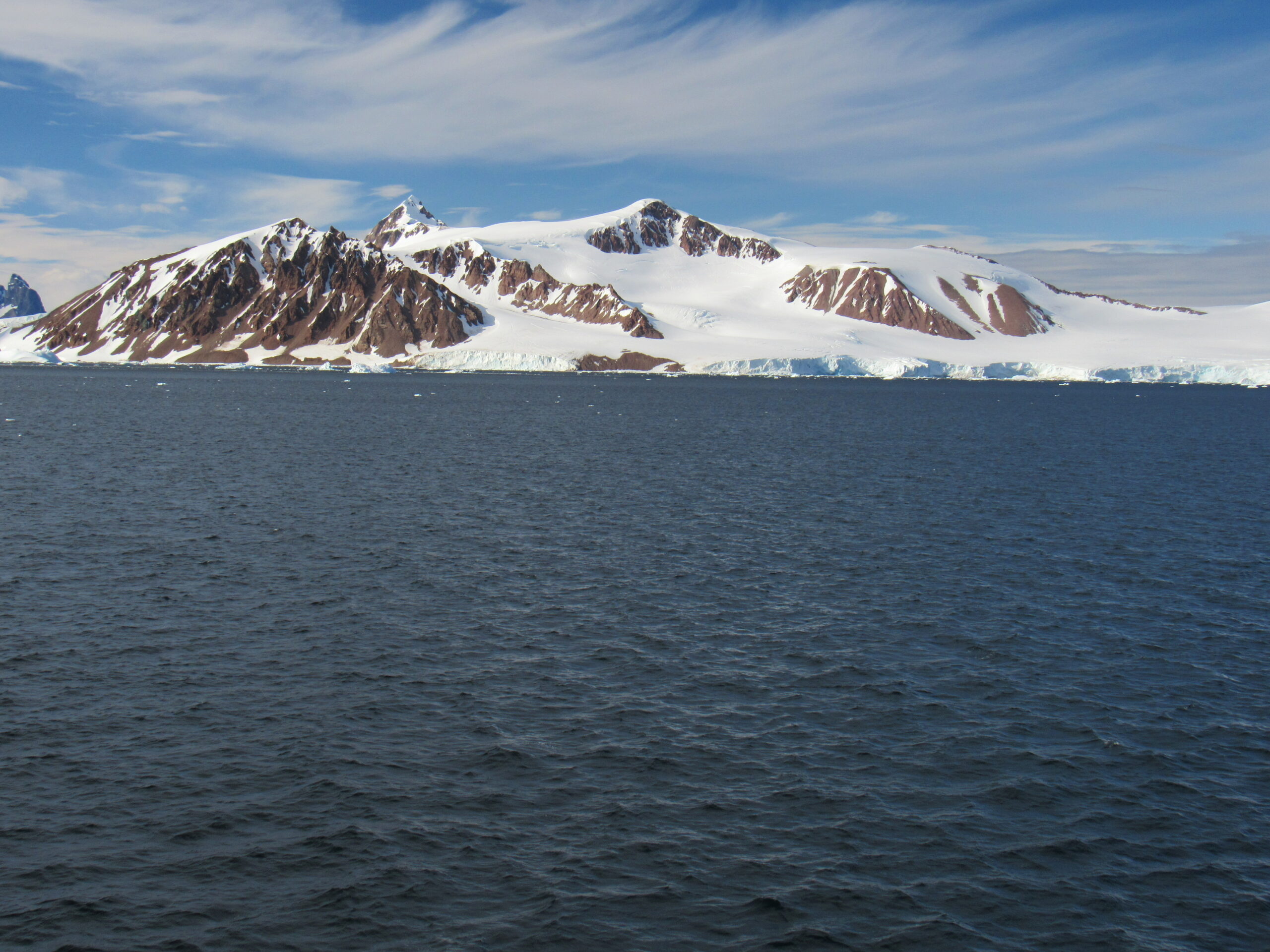
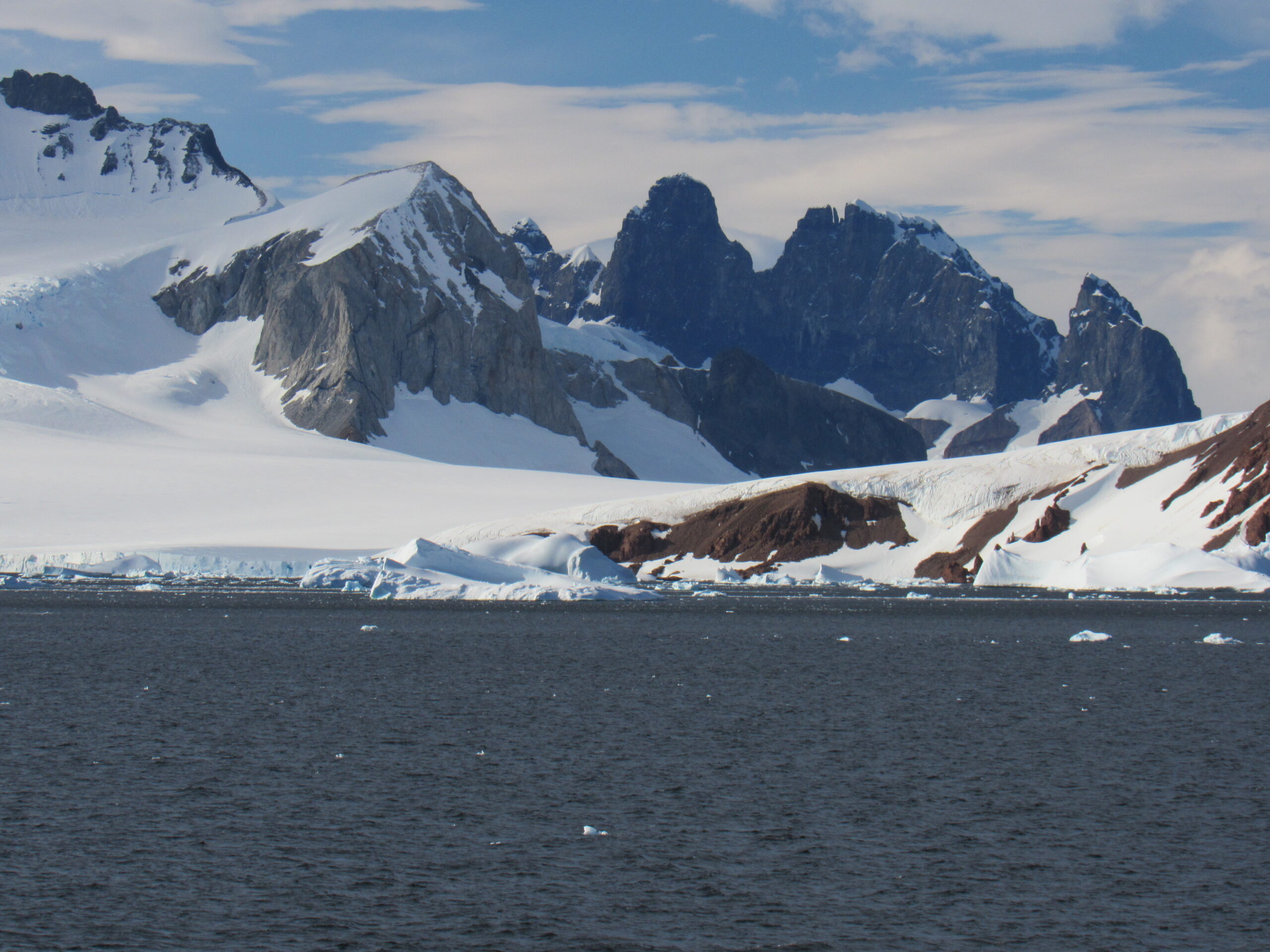
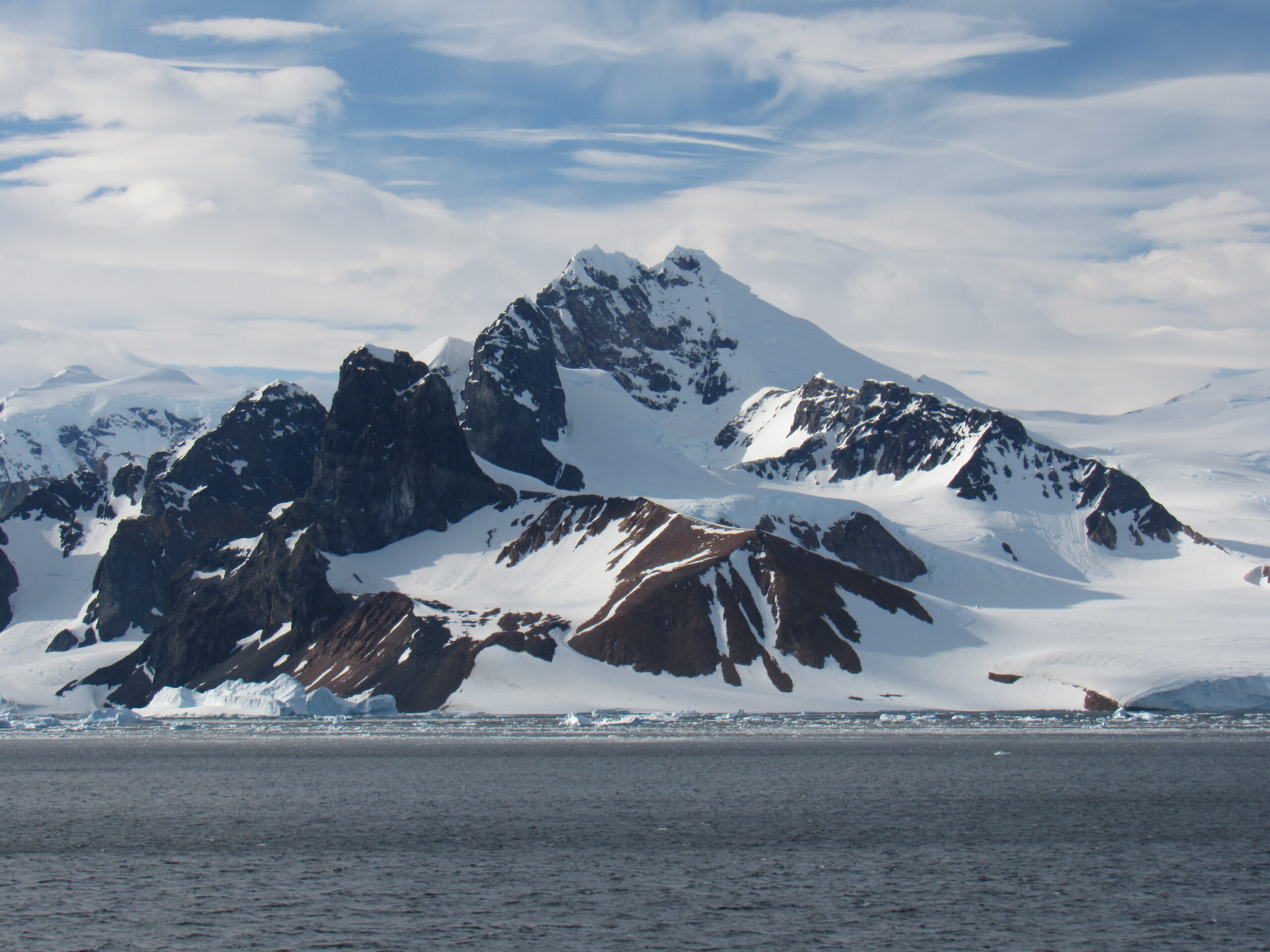
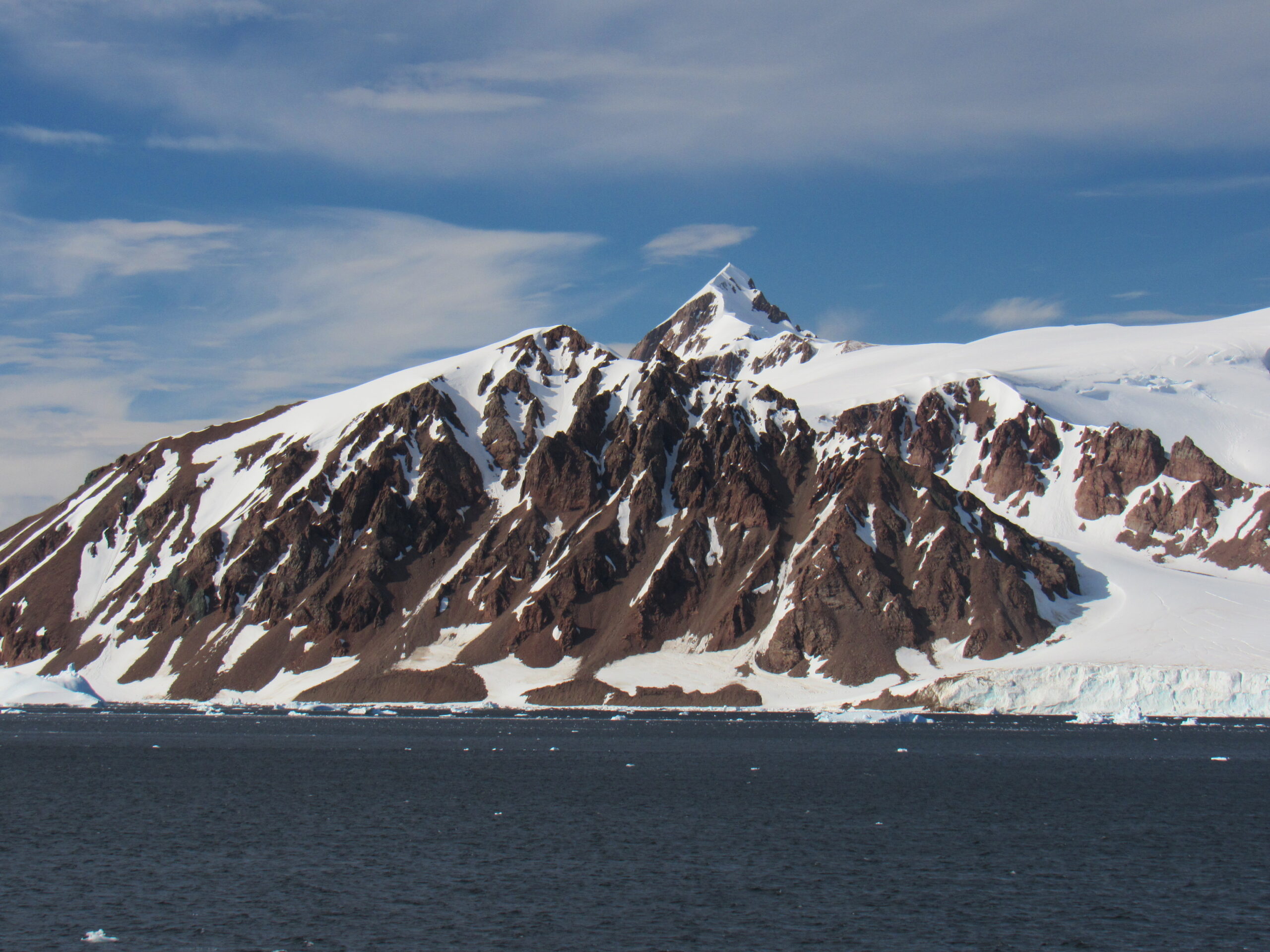
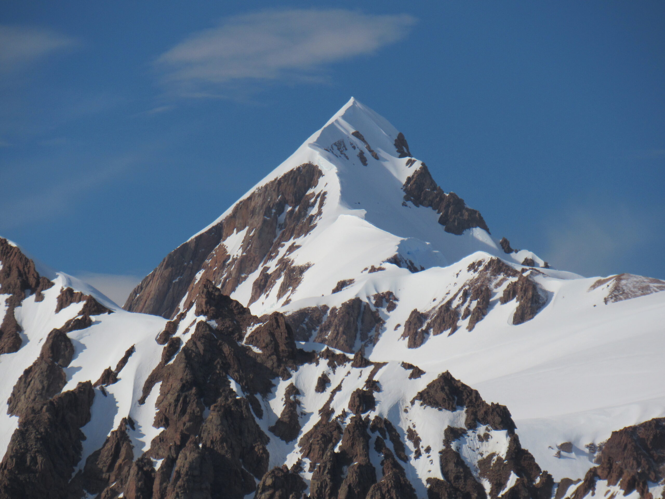
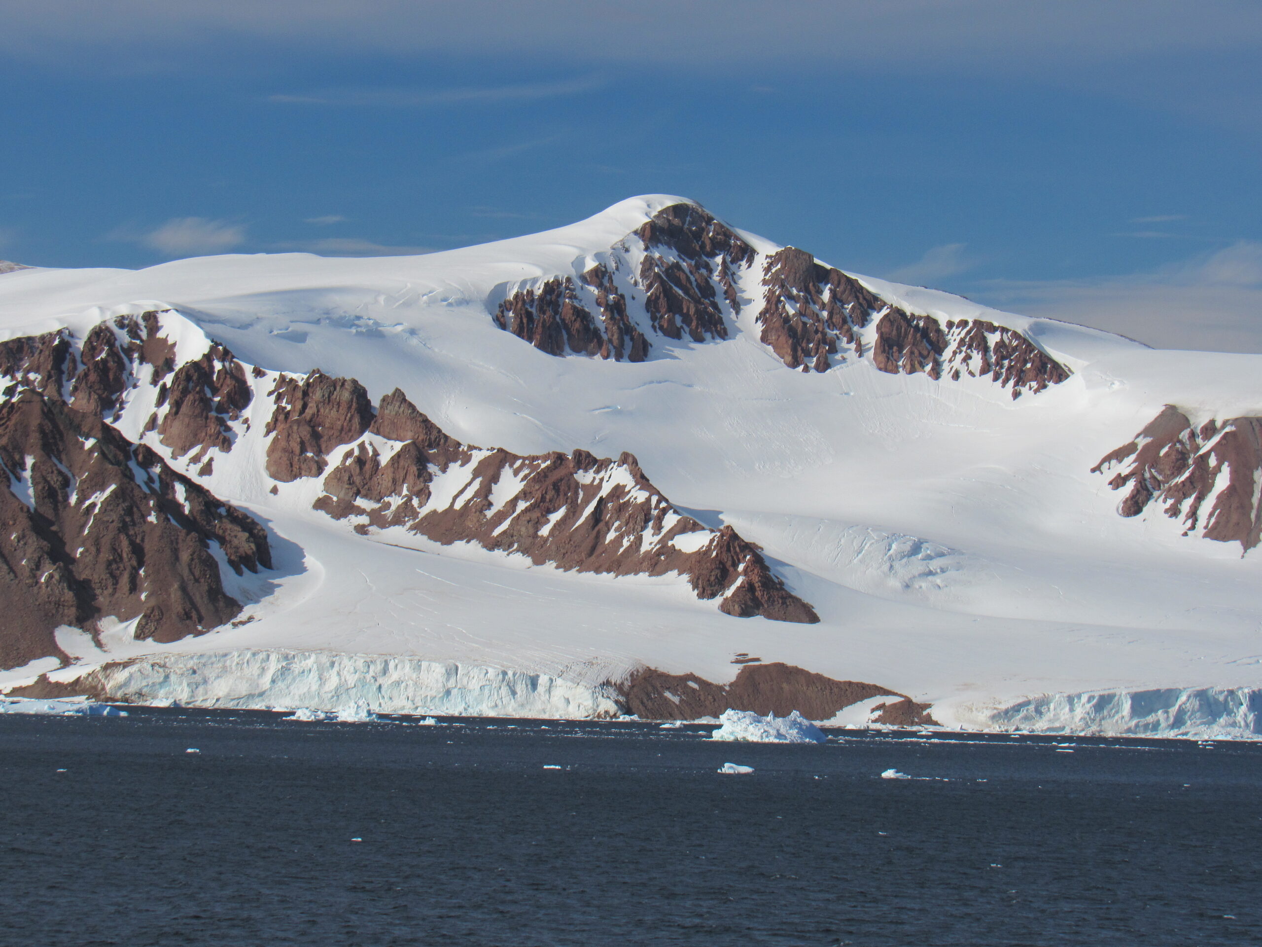
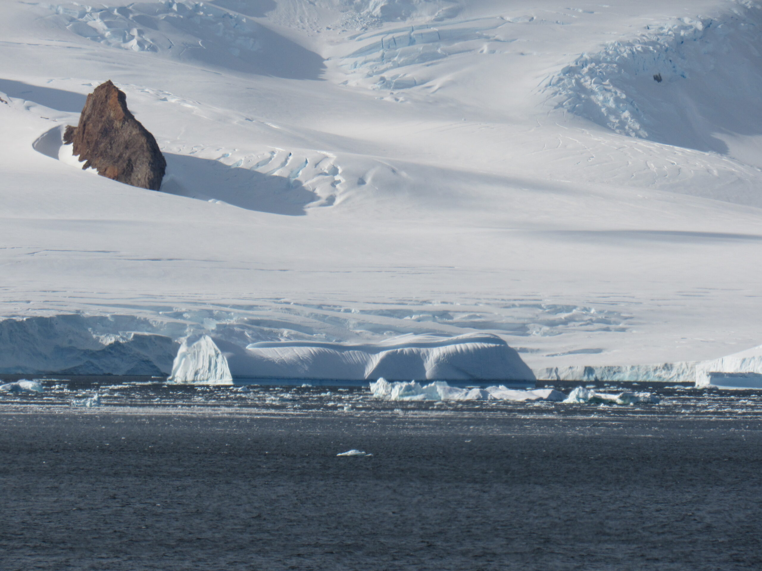
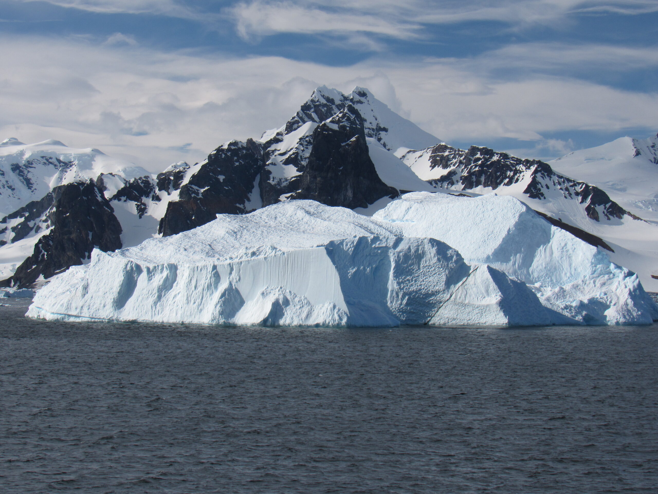
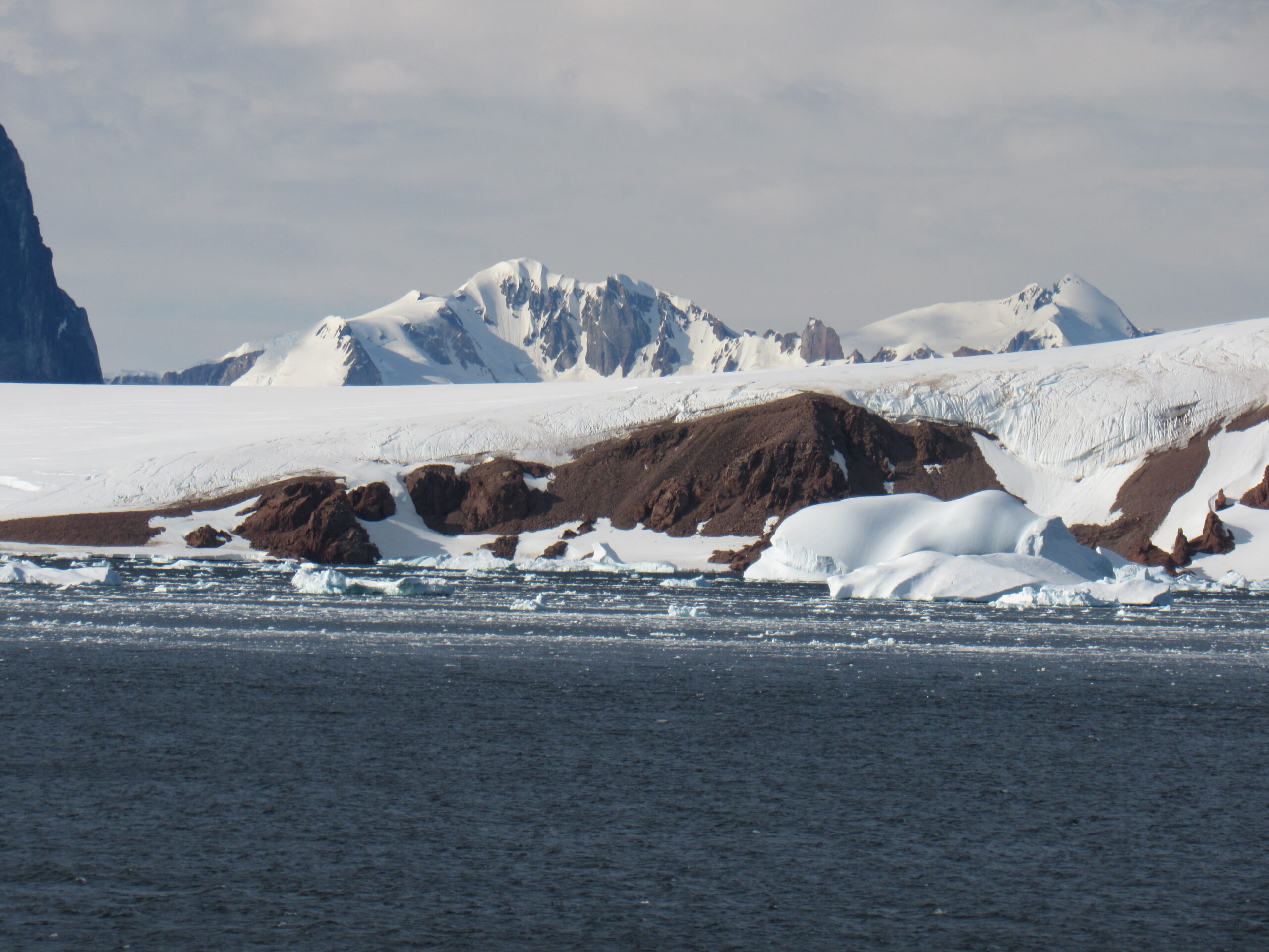
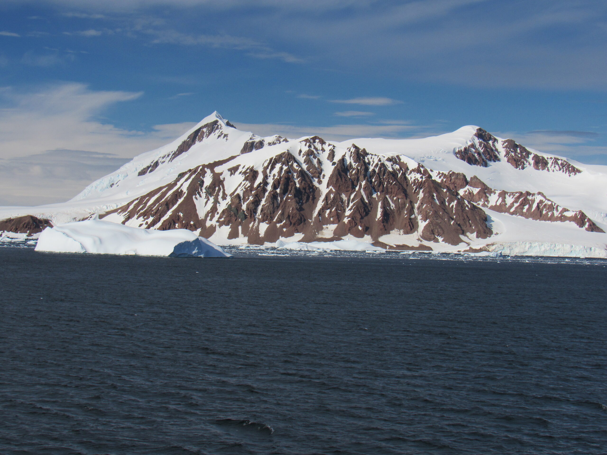
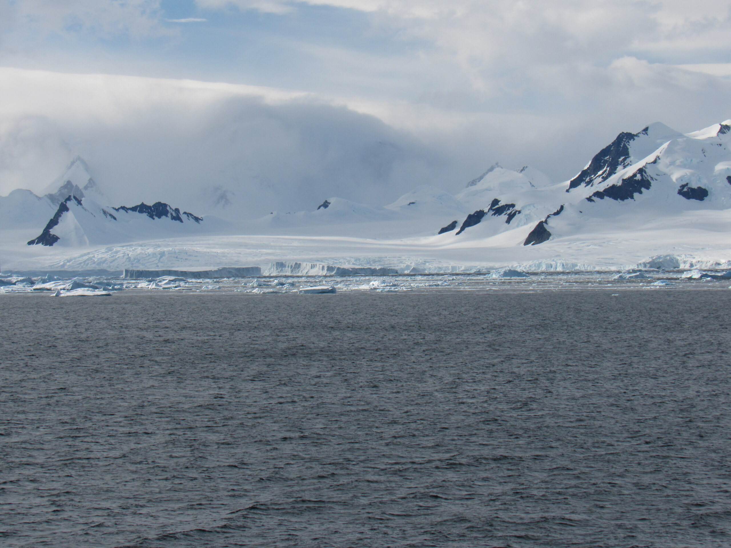
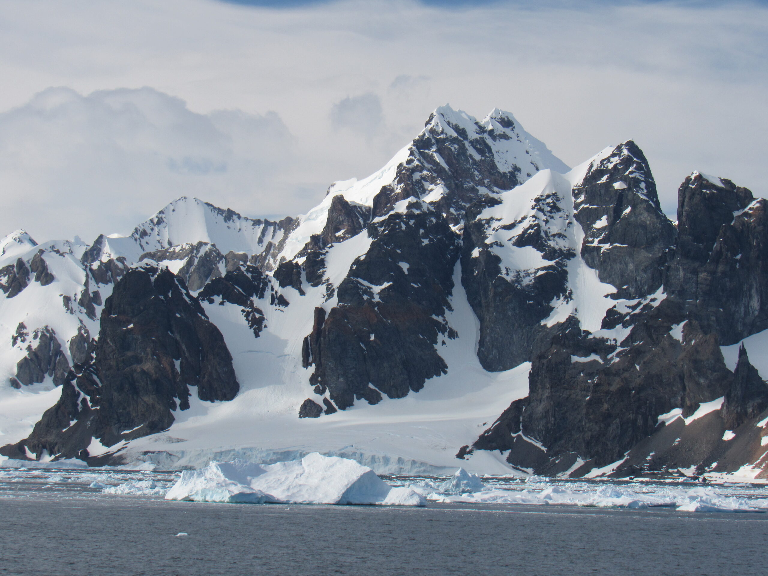
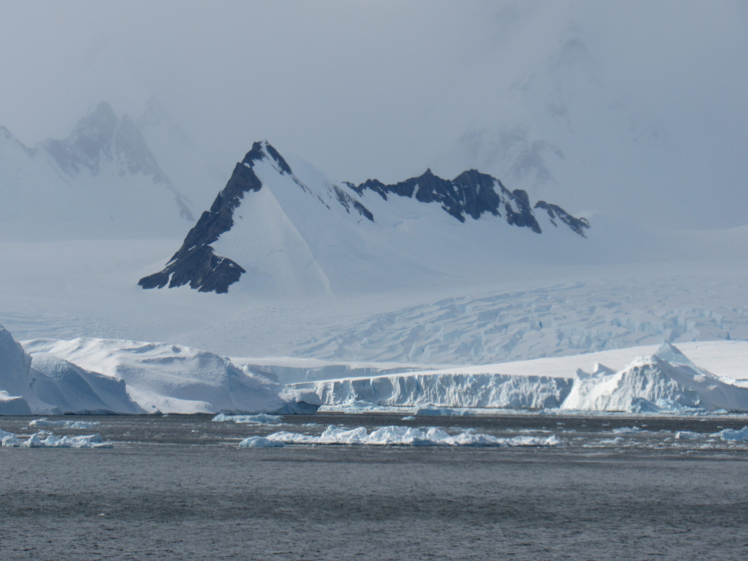
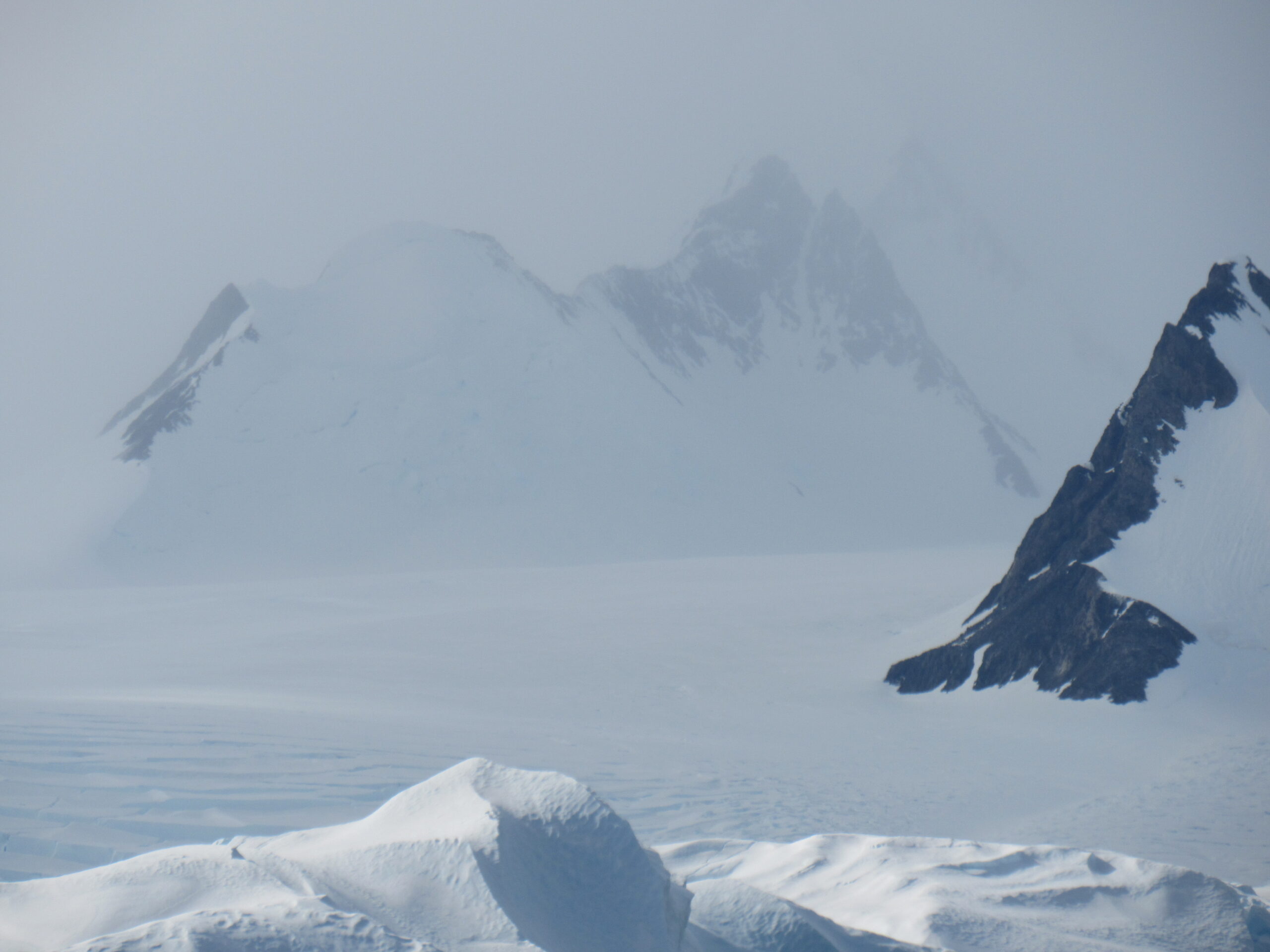
Rugged peaks lurking in the background.
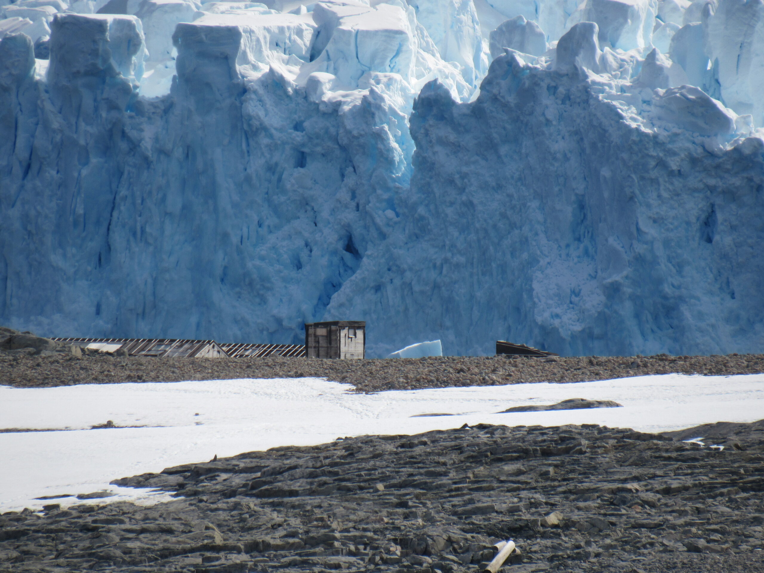
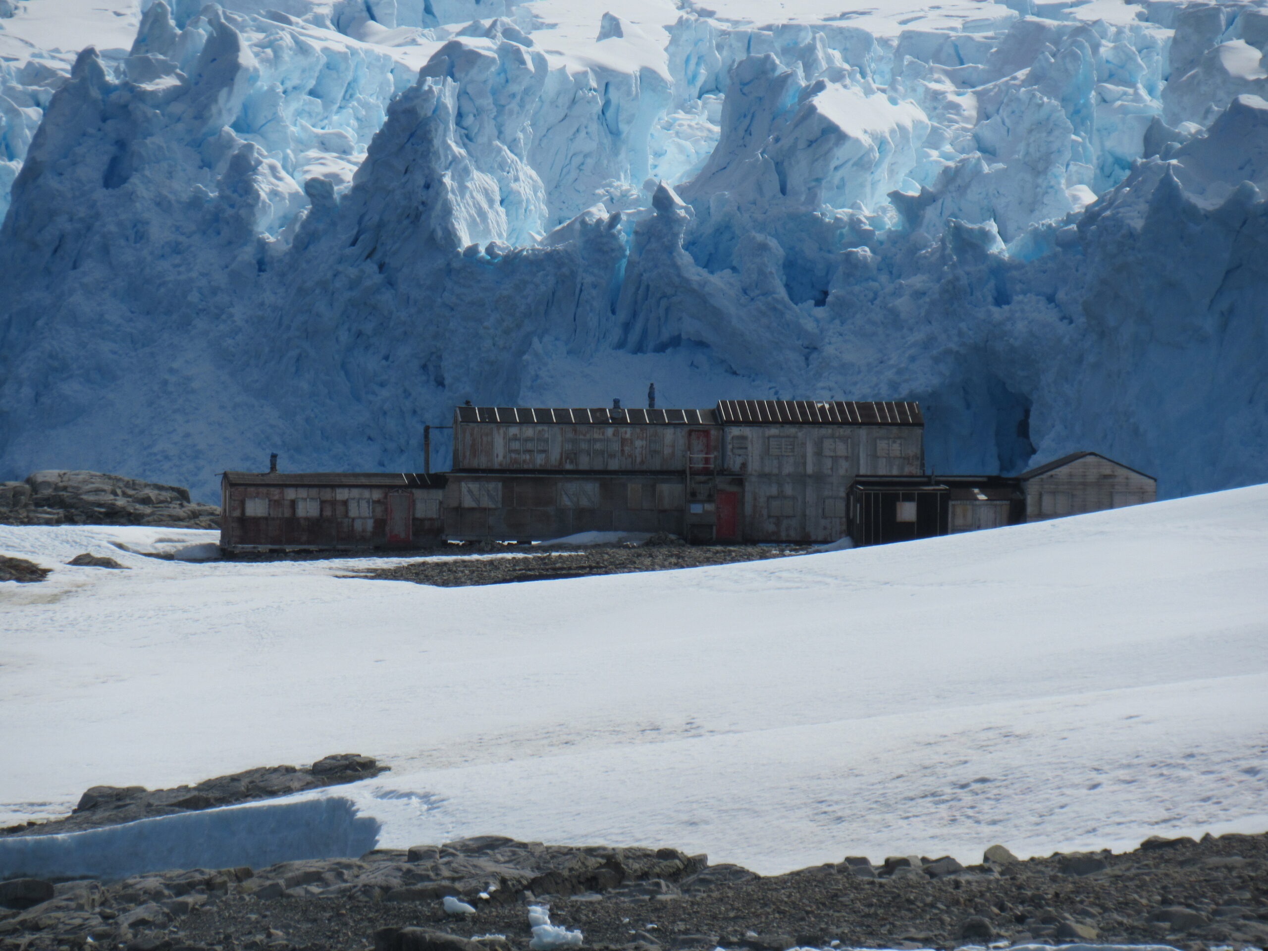
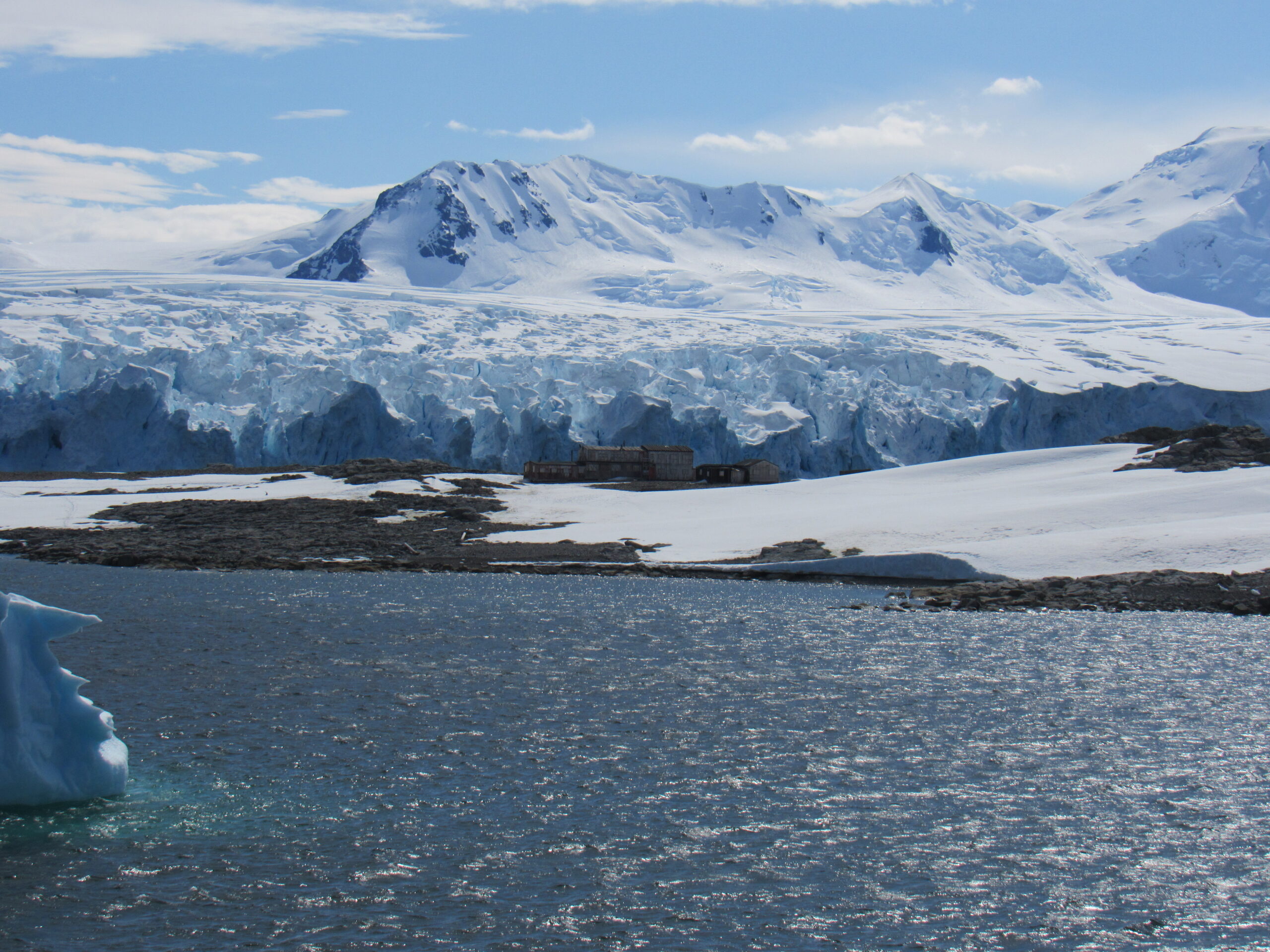
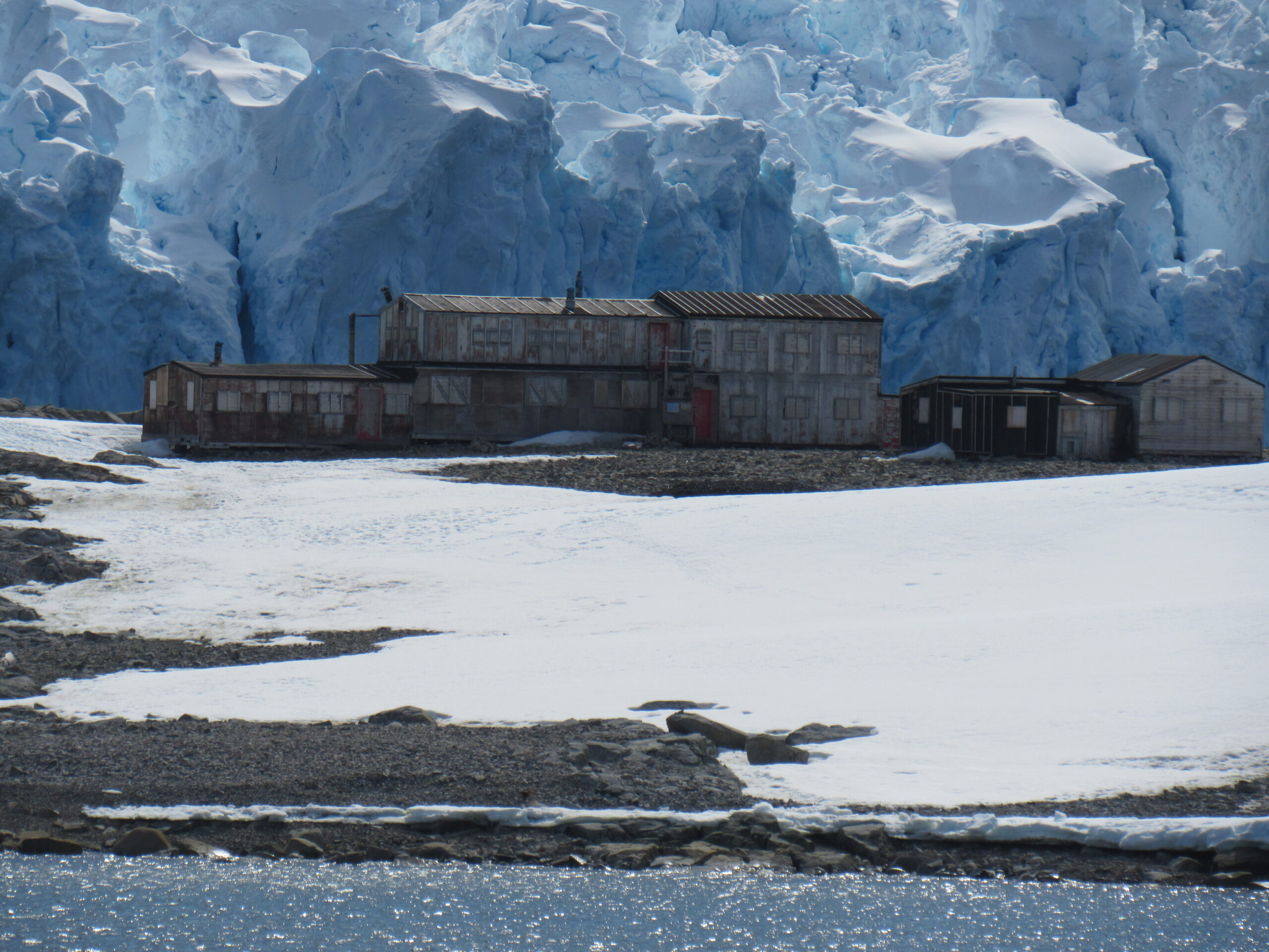
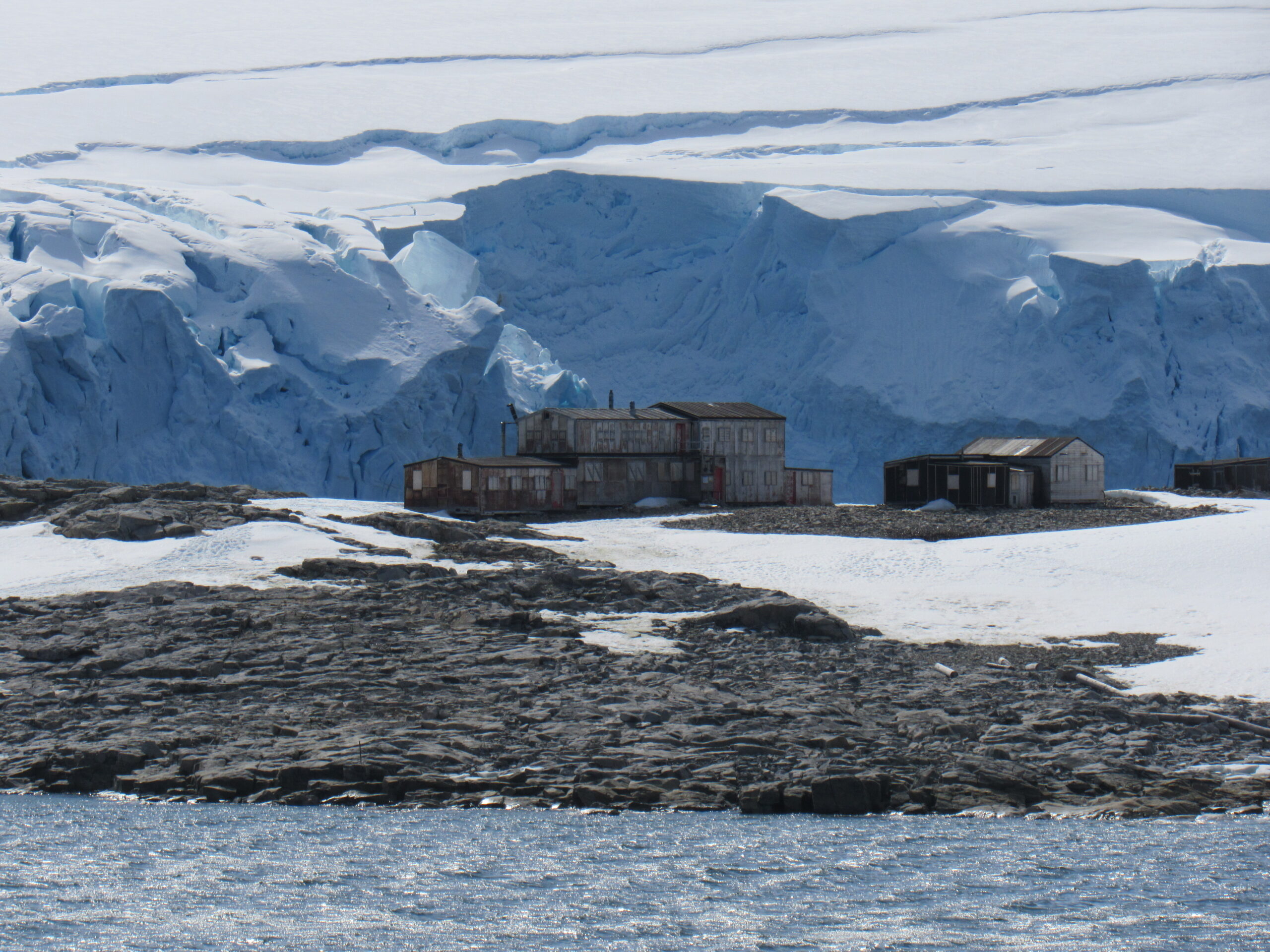
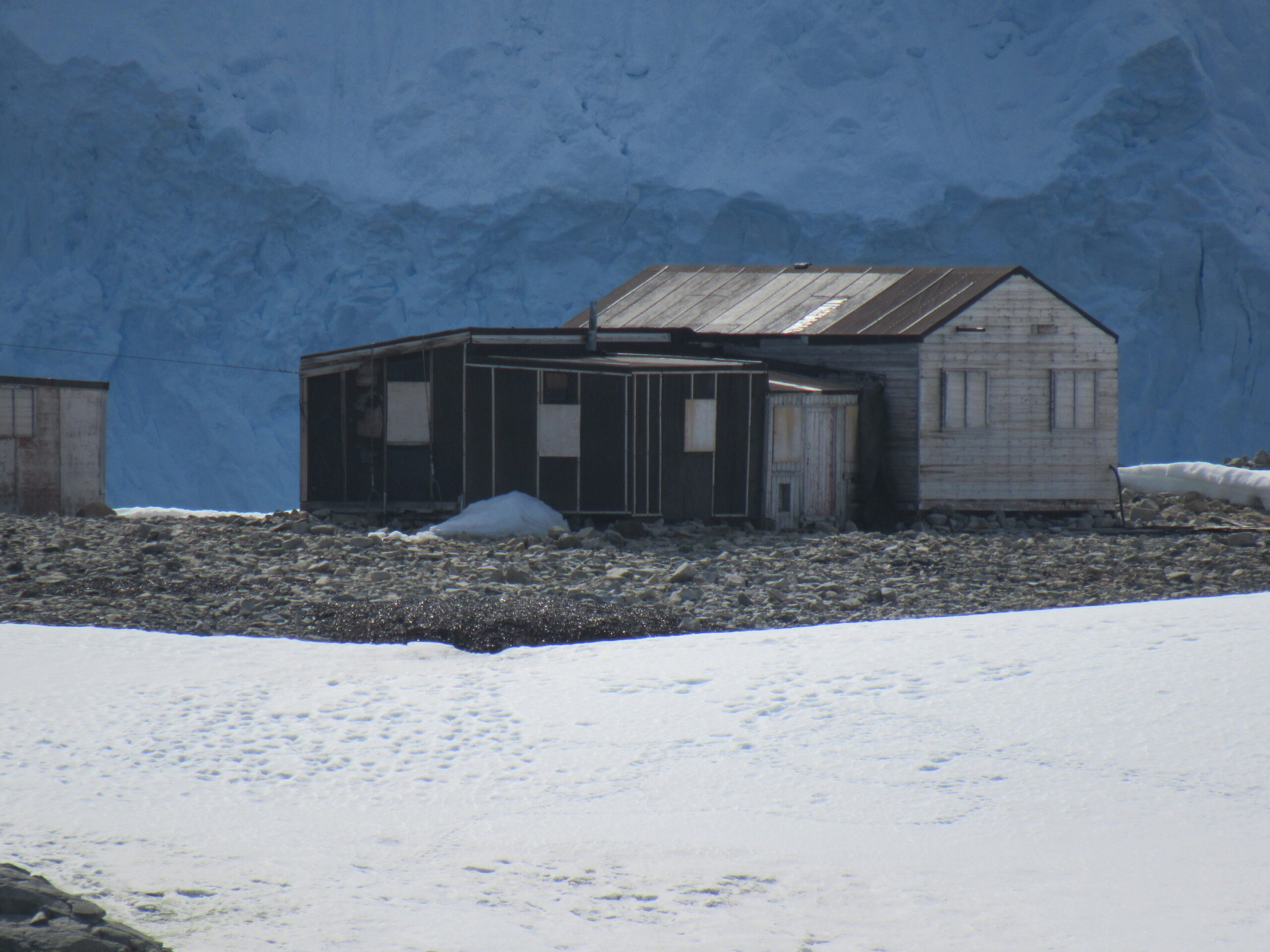
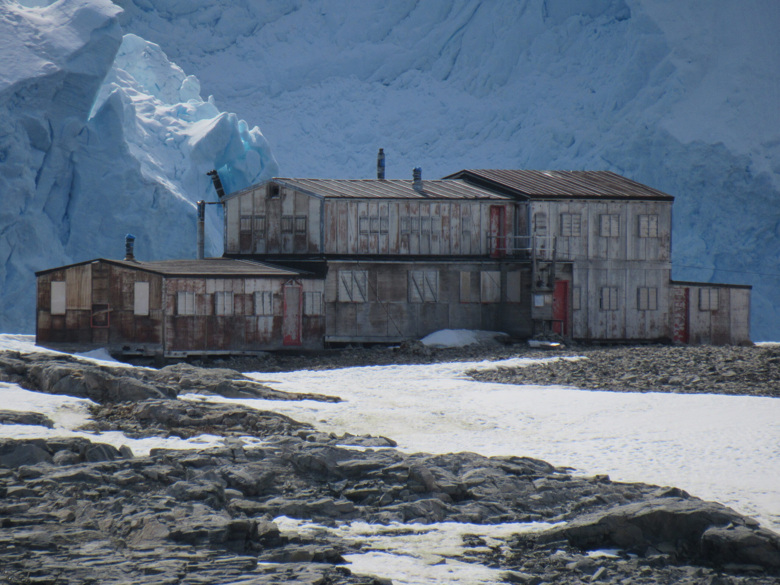
Just before noon, we finally stopped cruising and made ready to go ashore. This was at Stonington Island, a rocky island lying 1.1 mi northeast of Neny Island. It is 0.75 km (0.47 mi) long from north-west to south-east and 0.37 km (0.23 mi) wide, yielding an area of 20 ha (49 acres). It was formerly connected by a drifted snow slope to Northeast Glacier on the mainland. Highest elevation is Anemometer Hill which rises to 25 m (82 ft).
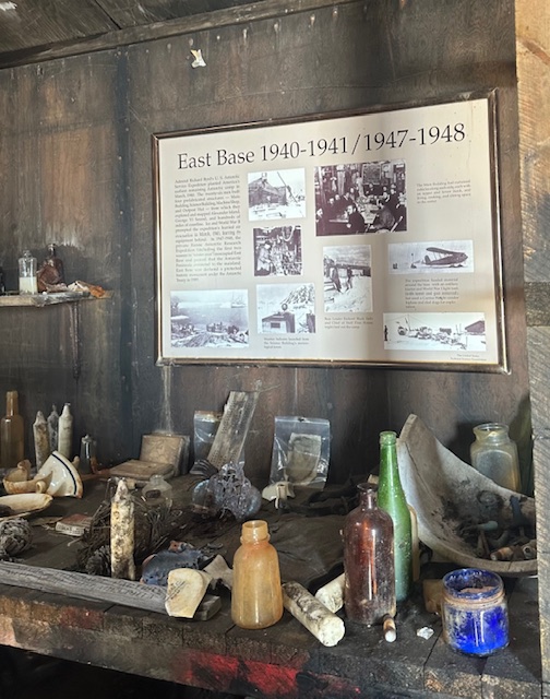
Stonington Island was chosen as the site for the East Base of the United States Antarctic Service (USAS) Expedition (1939–41). It was named after Stonington, Connecticut, home port of the sloop Hero in which Captain Nathaniel Palmer sighted the Antarctic continent in 1820. It is the oldest American research station in Antarctica, having been commissioned by Franklin D. Roosevelt in 1939.
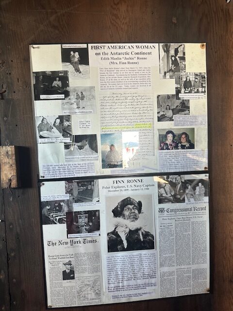
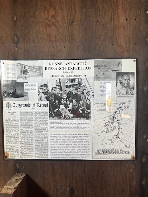
Stonington Island was the site of the first women to overwinter in Antarctica. Americans Edith “Jackie” Ronne – whose husband Finn Ronne was the base leader at East Base – and Jennie Darlington spent the 1947-48 winter at Stonington on the way to becoming the first women to spend a year on the continent. The Ronne Ice Shelf would later be named in honor of Edith.
The island was also home to the British Antarctic Survey (BAS) Station E and the Ronne Antarctic Research Expedition, and was the base of operations for many historic Antarctic Peninsula surveying missions in the 1940s. Station E was occupied until 23 February, 1975 and the main building was known as Trepassey House. It was cleaned and repaired in 1992. In 1995, the huts became a protected historic site with the name Base E.
From 1940–1974 Stonington Island was the site of operations for both the Americans and British, where they carried out significant survey work in the Peninsula region. The logistics to reach Stonington Island are challenging, and rely on the goodwill and strong relationships built up with the IAATO tour ship companies and British Royal Navy. It takes a week to travel there from either South America or the Falkland Islands, with landing reliant on good sea ice conditions at the time.
I was still quarantined because of my Covid, but I managed to take some pictures of the base from my cabin.
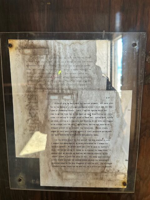
My friend Lisa took some nice pictures inside the base and has kindly allowed me to share them with you here. Zoom in to read any details on these.
The ship’s photographer took some excellent photos as well, and I share them with you here.
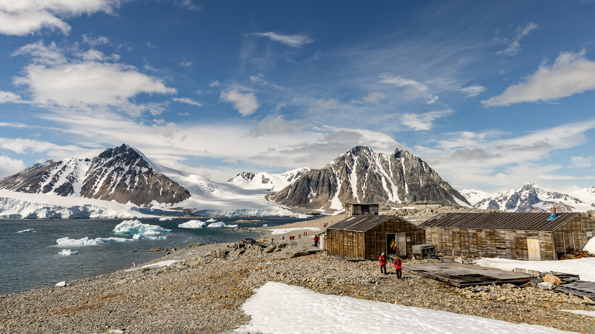
The American base
Our landing site
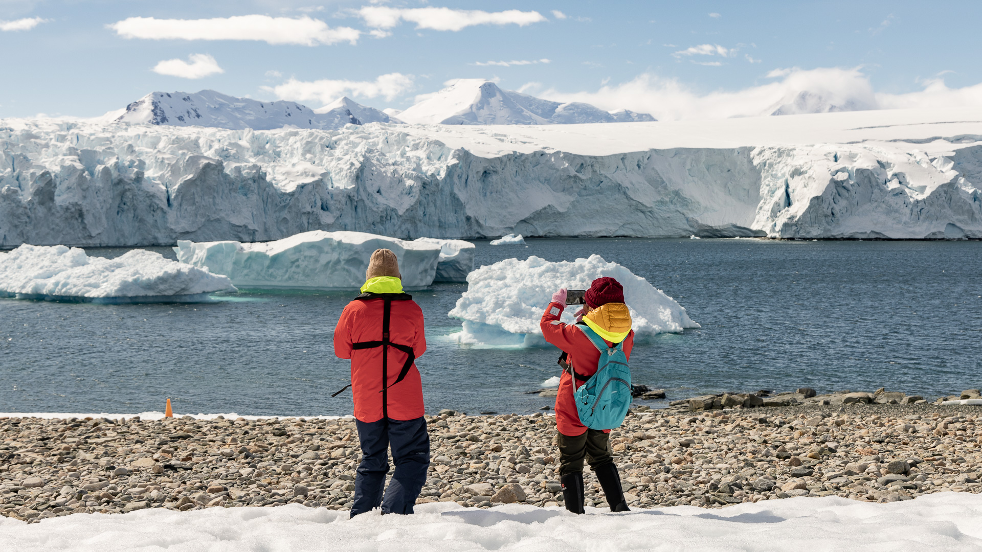

Our landing site.
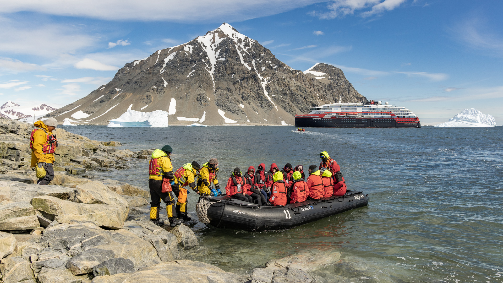
The crew in yellow would help each of us off the zodiac.
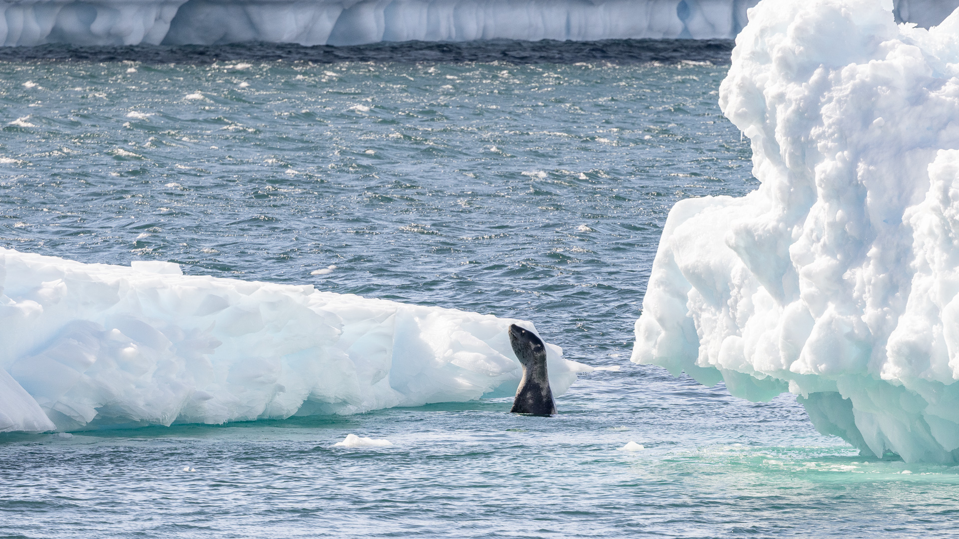
Leopard seal
We never got very close to any leopard seals, thank goodness. We were warned to stay far away from them if we saw one. These creatures are top predators, growing up to 11.5 feet in length and weighing up to 1,320 pounds. They have sharp teeth and a nasty disposition, and have attacked humans and even killed one. They are only found in Antarctic waters. You can read all about them here.
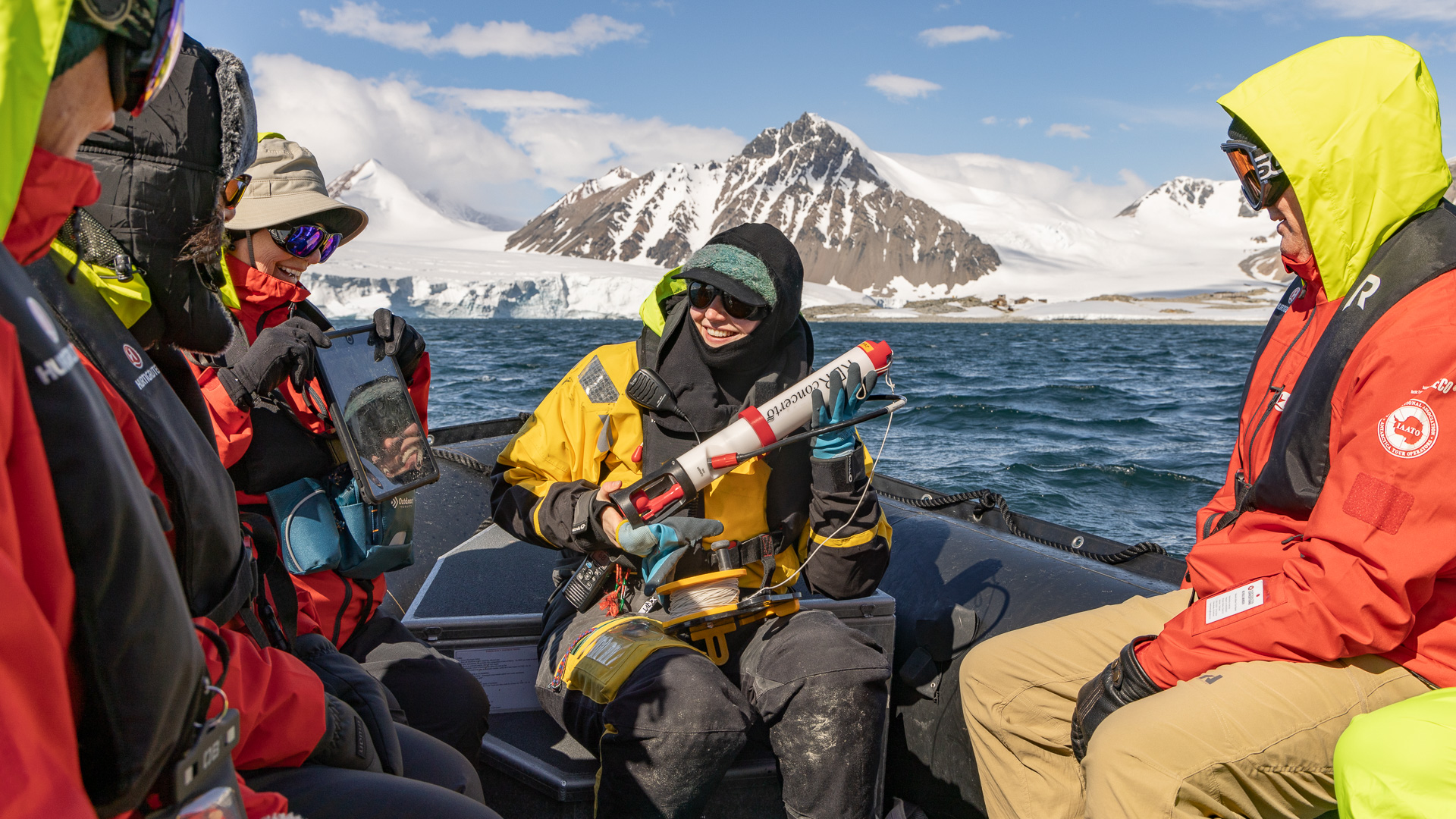
Science boat.
Ours was an expedition cruise and we had scientists aboard. Passengers could sign up to be a part of a team doing research, like this group doing sampling from one of the zodiacs.
Among the earlier climbing done along the Antarctic Peninsula was that done by members of the Creagh Dhu Mountaineering Club. Its members originated from the rough working-class areas of Glasgow, particularly the shipyards, and had a reputation for drinking and fighting as hard as they climbed. The leading light of the club was John Cunningham, who had spent time on South Georgia in the mid-1950s with Duncan Carse, and was Base Commander at Stonington in the early 1960s. In 1962, Cunningham, Ben Hodges, Ian McMorrin, Bob Metcalf and Ivor Morgan traveled using dog teams among the mountains and glaciers north of Stonington. These men all did various climbs around the area, but Cunningham in particular was serious about snaring first ascents. He had already snatched Mount Barré soon after Base T opened on Adelaide Island in 1961, and would later steal the grand prize of the peninsula, Mount Jackson, with fellow Creagh Dhu men in 1964.
In addition to first peak ascents, Creagh Dhu climbers often practiced climbing on short ice cliffs and gullies during winter, honing techniques that later influenced ice climbing in Scotland and North America. An example of their hard local climbing was the Pinnacle Buttress on Roman Four Promontory, an attractive wall of rock 2,723 feet high and riven with ice gullies, three of which form the Roman numerals “IV”. Roman Four Promontory is southeast of Stonington, west of Mount Nemesis, and runs down to the sea, forming a northern boundary to Neny Fjord. The Creagh Dhu route climbed the left side of a steep rock pillar, clearly visible from the base. Richard Brook, writing years later in the 1973 Alpine Journal, described it as “probably the first rock climb of alpine length and standard to be done in the Antarctic.” It took Mike Cousins, Jimmy Gardner, John Noble and Davie Todd five hours, climbing over rock at UIAA grade IV. Climbing this far south, on unclimbed mountains and untraveled glaciers, with no field radios or satellite phones, no means of rescue and no GPS in whiteouts, was extremely serious, making the sheer amount of hard climbing done in the area all the more remarkable.
Roman Four Promontory
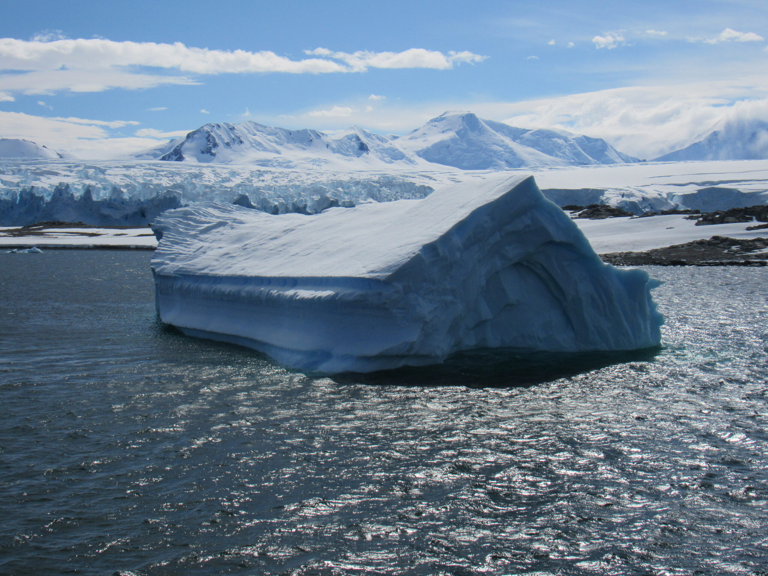
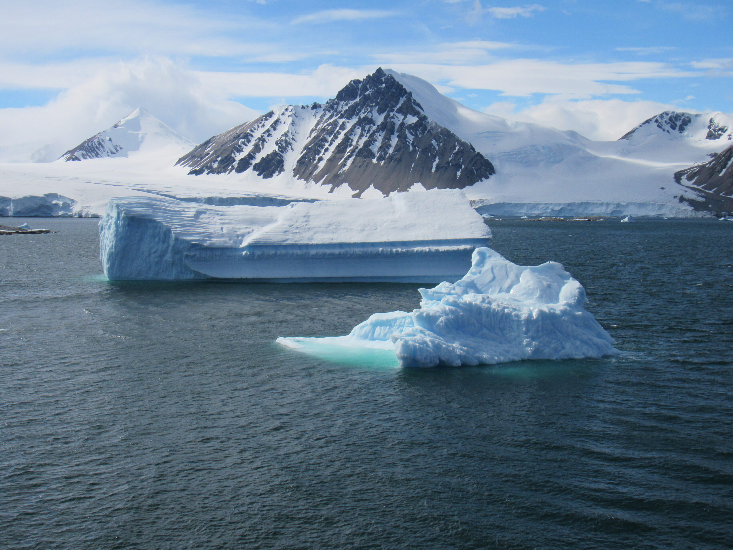
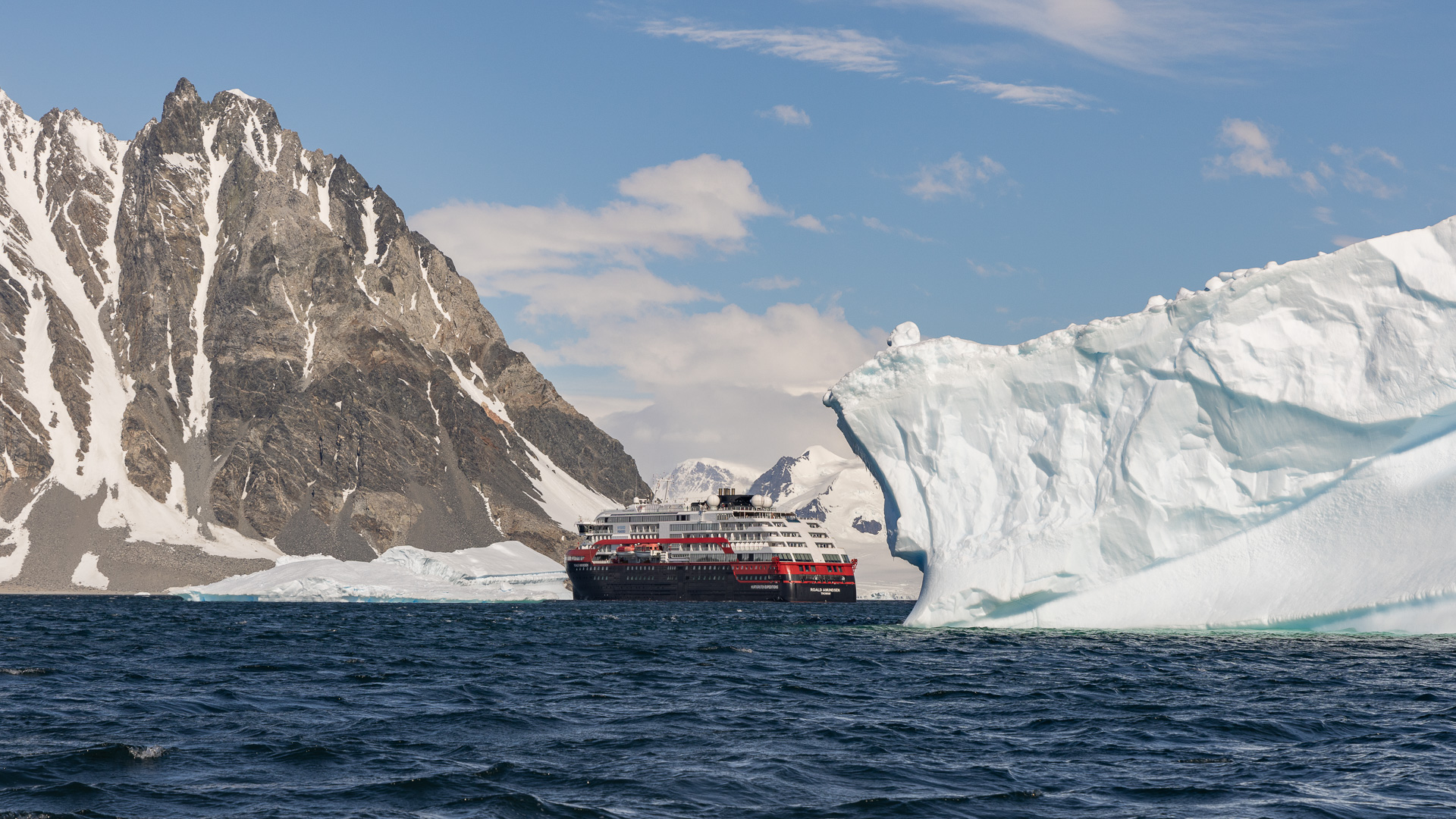
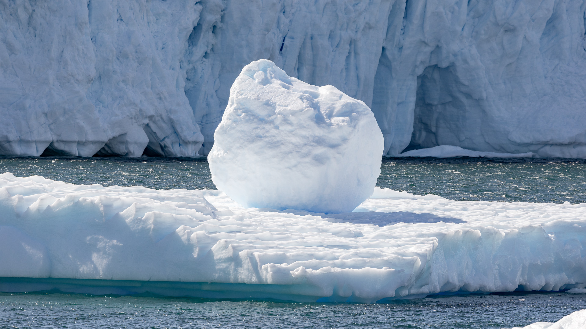
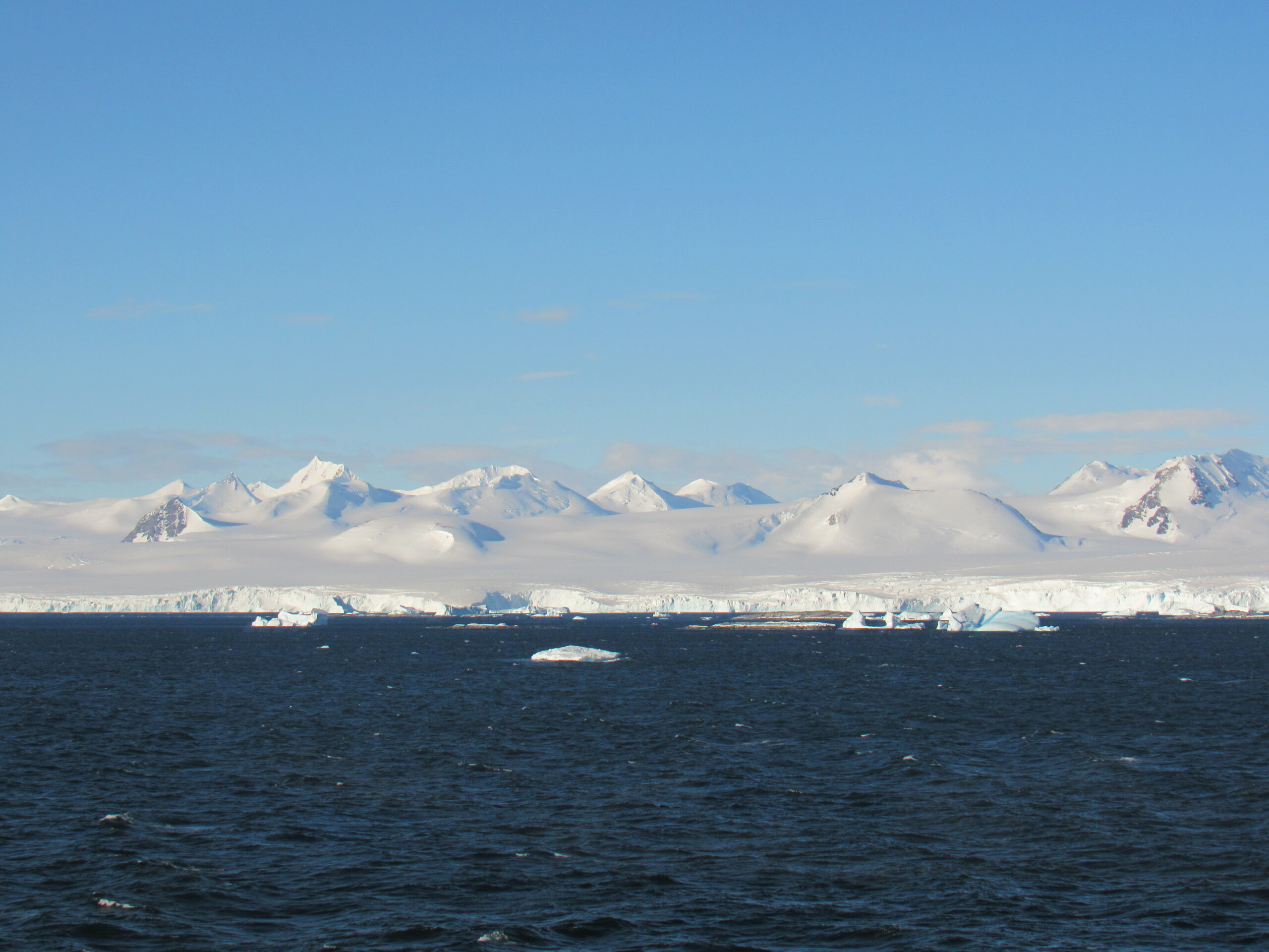
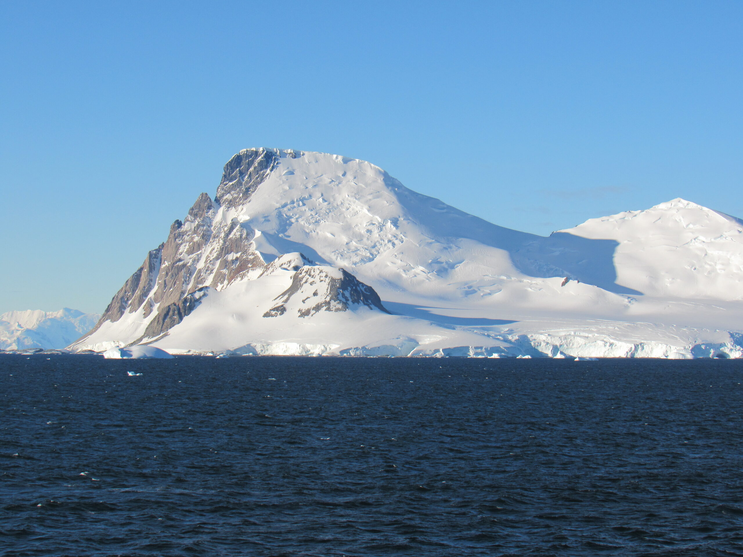
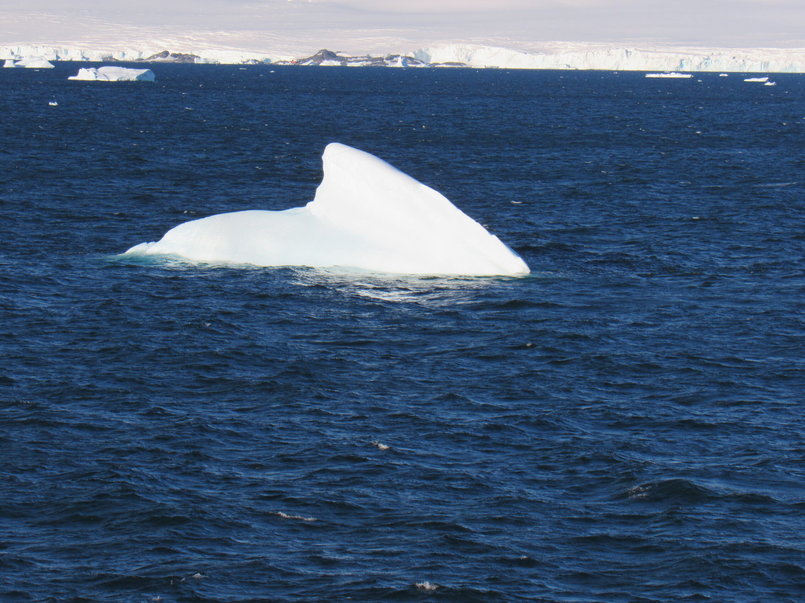
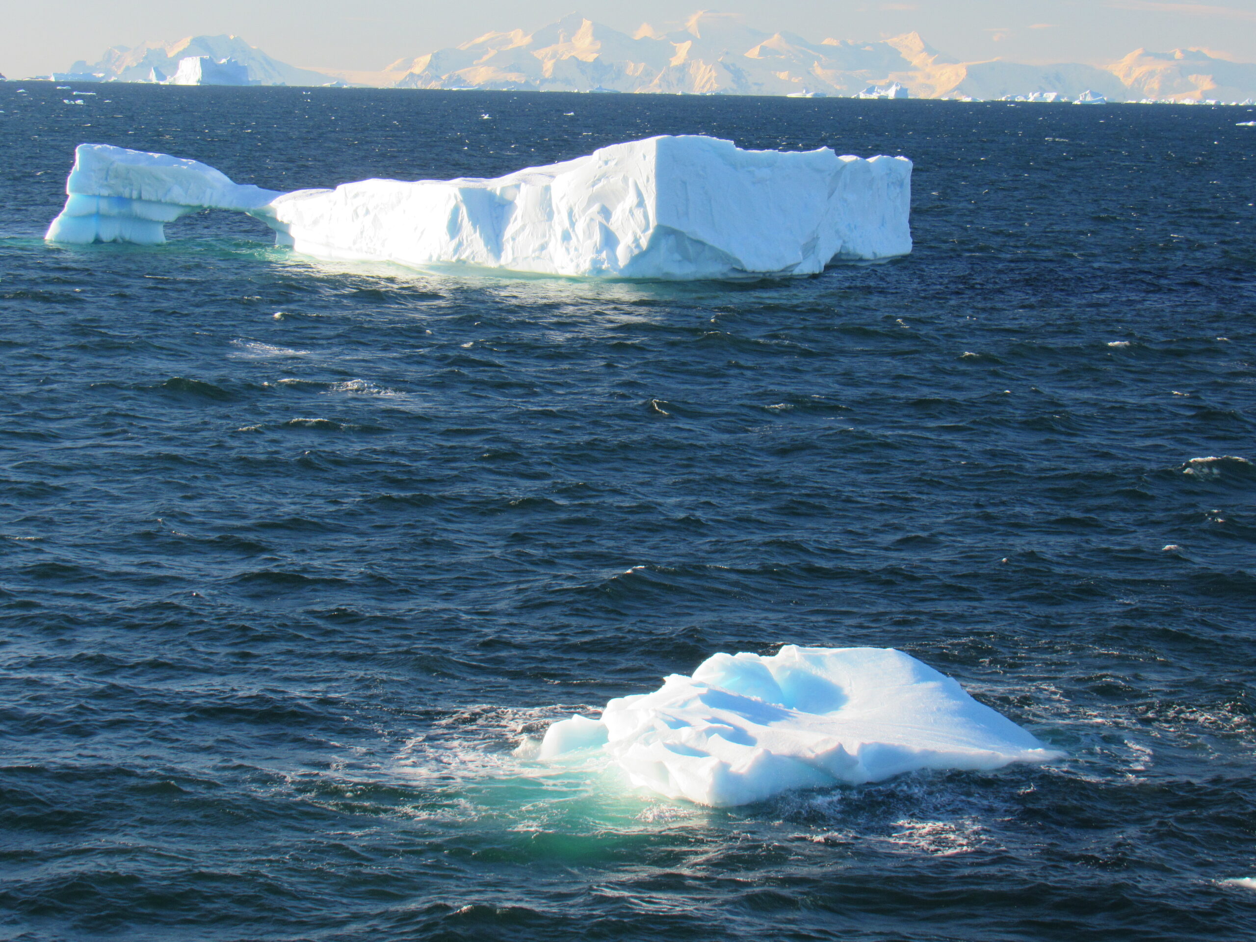
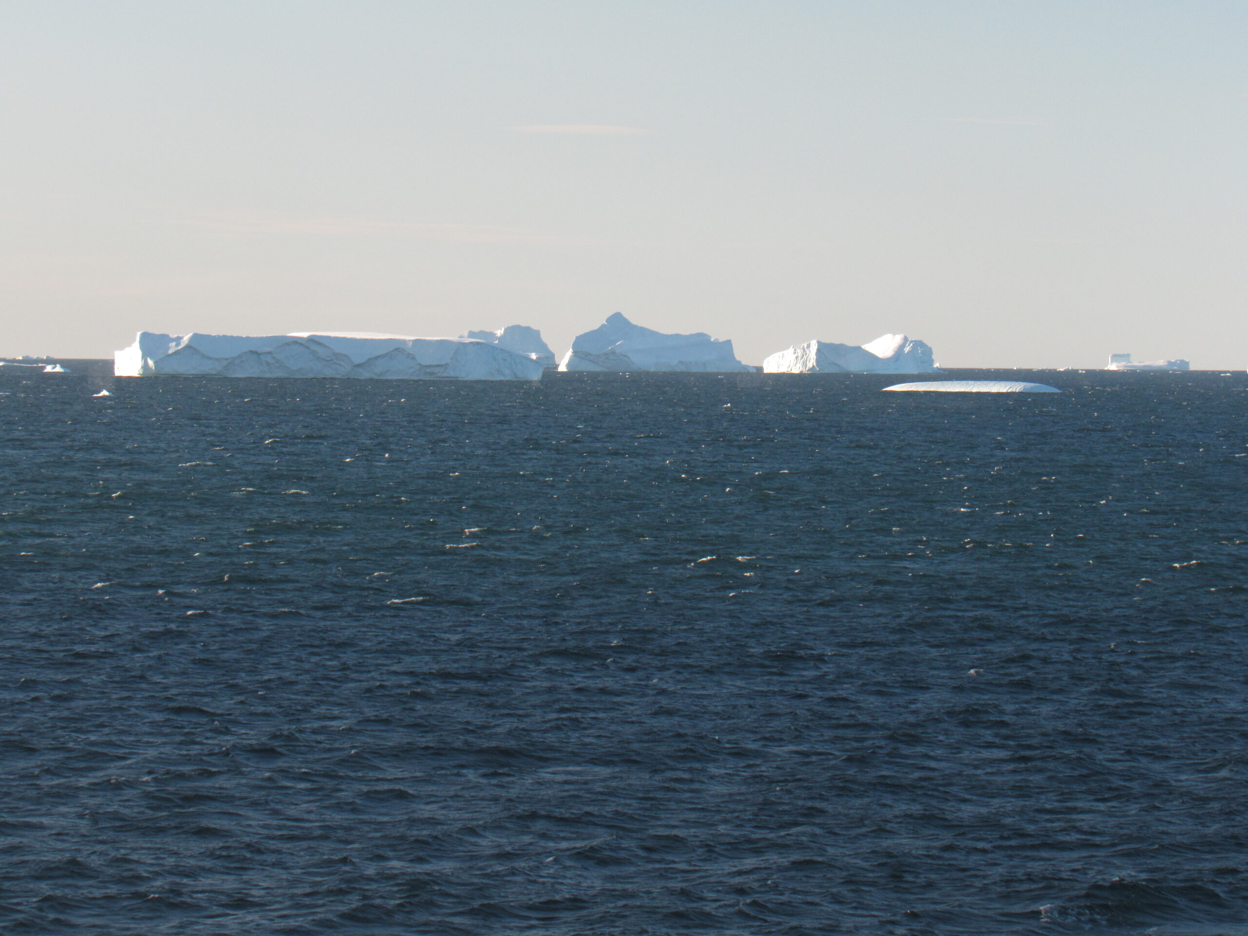
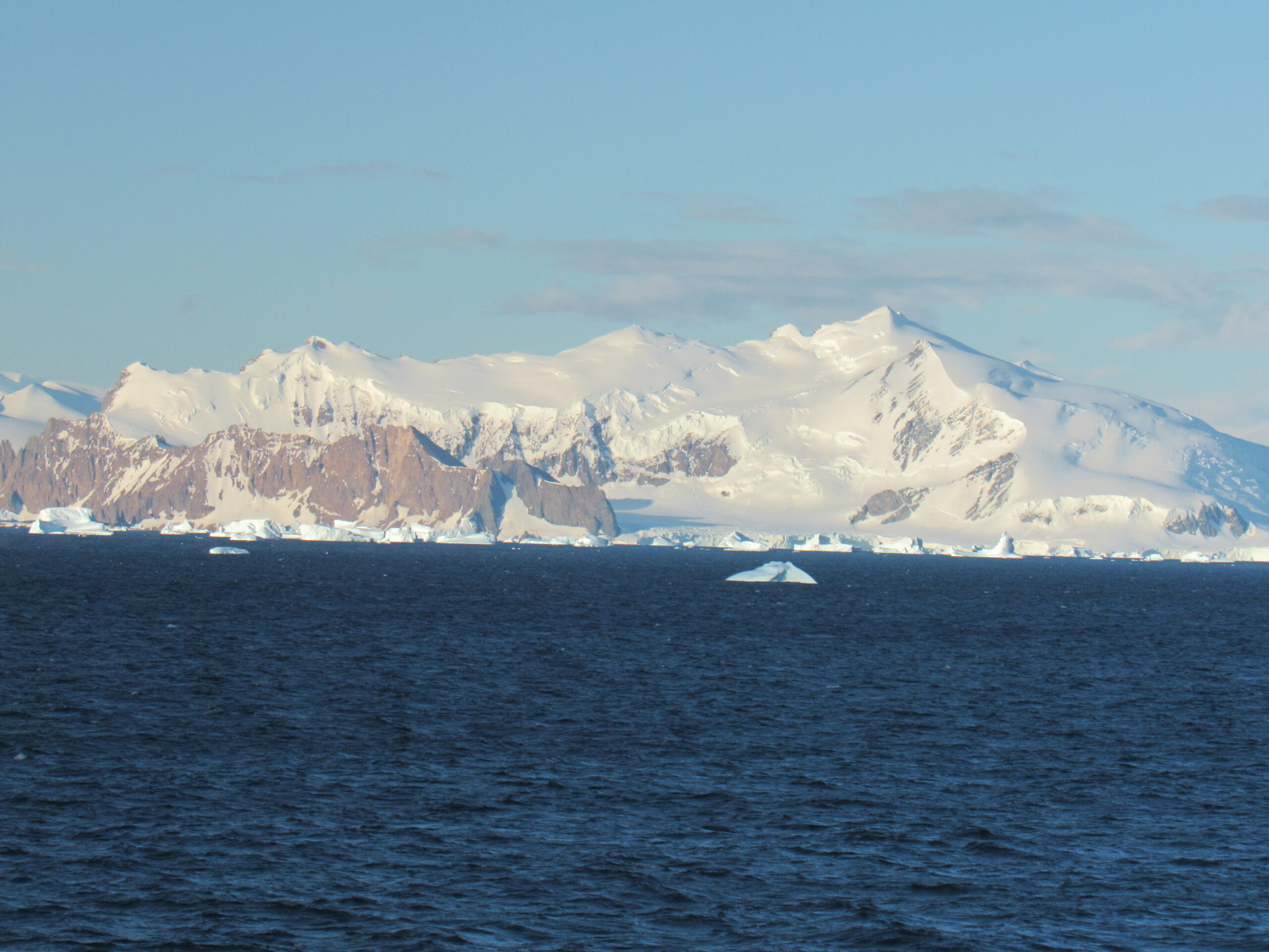
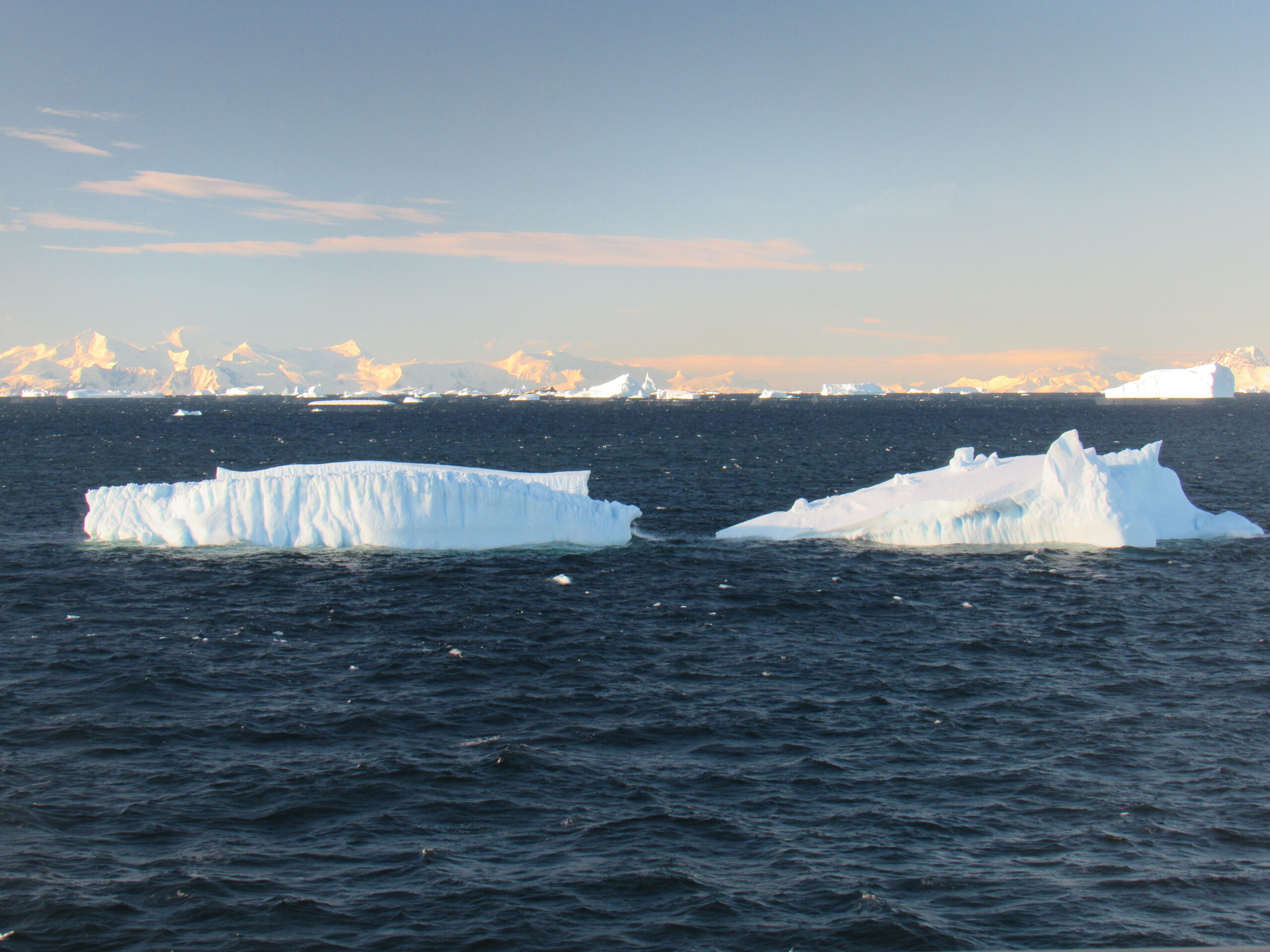
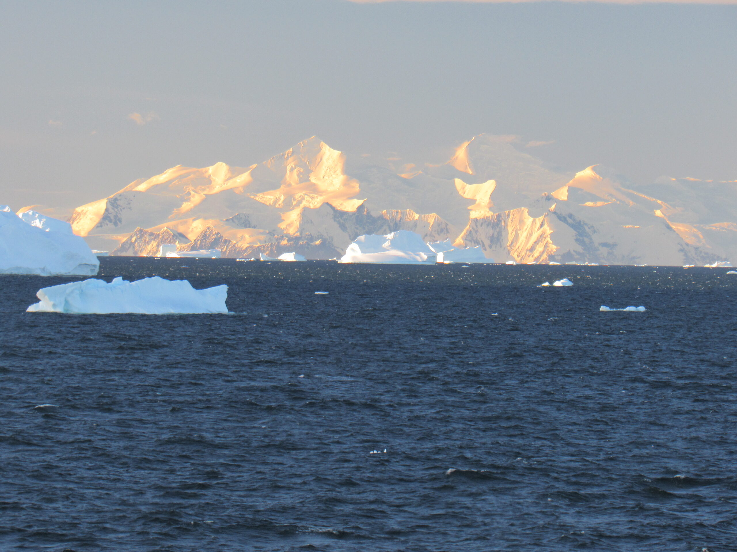
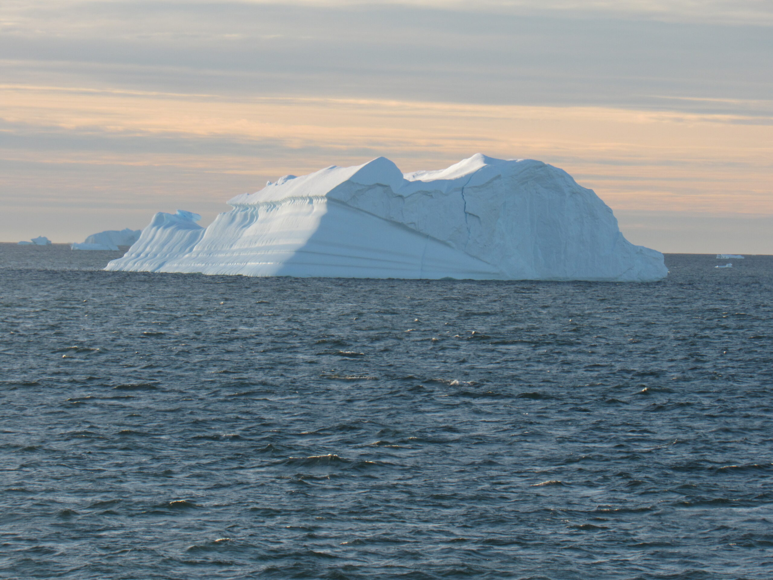
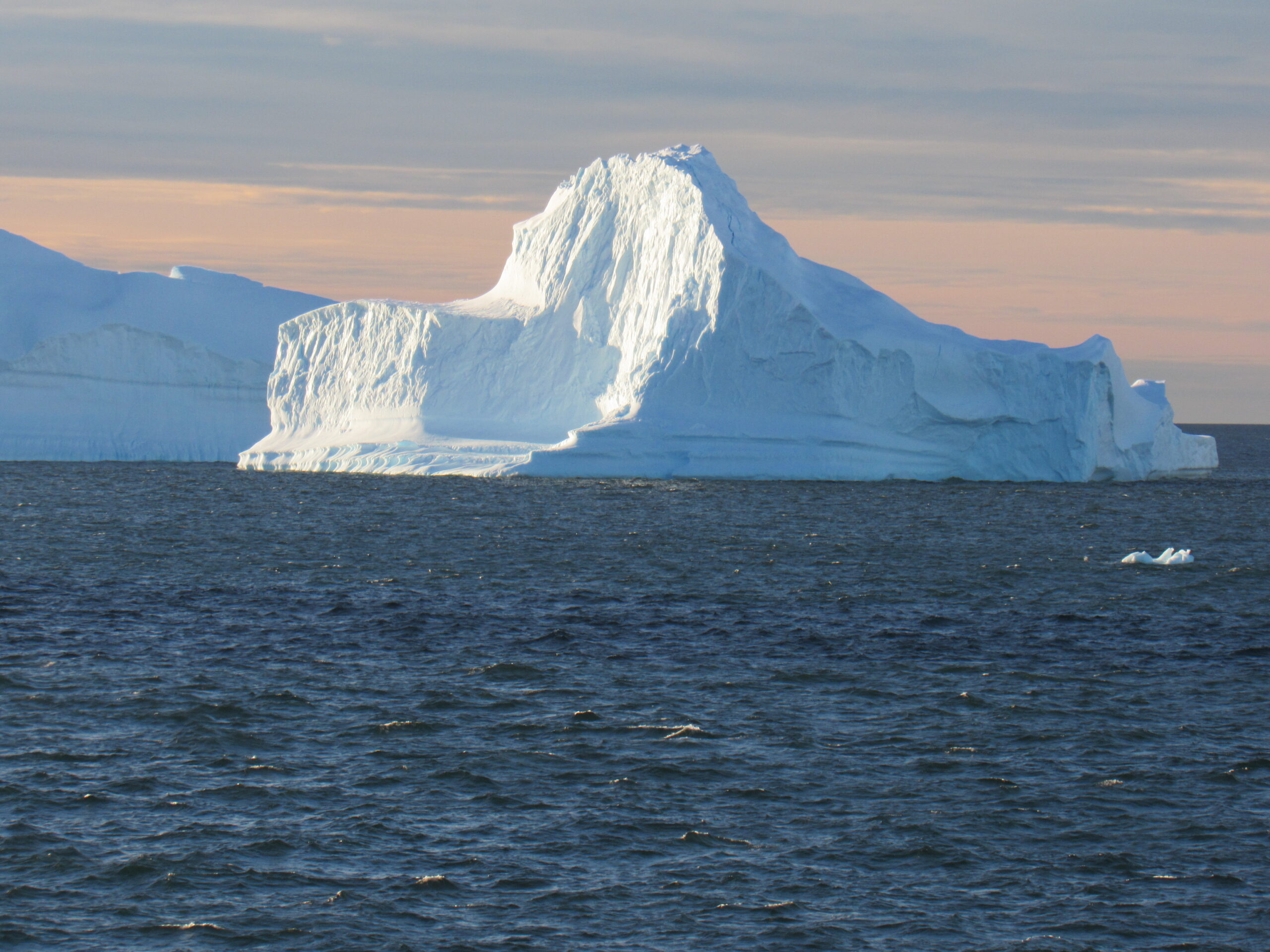
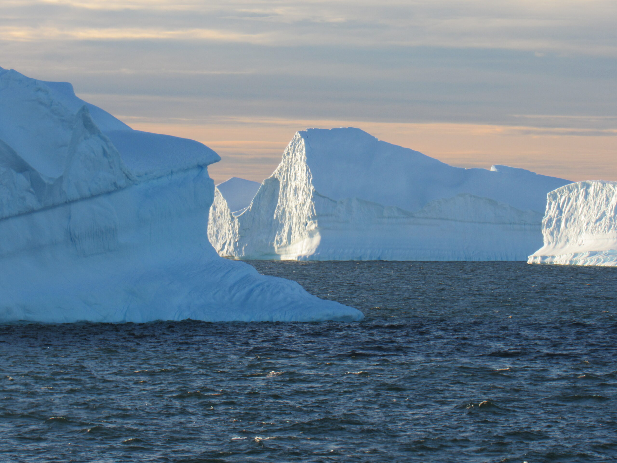
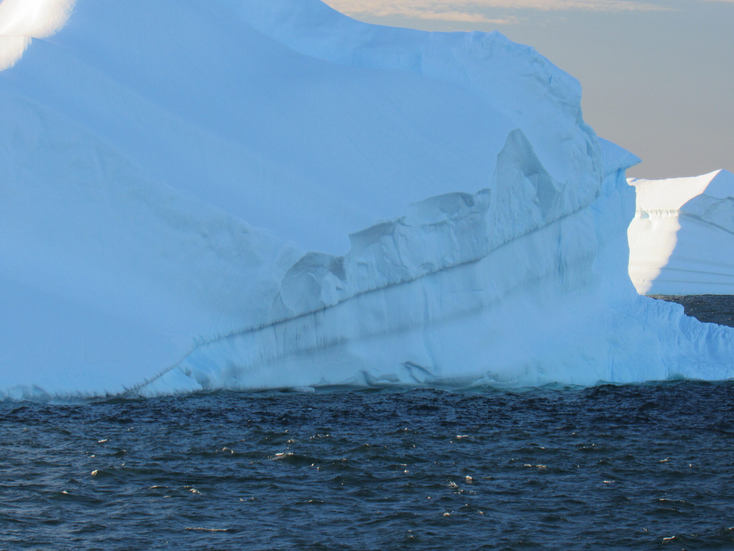
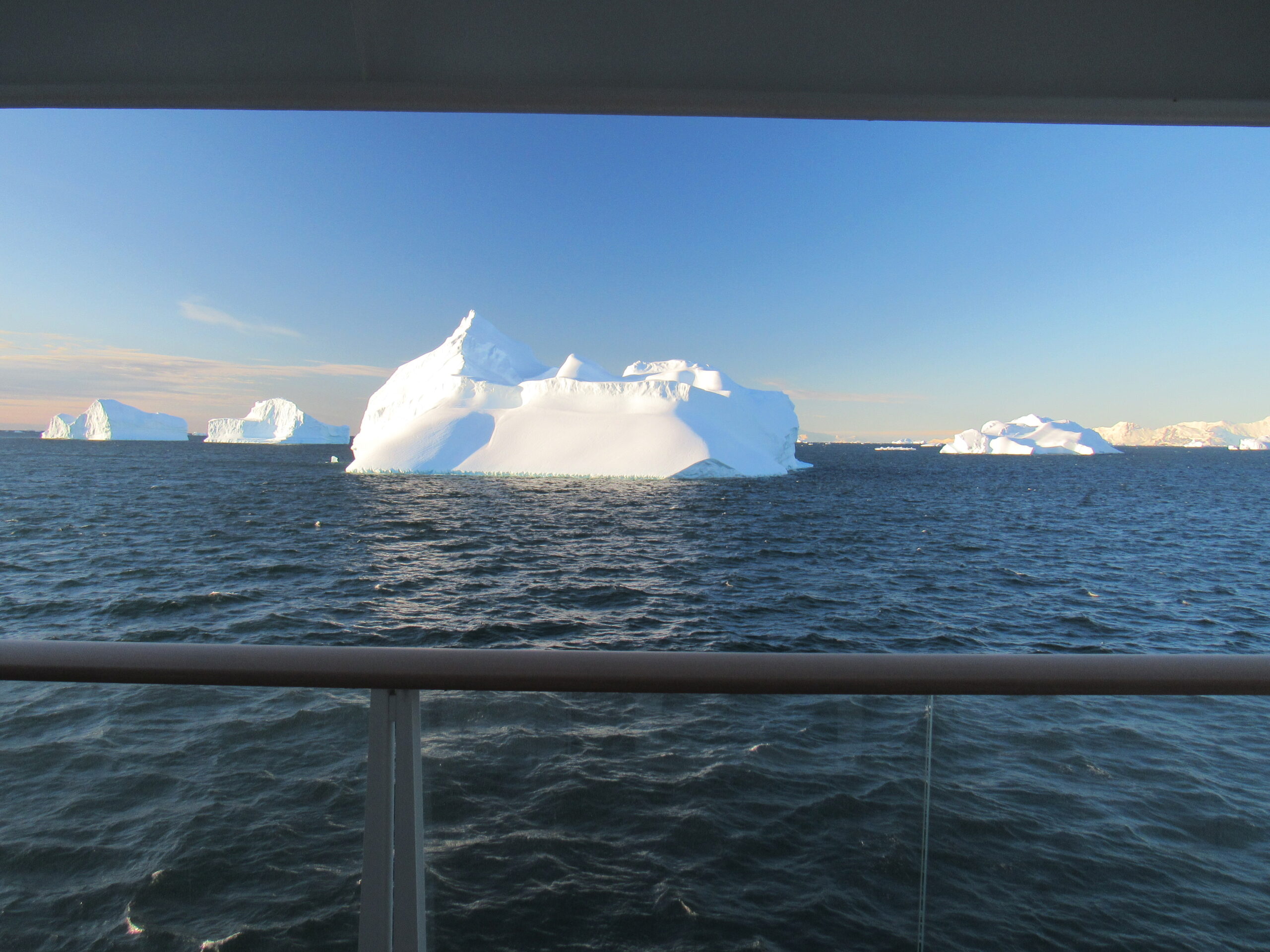
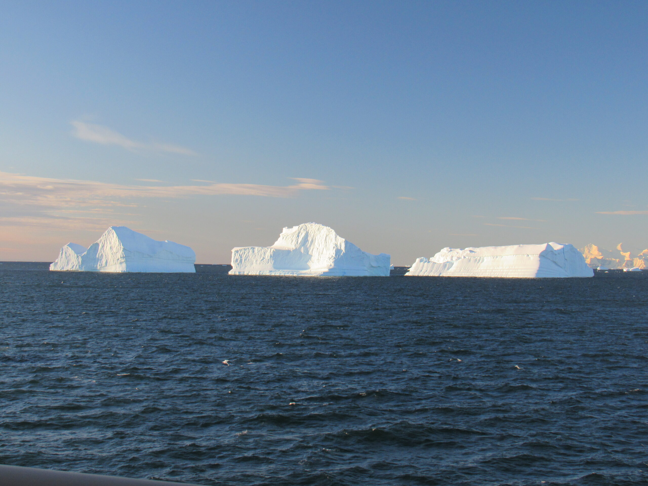
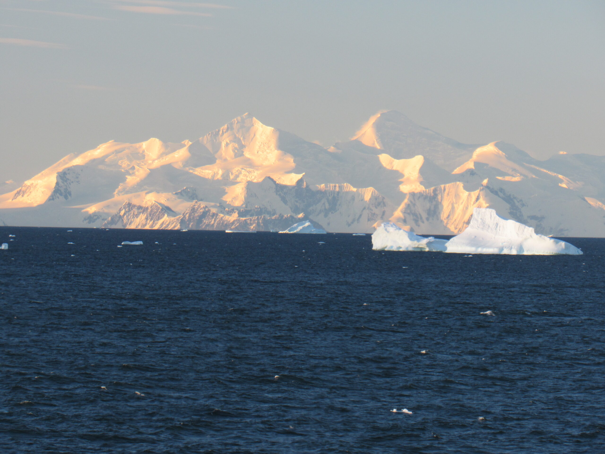
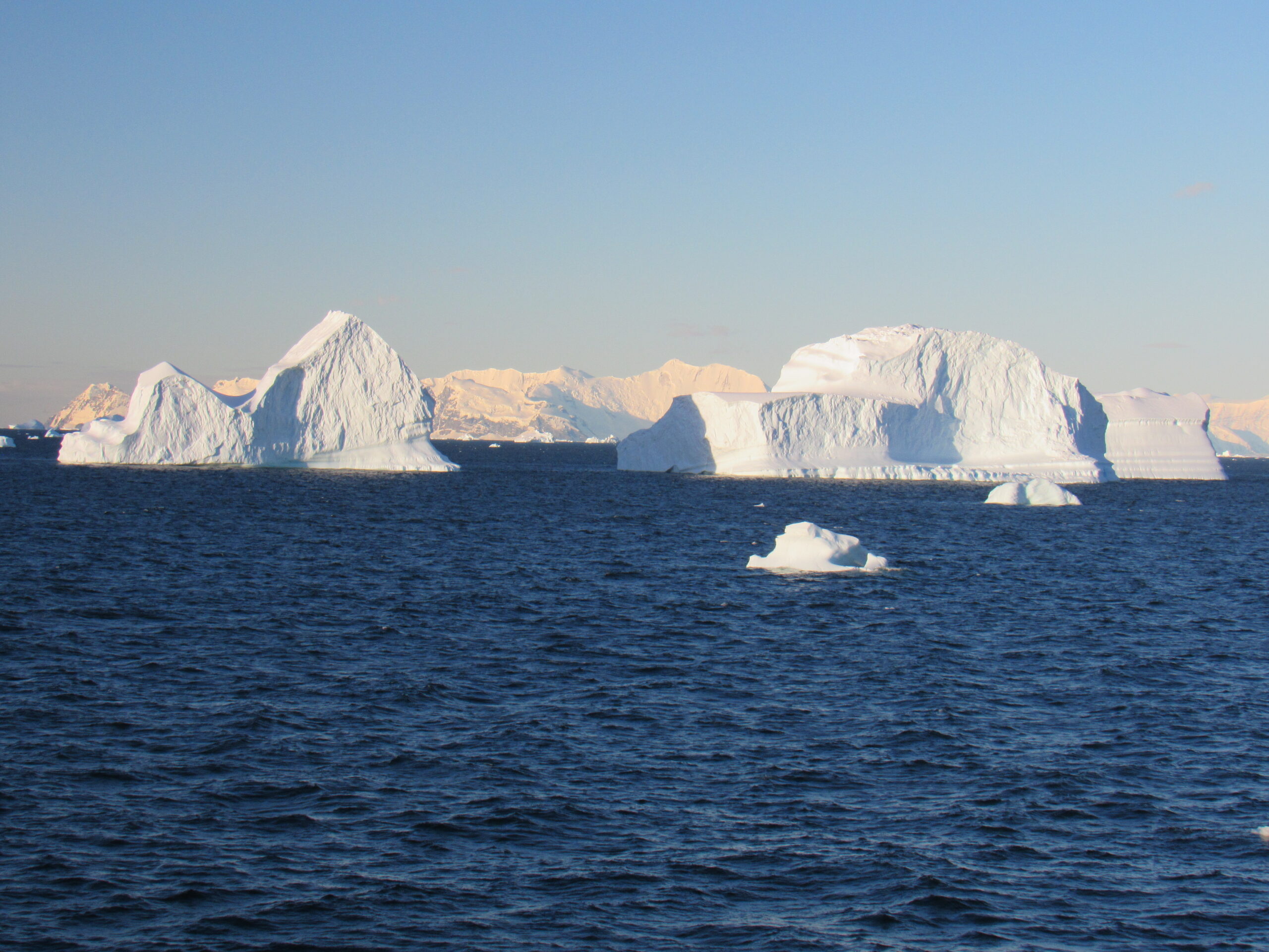
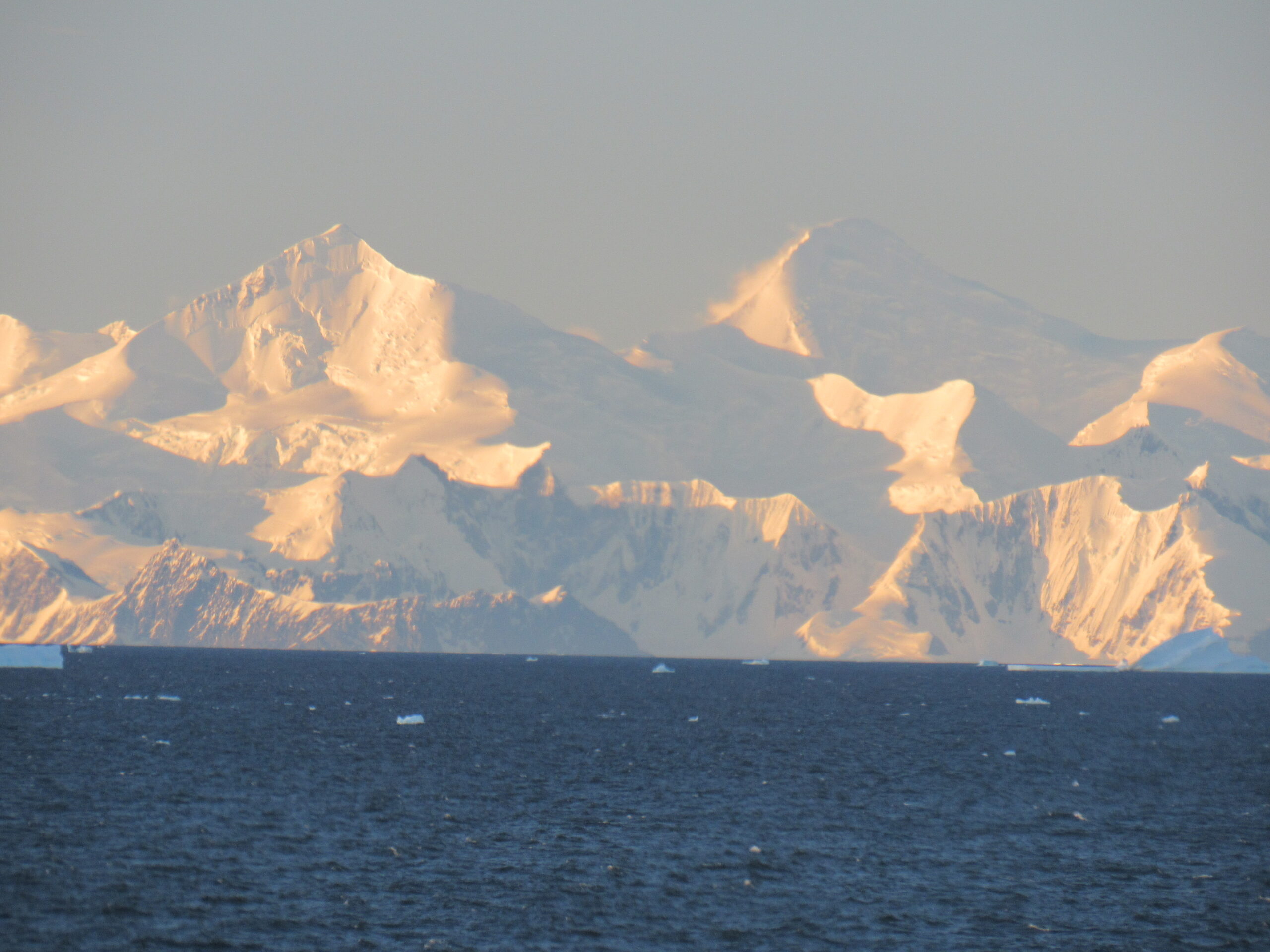
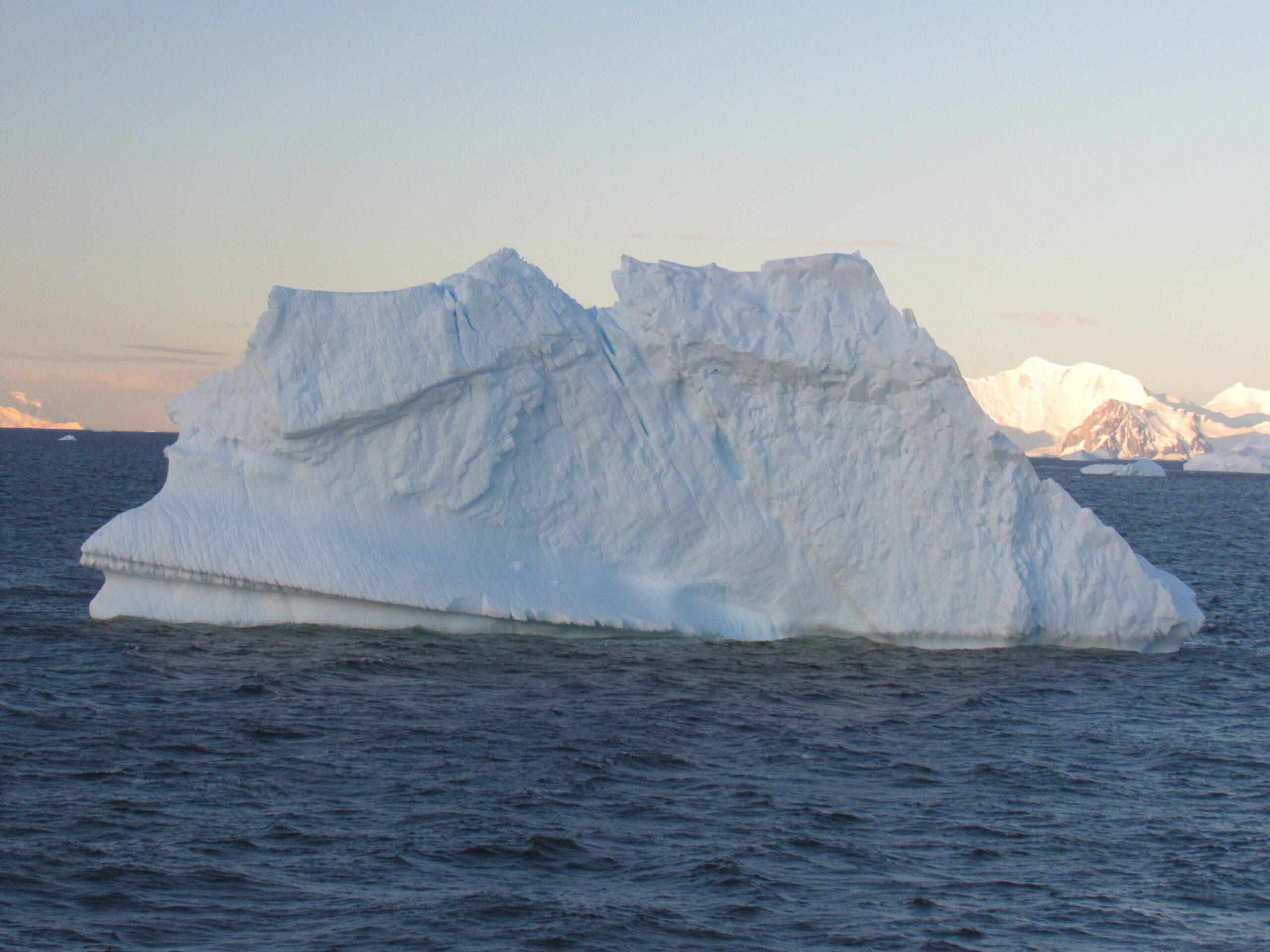
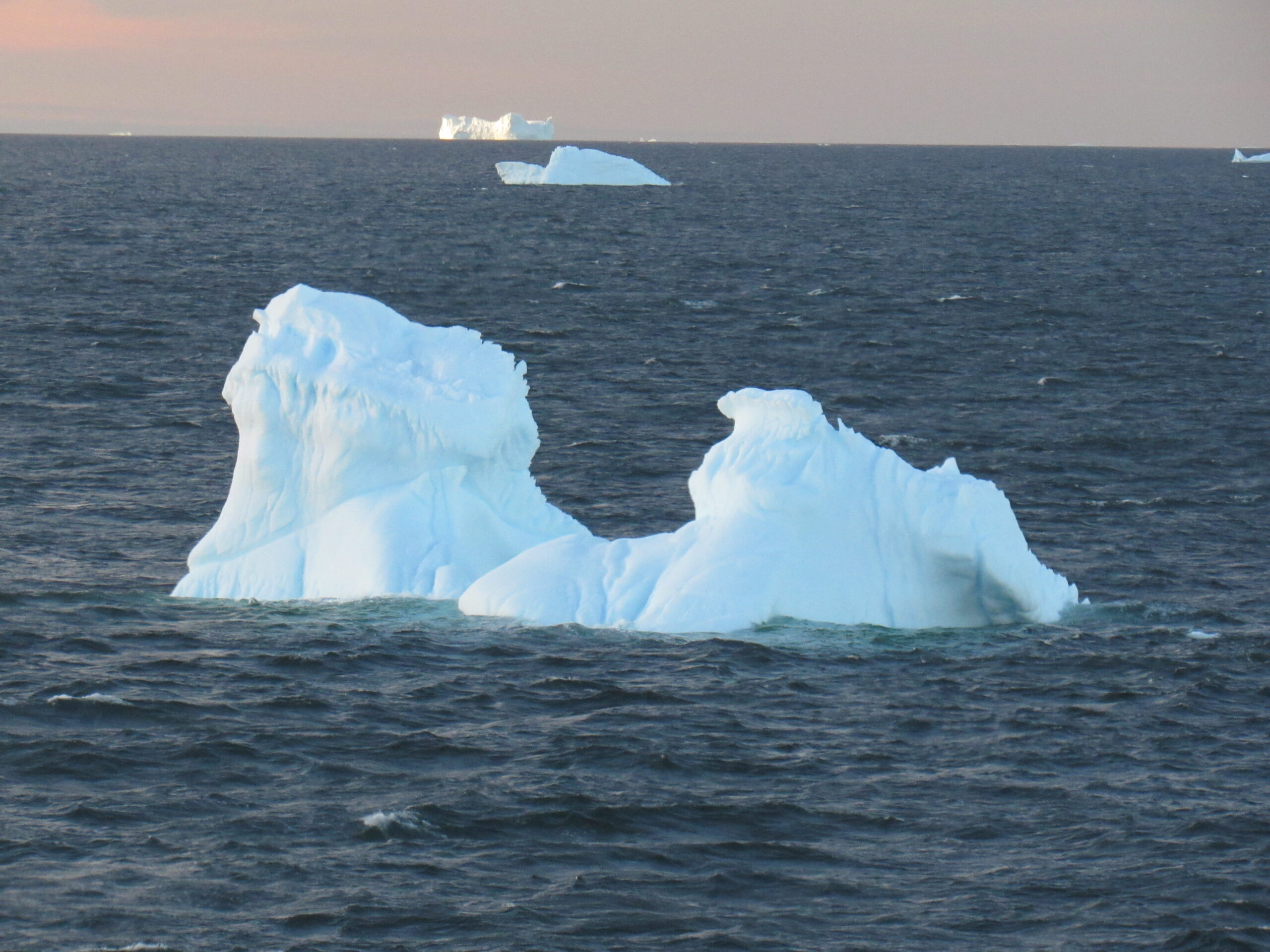
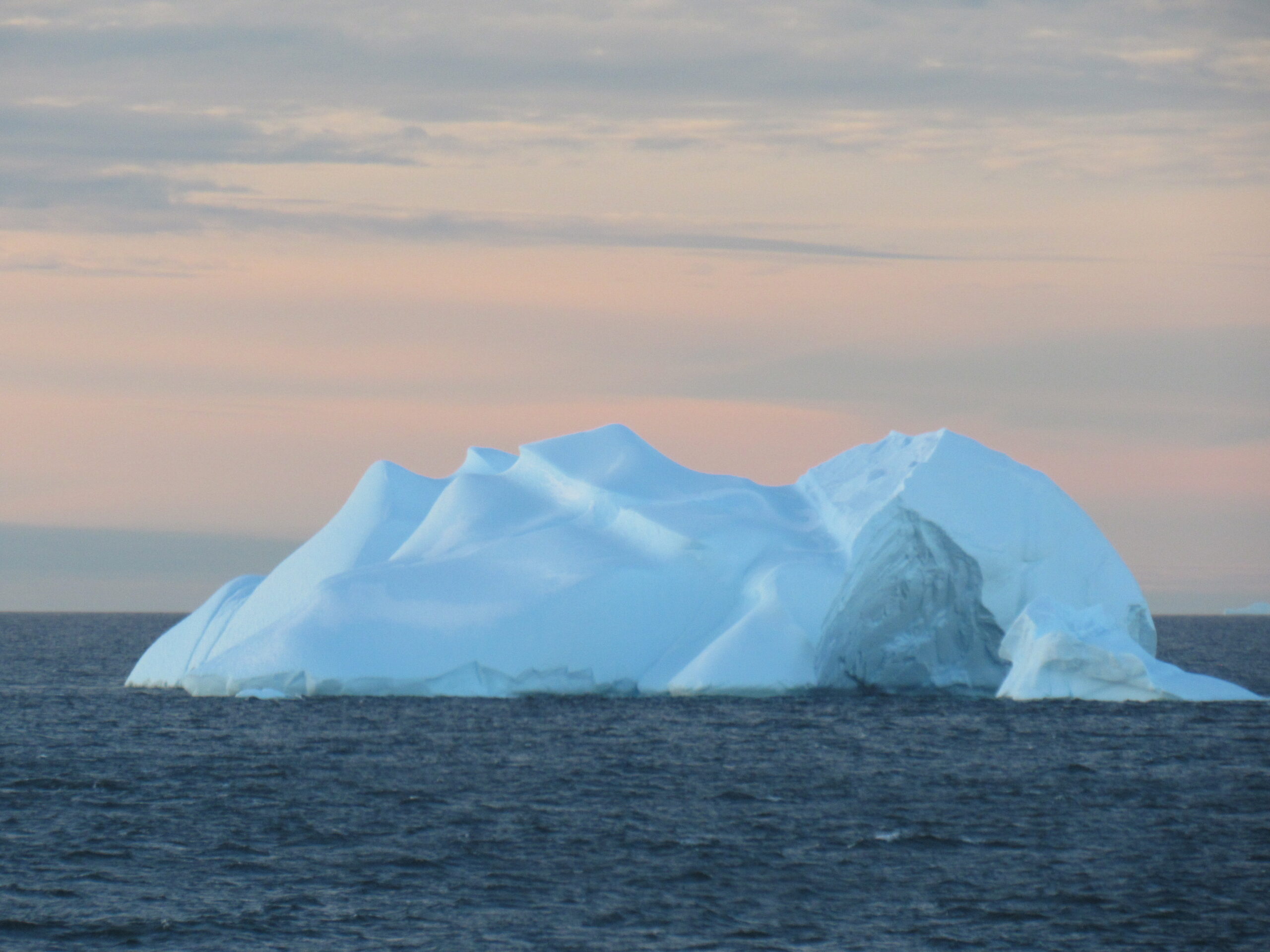
By the time all of the groups had gone ashore and all of that activity had been wrapped up, it was seven in the evening and we headed south and west back out into Marguerite Bay. I spent hours looking at the amazing icebergs out in the bay as we cruised about. Each one was unique and special. As you look at these pictures, remember that only 1/10th of each one is visible above the water. The vast majority of its bulk, a full 90%, is hidden below the water.
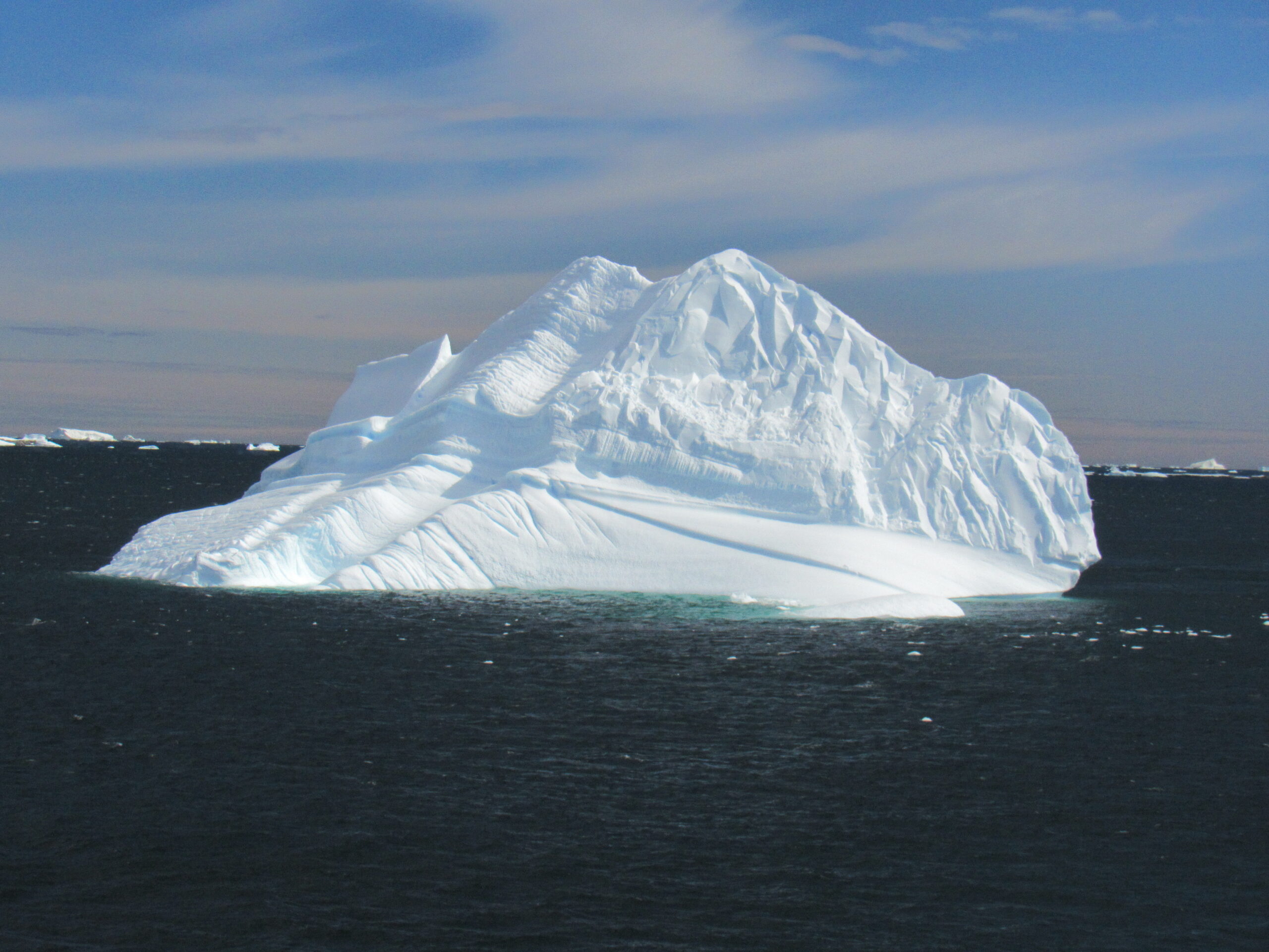
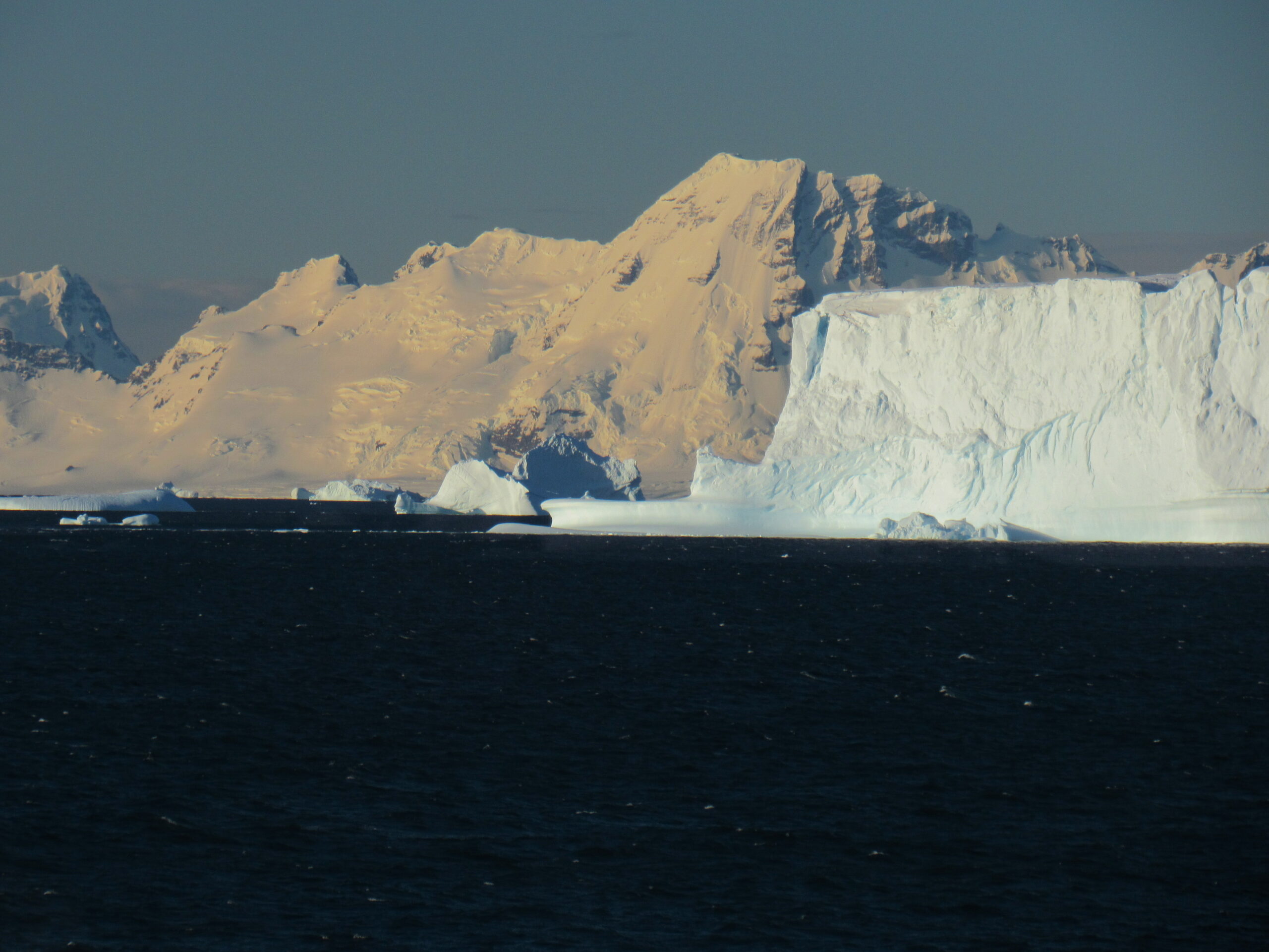
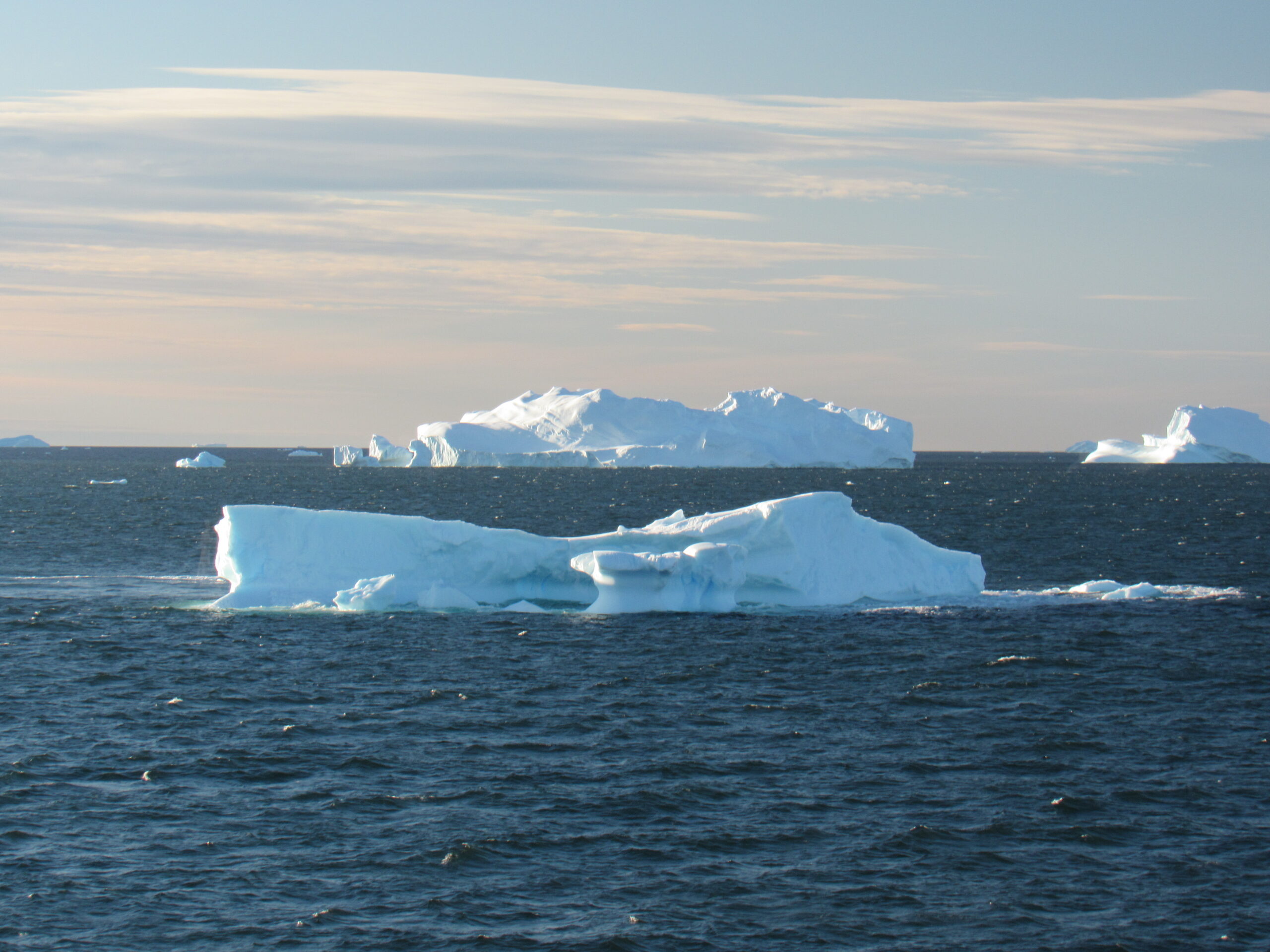
 In the above photo, on the left side you can see what is called a tabular iceberg. These have a flat top and steep sides, and are the largest of all icebergs. They usually break off of an ice sheet or an ice shelf. They can be enormous – the largest one known was 208 miles by 60 miles, with an area of 12,480 square miles, larger than Belgium.
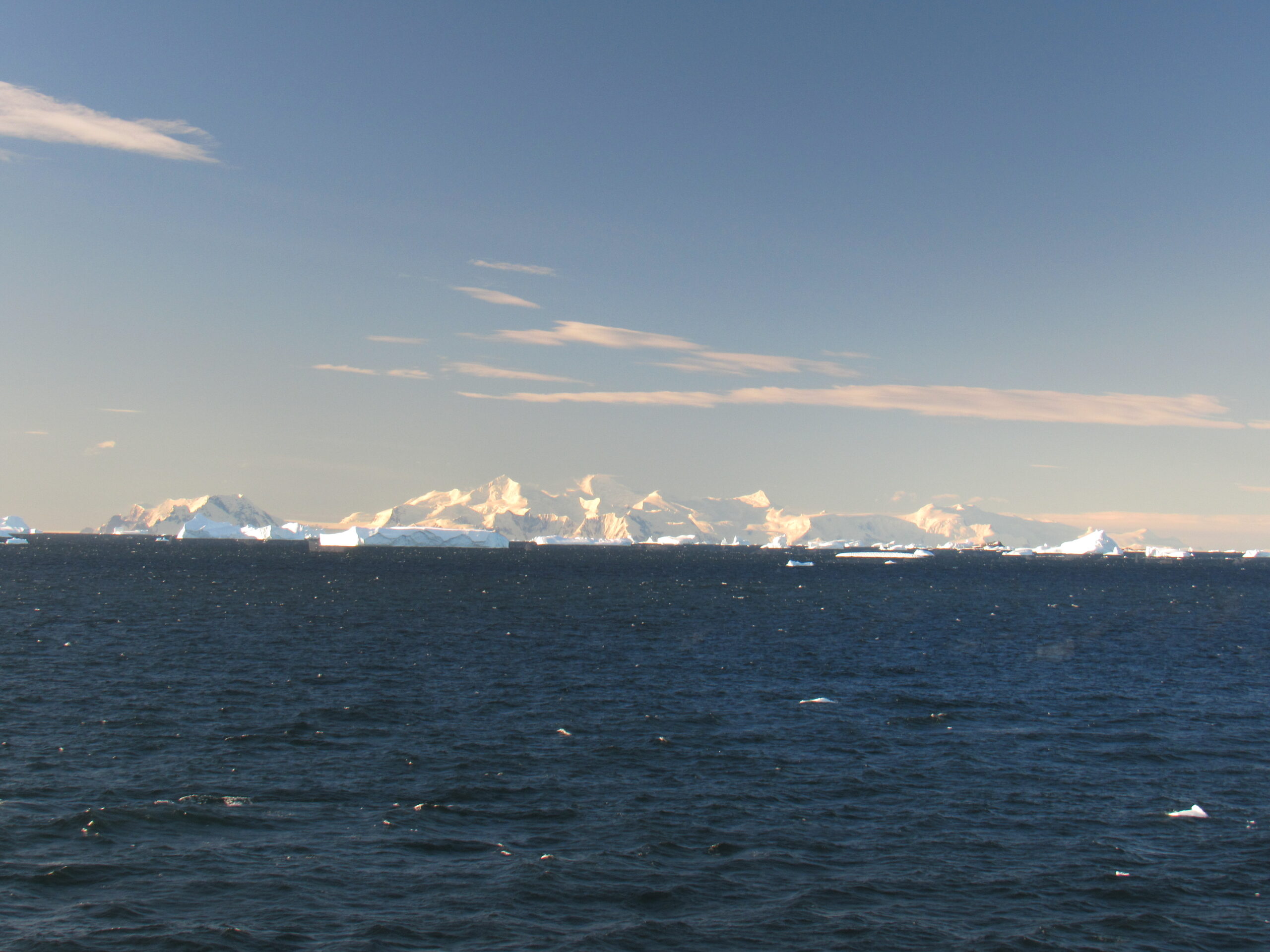
Mt. Gaudry, the high point of Adelaide Island, elevation 7,595 feet
 In the above photo, on the right side in the back we can see a blocky iceberg.
The diagonal line you see in the above photo shows a previous water line.
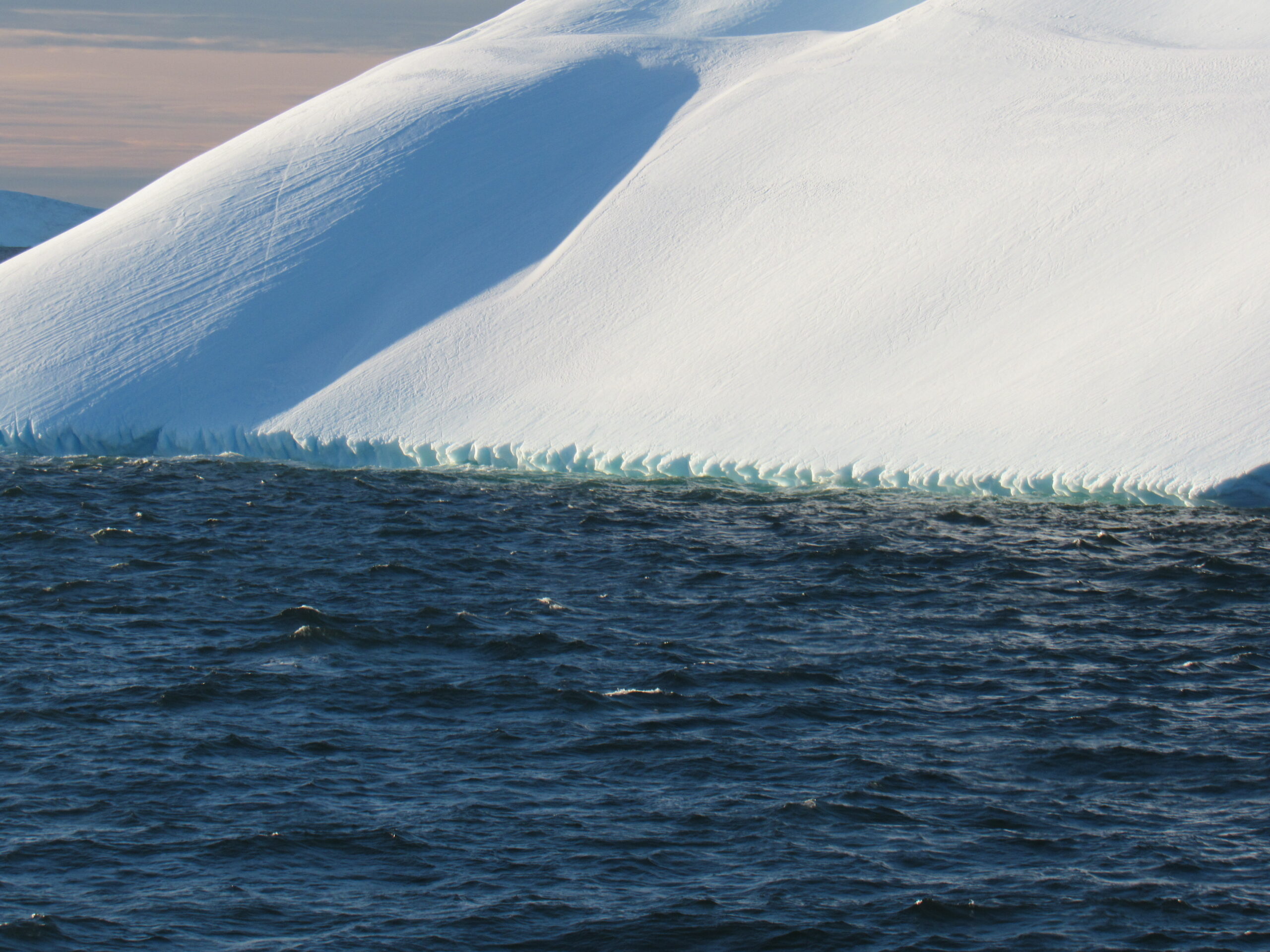
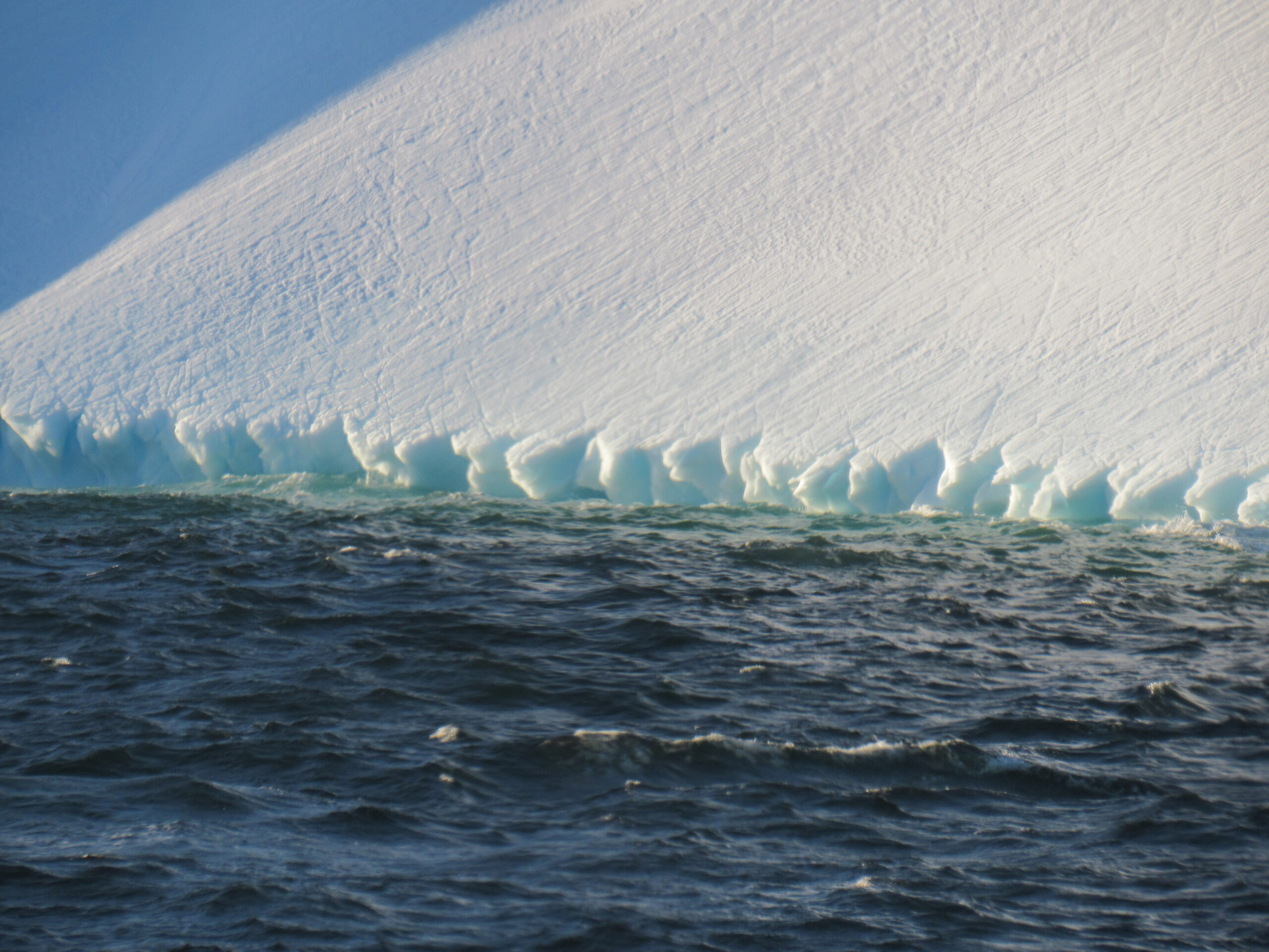 The feature you see in the above photo is caused by wave erosion.
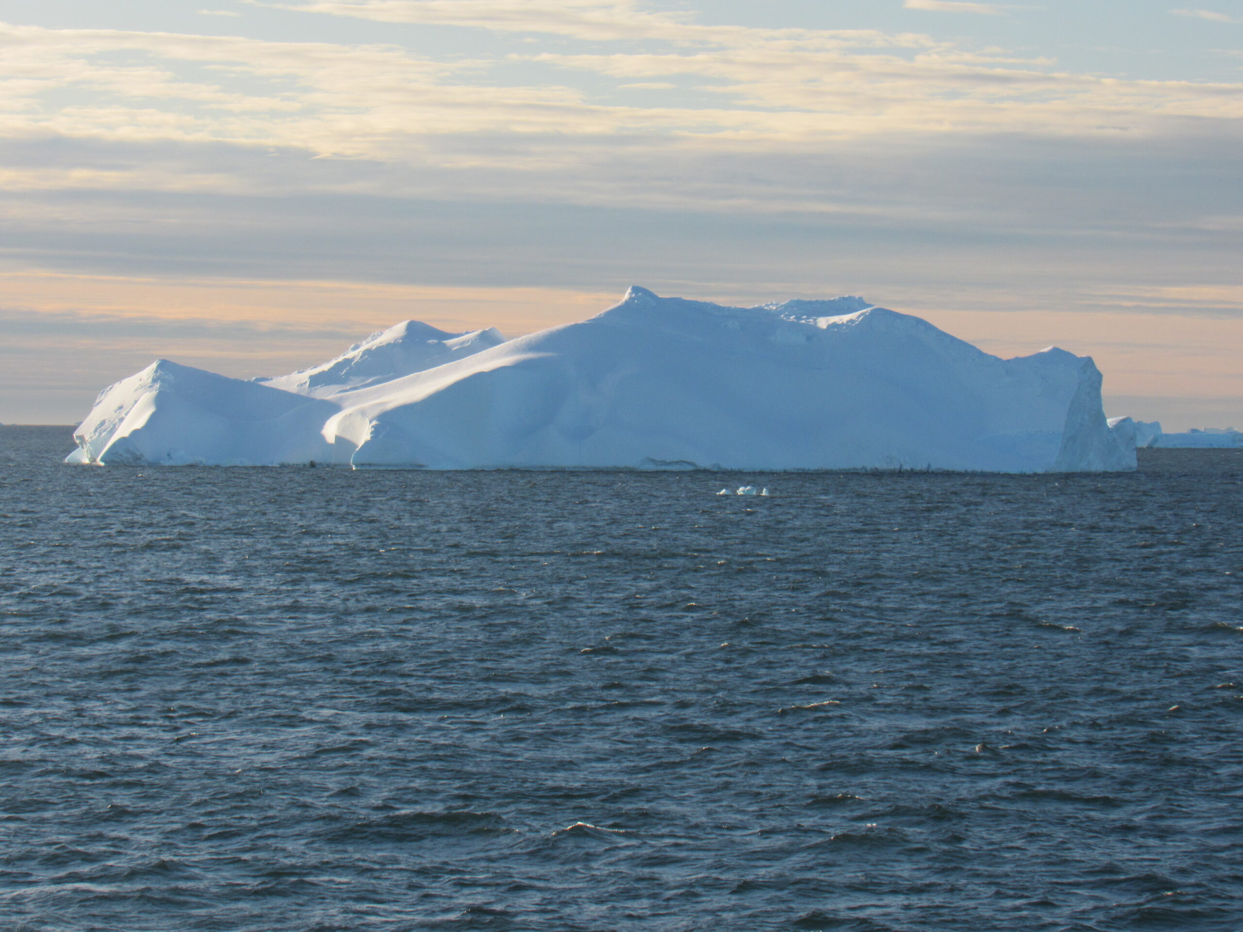
 In the above photo, the pointed left side would be a pinnacle iceberg.
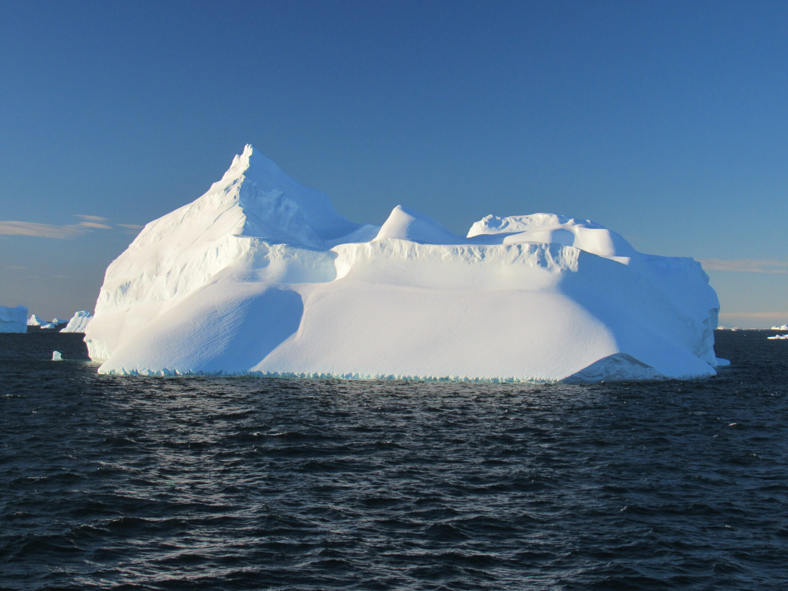
 In the above photo, in the middle we can see a domed iceberg.
Here is a short video I took while cruising around the bay that evening.
A nurse from the medical clinic visited me this evening, said I looked good and that I would be released from quarantine tomorrow morning – good news!
An announcement came from the bridge advising us of an important bit of news. They had learned that on January 24th, there would be a general strike in Argentina. That meant that the country would grind to a halt. Nothing would be running – no planes, ships, trains, buses, taxis – all businesses and services would close, nationwide. Why did we care? Well, that was the very day we were scheduled to be back in port at Ushuaia and board our charter flight back to the capital and fly home. Granted, that was still 11 days away, and anything could happen during that interval, but we should at least be thinking of what alternate arrangements we might need to make.
Please stay tuned for Chapter 5 of this story, coming soon.