
Back in the 1980s, when I was still fairly new to Arizona climbing, I set an unusual goal for myself. I compiled a list of all of the 193 mountain ranges of Arizona and their high points, then added a few more peaks to the list which fell just outside the state boundaries. Five of those “few more” turned out to be in old Mexico, south of the U.S. border. At the time, it seemed like a fairly harmless idea, so I started making plans to climb those 5 Mexican peaks. There were 5 different mountain ranges involved, as follows and in no particular order: Sierra de la Nariz; Sierra de la Lechuguilla; Pajarito Mountains; Tule Mountains; La Lesna Mountains. It’s no coincidence that they all have Spanish names because at one time the whole area was part of Mexico.
Each of those ranges had a high point in Arizona and an even higher point in Mexico, so in my mind that made all 10 peaks a “must-do” on my list. Even in the 80s, there was a lot of bad shit happening along the Mexican border – granted, nothing as bad as what goes on nowadays, but still plenty bad enough. Enough so that you had to exercise caution when climbing there.
My first exposure to those border peaks was on April 25th of 1987. Climber Bob Martin and I made our way down to the Sierra de la Lechuguilla by the border and together climbed the crumbling granite that passed for the high point of the Arizona part of the range.
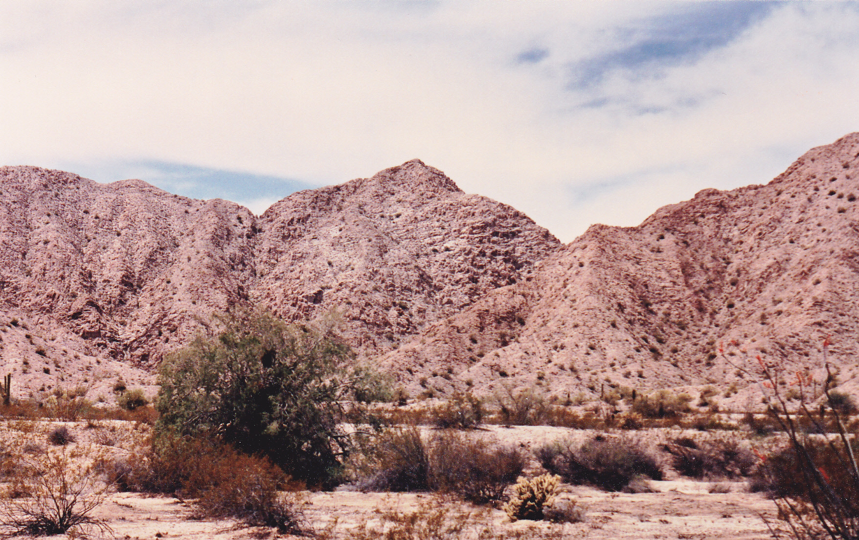
The Arizona high point seen from the east.
It was pretty late in the year to be making that climb, as it hit 100 degrees the afternoon we were there. That point had an elevation of 1,850 feet, and can be seen here. Once atop it, we could see that the border was only half a mile away along the broken ridge, so away we went to pay a visit. Here’s Bob at Border Monument 189.
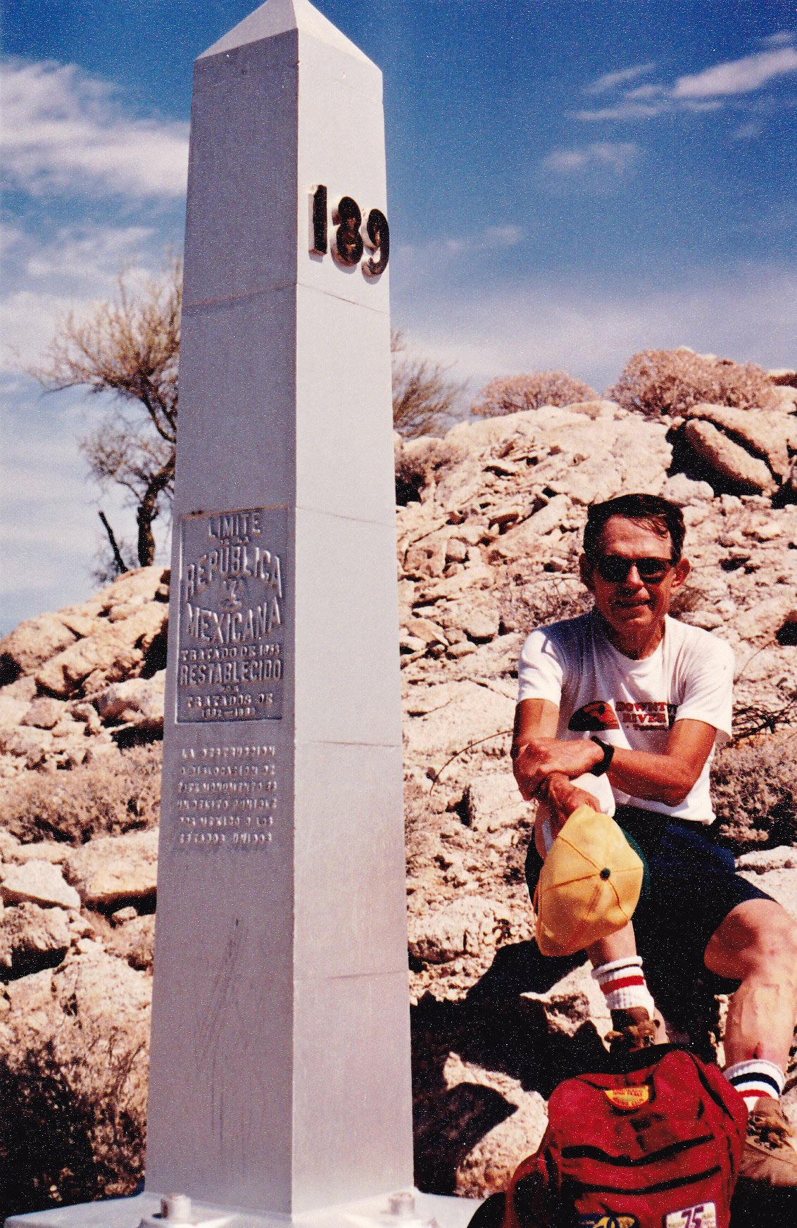
Bob at the border.
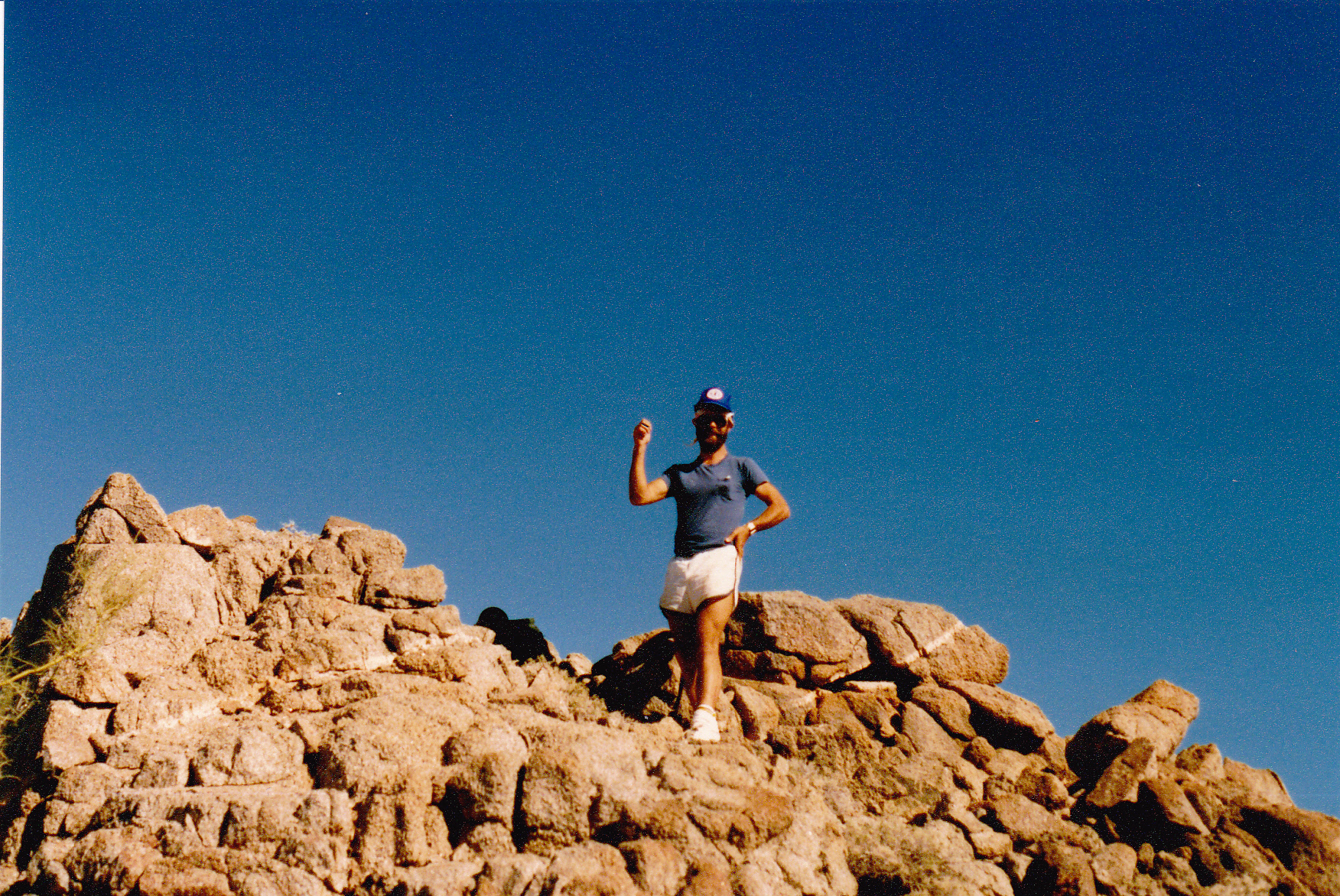
He took this photo of me at the same place. I can’t believe I used to dress like that to climb – nowadays, I’m covered head to foot.
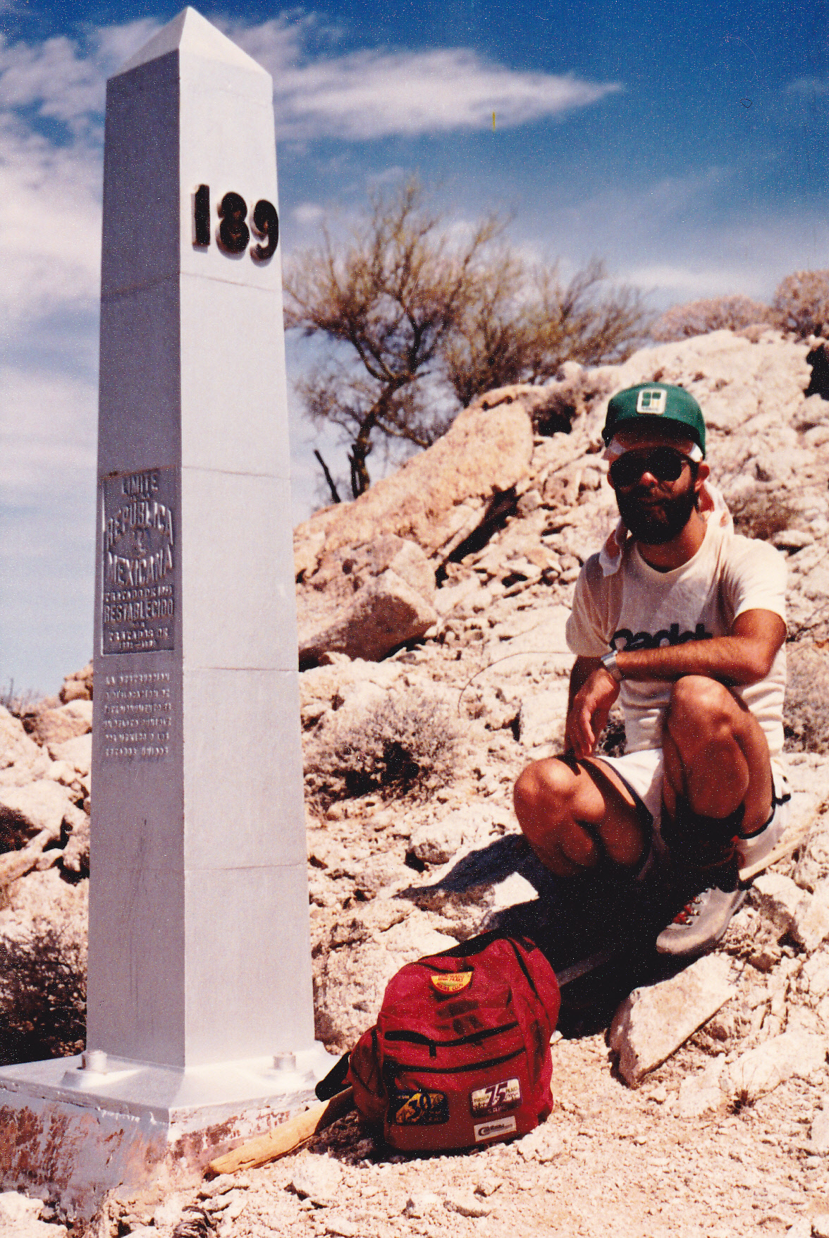
A younger Desert Mountaineer.
We dropped down from the monument to the desert floor to the east and then the same day went and did the more imposing high point of the Tinajas Altas Mountains a few miles to the west.
It wasn’t until October 9th of the following year that I came back to do the Mexican counterpart. South of the border, the range is called Sierra Tinajas Altas, not to be confused with the U.S. range nearby. The high point there has no name, but stands 2,329 feet high. Even though it was technically autumn, the temperature reached 103 degrees the afternoon I visited. Feeling rather bold, I drove a full 2 miles into Mexico to get closer to the peak. I simply drove across the 3 strands of barbed wire which were lying on the ground and which marked the border. Here’s a view of the high point.
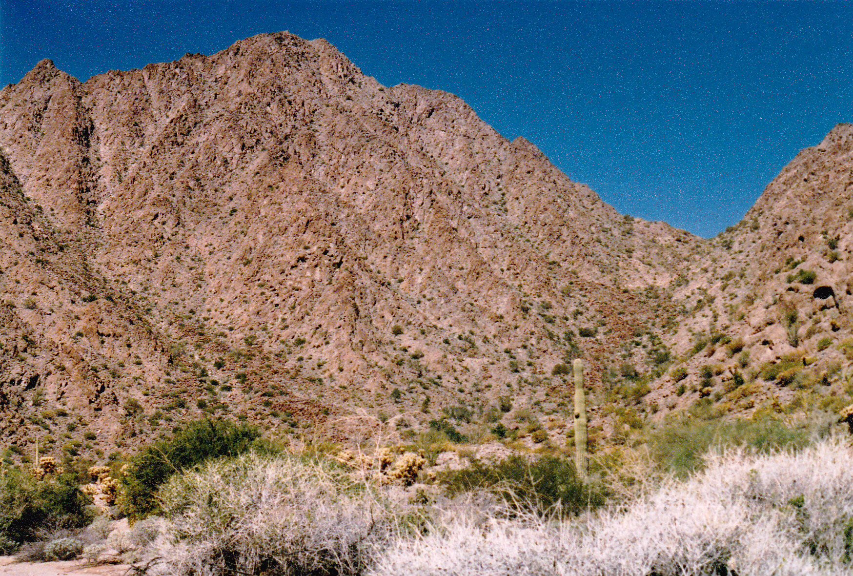
Peak 2329, the Mexican (and true) high point of the Sierra de la Lechuguilla
Here’s my selfie on the summit – climbing in sneakers? I must have been out of my mind.
DM on Peak 2329.
I have to tell you that I was plenty paranoid that day. What if, while I was away on foot doing the climb, smugglers or the Mexican police came upon my truck and stole it or seized it? Man, talk about screwed! I had crossed illegally into Mexico and would have been caught dead to rights. If I’d returned to where I’d parked and my truck were missing, I’d have no choice but to walk the 2 miles back to the U.S. border and consider my truck a total loss. From the summit, I hustled back to the truck and drove quickly back into the States, following my obvious tire tracks.
It wasn’t until 9 months after I’d climbed the Lechuguilla peak with Bob that I went for my second of the 5 border ranges. This time, it was the Tule Mountains. On January 18th of 1988, I parked and walked the short distance to Peak 2307, also known as Tule Benchmark. It’s the flat-looking one on the skyline in the back, just to the left of center.
Looking southwest to Peak 2307.
When I was on top of Peak 2307, I had this view southeast to Cerro Pinacate in Mexico, and also to the true high point of the Tule Mountains in Mexico.
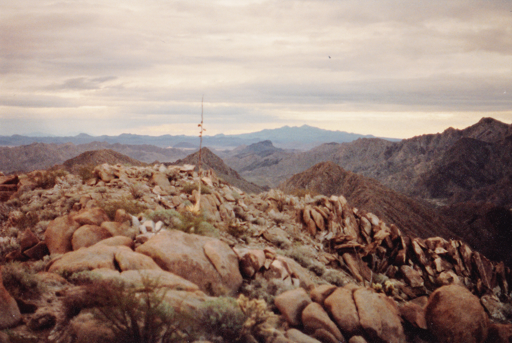
Pinacate in the far distance just right of center, and the Tule high point on the extreme right edge of the photo.
Of course, I was intrigued by the real high point down in Mexico and knew I’d have to climb it some day to complete my list, but for now it could wait.
The wait was over on October 8th – almost 9 months had passed since I’d climbed the Arizona high point of the range, and I was eager to climb the true high point. Here was my plan: I would leave my truck parked half a mile from the border, then walk south into Mexico to find my peak and climb it. I had never been there before, so all of this would be new to me. There was some risk involved – the area was notorious for the smuggling of people and drugs from Mexico into the U.S. Even leaving my truck unattended for many hours would be risky – it might not be there when I returned! It would make a dandy vehicle for lawbreakers to use to further their goals. I could see in the distance the area where my peak was located, right in the center of the next photo. This picture was taken from the Camino del Diablo in Arizona, and the Mexican summit is plainly visible.
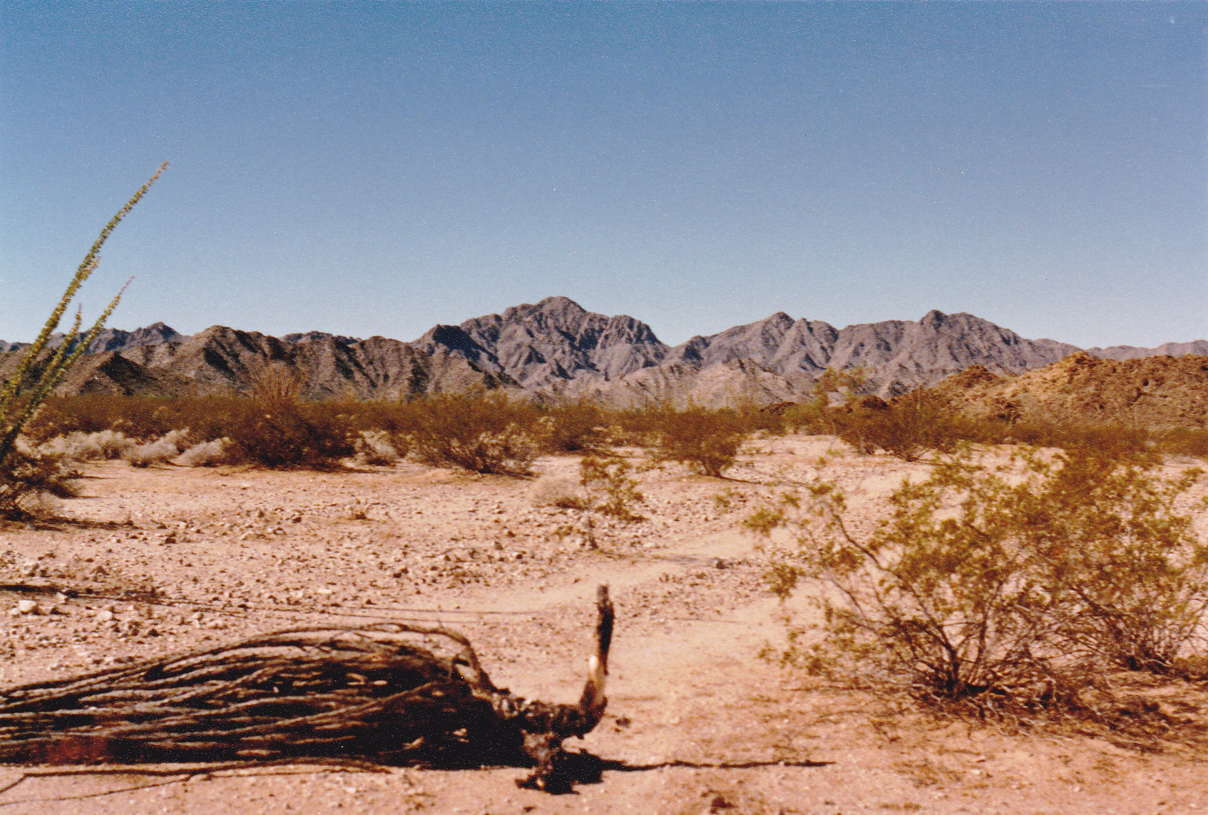
Looking southwest
This time, I was going to be much more careful. I loaded a lot of gatorade into my pack and set out on foot. In a few short minutes, I reached the border – a couple of limp strands of barbed wire marked the spot. Looking back across the fence into the U.S., I took this next photo – one last look into the homeland. The barren Sierra Arida was visible in the distance. See, I wasn’t kidding about how the border looked in those days, just a bit of wire.
The mighty border fence.
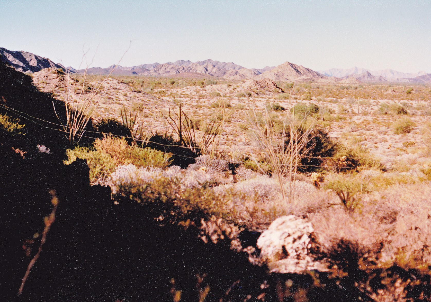
The mountain range I was in was called the Tule Mountains in Arizona, but the Mexicans call it Sierra el Choclo Duro, which means “the hard corn range”. Interesting name for a mountain range – it refers to dried corn kernels, which are used in recipes in some Spanish-speaking countries. No corn growing here, though – just harsh desert. Straight ahead of me was a low pass, which I crossed, then my path changed to a more southwesterly direction. There were gullies of varying sizes to get through, then another low gap in some hills. Now, I was standing at the edge of a flattish area that extended right over to the base of my peak. Here is what I saw.
Looking west to the Mexican high point of the range.
From this point the climb was pretty straightforward, and before long I stood on top. Here’s a look back north into the U.S.
A look north from the high point of the Tule Mountains
This spot had an elevation of 2,657 feet, so a clear 350 feet higher than the Arizona high point of the range – definitely worth doing. It was an easy return to my truck, and this time I didn’t feel quite as wary as I had when I had driven into Mexico for the high point of the Lechuguillas. It was unseasonably hot for October, however – 102 degrees by my thermometer by the time I arrived back at my truck, and it felt good to be done.
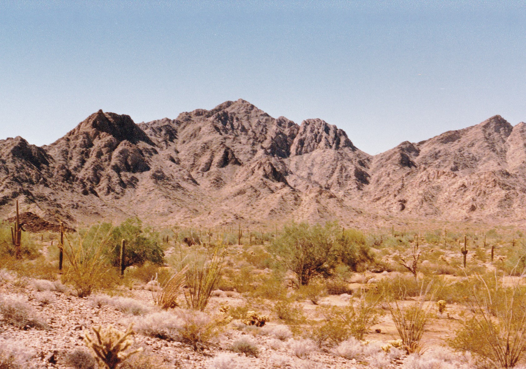
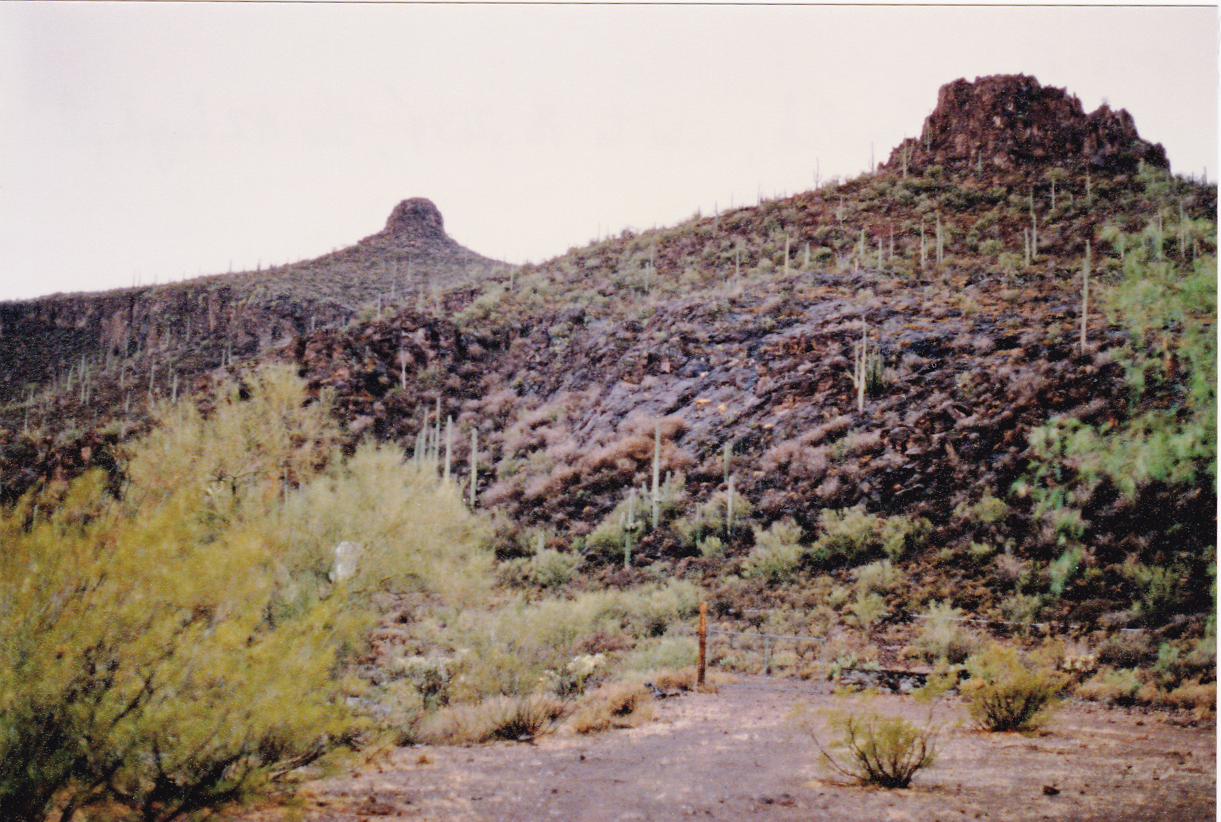
Both the Lechuguilla and Tule ranges sit within the Cabeza Prieta Wildlife Refuge. The next one of the 5 cross-border ranges I visited was called the Pajarito Mountains, south of Tucson and a bit west of the city of Nogales. “Pajarito” is the diminutive form of “pajaro”, and it means “birdie” or “little bird”. This range lies within the Coronado National Forest. I paid a visit to the Arizona high point, Peak 5460, on February 17th of 1988, so that made it the third range of the 5 in which I climbed. Peak 5460 is a minor bump and sits along a ridge only about 550 feet from the Mexican border. Here’s a picture of it – we are looking southwest.
Peak 5460
If you’re going to climb Peak 5460, you must pay a visit to the nearby Border Monument #129. It’s a real beauty, one of the old-timey ones they used to build a century ago.
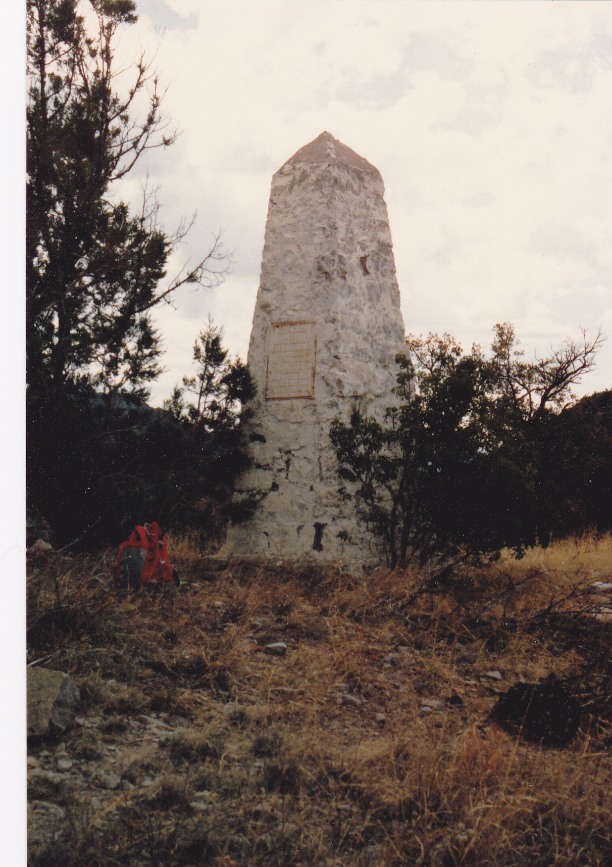
The monument
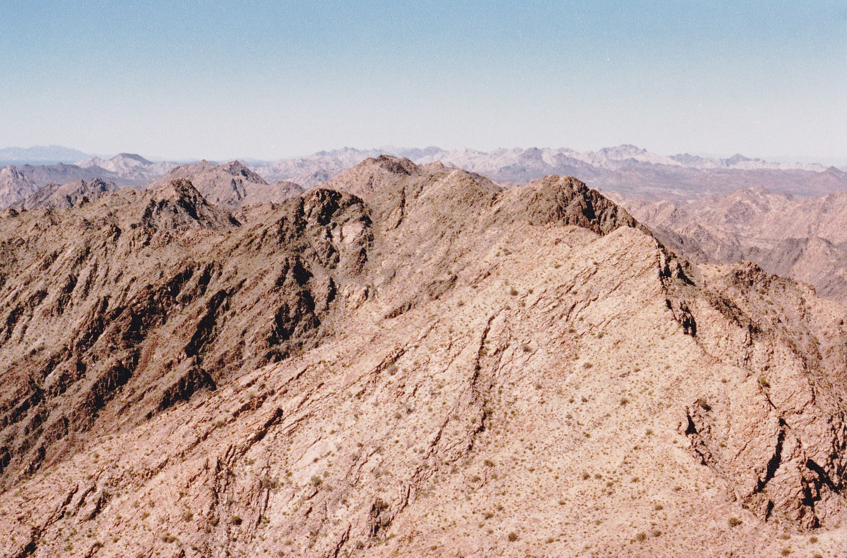
When you’re atop Peak 5460, you get this great view southeast to the true high point of the range down in Mexico. It’s the one in the distance on the skyline, but the ridge in the foreground is also in Mexico.
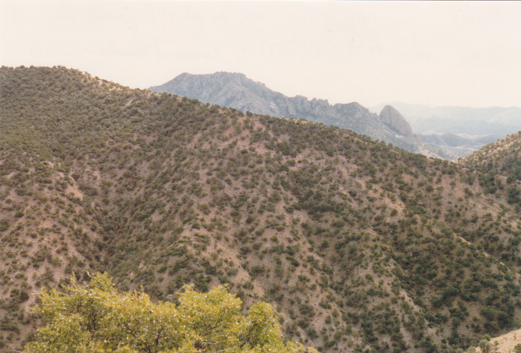
Looking into Mexico
My plan was to climb both the Arizona and Mexico high points on consecutive days, so after I finished Peak 5460 I drove a series of Forest Service roads and ended up parked only 800 feet from the Mexican border. Spending the night there seemed like a great idea, I’d be in the perfect spot to begin the climb. While it was still broad daylight, I thought I heard the sound of a vehicle approaching, so I cautiously got out of my truck and waited. Up came a vehicle I didn’t recognize – it was my first close encounter with the Border Patrol. An agent got out of his truck and walked up to me, cautiously, and asked me who I was and what the hell I was doing there. I explained to him that I was going to walk into Mexico in the morning and climb a mountain. He was incredulous. “Alone?”, he asked. He then proceeded to inform me that this area had “a lot of bad people, really bad people”. He went on to explain that it was a major drug-smuggling corridor, very dangerous, and I was nuts to even consider crossing the border here for any reason. I told him that I really, really badly needed to climb that mountain. “Well, it’s your funeral, but if you’ve gotta go there, please be careful”. I promised him I would, and he drove away. I could tell he considered my plan to be a galactically stupid one.
My starting point was just downhill from Border Monument #128, which I passed by early the next morning as I started out.
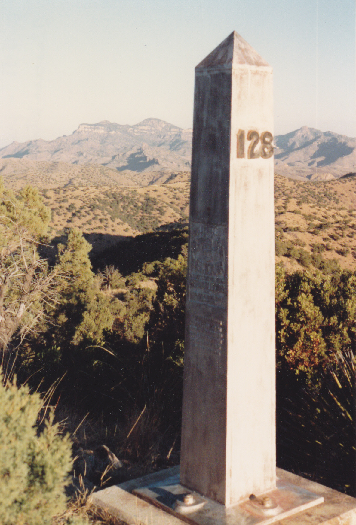
In the distance, to the left of the monument, you can see Atascosa Peak in Arizona.
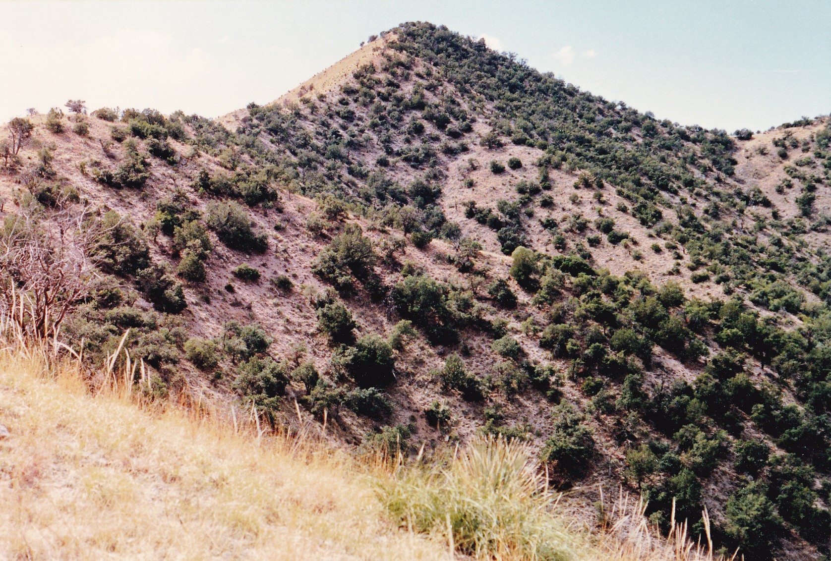
My path was a long and winding one, crossing over several intervening bumps, as I approached the Mexican high point. This is it, Cerro el Ruido, elevation 5,938 feet, almost 500 feet higher than its American counterpart.
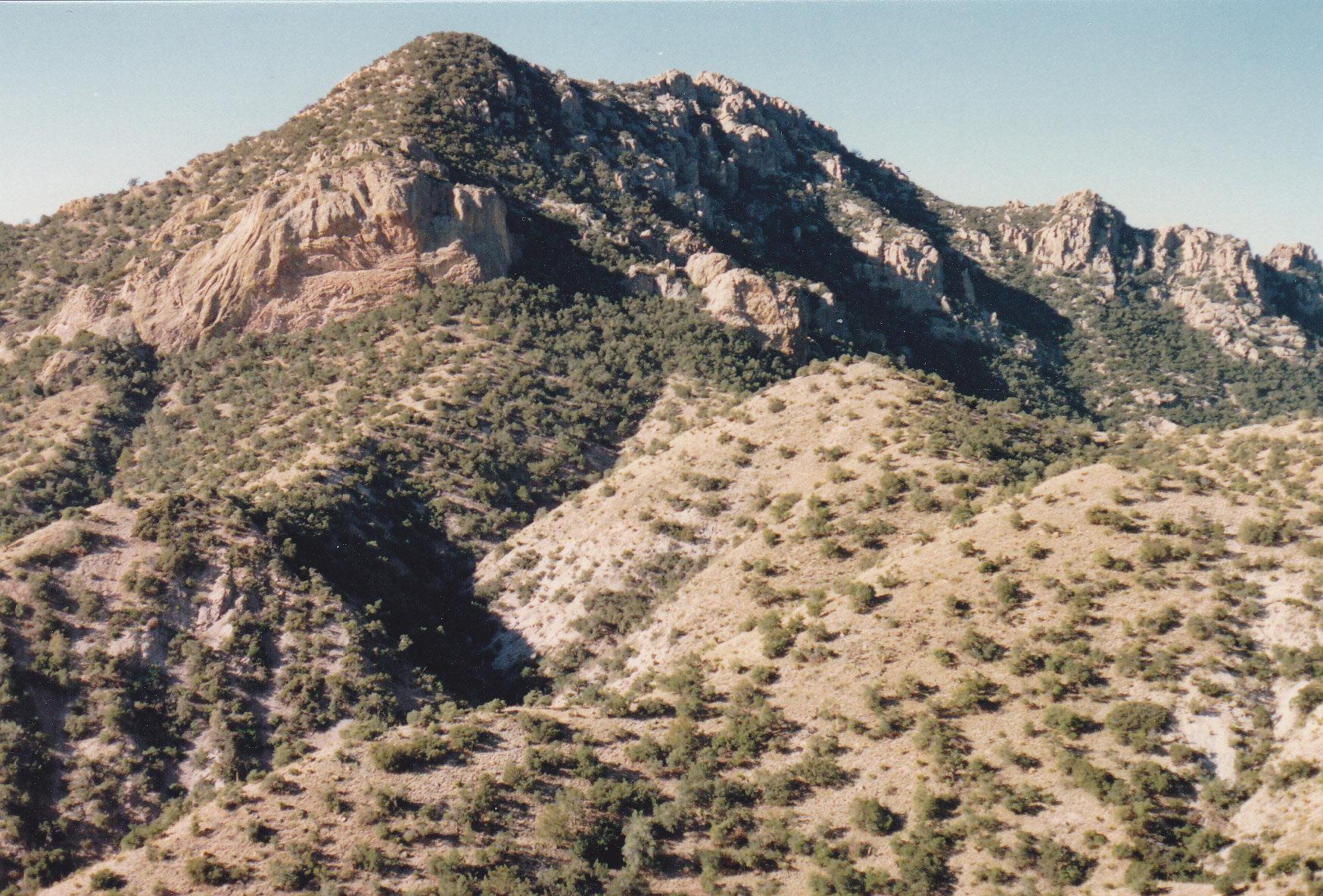
Looking southwest to my peak.
Once atop the summit ridge, it was a real bushwhack to the highest point.
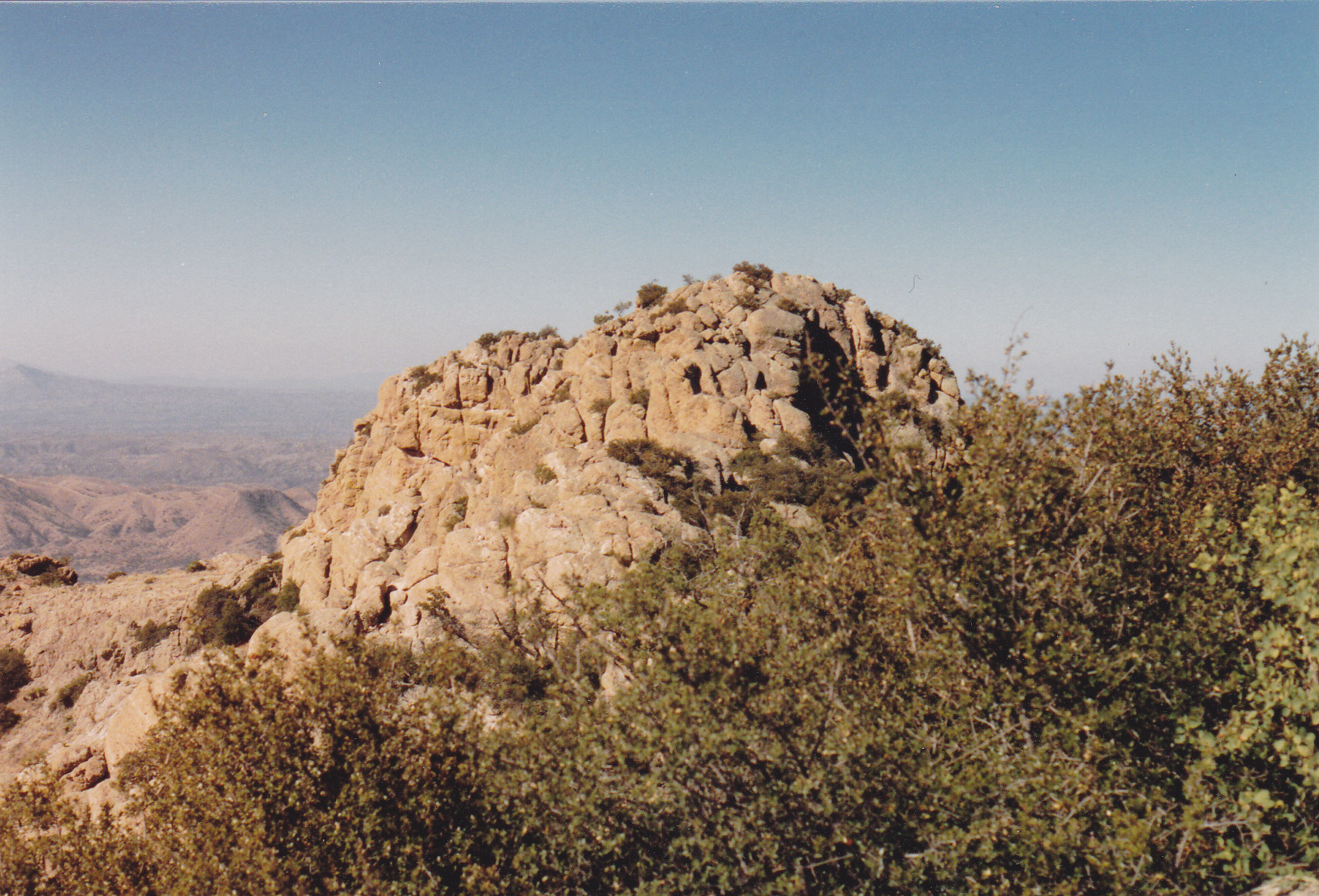
The highest bit.
I even found the benchmark, called Matanza – that word can mean a lot of things, such as killing, slaughter, massacre, carnage or bloodshed. Hmmm, curiouser and curiouser. I had the privilege of leaving a register and then I actually sat and soaked up the view for a while. What a rush – sneaking across the border into Mexico and climbing a great peak like this, and getting away with it.
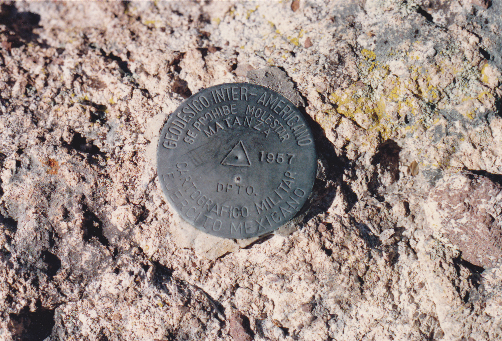
Matanza benchmark
Once I left the summit and started on my way back to the States, I had a terrifying experience. While on that long ridge negotiating my way back to the promised land, I was overtaken by masked men with guns. They questioned me at length, and the one who was obviously the leader told me that this was a very dangerous area, that people were crossing his land all the time, men with bad intentions. I swore that, if he let me go, I would leave immediately and hurry back to my vehicle on the U.S. side and never darken his doorstep again. He seemed okay with that and said I could go. (All of this conversation occurred in Spanish). Thanking him profusely, I hustled back the remaining miles and sneaked across the border back into the good ol’ U. S. of A. What a relief to be done! This was the only time I’d actually encounter someone while climbing one of the 5 Mexican summits, and the scare it gave me was more than enough.
There were 2 cross-border ranges remaining, and they both lay within the confines of the Tohono O’odham Indian Reservation. The first of them I visited was a beautiful little range called the La Lesna Mountains. The Arizona high point was easy to reach and climb, Peak 2694 – I did this one on May the 15th of 1989.
Looking southwest to Peak 2694, on the left in the distance.
Before I returned to climb the Mexican one, though, I made the acquaintance of a young fellow named Nathaniel Harvey. He lived on the reservation, and agreed to accompany me on climbs of some of the mountain ranges within the confines of his land. I seized the opportunity, and a mere 8 days after my visit to the La Lesna Mountains, he and I traveled to the extreme southwest corner of his reservation for an unusual climb. It was May 23rd and hotter than the hinges of hell. The prediction was for a high temperature of 106 degrees, but so determined was I to finish this last range that we went anyway, in spite of the insane heat.
Sierra de la Nariz, or “Nose Range”, was its name. As we approached it along the highway from the northwest, here is what we saw. This was going to be one long day, as we had to start low down on the left and climb up along the ridge to the right over several bumps to reach the highest point.
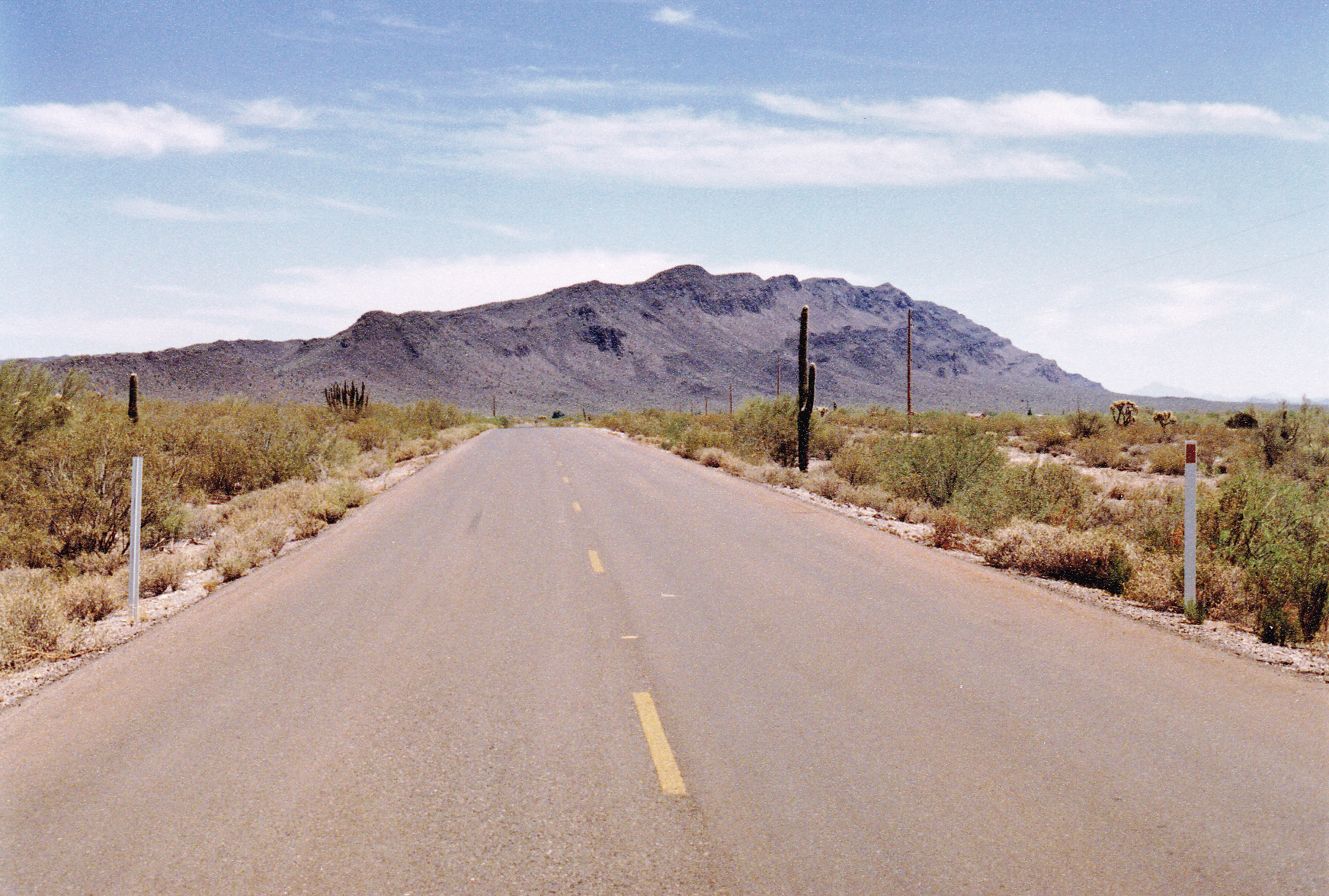
Sierra de la Nariz, seen from the northwest
We drove through the small village of Ali Chuk, then east a bit more and parked in a low saddle at 1,950 feet elevation. Carrying plenty to drink, we started out, heading south to cross over 3 small bumps to reach Arizona’s highest point of the range, a bump at 2,410 feet with only 80 feet of prominence. Moving on, we soon reached Border Monument #160, sitting at 2,688 feet.
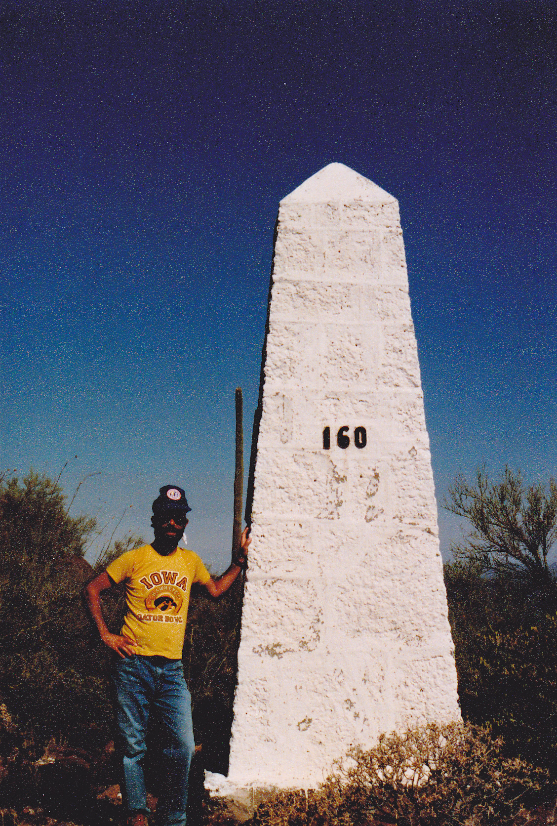
The monument.
The fun was only beginning, though. On we went into Mexico, slowly gaining elevation along what seemed an endless ridge, crossing over way too many bumps in the process. The heat was palpable, but eventually we reached the highest point and left a register at 3,199 feet elevation. I took this picture along the way, looking south to the high point.
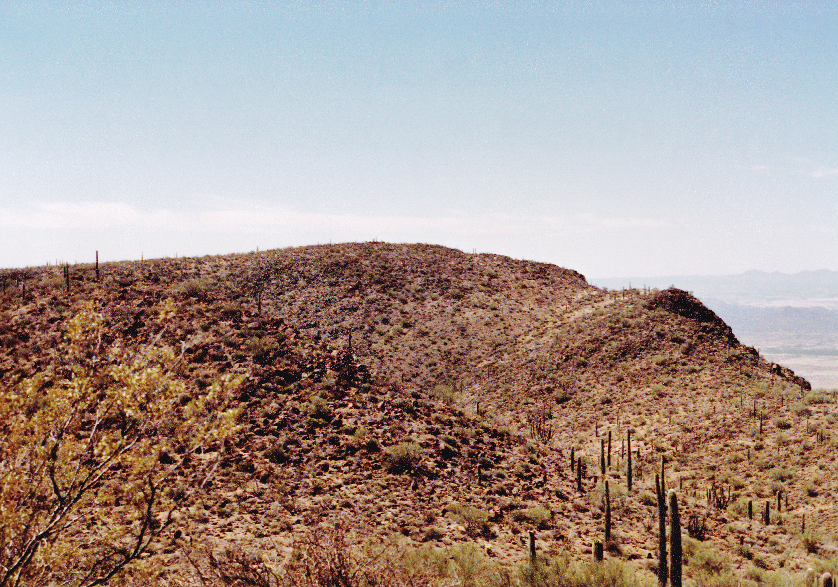
The high point.
It’s hard to describe what physical exertion in 106-degree heat feels like. It was as if the whole earth stood still in the choking heat. We didn’t say much to each other, instead numbly stumbling along, just trying to be done with the climb. After what seemed an eternity, we made it back to the truck – what a relief! My thermometer verified that we had in fact reached the promised 106 degrees F. As we drove back out to pavement, I had the air conditioning cranked up to maximum. Of the 10 cross-border peaks, I had now completed 9.
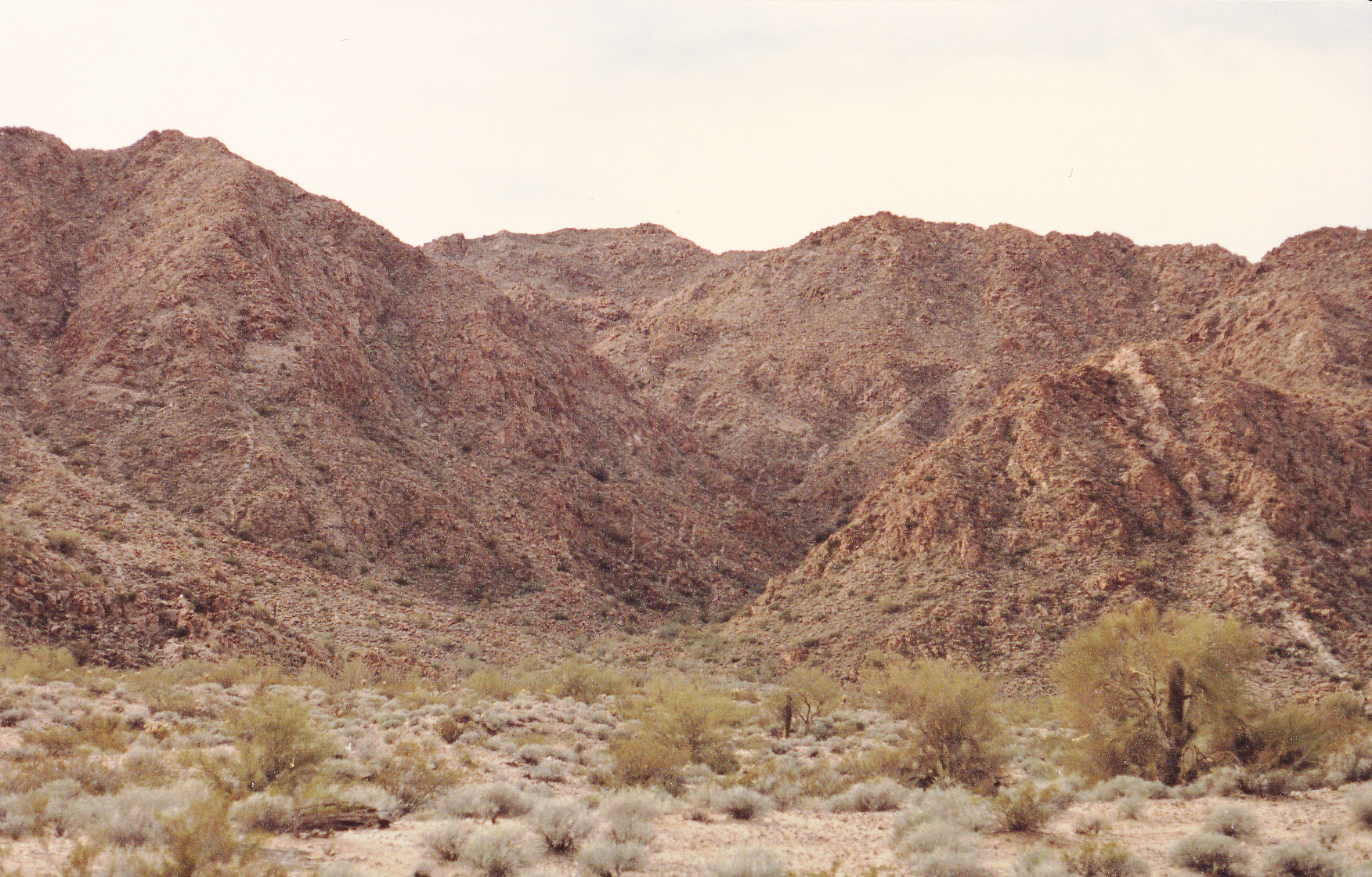
A mere 4 days later, we found ourselves standing at the border and staring at the Mexican high point of the La Lesna Mountains. That’s it out there in the next photo under the brooding skies. Even with a cloud cover on this June 27th of 1989, the temperature still reached 101 degrees. The La Lesna Mountains, situated as they are in the middle of the reservation and far from any towns, seem to attract an abundance of lawlessness. Rough roads come up on the Mexican side to the border, funneling more than their share of indocumentados and drug-runners into the States. Climbing there as we did that day requires a sharp lookout, especially if you’re trespassing miles into Mexico.
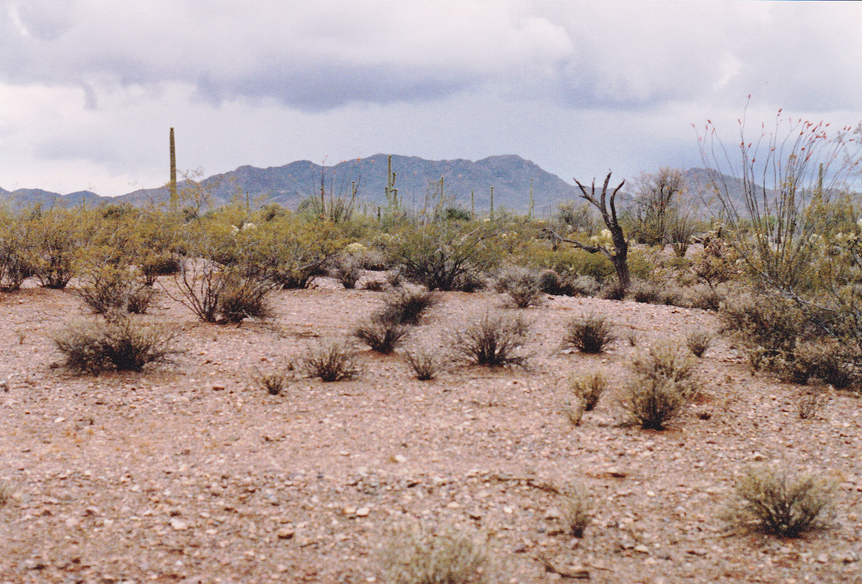
A look south to the Mexican and true high point of the La Lesna Mountains, Peak 3445.
South of the border, the range is called Sierra La Lesna. It was a climb of about 1,750 vertical feet by the time all was said and done, but straightforward. It felt good to be done.
In retrospect, there wasn’t a single one of those 5 Mexican high points that wasn’t tinged with some trepidation. It’s now been more than 30 years since I climbed them, and friends who’ve gone and done them in the intervening years say that it hasn’t gotten any easier. Crime is rampant along the entire border region, and getting worse each year as the drug cartels tighten their grip on smuggling activities. I pity any climber who sets out nowadays to try and climb those peaks, and thankfully I don’t know of anyone who’s thinking of trying. Like I said at the beginning, don’t try this at home!!!