This is a story of a day of climbing on the Indian reservation that I did in the extreme summer heat a few years ago.
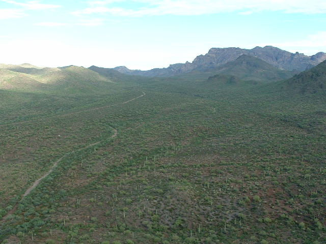
On Saturday, July 30, 2005 I went climbing on the reservation, in the middle of the rainy season and the summer heat. I left home in the middle of the night, and by the time I reached the Ajo Range at daybreak, there were still deep puddles on the dirt roads. The ground was very damp and the humidity was high. I was going into a new area, new for me, that is. When I arrived at the village of Gu Vo, I continued south on paved Indian Highway 1 for almost 6 miles. There, the highway abruptly changes direction. Instead of continuing due south, it turns southeast and crosses over Pia Oik pass. I left the highway right where it heads southeast, and continued due south on a dirt road into the southernmost end of the Barajita Valley. After 1.7 miles on the dirt road, another road crossed my path. I had been to this spot once before. On January 22, 2001 D.J. and I had been here to climb the high point of the Gu Vo Hills, which is Peak 2750, only one mile east of this junction. Today, I was going to go northwest from this junction up Siovi Shuatak wash. The road was in good condition, although quite muddy. The scenery was amazing – beautiful desert peaks on all sides, most of which I had never climbed.
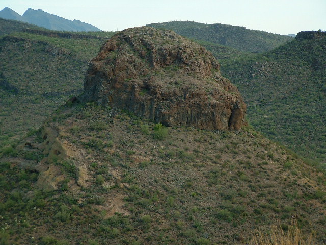
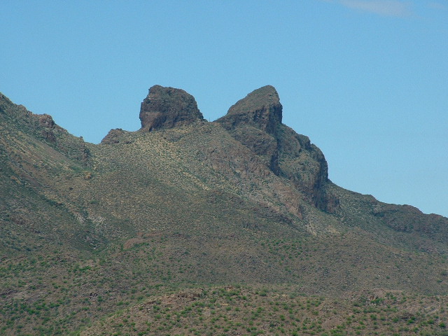
I drove 3.5 miles and finally pulled well off the road and parked in some brush out of sight. For some reason today I felt I should park as inconspicuously as possible. From this first parking spot, I intended to climb two peaks, making a loop and picking them both up before returning to the truck. The first of them, Peak 2699, barely rose the required 300 feet on all sides from the surrounding terrain to qualify as a summit, but what a beauty it was. It had me concerned from the moment I first saw it from the east on the paved highway. It rose very steeply on all sides, and as I had driven in closer to it I could see no breaks in its cliffs on any side. So it was with some concern that I approached it.
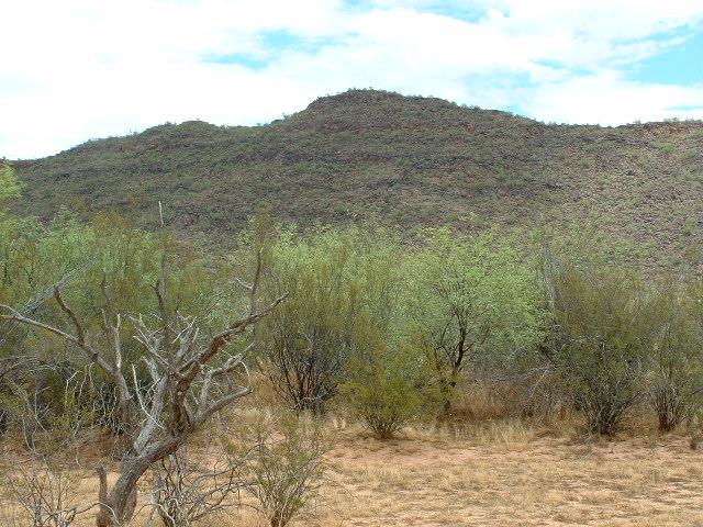
I reached the ring of vertical and even overhanging cliffs on the southwest side. There was no possible route here for a solo climber. I began to circle the summit block about 125 vertical feet below the summit in a clockwise direction. I was becoming discouraged, and starting to feel that this was one of those peaks I would have to come back to – with a partner with whom I could do a roped climb. When I reached the east side, I saw a possible weakness in the cliffs. There was a series of cracks and ledges up through the near-vertical cliff, with some easier bits between the most vertical parts. It looked like it would go. In the above photo, the route I chose is on the right side.
Still wearing my pack, with my phone, gatorade and a bit of food in it (I figured I’d better take it all up in case I ran into trouble and couldn’t get back down again) I started up. About 20 feet of 4th-class climbing got me to a steeply-sloping ledge. Above that, things got a bit easier. There were still two more stretches higher up which really got my heart a-pumping (and not because of the physical effort), but in probably ten to fifteen minutes I had scaled the 125 or so vertical feet and stood on the summit. I was really lucky this time. Definitely no sign of any previous visit to the summit. I did the cairn and register, and didn’t stay long on top. I was pretty concerned about the descent, but the worst bits went pretty well – I just took my time and very carefully down-climbed the rock, facing inwards. Two times I grabbed a portable handhold when I was in a precarious spot. I let out a yelp as the rock pulled loose and I tossed the rotten bits away from me, watching them free-fall to the easier slopes at the base of the cliffs. I was VERY glad to be down. From there it was an easy walk down to the saddle with my next objective, Peak 2691. An uneventful climb brought me to its summit, where I left another cairn and register.
I descended towards the saddle to the north, then took off down the western slope and made my way down to the broad, stony channel of Siovi Shuatak wash. It served as a nice conduit to the northwest and back to my truck. About two hours had passed since I had left. I had a few cool drinks and then drove a short distance farther northwest up the road.
Once again, I parked well off the road, out of sight in some heavy brush. The day had become quite warm and very muggy, but I still had a good cloud cover. I shouldered my pack and headed downslope, crossing the wash and gaining the south slopes of Peak 3262, the biggest one I would try today. It was an uneventful climb.
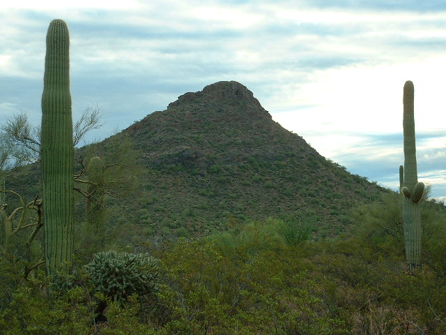
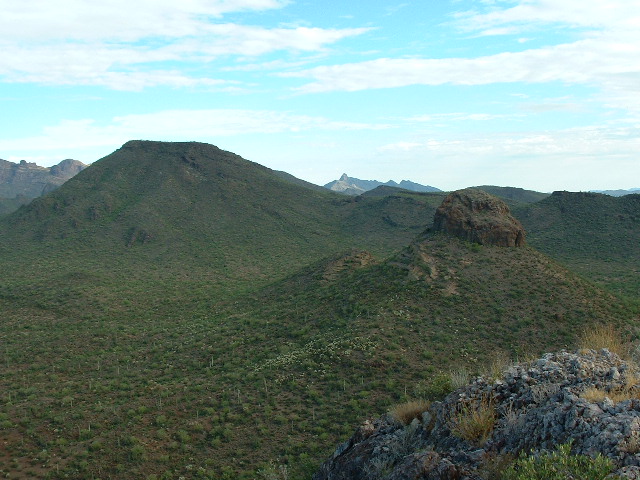
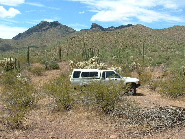
Every time I passed something that looked like an elephant tree, I saw its tiny blossoms covered with lots of bees. It was one of the few plants blooming now, and I guess the bees were taking advantage of it. Each of their back legs was covered with a big ball of orange pollen. I reached the summit area, a long flat stretch, with the highest point at the north end. There, I found signs of early surveyors. An old wooden pole still stood upright, supported by guy-wires on several sides. Each wire was anchored by a rock pile. There was no bench mark to be found. I built a cairn and completed a register. I returned to the truck the same way I had come up. It was a little after 10:30 by the time I got back to the truck. In the next photo, the flat-topped peak on the left is 3262. In the center of the photo, through the gap and in the distance, is the pointed Peak 4088.
With three summits behind me so early in the day, I decided to explore a bit. The maps showed the road continuing only another 3/4 mile, but I was curious if it went any farther. I drove that distance, to what is shown as Siovi Shuatak pass on the map. Pass – what pass? There is no pass there. But, to my delight, the road did continue. It got a bit rougher but was still good. High-clearance, yes, but still quite driveable. I drove to a dead end in a rough rocky area, then turned around and went back about half a mile to where I thought I had seen a faint track leaving the road I was on. Sure enough, this lesser road seemed to continue. I followed it until it ended in a flat area. It looked to me like I might have arrived at Sweetwater Pass. I parked and got out to explore.
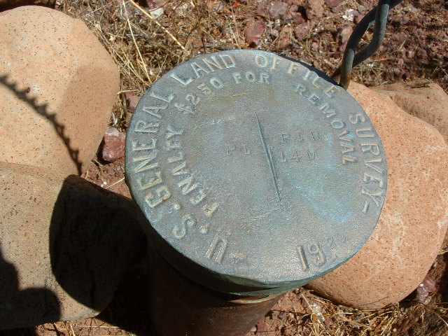
I soon found a survey marker, Monument 14 in the series of 20 which delineate the boundary between the reservation and Organ Pipe Cactus National Monument. This was proof positive that I had actually driven all the way to Sweetwater Pass, about 1.3 miles beyond the road-end shown on the map.
Years ago, several of us climbers had joked around about travelling through this pass as a means of getting from the east loop road in OPCNM to the Gu Vo Hills high point. I think it was a guy whose initials are DJ who actually came up with that hairbrained idea. Anyway, I was really pleased to be finally standing there. The reservation side was gentle and pleasant, whereas the OPC side dropped off steeply and ruggedly into the monument land. I stayed a while and enjoyed the tranquility of the place.
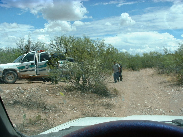
Finally it was time to leave. I drove out slowly, really pleased that I had made it to Sweetwater Pass. I had gone a few miles, and was just south of Peak 2691, when I noticed movement off to the right of the road. I saw five men, about 150 feet away. I was a bit startled to see them way out here. Soon I saw that some of them were wearing uniforms. Two of them left the group and headed towards me, waving at me to catch my attention. I stopped the truck and turned off the engine. I got out of the truck and moved slowly around to the front of it. One of the men, who I now could plainly see were U.S. Border Patrol agents, started looking through the passenger-side window of the truck. The other came up to me. I had my permit in hand and started to tell them that I was a climber from Tucson. They seemed relieved that I was not one of the Bad Guys. One of them said that he now recognized my truck – it turned out that he had been in one of their helicopters a week before and had flown over the truck a few times. And it turns out that the young female agent I had spoken with had in fact mentioned my name and vehicle description at their morning muster, so I guess my presence here was not too much of a surprise to them.
I asked them what was happening here. They said that they had just arrested two indocumentados who had crossed the desert through Organ Pipe Monument and had crossed over a pass south of Diaz Peak (probably near survey marker 17). While we spoke, the third agent was walking the two men over to the two BP vehicles which were parked five hundred feet farther down the road.
Anyway, we spoke for quite a while. They seemed very interested in what I was doing. I told them of the project to climb all of the reservation peaks. They questioned me about who or what I had seen out there. They asked if I ever found stashes of supplies (food, water, equipment) on mountain tops. I told them that in fact I had found quite a few over the years. They seemed very excited to know that, and asked me if it would be too much trouble to give them GPS coordinates of any such locations. They told me that such stashes were placed there by smugglers bringing in drugs, and they would be very grateful for any information I could give them. I promised to help them any way I could, and gave them my e-mail address. They said they would e-mail me with their addresses. I didn’t think much would come of it. Finally, they said they’d better be going, so we said goodbye. Nice guys, probably 30-something, seemed very dedicated to their work.
They walked back to their vehicles. In a minute or two, I continued driving out, and slowly passed them. By then, they were loading the men into one of the vehicles. They gave me a wave and a smile as I passed. Several minutes later, I could see them coming up fast in my rear-view mirror. I pulled off the road to let them by. They wasted no time, driving much faster than I, and soon were out of sight ahead. Before long, I reached the pavement and drove back north to Gu Vo. Once there, I decided to climb one more peak, so I drove up the old dirt highway to the west of the Gu Vo Hills. After 3 miles, I turned east off the road and parked 200 yards away in a thick clump of trees near a wash.
I quickly climbed Peak 2487. Once on top, I left a cairn and register. I was also able to phone home. It was the first time that day I was able to get a signal out to a cell site. As I descended to the truck, I started to hear the rumble of thunder – a storm was approaching across the desert from the east. At the truck, I freshened up, had several cold drinks and drove back to Gu Vo. From there, north on the paved highway through a downpour to State Highway 86 and then back to Tucson.
A few days later, a tragic accident happened near Sells on the reservation. A family’s car got caught in a wash in a flash flood. As they tried to escape the quickly rising waters, the baby was snatched from the mother’s arms and swept downstream. Several days of looking had failed to locate the child. This is a heart-wrenching example of nature’s power during the monsoon season.
Here is another post-script to this write-up. On August 2nd, three days after I met the Border Patrol agents, the two I spoke with sent me an e-mail. They asked me if I could give them coordinates of any suspicious spots I had found on mountaintops. I responded with five locations that I could remember off the top of my head, promising more as soon as I had time to research my field notes. On Friday, August 5th, one of them sent me a short note, which I quote here:
“DM, I just wanted to let you know we have started responding to these areas and arrests have been made and items have been seized. We really appreciate your help. Keep the info coming.”
That really made my day, to think that I was able to play a small part in the apprehension of those scumbag drug-runners. I’ll certainly send those agents all the information I can gather.
Please visit our Facebook page at https://www.facebook.com/pages/Desert-Mountaineer/192730747542690

