
What I’m calling Babo is actually Baboquivari Peak. It’s the highest point in the Baboquiviri Mountains, a range that runs north-south. The peak is located about 55 air miles southwest of downtown Tucson, Arizona. At 7,734 feet, it stands well above any other peak in the range. Although the range runs a dozen miles north from Babo, it’s not that part I want you to journey with me. Let’s focus on the much longer stretch that runs south all the way to the Mexican border. Before we leave Babo behind, I should mention that the peak is regarded by the Tohono O’odham people as the center of their cosmology, so its importance cannot be understated.
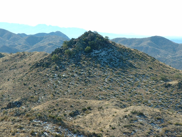
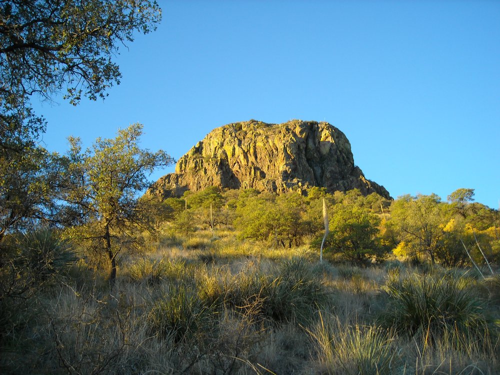
Let’s follow the spine of the range as we head south. This spine, or height-of-land, is actually the boundary between the TO nation to the west and non-reservation land to the east. Let’s call the summit of Babo mile 0.0 and to begin our journey, we’ll take a dive and drop down the spectacular southeast arête. It’s steep, and in only half a mile we’re all the way down to 6,140 feet. There’s a bump in the way after that, and we have to climb up to it at 6,285′. At this point, we’ve barely gone 0.7 miles. Beyond that, we drop down to another saddle at 6,000 feet at the 1.1-mile mark. Next we climb steeply up to a summit called La Jolla Peak. This summit has a height of 6,230 feet and is found at the 1.3-mile mark. It’s time for a few photos. From the top of La Jolla, we look back north to Babo. That’s the southeast arête on its right side on the skyline.
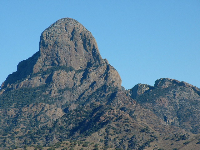
Baboquivari Peak
And here’s La Jolla Peak, what it looks like from the south.
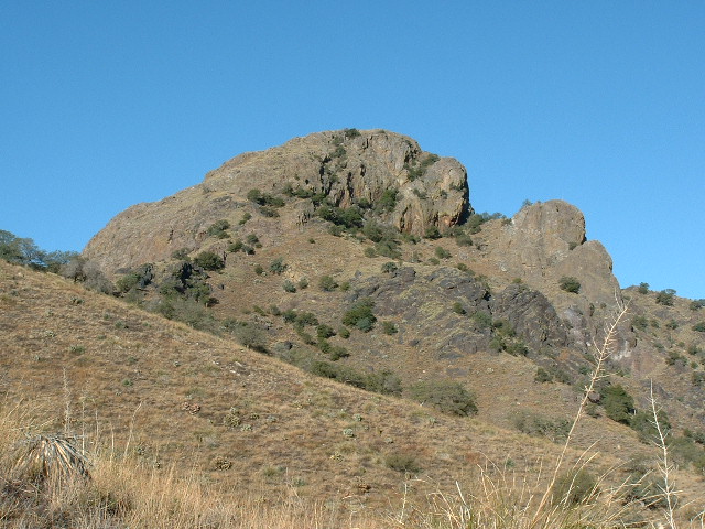
La Jolla Peak
Two thousand feet below to the east sits Thomas Canyon. When we drop off La Jolla Peak to continue south, our ridge meanders a lot. Before long, we find that we’ve dropped all the way down to a saddle at 5,540 feet elevation. We then quickly climb up to a distinct but un-named bump at 5,630 feet. Our travel along the ridge soon takes a distinct swing to the west, passing over a series of 4 bumps to arrive at one with an elevation of 5,647 feet. We’ve now traveled 3.5 miles on our journey.
Let’s stop here for a few minutes because I want to show you something important. There’s a lesser ridge that leaves our main ridge, the one we’ve been traveling so far. It heads off in a different direction, to the northwest out into the Tohono O’odham Indian Reservation. If we go only about a mile and drop down a bit, we come to a striking peak simply known as Peak 5380. It took me 2 tries to climb it, but it was worth it. What a cool peak. A Class 5.0 climb on steep rock starts it off, then a walk along a narrowing ridge, at one point involving a stretch of au cheval with breathtaking drops on both sides. Actually, it is one of the most memorable peaks I climbed on the entire reservation with its 400 summits. Here is a photo of it taken from the north. Thanks to John Kirk for the use of his photo.
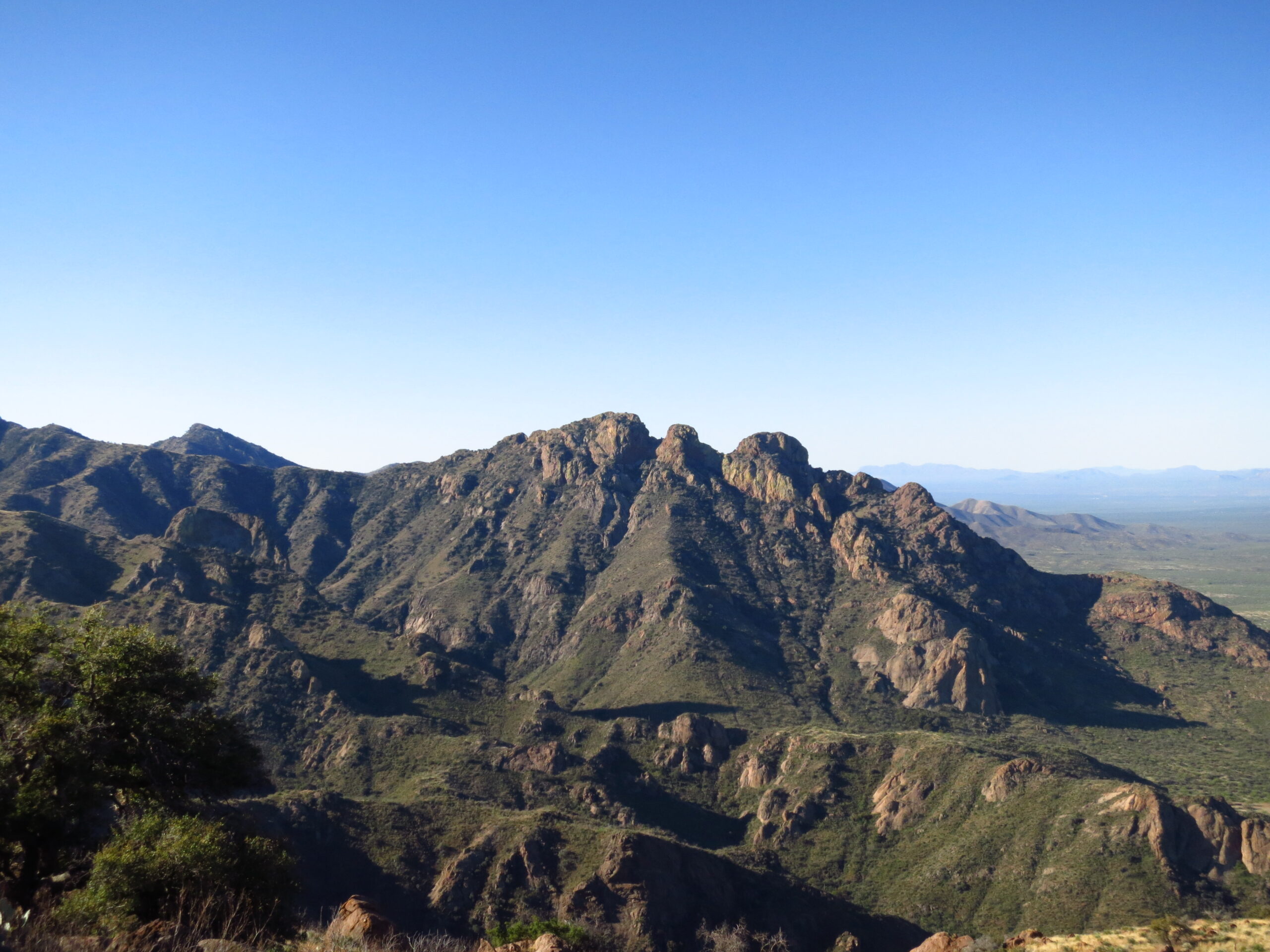
Peak 5380 seen in profile from the north.
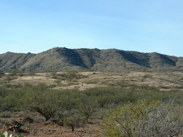
Back on the main ridge, we leave Point 5647 and continue south. We cross over a couple of bumps and arrive at Peak 5674 at 4.6 miles. In this view, we are looking north to 5674, which I’ve shown by a red dot.
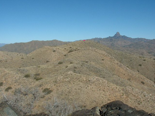
Looking north to Peak 5674.
As you can see, this is all gentle, rolling country. Continuing south from Peak 5674, we would be approaching the camera in the above view. In the next mile, as we look south, we can see that we are approaching Osobavi Peak. Here’s how it looks as we get nearer.
Looking south to Osobavi.
Climber friend Andy Martin did some sleuthing and came up with this information. O:so waw in the O’odham language means scythe bedrock. By the time we stand on its summit, we’ve traveled 5.7 miles from Babo. Let’s stop for a bit and take a look at our surroundings.
To the west, on TO land, Bear Canyon runs away and drops 3,000 feet to the bottom of Baboquivari Valley. To the east, on the White Man’s land, more was going on. There, we find Weaver Canyon and the old Gold Bullion Mine. Nearby is Jupiter Canyon with the old Jupiter Mine. These 2 canyons join forces to become Schaffer Wash, which runs east to meet Highway 286 after several miles.
Let’s continue our journey. Half a mile after leaving Osobavi, we find ourselves in Chutum Vaya Pass, just a hair under 5,200 feet. In the O’odham language, vaya means “well” and chutum means “bear” (thanks again to Andy for this). If we fly from the pass and travel about 2 miles down Bear Canyon, we come to a spot where the ruins of an old house sit. Bear Well also sits there, and an old corral. This place is shown on the map as Chutum Vaya, but it’s been long-deserted. I’d love to find a meaning for chutum – I’m certain it is the anglicized version of an O’odham word.
One more thing of note about the pass – a mile east of it sits Mildred Peak, a lovely little climb, slightly technical and a fun outing.
The north side of Mildred Peak.
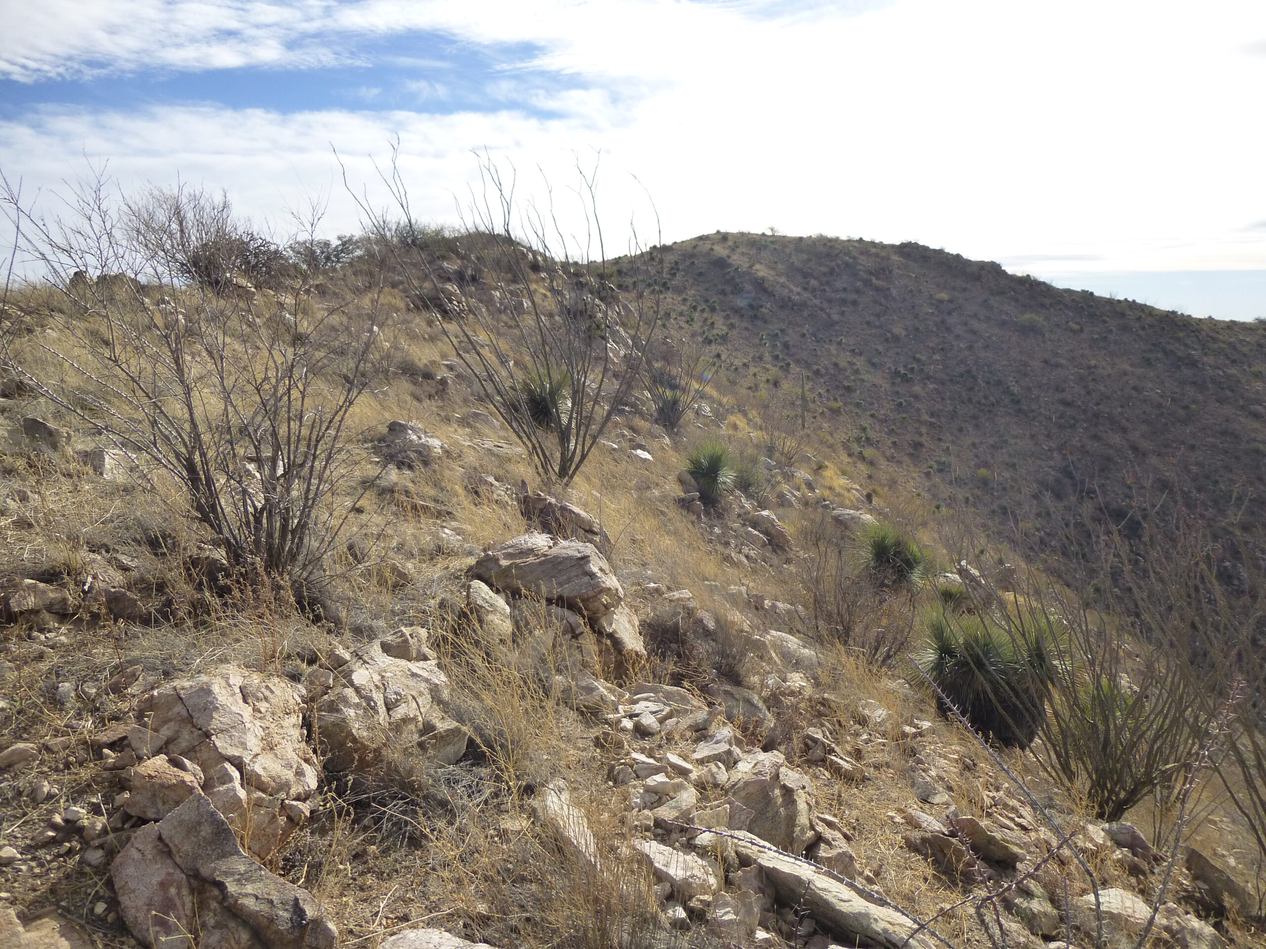
Okay, back to the pass and the main ridge. We climb up out of the pass and over nearby Point 5286, then take a hard swing to the southwest. Soon we cross over Point 5065 and by the time we reach mile 10.1, we come to a survey marker along the ridge. There is a series of these along the way, marking the eastern boundary of the Tohono O’odham nation. This particular marker is Number 17 and it puts us 10.6 miles out from Babo. Moving along from there takes us to Peak 5300, 12.0 miles out. Almost a mile later, we cross over Point 4862. Continuing, once we’ve gone a total of 15.1 miles, we arrive at Peak 5180, where we encounter a tall microwave tower with a huge array of solar panels. This is the only work of man so far that we’ve encountered in all those miles from Babo.
While you’re at Peak 5180, you might as well make a nice side trip. Only seven-tenths of a mile to the southwest sits Choulic Benchmark. To get there, you follow an enjoyable ridge, all of it over 5,000 feet, taking you well into the reservation. The benchmark, at 5,105 feet elevation, is named after a small community about 8 miles away to the west on the reservation. There are no trees along the ridge, so no bushwhacking to do – it’s a pleasant walk.
Okay, back at Peak 5180 along the main ridge, we continue almost due east for 0.8 miles until we drop down to North Pass at 4,660 feet. This is the source of Leyvas Canyon, which drops away to the east. Ever since we left Peak 5300, our path has described a huge loop which forms the head of Leyvas Canyon. North Pass is the lowest point we’ve reached so far on our journey south from Babo. A short climb uphill from the pass in a southerly direction puts us squarely on top of a triple summit which is aptly named Three Peaks, at 4,900 feet and 16.2 miles from Babo. Just below Three Peaks, a tired old road snakes its way up from the east to some old mine diggings and the head of Pozo Hondo Wash.
Let’s continue. We’ll drop down to the south from Three Peaks and continue in a southerly direction. Crossing 6 more bumps, we finally arrive at Peak 4805, at the 17.7-mile mark.
Looking west to Peak 4805
From there, a short run of 0.7 of a mile drops us down to Deadman Pass. This is a new low point along our ridge, at only 4,300 feet. At the pass, we find another of the markers denoting the boundary with the Indian reservation, this one being #22. The pass sits at the head of Asolido Wash which runs away to the east. An old road snakes its way up the wash to a mere 100 feet lower than the pass itself.
As we continue south from the pass, the ridge climbs up to Point 4588, then twists and turns its way southward, crosses 4 bumps, and finally arrives at Lalo Peak. We have now traveled 20.1 miles from Babo, and it’s definitely fading into the distance. Just half a mile south of Lalo we encounter Aguirre Peak which, at 4,923 feet, sits just 17 feet lower than Lalo.
As we continue south from Aguirre, the ridge we are traveling keeps us above Coyote Canyon to the west and Coyote Wash to the east. Crossing 4 intervening bumps arrives us at Point 4638 at a distance of 22.2 miles. If we then cross five more bumps to the south, we arrive at Coyote Pass, where we have dropped down to 4,100 feet. Babo is now 23.3 miles back to the north. A short distance from the pass, over on reservation land, sits Peak 4469.
Okay, let’s get back to the main ridge and continue south. In just 0.7 miles, we climb up to Peak 4642. As you can see from the photos in the links, these are all gentle, rounded peaks. Half a mile beyond Peak 4642 we cross over Point 4323, then continue south until we reach a place that is 25.8 miles out from Babo. If we stop there a minute, we can see Peak 4661 just a thousand feet over to the east. It’s not exactly on the main ridge, but so close that we’d want to climb it anyway. If you click on any of the links a small map will open. If you click on that small map, a full-screen map will open and you can easily follow along to see all the details of our progress along the ridge.
Our ridge is now taking a definite swing to the southeast. The non-reservation land to the east of the ridge is definitely cattle country and is dotted with many tanks, which are man-made water catchments meant to capture runoff. We see names like Saguaro Tank, Antonio Tank, Papago Tank, Beyota Tank and Caponera Tank. By the time we’re 28.1 miles from Babo, we arrive at Caponera Peak. At 4,885 feet, this is the highest we’ve climbed since way back at Aguirre Peak. Caponera is a Spanish word which translates to caponier in English. I learned that this word is a type of defensive structure used in a fortification.
Merely a mile away to the east sits Presumido Peak, practically a twin of Caponera at 4,885 feet. Another Spanish word, it translates as smug or conceited. Seems odd, maybe there’s a better translation? From the peak, we wind our way east for another mile and a half. There, 30.6 miles out from Babo, we arrive at Presumido Pass. This is a significant spot for several reasons. The pass is the head of Presumido Canyon, which runs south from the pass. It also marks the spot where we say a fond farewell to the Baboquivari Mountains, which we’ve followed all the way from Baboquivari Peak. The canyon is the line of demarcation between the Baboquivari Mountains and the new range we are about to enter, which is called the Pozo Verde Mountains.
We now climb up from the pass and follow the height-of-land in our new range. At a point which is 32.0 miles out from Babo, the reservation boundary makes a bee-line due west and that’s the last we see of Tohono O’odham land. That’s okay, we can still carry on, following the high ridge in the Pozo Verdes. If we do that, in just over another mile we come to Buena Vista Benchmark. The elevation here is 4,547 feet.
Looking east up to Buena Vista.
Another mile to the south, we arrive at a pass at 4,260 feet. A road climbs up to and through the pass. Not lingering here, we move on, now heading southwest. It doesn’t take long for us to arrive at Pozora Benchmark. At 4,701 feet, this is the highest point in the Pozo Verde Mountains. Pozora is a word for a water well in Spanish. Pozo Verde means green well. Because this is a range high point, it has been visited by more climbers than any of the peaks in this story that are south of Babo. Range high points are a strong draw for peakbaggers.
Continuing south along the height-of-land, we soon come to Point 4495. This puts us 36.9 miles out. From this bump, another six-tenths of a mile takes us to Point 4474. Let’s keep going, Crossing over 2 more gentle bumps, we see something ahead. What is it? We haven’t seen anything like it in our entire journey. As we get closer, we see a fence, but there’s something else, something tall. I’ll be darned – it’s border monument #141. We’ve arrived!! We’ve traveled 38.0 miles from Baboquivari Peak and here we are at the border.

This is a pretty lawless area. Undocumented border-crossers regularly try to sneak into the States here. The Mexican drug cartels are very active in these parts. Just down-slope to the east of where we’re standing is the aptly-named Smuggler’s Canyon. That’s the official name on the map, and it’s had that name for a long time. Let’s skedaddle before we get involved in any mayhem. Thanks for keeping me company.