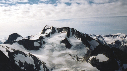
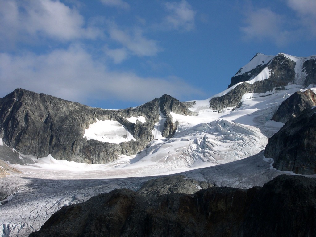
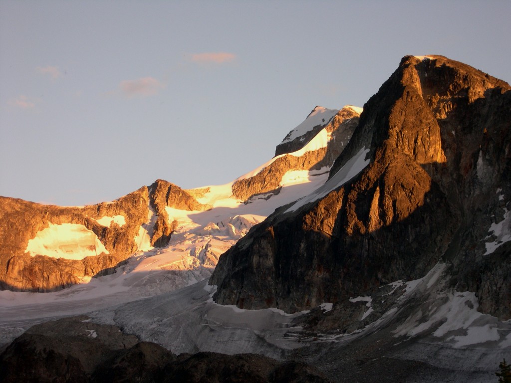
The above photo is used with the kind permission of Clayton Worbeck.
I had hiked into the Berg Lake chalet on the north side of Mt. Robson a few times over the years, in the late 1970s and early 1980s, only to end up gazing up at the north face and thinking how impossibly difficult it looked to climb. It is a world-class peak, and some of the statistics of its climbing history command respect. One of the most impressive is the fact that, despite all attempts, it was once not summited for a 14-year period. Can you name another major peak which is attempted as often as Robson, that has repelled all attempts for 14 consecutive years? It is a 10,000-foot vertical climb from Kinney Lake, and even the easiest route is a real hair-raiser, not for the faint-of-heart. During the 1980s I was in the Jasper area a few times and seriously contemplated an attempt but never tried. However, in the summer of 1989, I went back.
I went there with Brian once again, and another Toronto climber named Scott. That year, Scott was 29, Brian was 32 and I was 42. Although Scott was fairly new to the sport of climbing, he was strong and technically skilled on both ice and rock. We flew in by helicopter to the Dome, a feature on the southeast side of the mountain at 10,000′. We made two attempts on the Kain Face, which is about 1,000 vertical feet of 50 to 60-degree ice. This is the the route by which the mountain was first climbed. The weather was atrocious, and we got our asses kicked on both tries. We were up there for 10 days, and it was socked in and snowing most of the time. We spent a lot of time building walls out of snow blocks to act as a windbreak so the snow wouldn’t keep burying the tents. During those loooooong days of being tent-bound, Scott asked many questions of me and Brian. We had climbed a lot of mountains in BC over the years, and he pumped us for information about routes, access, etc… on many of them. We didn’t know if he was hatching any plans to climb anything in particular, but we sure did have a lot of time to kill.
Finally, we gave up and walked out of there – we realized that Robson wasn’t giving up any secrets – it took three long days through some treacherous terrain to get back to the road.
A month later, Brian called me from Toronto. He said “Hey Man, it’s Brian. I’m calling to tell you that Scott’s dead”. It hit me like a ton of bricks! I had just spent ten days with this guy in the closest of quarters, stuck in a tent, waiting out storms, and now I find out he’s gone. Brian went on to tell me that after our trip, Scott had flown out to Vancouver on business. He had some spare time, so he rented a car and drove up to Wedge Mountain. He went up to the hut at Wedgemount Lake, and from there, he made his way up to the north arête.
Before I continue, I would like to share with you a well-written description of a climb of this north arête which was written by a climber identified only as “iluka” and posted on Summit Post.
As we got out onto the level part of the glacier we saw the two options for gaining the ridge that comprises the North Arête. It is possible to work high up on the glacier and climb a steep snow slope that puts you on the ridge about 2/3 of the way along its length towards the summit. We were intrigued by what we had heard about the ridge run and opted to do it’s full length instead. We headed up the wide, less steep snow slope to our left lower down on the glacier. Rather than going all the way to the top of this slope, we traversed to our right and headed up a short gully that led to the ridge proper. This stretch was a bear as the snow was very soft and Paul, out in the lead, was constantly breaking through as he put in steps. Out on the ridge itself, we had a view of the entire route. Two things strike one at this point: (1) It’s still a long way to the summit, and (2) there’s a lot of exposure on both sides.
We opted to stay roped up for the ridge run, prepared to jump off the opposite side if one of us fell. Most of the ridge was covered in snow, although there were a few short sections with mixed climbing on snow and rock — always fun in crampons. Fortunately, there wasn’t too much ice, as that would make that ridge an unpleasant experience at best. The snow was soft enough that we could get in very reliable steps, perhaps a bit too soft in spots, however, as the second and third people were often breaking through. We spent some time on the east side of the ridge and some time on the west side… it’s easy to tell when to be in what spot. It took us perhaps a bit more than an hour to do the bulk of the ridge and get to the bottom of the steeper portion up to the summit ridge. From afar, it looks pretty steep and unappealing but once at its base, the slope didn’t appear too bad after all. We had good snow for making solid steps. Still a lot of exposure at this point and no good runout if you happen to fall on this part. Had the snow been firmer, we might have opted to place some pickets but with it being so soft and our footholds so good, we decided not to do so.
After 30-45 minutes we were on the summit ridge. From there, it’s a 100 m horizontal distance walk to the summit itself with perhaps 10m of elevation gain, if that much. We arrived just in time for the clouds to blow in from the south and take away the view. We wasted all of about 2 minutes on the summit itself before heading back down to where we gained the ridge to pick up our rope and grab some food. Some books say you can descend the North Arête itself but, in the whiteout, that didn’t look very appealing. Nor did the prospect of going back along the entire ridge itself before dropping off the glacier.
So, Scott soloed the north arête, to the summit, where he signed the register. He decided to descend the same way, rather than taking an easier route back down. This was perhaps the riskiest decision he made. During the descent, it appears that he slipped on the steep ice and could not self-arrest in time to prevent himself from going over the edge of a 300-foot cliff. He was wearing crampons at the time and also had his ice axe with him. He died instantly from massive injuries. If he hadn’t phoned his wife from his hotel room in Vancouver before he went to Wedge and told her of his planned route, they might never have found him.
The two pictures shown above (used with the kind permission of John Stolk) plainly show the north arête – it is the knife-edge, graceful snow/ice route seen partly on the skyline in the middle of the picture. It angles from left center to the upper right and is a mix of rock, snow and ice. As one description of it says, “as snow lines go, this one is hard to beat”. I guess Scott must have become pretty fixated on Wedge during our long tentbound days on Mt.Robson. He was technically strong, but was such a new climber that he hadn’t yet gained a lot of the mountain wisdom that could have helped him make better decisions in the mountains. To this day, Brian and I both wonder if we had in some small way contributed to Scott’s death through information we gave him or perhaps by not cautioning him enough. We’ll never know.
It’s not likely I’ll ever go back to Wedge again, but it sure does resonate with me as a peak which has played a stronger role in my life than most other mountains I have climbed. Thanks for listening.
Please visit our Facebook page at https://www.facebook.com/pages/Desert-Mountaineer/192730747542690


